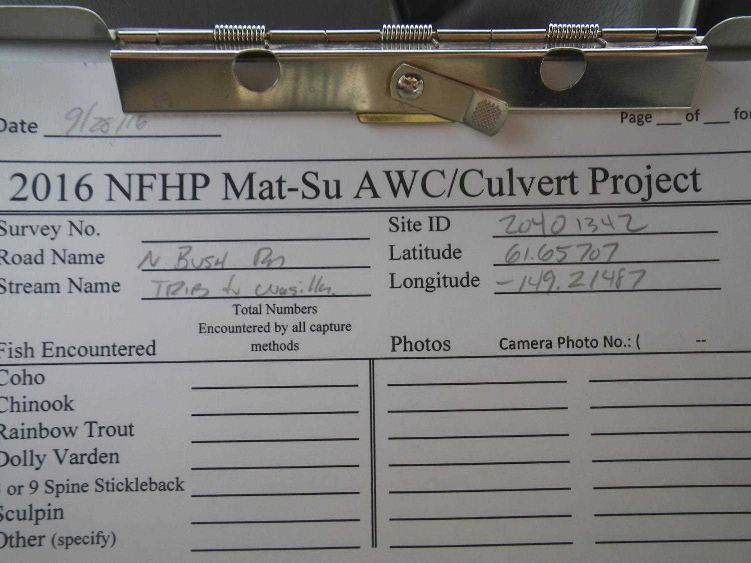
Fish Passage Site 20401342
Coordinates (dec. deg.): 61.65704°, -149.21489°
Legal Description: S018N001E12
Region: South Central
Road Name: Bush Road
Datum: WGS84
Quad Name / ITM: Anchorage C-6
AWC Stream #: 247-50-10260-2019
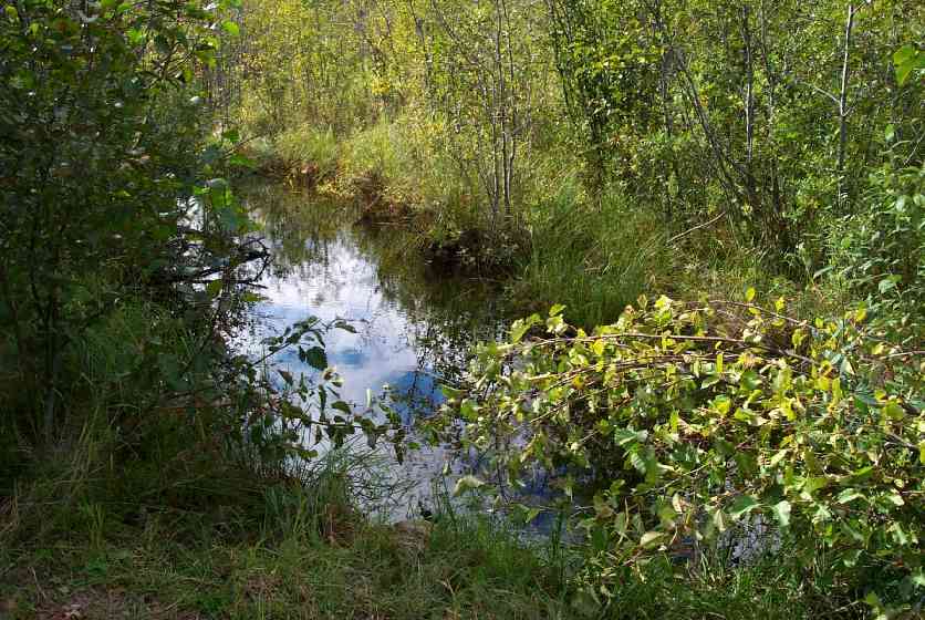
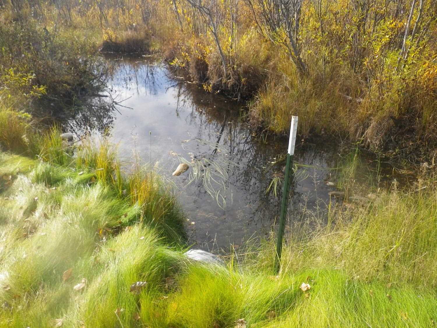
Stream Name: Wasilla Creek tributary
Elevation:
Site Comments: None
arrow to the right of the survey date below to choose a different report for this site.
Survey MSCS1-WA036
Observers: Olof Jacobsson, Edward Weiss, Mike Roy
Overall Fish Passage Rating:
Tidal: No
Backwatered: No
Step Pools:
Construction Year:
Site Observations:
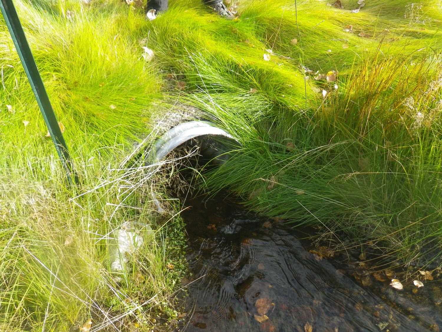
- Outfall height red
- Mechanical damage or joints parting
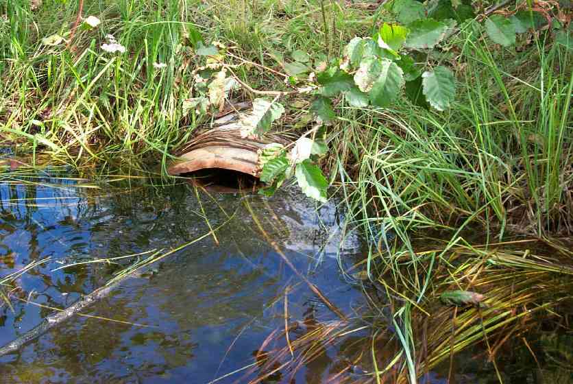
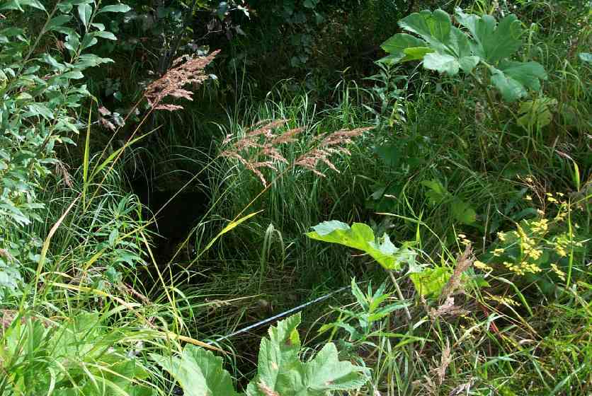
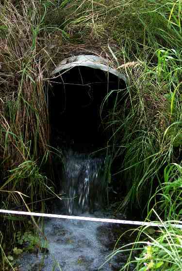
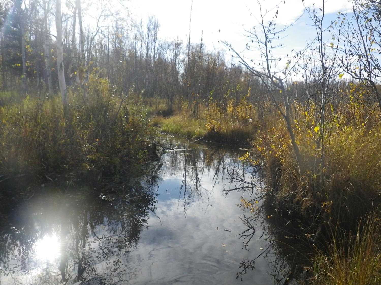
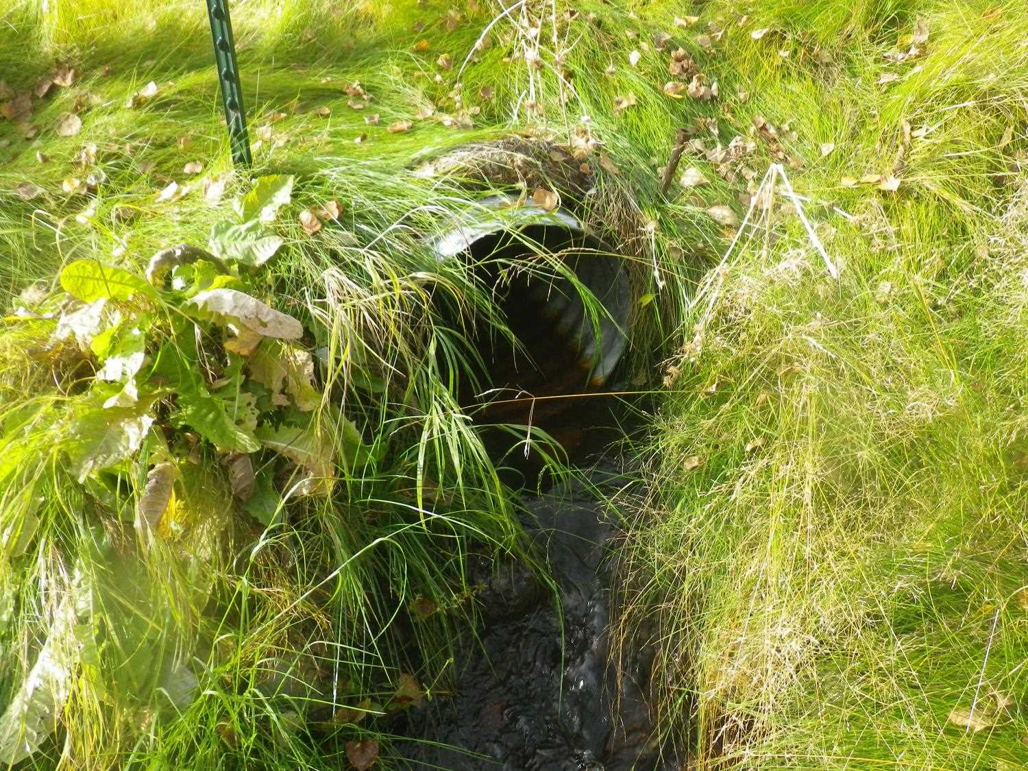
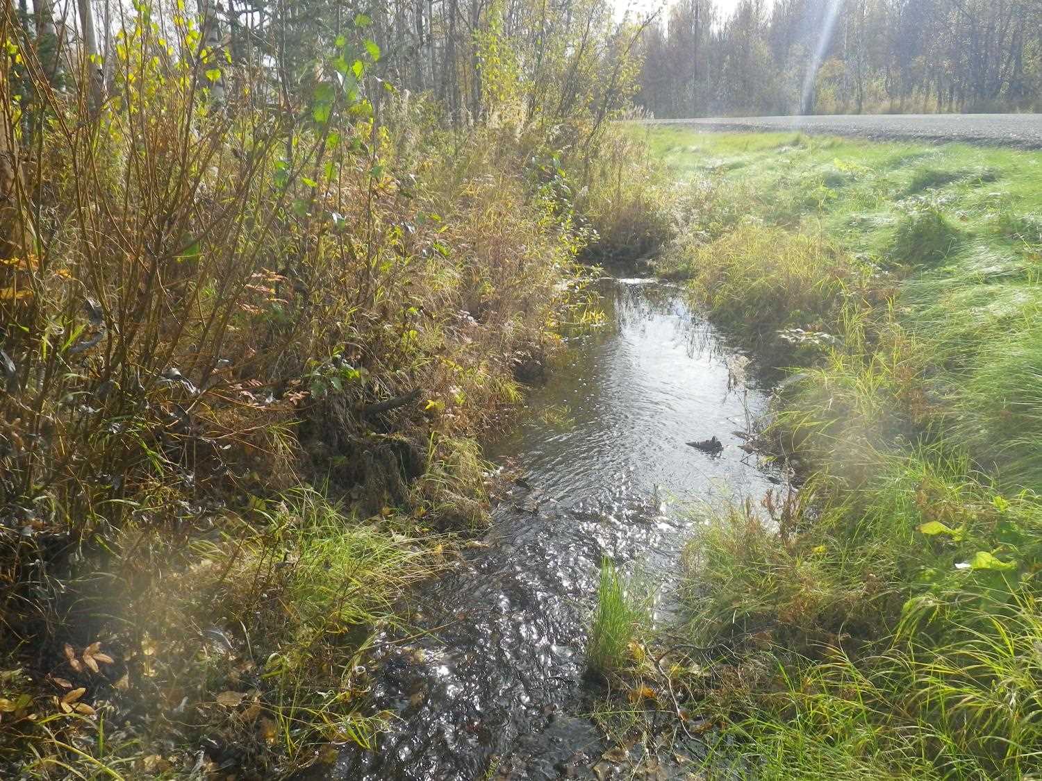
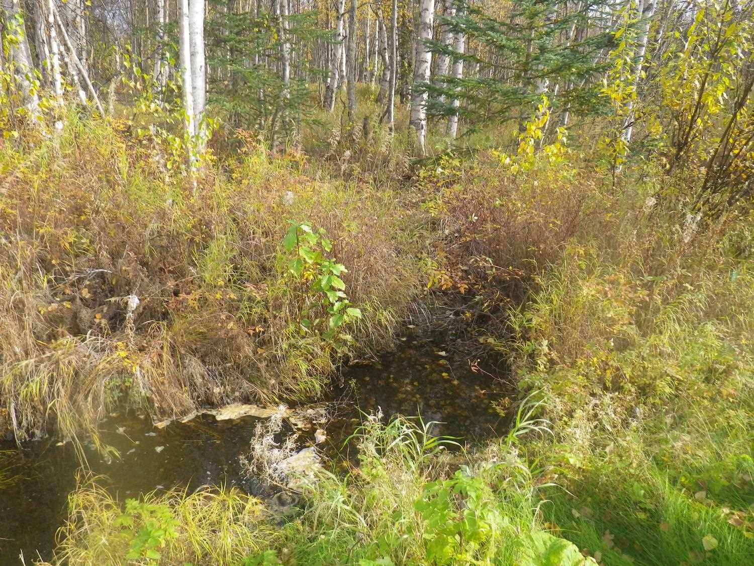
Comments: Updated site photos and fish capture data added from 9/28/16 site visit from Sampling Unmapped Streams in the MSB project. Wetland ponded on upper end. Apparent BLOCKAGE within culvert. Water depth at inlet significantly more than outlet. More than 10 ft inside from inlet. Some woody debris pulled out of inlet. Other sediment certain.
Culvert Measurements
| ID: 1 | Structure Type: Circular pipe (Corrugated Metal) | Fish Passage Rating: | |||||||||||||||||||||||||||||||||||||||||
|
|
|
|||||||||||||||||||||||||||||||||||||||||
Culvert Observations:
|
|||||||||||||||||||||||||||||||||||||||||||
Stream Measurements
|
|
| Stream Width Type | Distance From Crossing (ft) |
Stream Width (ft) |
|---|---|---|
| Downstream ordinary high water | 50.0 | 3.00 |
| Downstream ordinary high water | 100.0 | 6.00 |
Elevations
| Locator ID | Culvert Number |
River Distance (ft)1 |
Distance From Crossing (ft)2 |
Relative Elevation (ft) |
|---|---|---|---|---|
| D/S Thalweg | 88.99 | |||
| D/S Thalweg | 89.86 | |||
| Outlet Culvert Top | 1 | 93.34 | ||
| Inlet Culvert Top | 1 | 93.38 | ||
| D/S Tailcrest or 1st Thalweg | 0.00 | 2.2 | 90.77 | |
| D/S Thalweg | 0.40 | 1.8 | 90.49 | |
| Outlet Thalweg | 1 | 2.20 | 0.0 | 91.08 |
| Outlet Invert | 1 | 2.20 | 0.0 | 91.76 |
| Road Elev | 22.20 | 94.39 | ||
| Road Elev | 22.20 | 94.75 | ||
| Inlet Culvert Invert | 1 | 42.20 | 0.0 | 91.84 |
| Inlet Thalweg | 1 | 42.20 | 0.0 | 89.00 |
| U/S Thalweg | 54.20 | 12.0 | 91.20 |
Notes:
- River distance is measured continuously throughout the survey reach along the thalweg of the stream.
- Measured from each end of the crossing along the thalweg of the stream.
Fish Sampling Efforts
| Gear Type: Minnow Trap (A) | Trap Duration(h): 18 | |
| Gear Type: Minnow Trap (B) | Trap Duration(h): 20 | |
| Gear Type: Minnow Trap (C) | Trap Duration(h): 2.5833333 | |
| Comments: Trapped 9/28/16 | ||
| Gear Type: Minnow Trap (D) | Trap Duration(h): 2.5666666 | |
| Comments: Trapped 9/28/16 | ||
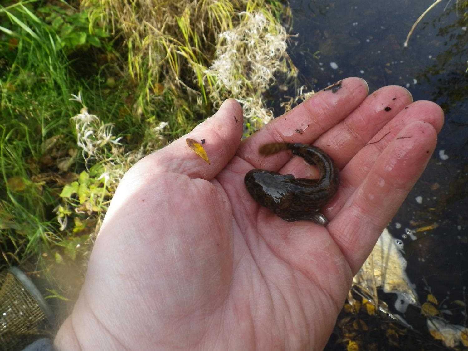
Fish Observations
| Species: juvenile/adult stickleback-unspecified | Life History: Resident | ||
| Total Fish Observed: 3 | Fish Measured: 1 | Fork Lengths (mm) Min: 30 Max: 30 Mean: 30 | |
| Collected/Observed by Gear Type: Downstream Minnow Trap (1) Upstream Minnow Trap (2) | |||
| Species: juvenile/adult sculpin-unspecified | Life History: Resident | ||
| Total Fish Observed: 7 | Fish Measured: 2 | Fork Lengths (mm) Min: 90 Max: 96 Mean: 93 | |
| Collected/Observed by Gear Type: Downstream Minnow Trap (2) Upstream Minnow Trap (1) Downstream Minnow Trap (4) | |||
| Species: threespine stickleback | Life History: Resident | ||
| Total Fish Observed: 1 | Fish Measured: | Fork Lengths (mm) Min: Max: Mean: | |
| Collected/Observed by Gear Type: Upstream Minnow Trap (1) | |||
Photos
Questions or comments about this report can be directed to dfg.dsf.webmaster@alaska.gov