Fish Passage Site 20401340
Coordinates (dec. deg.): 61.64674°, -149.19020°
Legal Description: S018N001E13
Region: South Central
Road Name: Bonnie Drive
Datum: NAD83
Quad Name / ITM: Anchorage C-6
AWC Stream #:
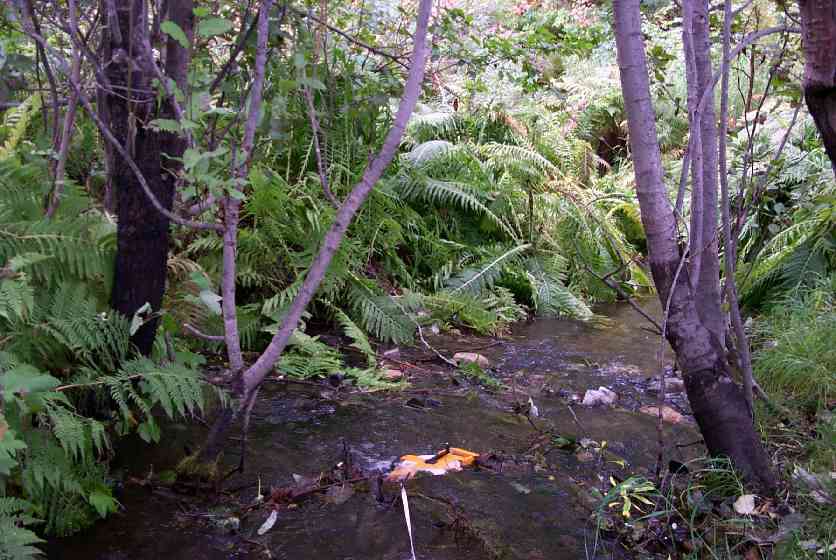
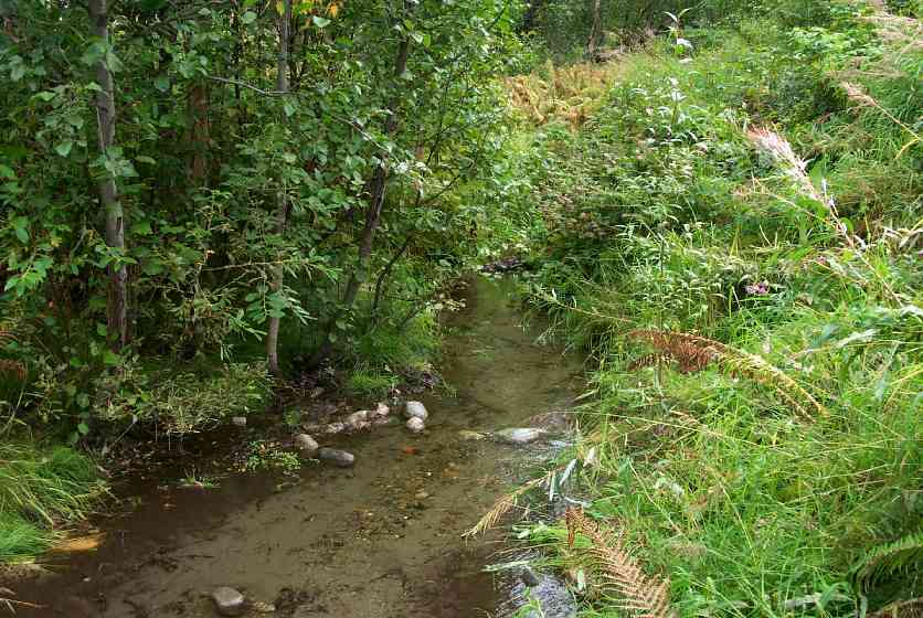
Stream Name: Wasilla Creek tributary
Elevation:
Site Comments: Wasilla Creek tributary upstream of Wight Lake
Multiple surveys have been conducted at this site — click on the drop down
arrow to the right of the survey date below to choose a different report for this site.
arrow to the right of the survey date below to choose a different report for this site.
Survey MSCS1-WA033
Observers: Edward Weiss, Olof Jacobsson, Mike Roy
Overall Fish Passage Rating:
Tidal: No
Backwatered: No
Step Pools:
Construction Year:
Comments: None
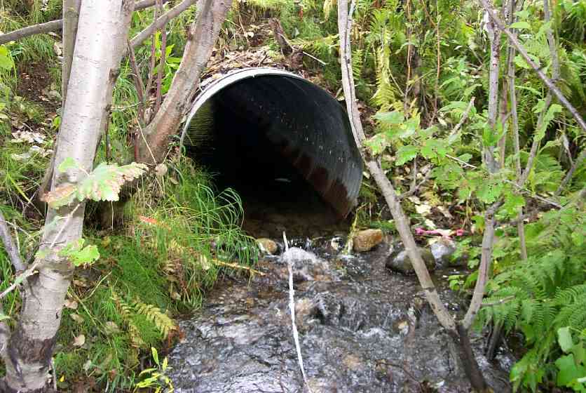
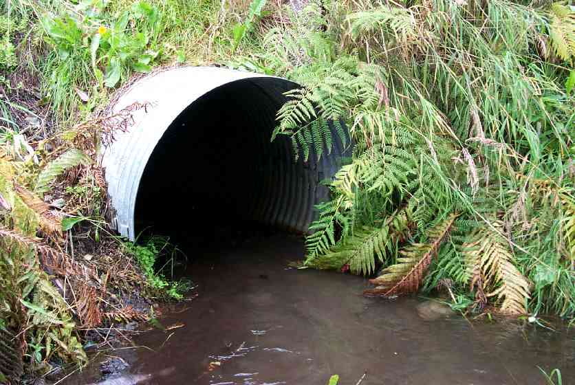
Culvert Measurements
| ID: 1 | Structure Type: Closed-bottom arch (Strutural Metal Plate) | Fish Passage Rating: | |||||||||||||||||||||||||||||||||||||||||
|
|
|
|||||||||||||||||||||||||||||||||||||||||
Culvert Observations:
|
|||||||||||||||||||||||||||||||||||||||||||
Stream Measurements
|
|
| Stream Width Type | Distance From Crossing (ft) |
Stream Width (ft) |
|---|---|---|
| Downstream ordinary high water | 56.0 | 5.00 |
| Downstream ordinary high water | 90.0 | 5.00 |
| Upstream ordinary high water | 52.0 | 6.00 |
| Upstream ordinary high water | 72.0 | 6.00 |
Elevations
| Locator ID | Culvert Number |
River Distance (ft)1 |
Distance From Crossing (ft)2 |
Relative Elevation (ft) |
|---|---|---|---|---|
| Outlet Culvert Top | 1 | 92.88 | ||
| Inlet Culvert Top | 1 | 93.52 | ||
| D/S Thalweg | 0.00 | 90.0 | 86.30 | |
| D/S Thalweg | 34.00 | 56.0 | 86.27 | |
| Outlet Invert | 1 | 90.00 | 0.0 | 89.01 |
| Outlet Thalweg | 1 | 90.00 | 0.0 | 89.48 |
| Road Elev | 110.00 | 95.52 | ||
| Road Elev | 110.00 | 95.76 | ||
| Inlet Thalweg | 1 | 130.00 | 0.0 | 89.81 |
| U/S Thalweg | 182.00 | 52.0 | 89.69 | |
| U/S Thalweg | 202.00 | 72.0 | 90.81 |
Notes:
- River distance is measured continuously throughout the survey reach along the thalweg of the stream.
- Measured from each end of the crossing along the thalweg of the stream.
Fish Sampling Efforts
| Gear Type: Minnow Trap (A) | Trap Duration(h): 18 | |
| Comments: Perched culvert. | ||
Fish Observations
| Species: juvenile/adult Dolly Varden | Life History: Unknown | ||
| Total Fish Observed: 2 | Fish Measured: 1 | Fork Lengths (mm) Min: 55 Max: 55 Mean: 55 | |
| Collected/Observed by Gear Type: Upstream Minnow Trap (2) | |||
Photos
Questions or comments about this report can be directed to dfg.dsf.webmaster@alaska.gov