Fish Passage Site 20401330
Coordinates (dec. deg.): 61.61601°, -149.21210°
Legal Description: S018N001E26
Region: South Central
Road Name: Seagull Drive
Datum: NAD83
Quad Name / ITM: Anchorage C-6
AWC Stream #: 247-50-10260-2019-3066-4025
Stream Name: Wasilla Creek tributary
Elevation:
Site Comments: Drains a small retenition area only. Seperated from the upastream lake by an upland area with no connection.No significant habitat upstream of this culvert
arrow to the right of the survey date below to choose a different report for this site.
Survey MSCS1-WA022
Observers: Edward Weiss, Olof Jacobsson, Joe Conner
Overall Fish Passage Rating:
Tidal: No
Backwatered: No
Step Pools:
Construction Year:
Comments: Drains a small retenition area only. Seperated from the upastream lake by an upland area with no connection.No significant habitat upstream of this culvert
Culvert Measurements
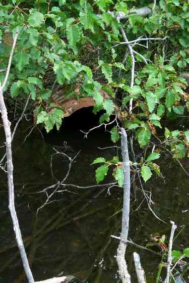
| ID: 1 | Structure Type: Circular pipe (Corrugated Metal) | Fish Passage Rating: | |||||||||||||||||||||||||||||||||||||||||
|
|
|
|||||||||||||||||||||||||||||||||||||||||
Culvert Observations:
|
|||||||||||||||||||||||||||||||||||||||||||
Stream Measurements
|
|
| Stream Width Type | Distance From Crossing (ft) |
Stream Width (ft) |
|---|---|---|
| Downstream ordinary high water | 18.0 | 7.00 |
| Downstream ordinary high water | 55.0 | 6.00 |
| Upstream ordinary high water | 50.0 | 8.00 |
| Upstream ordinary high water | 115.0 | 8.00 |
Elevations
| Locator ID | Culvert Number |
River Distance (ft)1 |
Distance From Crossing (ft)2 |
Relative Elevation (ft) |
|---|---|---|---|---|
| Outlet Culvert Top | 1 | 87.62 | ||
| Inlet Culvert Top | 1 | 88.98 | ||
| U/S Thalweg | 87.01 | |||
| D/S Thalweg | 0.00 | 55.0 | 86.45 | |
| D/S Thalweg | 37.00 | 18.0 | 86.46 | |
| OHW Left Bank | 53.00 | 2.0 | 85.90 | |
| Outlet Invert | 1 | 55.00 | 0.0 | 85.63 |
| Road Elev | 82.00 | 93.59 | ||
| Road Elev | 82.00 | 94.48 | ||
| Inlet Culvert Invert | 1 | 109.00 | 0.0 | 87.28 |
| U/S Thalweg | 1 | 110.50 | 1.5 | 86.83 |
| U/S Thalweg | 224.00 | 115.0 | 87.30 |
Notes:
- River distance is measured continuously throughout the survey reach along the thalweg of the stream.
- Measured from each end of the crossing along the thalweg of the stream.
Fish Sampling Efforts
| Gear Type: Minnow Trap (A) | Trap Duration(h): 3 | |
| Gear Type: Minnow Trap (B) | Trap Duration(h): 3 | |
Fish Observations
| Species: juvenile/adult stickleback-unspecified | Life History: Resident | ||
| Total Fish Observed: 3 | Fish Measured: | Fork Lengths (mm) Min: Max: Mean: | |
| Collected/Observed by Gear Type: Downstream Minnow Trap (3) | |||
| Species: no fish collected or observed | Life History: Not Applicable | ||
| Total Fish Observed: 0 | Fish Measured: | Fork Lengths (mm) Min: Max: Mean: | |
| Collected/Observed by Gear Type: Upstream Minnow Trap (0) | |||
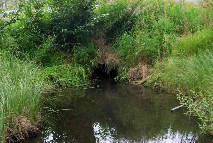
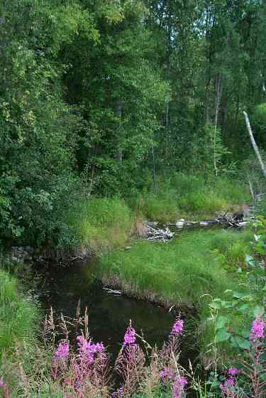
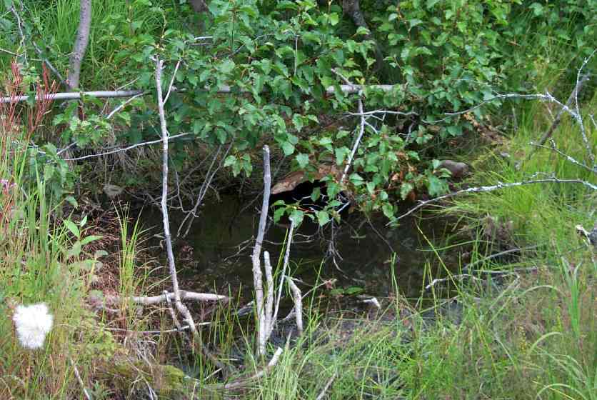
Photos
Questions or comments about this report can be directed to dfg.dsf.webmaster@alaska.gov