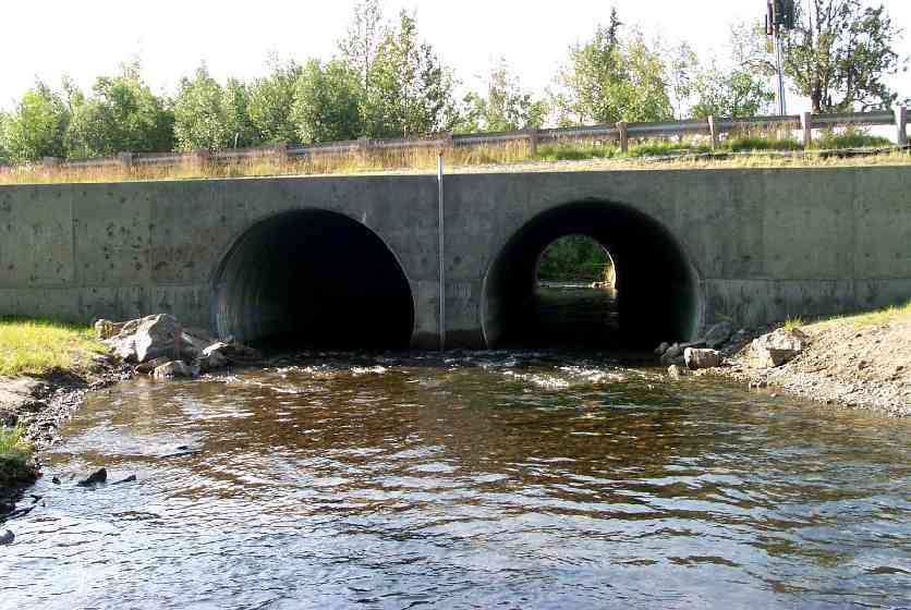
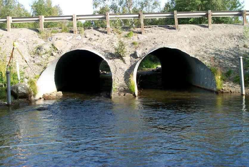
Fish Passage Site 20401326
Coordinates (dec. deg.): 61.59935°, -149.25107°
Legal Description: S017N001E03
Region: South Central
Road Name: Palmer Wasilla Highway
Datum: NAD83
Quad Name / ITM: Anchorage C-6
AWC Stream #: 247-50-10260-2019
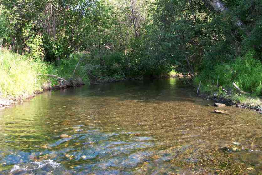
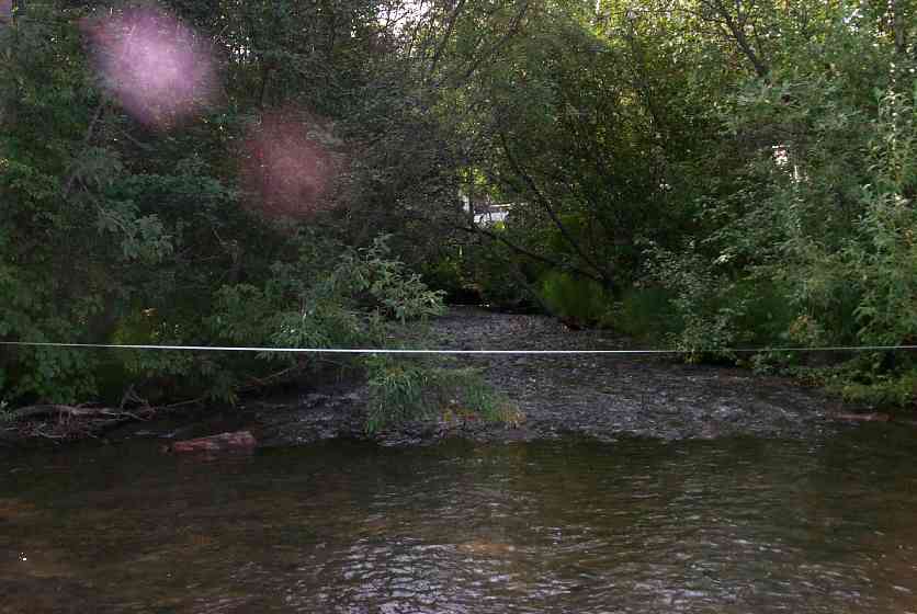
Stream Name: Wasilla Creek
Elevation:
Site Comments: ATV Crossing through outlet pool area.
Multiple surveys have been conducted at this site — click on the drop down
arrow to the right of the survey date below to choose a different report for this site.
arrow to the right of the survey date below to choose a different report for this site.
Survey MSCS1-WA018
Observers: Edward Weiss, Olof Jacobsson, Joe Conner
Overall Fish Passage Rating:
Tidal: No
Backwatered: No
Step Pools:
Construction Year:
Comments: ATV Crossing through outlet pool area.
Culvert Measurements
| ID: 1 | Structure Type: Circular pipe (Corrugated Metal) | Fish Passage Rating: | |||||||||||||||||||||||||||||||||||||||||
|
|
|
|||||||||||||||||||||||||||||||||||||||||
Culvert Observations:
|
|||||||||||||||||||||||||||||||||||||||||||
| ID: 2 | Structure Type: Circular pipe (Corrugated Metal) | Fish Passage Rating: | |||||||||||||||||||||||||||||||||||||||||
|
|
|
|||||||||||||||||||||||||||||||||||||||||
Culvert Observations:
|
|||||||||||||||||||||||||||||||||||||||||||
Stream Measurements
|
|
| Stream Width Type | Distance From Crossing (ft) |
Stream Width (ft) |
|---|---|---|
| Downstream ordinary high water | 86.0 | 23.00 |
| Downstream ordinary high water | 111.0 | 23.00 |
| Upstream ordinary high water | 50.0 | 23.00 |
| Upstream ordinary high water | 112.0 | 23.00 |
Elevations
| Locator ID | Culvert Number |
River Distance (ft)1 |
Distance From Crossing (ft)2 |
Relative Elevation (ft) |
|---|---|---|---|---|
| Outlet Culvert Top | 1 | 90.03 | ||
| Outlet Culvert Top | 2 | 90.42 | ||
| Inlet Culvert Top | 1 | 90.62 | ||
| Inlet Culvert Top | 2 | 90.78 | ||
| D/S Thalweg | 0.00 | 111.0 | 81.29 | |
| D/S Thalweg | 25.00 | 86.0 | 81.87 | |
| D/S Tailcrest or 1st Thalweg | 75.00 | 36.0 | 82.96 | |
| D/S Thalweg | 93.00 | 18.0 | 82.55 | |
| OHW Left Bank | 103.00 | 8.0 | 82.92 | |
| Outlet Invert | 2 | 111.00 | 0.0 | 82.77 |
| Outlet Invert | 1 | 111.00 | 0.0 | 82.78 |
| Road Elev | 156.50 | 92.42 | ||
| Road Elev | 156.50 | 94.15 | ||
| Inlet Thalweg | 2 | 202.00 | 0.0 | 83.32 |
| Inlet Culvert Invert | 2 | 202.00 | 0.0 | 82.89 |
| Inlet Culvert Invert | 1 | 202.00 | 0.0 | 82.67 |
| U/S Thalweg | 2 | 205.00 | 3.0 | 83.18 |
| U/S Thalweg | 252.00 | 50.0 | 83.17 | |
| U/S Thalweg | 314.00 | 112.0 | 82.25 |
Notes:
- River distance is measured continuously throughout the survey reach along the thalweg of the stream.
- Measured from each end of the crossing along the thalweg of the stream.
Fish Sampling Efforts
| Gear Type: Minnow Trap (A) | Trap Duration(h): 3 | |
| Gear Type: Minnow Trap (B) | Trap Duration(h): 2 | |
| Gear Type: Visual Observation, Ground (C) | ||
| Comments: No numbers provided on data sheet | ||
Fish Observations
| Species: juvenile coho salmon | Life History: Anadromous | ||
| Total Fish Observed: 42 | Fish Measured: 20 | Fork Lengths (mm) Min: 38 Max: 68 Mean: 53 | |
| Collected/Observed by Gear Type: Downstream Minnow Trap (22) Upstream Minnow Trap (20) | |||
Photos
Questions or comments about this report can be directed to dfg.dsf.webmaster@alaska.gov