Fish Passage Site 20401308
Coordinates (dec. deg.): 61.60934°, -149.29179°
Legal Description: S018N001E33
Region: South Central
Road Name: Trail near Palmer Elks
Datum: NAD83
Quad Name / ITM: Anchorage C-7
AWC Stream #: 247-50-10300
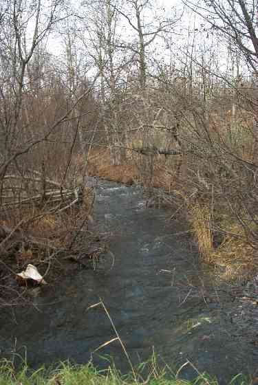
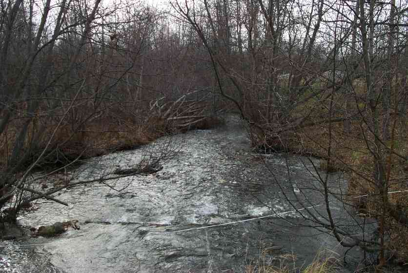
Stream Name: Cottonwood Creek
Elevation:
Site Comments: Footbridge installed and new photos taking on 8/31/11.
arrow to the right of the survey date below to choose a different report for this site.
Survey MSCS1-CT160
Observers: Edward Weiss, Joe Conner
Overall Fish Passage Rating:
Tidal: No
Backwatered: No
Step Pools:
Construction Year:
Site Observations:
- Hydraulic flows exceeded capacity
- Inlet perch
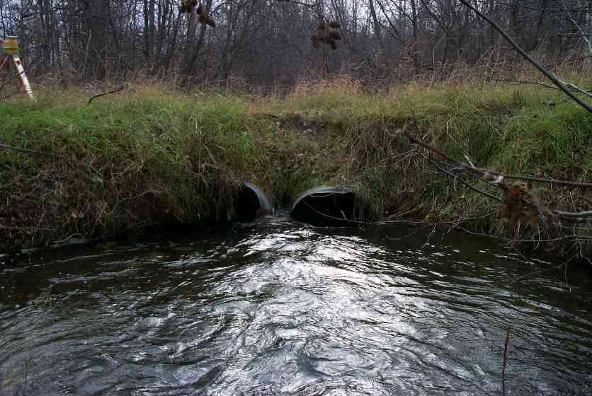
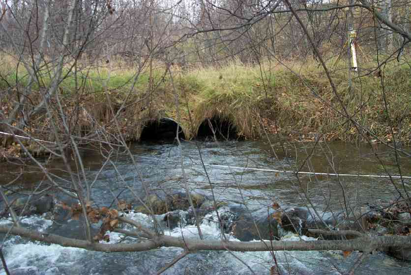
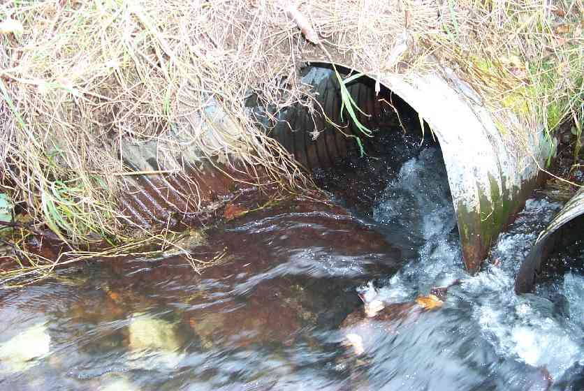
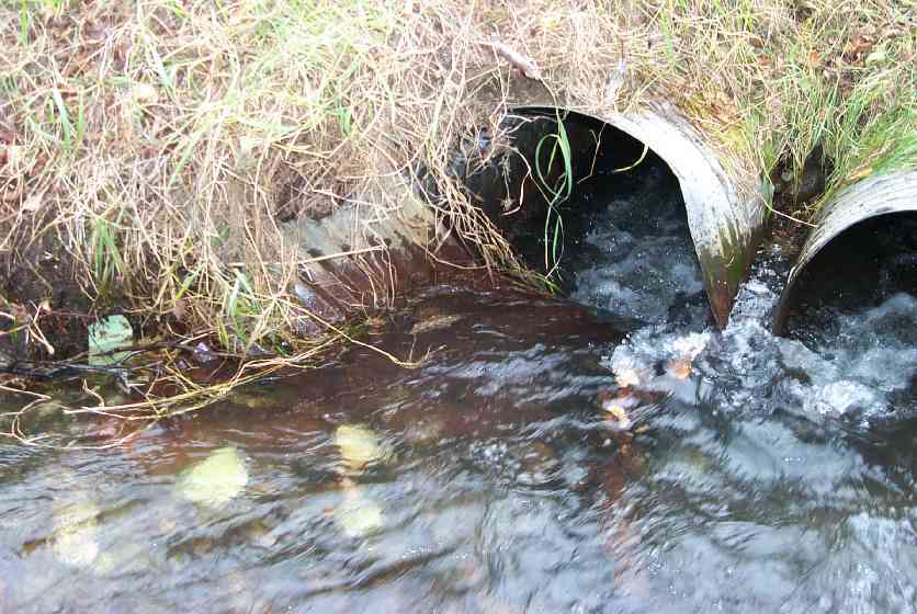
Comments: 2 half pipes form 1 pipe;upper end left culvert damaged collapsed fallen inlet blocking flow-most flow jetting thru right culvert;culverts need to come out-no longer have an purpose-old farm road.
Culvert Measurements
| ID: 1 | Structure Type: Closed-bottom arch (Strutural Metal Plate) | Fish Passage Rating: | |||||||||||||||||||||||||||||||||||||||||
|
|
|
|||||||||||||||||||||||||||||||||||||||||
| ID: 2 | Structure Type: Closed-bottom arch (Strutural Metal Plate) | Fish Passage Rating: | |||||||||||||||||||||||||||||||||||||||||
|
|
|
|||||||||||||||||||||||||||||||||||||||||
Stream Measurements
|
|
| Stream Width Type | Distance From Crossing (ft) |
Stream Width (ft) |
|---|---|---|
| Downstream ordinary high water | 50.0 | 20.20 |
| Downstream ordinary high water | 81.0 | 20.60 |
| Upstream ordinary high water | 50.0 | 21.00 |
| Upstream ordinary high water | 95.0 | 14.80 |
Elevations
| Locator ID | Culvert Number |
River Distance (ft)1 |
Distance From Crossing (ft)2 |
Relative Elevation (ft) |
|---|---|---|---|---|
| Inlet Culvert Top | 2 | 92.70 | ||
| Inlet Culvert Top | 1 | 93.10 | ||
| Outlet Culvert Top | 2 | 92.17 | ||
| Outlet Culvert Top | 1 | 92.35 | ||
| D/S Thalweg | 0.00 | 81.0 | 87.96 | |
| D/S Thalweg | 31.00 | 50.0 | 88.64 | |
| D/S Tailcrest or 1st Thalweg | 70.00 | 11.0 | 90.11 | |
| OHW Left Bank | 72.00 | 9.0 | 89.66 | |
| D/S Thalweg | 74.00 | 7.0 | 89.42 | |
| Outlet Invert | 1 | 81.00 | 0.0 | 89.66 |
| Outlet Thalweg | 1 | 81.00 | 0.0 | 89.66 |
| Outlet Invert | 2 | 81.00 | 0.0 | 89.71 |
| Outlet Thalweg | 2 | 81.00 | 0.0 | 89.73 |
| Road Elev | 91.50 | 94.07 | ||
| Road Elev | 91.50 | 94.67 | ||
| Inlet Culvert Invert | 2 | 102.00 | 0.0 | 89.79 |
| Inlet Thalweg | 2 | 102.00 | 0.0 | 89.92 |
| Inlet Thalweg | 1 | 102.00 | 0.0 | 90.57 |
| U/S Thalweg | 152.00 | 50.0 | 91.33 | |
| U/S Thalweg | 197.00 | 95.0 | 92.66 |
Notes:
- River distance is measured continuously throughout the survey reach along the thalweg of the stream.
- Measured from each end of the crossing along the thalweg of the stream.
Fish Sampling Efforts
| Gear Type: Visual Observation, Ground (C) | ||
Fish Observations
| Species: adult coho salmon | Life History: Anadromous (Suspected Spawning) | ||
| Total Fish Observed: | Fish Measured: | Fork Lengths (mm) Min: Max: Mean: | |
| Collected/Observed by Gear Type: Upstream Visual Observation, Ground () | |||
| Comments: Adult coho upstream and downstream of culvert | |||
Photos
Questions or comments about this report can be directed to dfg.dsf.webmaster@alaska.gov