Fish Passage Site 20401307
Coordinates (dec. deg.): 61.61382°, -149.29070°
Legal Description: S018N001E33
Region: South Central
Road Name: Bogard Road
Datum: NAD83
Quad Name / ITM: Anchorage C-7
AWC Stream #: 247-50-10300
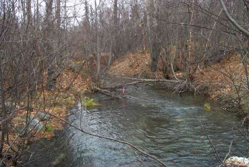
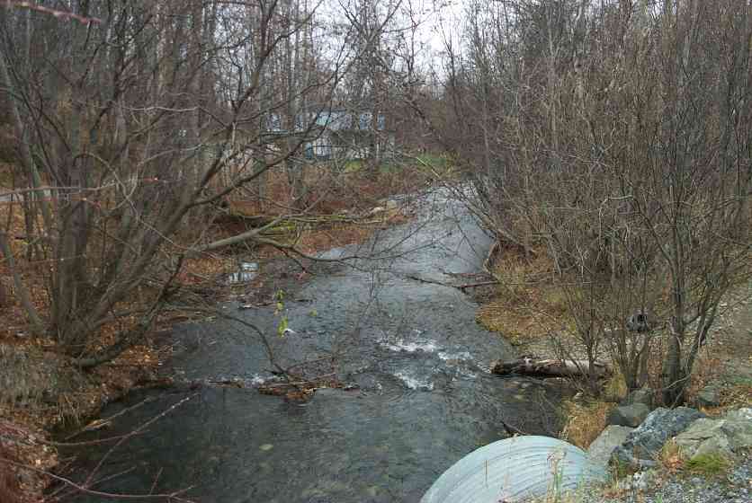
Stream Name: Cottonwood Creek
Elevation:
Site Comments: Old ATV Xing upstrm-some use; Active ATV Xing downstream-goes up and over culverts
arrow to the right of the survey date below to choose a different report for this site.
Survey MSCS1-CT159
Observers: Edward Weiss, Joe Conner
Overall Fish Passage Rating:
Tidal: No
Backwatered: No
Step Pools:
Construction Year:
Site Observations:
- Constriction ratio red
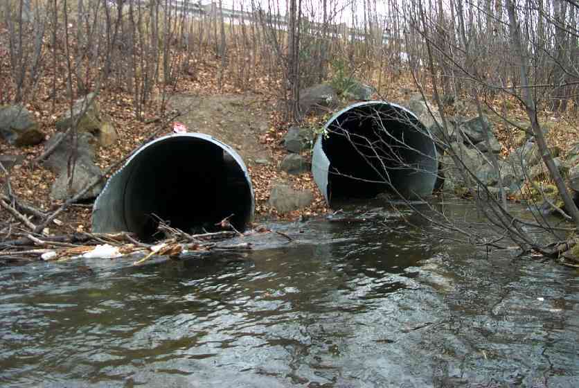
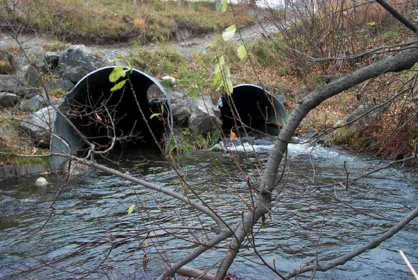
Comments: Old ATV Xing upstrm-some use;Active ATV Xing downstream-goes up and over culverts; Caving/erosion/sediment input; boulders at culvert inlets may impede fish passage; boulder at outlet (east culvert);Tailcrest mainly debris filled
Culvert Measurements
| ID: 1 | Structure Type: Closed-bottom arch (Strutural Metal Plate) | Fish Passage Rating: | |||||||||||||||||||||||||||||||||||||||||
|
|
|
|||||||||||||||||||||||||||||||||||||||||
Culvert Observations:
|
|||||||||||||||||||||||||||||||||||||||||||
| ID: 2 | Structure Type: Closed-bottom arch (Strutural Metal Plate) | Fish Passage Rating: | |||||||||||||||||||||||||||||||||||||||||
|
|
|
|||||||||||||||||||||||||||||||||||||||||
Culvert Observations:
|
|||||||||||||||||||||||||||||||||||||||||||
Stream Measurements
|
|
| Stream Width Type | Distance From Crossing (ft) |
Stream Width (ft) |
|---|---|---|
| Downstream ordinary high water | 50.0 | 34.50 |
| Downstream ordinary high water | 93.0 | 36.60 |
| Upstream ordinary high water | 50.0 | 37.00 |
| Upstream ordinary high water | 100.0 | 17.00 |
Elevations
| Locator ID | Culvert Number |
River Distance (ft)1 |
Distance From Crossing (ft)2 |
Relative Elevation (ft) |
|---|---|---|---|---|
| D/S Thalweg | 82.21 | |||
| D/S Tailcrest or 1st Thalweg | 83.52 | |||
| Outlet Culvert Top | 1 | 88.27 | ||
| Outlet Culvert Top | 2 | 89.24 | ||
| Inlet Culvert Top | 1 | 89.84 | ||
| D/S Thalweg | 0.00 | 93.0 | 81.97 | |
| Outlet Thalweg | 2 | 93.00 | 0.0 | 82.81 |
| Outlet Invert | 2 | 93.00 | 0.0 | 82.90 |
| Outlet Thalweg | 1 | 93.00 | 0.0 | 82.93 |
| Outlet Invert | 1 | 93.00 | 0.0 | 83.39 |
| Road Elev | 156.00 | 99.22 | ||
| Road Elev | 156.00 | 100.88 | ||
| Inlet Culvert Invert | 2 | 213.00 | -6.0 | 84.00 |
| Inlet Culvert Invert | 1 | 220.20 | 1.2 | 83.72 |
| Inlet Thalweg (Correct the inst Num from 3 to 1) | 2 | 223.00 | 4.0 | 73.47 |
| Inlet Thalweg | 1 | 223.00 | 4.0 | 84.62 |
| U/S Thalweg | 2 | 227.50 | 8.5 | 84.50 |
| U/S Thalweg | 235.00 | 16.0 | 84.23 | |
| U/S Thalweg (Base of gravel plume) | 264.00 | 45.0 | 84.61 | |
| U/S Thalweg | 269.00 | 50.0 | 85.35 | |
| U/S Thalweg | 319.00 | 100.0 | 85.32 |
Notes:
- River distance is measured continuously throughout the survey reach along the thalweg of the stream.
- Measured from each end of the crossing along the thalweg of the stream.
Fish Sampling Efforts
| Gear Type: Visual Observation, Ground (C) | ||
Fish Observations
| Species: adult coho salmon | Life History: Anadromous (Suspected Spawning) | ||
| Total Fish Observed: | Fish Measured: | Fork Lengths (mm) Min: Max: Mean: | |
| Collected/Observed by Gear Type: Upstream Visual Observation, Ground () | |||
| Comments: Adult coho observed upstream and downstream of culvert | |||
Photos
Questions or comments about this report can be directed to dfg.dsf.webmaster@alaska.gov