Fish Passage Site 20401306
Coordinates (dec. deg.): 61.59488°, -149.33951°
Legal Description: S017N001E06
Region: South Central
Road Name: North Shoreline Drive
Datum: NAD83
Quad Name / ITM: Anchorage C-7
AWC Stream #: 247-50-10300
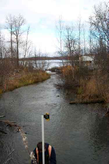
Stream Name: Cottonwood Creek
Elevation:
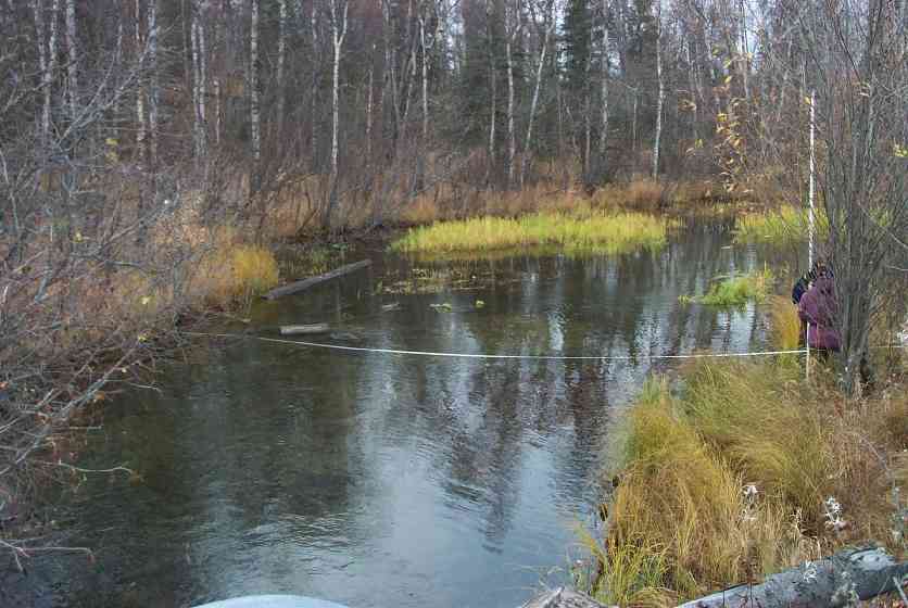
Site Comments: Between Cottonwood & Mud Lakes
Multiple surveys have been conducted at this site — click on the drop down
arrow to the right of the survey date below to choose a different report for this site.
arrow to the right of the survey date below to choose a different report for this site.
Survey MSCS1-CT158
Observers: Edward Weiss, Joe Conner, Jared Edgar
Overall Fish Passage Rating:
Tidal: No
Backwatered: No
Step Pools:
Construction Year:
Comments: Between Cottonwood & Mud Lakes; Many coho in this reach
Culvert Measurements
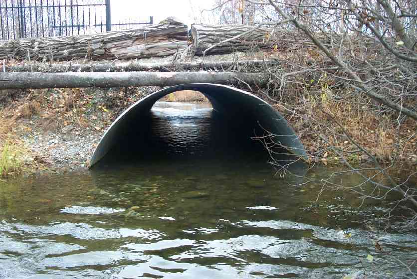
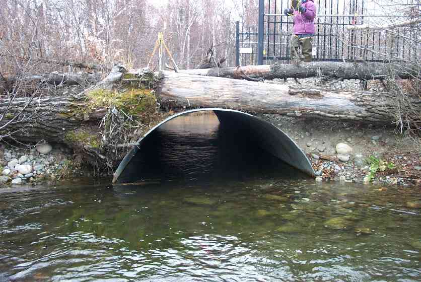
| ID: 1 | Structure Type: Open-bottom arch (Strutural Metal Plate) | Fish Passage Rating: | |||||||||||||||||||||||||||||||||||||||||
|
|
|
|||||||||||||||||||||||||||||||||||||||||
Culvert Observations:
|
|||||||||||||||||||||||||||||||||||||||||||
Stream Measurements
|
|
| Stream Width Type | Distance From Crossing (ft) |
Stream Width (ft) |
|---|---|---|
| Downstream ordinary high water | 50.0 | 61.50 |
| Downstream ordinary high water | 100.0 | 51.50 |
| Upstream ordinary high water | 50.0 | 35.50 |
| Upstream ordinary high water | 100.0 | 14.50 |
Elevations
| Locator ID | Culvert Number |
River Distance (ft)1 |
Distance From Crossing (ft)2 |
Relative Elevation (ft) |
|---|---|---|---|---|
| D/S Thalweg | 85.73 | |||
| D/S Thalweg | 86.69 | |||
| U/S Thalweg | 87.00 | |||
| U/S Thalweg | 87.85 | |||
| Inlet Culvert Top | 1 | 91.67 | ||
| Outlet Culvert Top | 1 | 91.85 | ||
| Outlet Invert | 1 | 0.00 | 0.0 | 86.78 |
| Outlet Thalweg | 1 | 0.00 | 0.0 | 86.78 |
| Road Elev | 24.00 | 93.75 | ||
| Road Elev | 24.00 | 94.84 | ||
| Inlet Culvert Invert | 1 | 48.00 | 0.0 | 86.80 |
| Inlet Thalweg | 1 | 48.50 | 0.5 | 86.86 |
Notes:
- River distance is measured continuously throughout the survey reach along the thalweg of the stream.
- Measured from each end of the crossing along the thalweg of the stream.
Fish Sampling Efforts
| Gear Type: Visual Observation, Ground (C) | ||
Fish Observations
| Species: adult coho salmon | Life History: Anadromous (Suspected Spawning) | ||
| Total Fish Observed: | Fish Measured: | Fork Lengths (mm) Min: Max: Mean: | |
| Collected/Observed by Gear Type: Upstream Visual Observation, Ground () | |||
| Comments: Many adult coho observed upstream and downstream of culvert | |||
Photos
Questions or comments about this report can be directed to dfg.dsf.webmaster@alaska.gov