Fish Passage Site 20401303
Coordinates (dec. deg.): 61.55406°, -149.48825°
Legal Description: S017N001W20
Region: South Central
Road Name: Edlund
Datum: NAD83
Quad Name / ITM: Anchorage C-7
AWC Stream #: 247-50-10300
Stream Name: Cottonwood Creek
Elevation:
Site Comments: None
arrow to the right of the survey date below to choose a different report for this site.
Survey MSCS1-CT154
Observers: Joe Conner, Edward Weiss, Nathan Pannkuk
Overall Fish Passage Rating:
Tidal: No
Backwatered: No
Step Pools: No
Construction Year:
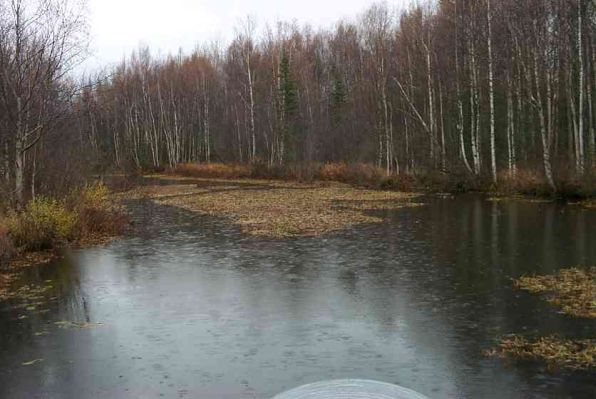
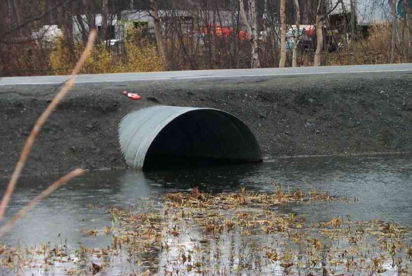
Comments: Ponded upstream and 100' downstream Ponded above & 100' below, Immediately below culvert is small cobble-gradually going to fine gravel @ top of plume/start of pond. Technically Red but likely passes fihs at most flows so rated as Gray.
Culvert Measurements
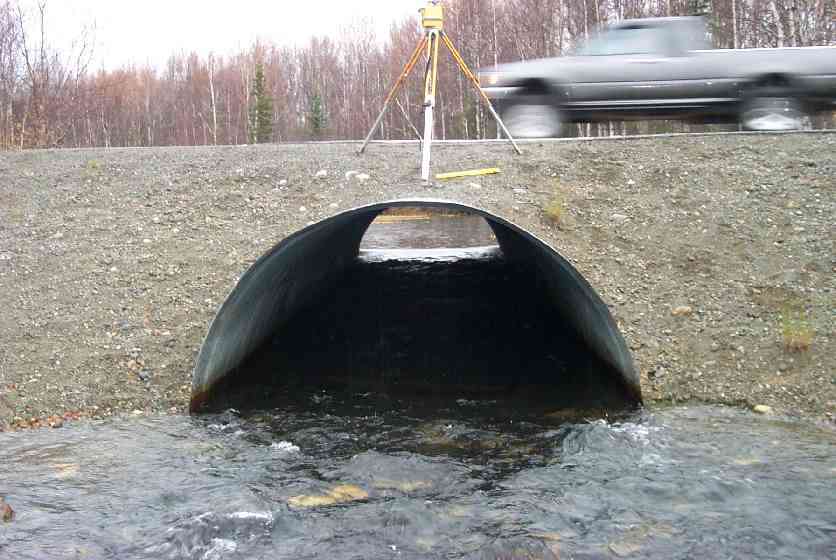
| ID: 1 | Structure Type: Open-bottom arch (Strutural Metal Plate) | Fish Passage Rating: | |||||||||||||||||||||||||||||||||||||||||
|
|
|
|||||||||||||||||||||||||||||||||||||||||
Culvert Observations:
|
|||||||||||||||||||||||||||||||||||||||||||
Stream Measurements
|
|
| Stream Width Type | Distance From Crossing (ft) |
Stream Width (ft) |
|---|---|---|
| Downstream ordinary high water | 50.0 | 62.00 |
| Downstream ordinary high water | 94.0 | 64.00 |
| Upstream ordinary high water | 55.0 | 95.00 |
Elevations
| Locator ID | Culvert Number |
River Distance (ft)1 |
Distance From Crossing (ft)2 |
Relative Elevation (ft) |
|---|---|---|---|---|
| Outlet Culvert Top | 1 | 94.31 | ||
| Inlet Culvert Top | 1 | 94.74 | ||
| D/S Thalweg (Base of gravel plume) | 0.00 | 104.5 | 87.05 | |
| D/S Thalweg | 10.50 | 94.0 | 88.78 | |
| D/S Thalweg | 54.50 | 50.0 | 88.79 | |
| Max Pool Depth | 97.50 | 7.0 | 89.47 | |
| Outlet Thalweg | 1 | 104.50 | 0.0 | 89.81 |
| Outlet Invert | 1 | 104.50 | 0.0 | 89.13 |
| Road Elev | 129.50 | 95.86 | ||
| Road Elev | 129.50 | 96.10 | ||
| Inlet Culvert Invert | 1 | 154.50 | 0.0 | 90.00 |
| Inlet Thalweg | 1 | 154.50 | 0.0 | 90.00 |
| U/S Thalweg | 1 | 161.50 | 7.0 | 89.38 |
| U/S Thalweg | 209.50 | 55.0 | 91.90 |
Notes:
- River distance is measured continuously throughout the survey reach along the thalweg of the stream.
- Measured from each end of the crossing along the thalweg of the stream.
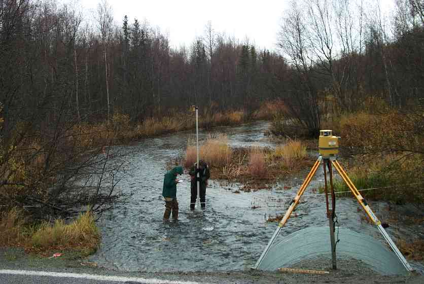
Fish Sampling Efforts
| Gear Type: Visual Observation, Ground (C) | ||
Fish Observations
| Species: adult coho salmon | Life History: Anadromous (Suspected Spawning) | ||
| Total Fish Observed: | Fish Measured: | Fork Lengths (mm) Min: Max: Mean: | |
| Collected/Observed by Gear Type: Upstream Visual Observation, Ground () | |||
| Comments: Adult coho observed upstream and downstream of culvert | |||
Photos
Questions or comments about this report can be directed to dfg.dsf.webmaster@alaska.gov