Fish Passage Site 20401302
Coordinates (dec. deg.): 61.54164°, -149.52385°
Legal Description: S017N001W30
Region: South Central
Road Name: Marble Way
Datum: NAD83
Quad Name / ITM: Anchorage C-7
AWC Stream #: 247-50-10300
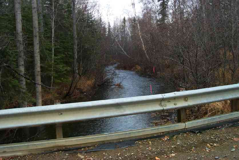
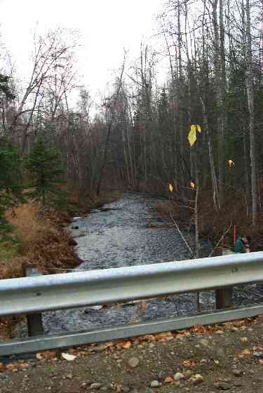
Stream Name: Cottonwood Creek
Elevation:
Site Comments: Borough Road
arrow to the right of the survey date below to choose a different report for this site.
Survey MSCS1-CT153
Observers: Gary Liepitz, Joe Conner, Nathan Pannkuk
Overall Fish Passage Rating:
Tidal: No
Backwatered: No
Step Pools:
Construction Year:
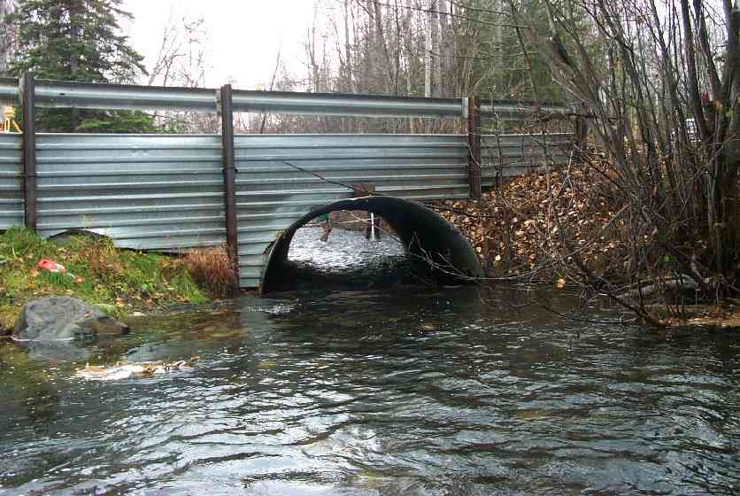
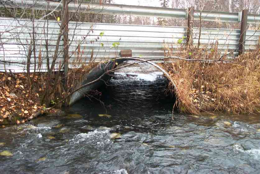
Comments: CULVERT:substr. Dep: bottomless arch culvert-no depth measurement, slightly bowed. Technically Red but proably passes fish at most flows.
Culvert Measurements
| ID: 1 | Structure Type: Open-bottom arch (Structural steel plate) | Fish Passage Rating: | |||||||||||||||||||||||||||||||||||||||||
|
|
|
|||||||||||||||||||||||||||||||||||||||||
Culvert Observations:
|
|||||||||||||||||||||||||||||||||||||||||||
Stream Measurements
|
|
| Stream Width Type | Distance From Crossing (ft) |
Stream Width (ft) |
|---|---|---|
| Downstream ordinary high water | 50.0 | 28.00 |
| Downstream ordinary high water | 100.0 | 30.00 |
| Upstream ordinary high water | 50.0 | 38.00 |
| Upstream ordinary high water | 137.0 | 43.00 |
Elevations
| Locator ID | Culvert Number |
River Distance (ft)1 |
Distance From Crossing (ft)2 |
Relative Elevation (ft) |
|---|---|---|---|---|
| Outlet Culvert Top | 1 | 93.19 | ||
| Inlet Culvert Top | 1 | 93.89 | ||
| D/S Thalweg | 0.00 | 100.0 | 86.73 | |
| D/S Thalweg | 50.00 | 50.0 | 87.46 | |
| Max Pool Depth | 98.00 | 2.0 | 87.72 | |
| Outlet Invert | 1 | 100.00 | 0.0 | 87.73 |
| Outlet Thalweg | 1 | 100.00 | 0.0 | 87.73 |
| Road Elev | 115.00 | 95.60 | ||
| Road Elev | 115.00 | 95.62 | ||
| Inlet Culvert Invert | 1 | 130.00 | 0.0 | 88.66 |
| Inlet Thalweg | 1 | 130.00 | 0.0 | 88.66 |
| U/S Thalweg | 1 | 133.00 | 3.0 | 88.93 |
| U/S Thalweg | 1 | 140.00 | 10.0 | 88.53 |
| U/S Thalweg | 180.00 | 50.0 | 88.71 | |
| U/S Thalweg | 267.00 | 137.0 | 89.53 |
Notes:
- River distance is measured continuously throughout the survey reach along the thalweg of the stream.
- Measured from each end of the crossing along the thalweg of the stream.
Fish Sampling Efforts
No fish sampling occurred during this survey.
Fish Observations
No fish observations occurred during this survey.
Photos
Questions or comments about this report can be directed to dfg.dsf.webmaster@alaska.gov