Fish Passage Site 20401301
Coordinates (dec. deg.): 61.53214°, -149.52786°
Legal Description: S017N001W30
Region: South Central
Road Name: West Riverdell Drive
Datum: NAD83
Quad Name / ITM: Anchorage C-7
AWC Stream #: 247-50-10300
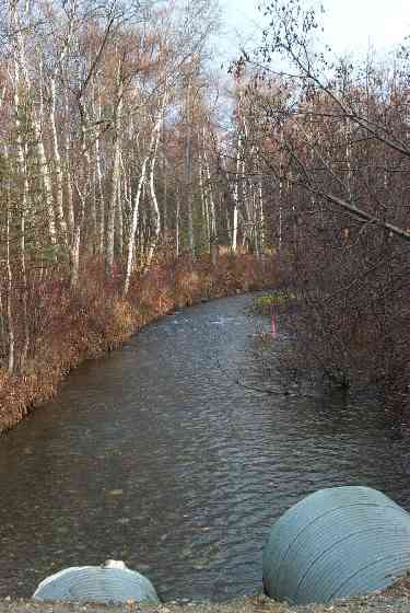
Stream Name: Cottonwood Creek
Elevation:
Site Comments: None
arrow to the right of the survey date below to choose a different report for this site.
Survey MSCS1-CT152
Observers: Edward Weiss, Joe Conner, Doug Hill
Overall Fish Passage Rating:
Tidal: No
Backwatered: No
Step Pools:
Construction Year:
Site Observations:
- Hydraulic flows exceeded capacity
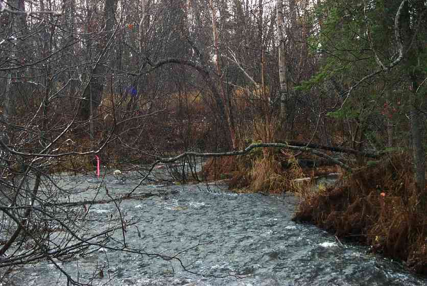
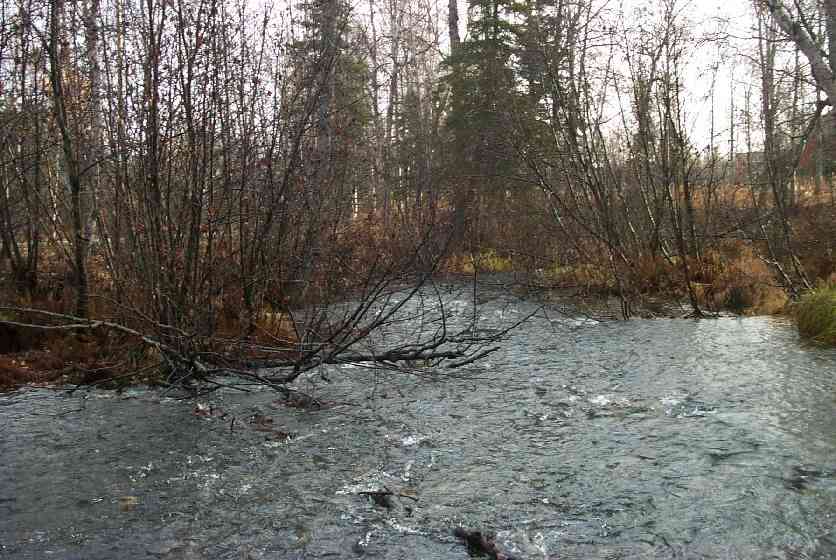
Comments: Downstream reach is braided w/lots of woody debris, channel breaks apart a lot, ice problems in winter.
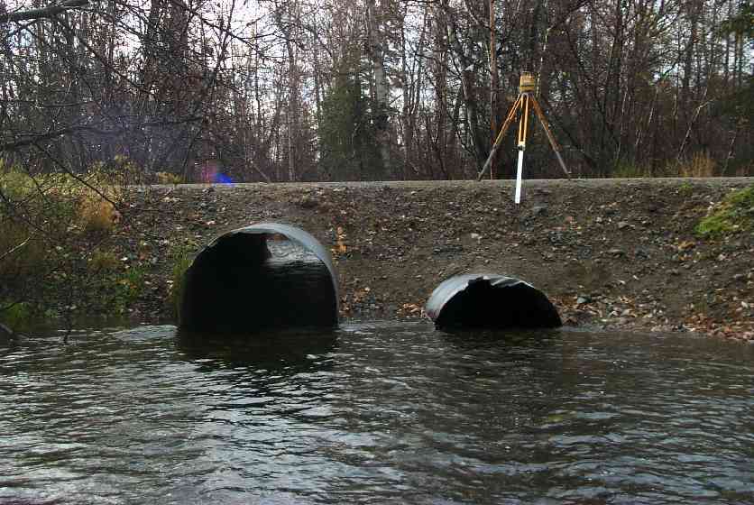
Culvert Measurements
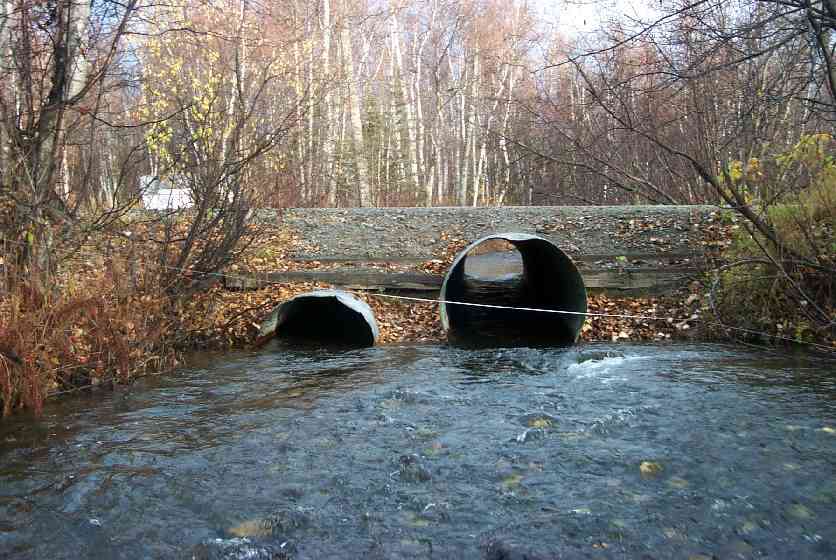
| ID: 1 | Structure Type: Circular pipe (Strutural Metal Plate) | Fish Passage Rating: | |||||||||||||||||||||||||||||||||||||||||
|
|
|
|||||||||||||||||||||||||||||||||||||||||
Culvert Observations:
|
|||||||||||||||||||||||||||||||||||||||||||
| ID: 2 | Structure Type: Pipe-arch (Corrugated Metal) | Fish Passage Rating: | |||||||||||||||||||||||||||||||||||||||||
|
|
|
|||||||||||||||||||||||||||||||||||||||||
Culvert Observations:
|
|||||||||||||||||||||||||||||||||||||||||||
Stream Measurements
|
|
| Stream Width Type | Distance From Crossing (ft) |
Stream Width (ft) |
|---|---|---|
| Downstream ordinary high water | 129.0 | 44.00 |
| Upstream ordinary high water | 50.0 | 30.00 |
| Upstream ordinary high water | 125.0 | 28.70 |
Elevations
| Locator ID | Culvert Number |
River Distance (ft)1 |
Distance From Crossing (ft)2 |
Relative Elevation (ft) |
|---|---|---|---|---|
| U/S Thalweg | 89.91 | |||
| Outlet Culvert Top | 2 | 92.09 | ||
| Inlet Culvert Top | 2 | 92.46 | ||
| Inlet Culvert Top | 1 | 94.01 | ||
| Outlet Culvert Top | 1 | 94.08 | ||
| D/S Thalweg (Channel split --main flow) | 0.00 | 129.0 | 86.92 | |
| D/S Thalweg | 76.00 | 53.0 | 88.31 | |
| D/S Tailcrest or 1st Thalweg | 117.00 | 12.0 | 89.86 | |
| OHW Left Bank | 124.00 | 5.0 | 89.33 | |
| D/S Thalweg | 127.75 | 1.25 | 89.00 | |
| Outlet Invert | 1 | 129.00 | 0.0 | 89.05 |
| Outlet Invert | 2 | 129.00 | 0.0 | 89.36 |
| Outlet Thalweg | 1 | 129.00 | 0.0 | 88.92 |
| Outlet Thalweg | 2 | 129.00 | 0.0 | 89.24 |
| Road Elev | 154.00 | 95.22 | ||
| Road Elev | 154.00 | 95.40 | ||
| Inlet Culvert Invert | 2 | 179.00 | 0.0 | 90.13 |
| Inlet Thalweg | 2 | 179.00 | 0.0 | 90.24 |
| Inlet Culvert Invert | 1 | 179.00 | 0.0 | 88.96 |
| Inlet Thalweg | 1 | 179.00 | 0.0 | 89.19 |
| U/S Thalweg | 304.00 | 125.0 | 90.84 |
Notes:
- River distance is measured continuously throughout the survey reach along the thalweg of the stream.
- Measured from each end of the crossing along the thalweg of the stream.
Fish Sampling Efforts
No fish sampling occurred during this survey.
Fish Observations
No fish observations occurred during this survey.
Photos

Questions or comments about this report can be directed to dfg.dsf.webmaster@alaska.gov