Fish Passage Site 20401300
Coordinates (dec. deg.): 61.52724°, -149.52698°
Legal Description: S017N001W31
Region: South Central
Road Name: Fairview Loop Road
Datum: NAD83
Quad Name / ITM: Anchorage C-7
AWC Stream #: 247-50-10300
Stream Name: Cottonwood Creek
Elevation:
Site Comments: ATV trails thru outlet area & over top of culvert.
arrow to the right of the survey date below to choose a different report for this site.
Survey MSCS1-CT151
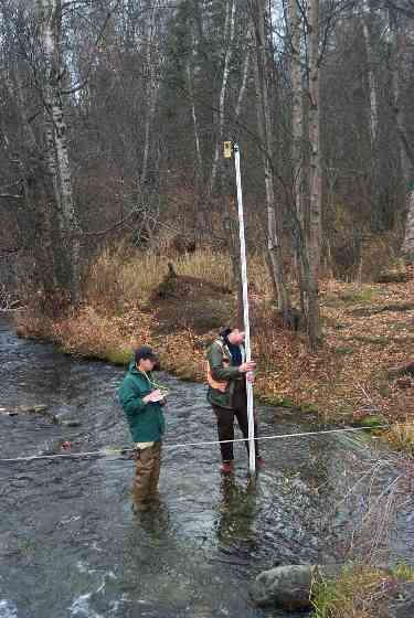
Observers: Edward Weiss, Joe Conner, Nathan Pannkuk
Overall Fish Passage Rating:
Tidal: No
Backwatered: No
Step Pools:
Construction Year:
Comments: ATV trails thru outlet area & over top of culvert; apparent inlet controlled-ponded slightlty & wetland areas on upstream side.
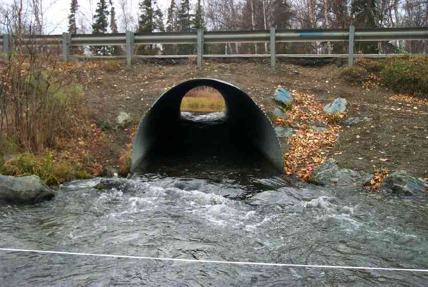
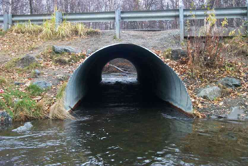
Culvert Measurements
| ID: 1 | Structure Type: Circular pipe (Corrugated Metal) | Fish Passage Rating: | |||||||||||||||||||||||||||||||||||||||||
|
|
|
|||||||||||||||||||||||||||||||||||||||||
Culvert Observations:
|
|||||||||||||||||||||||||||||||||||||||||||
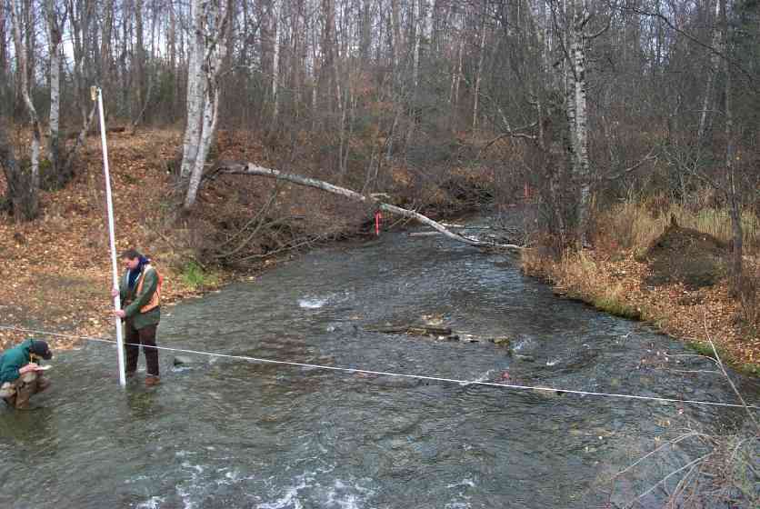
Stream Measurements
|
|
| Stream Width Type | Distance From Crossing (ft) |
Stream Width (ft) |
|---|---|---|
| Downstream ordinary high water | 51.0 | 27.00 |
| Downstream ordinary high water | 100.0 | 31.50 |
| Upstream ordinary high water | 50.0 | 40.00 |
| Upstream ordinary high water | 108.0 | 41.00 |
Elevations
| Locator ID | Culvert Number |
River Distance (ft)1 |
Distance From Crossing (ft)2 |
Relative Elevation (ft) |
|---|---|---|---|---|
| OHW Left Bank | 86.76 | |||
| Outlet Culvert Top | 1 | 93.35 | ||
| Inlet Culvert Top | 1 | 93.71 | ||
| U/S Thalweg | 87.05 | |||
| D/S Thalweg | 0.00 | 99.0 | 86.14 | |
| D/S Thalweg | 48.00 | 51.0 | 86.63 | |
| D/S Tailcrest or 1st Thalweg | 85.00 | 14.0 | 87.84 | |
| D/S Thalweg | 93.60 | 5.4 | 86.68 | |
| Outlet Invert | 1 | 99.00 | 0.0 | 86.86 |
| Outlet Thalweg | 1 | 99.00 | 0.0 | 86.86 |
| Road Elev | 132.50 | 95.63 | ||
| Road Elev | 132.50 | 95.73 | ||
| Inlet Thalweg | 1 | 166.00 | 0.0 | 86.80 |
| Inlet Culvert Invert | 1 | 166.00 | 0.0 | 86.69 |
| U/S Thalweg | 274.00 | 108.0 | 86.64 |
Notes:
- River distance is measured continuously throughout the survey reach along the thalweg of the stream.
- Measured from each end of the crossing along the thalweg of the stream.
Fish Sampling Efforts
No fish sampling occurred during this survey.
Fish Observations
No fish observations occurred during this survey.
Photos

Questions or comments about this report can be directed to dfg.dsf.webmaster@alaska.gov