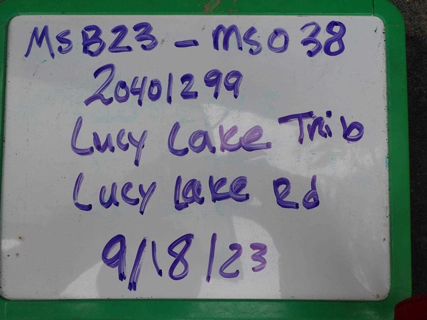
Fish Passage Site 20401299
Coordinates (dec. deg.): 61.45491°, -149.80899°
Legal Description: S016N003W28
Region: South Central
Road Name: Lucy Lake Road
Datum: NAD83
Quad Name / ITM: Anchorage B-8
AWC Stream #: 247-50-10300-2001
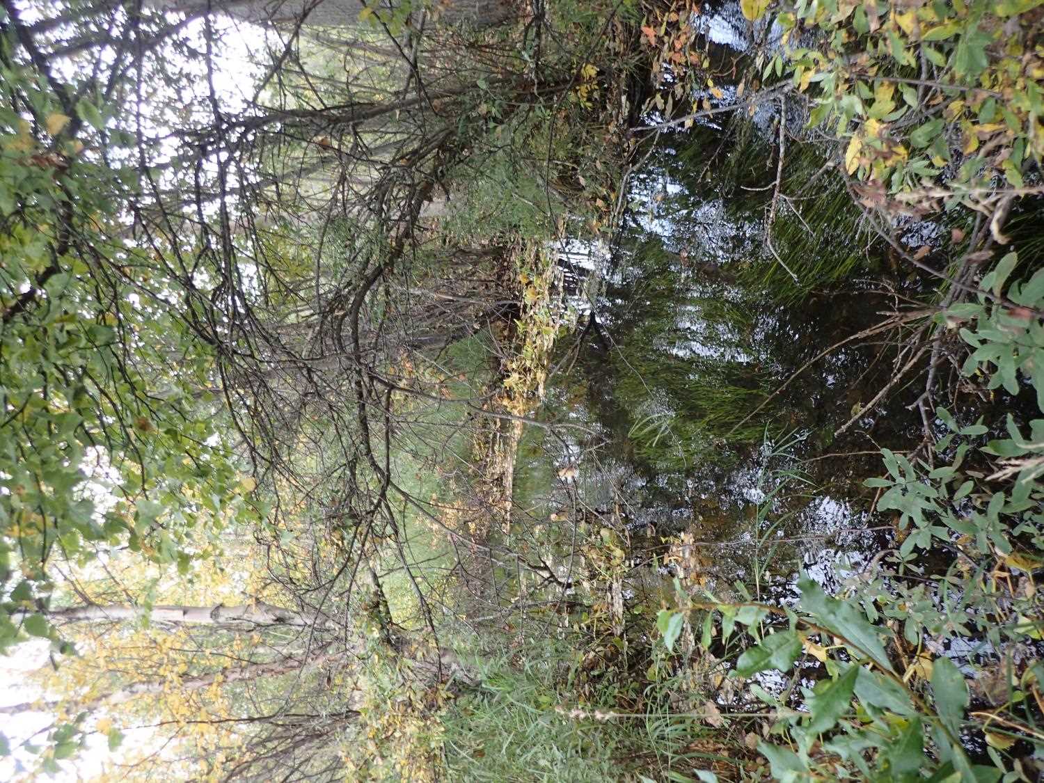
Stream Name: Lucy Creek Tributary
Elevation:
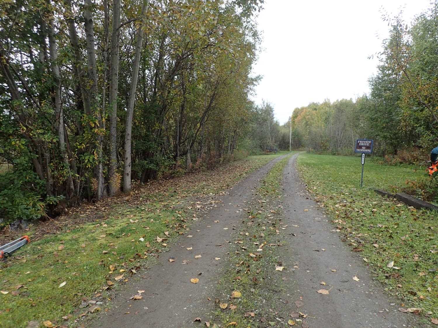
Site Comments: Bruno Wiida's drive (visited with Bruno)
arrow to the right of the survey date below to choose a different report for this site.
Survey MSB23-MS038
Project Supervisor: Michael Mazzacavallo, Alaska Department of Fish and Game
— Anchorage, AK
Observers: Michael Mazzacavallo, Kat Leavitt, Beth Evers
Overall Fish Passage Rating:
Tidal: No
Backwatered: No
Step Pools: No
Construction Year:
Site Observations:
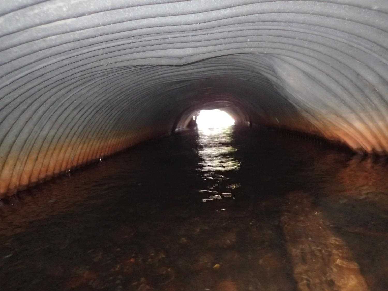
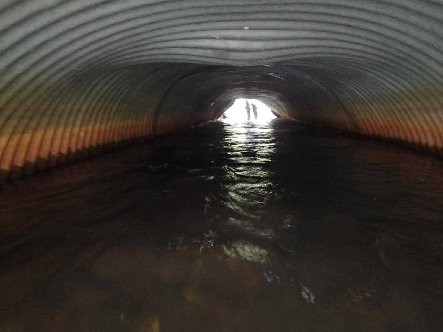
- Structural Problem
- Culvert is poorly aligned
- Constriction ratio gray
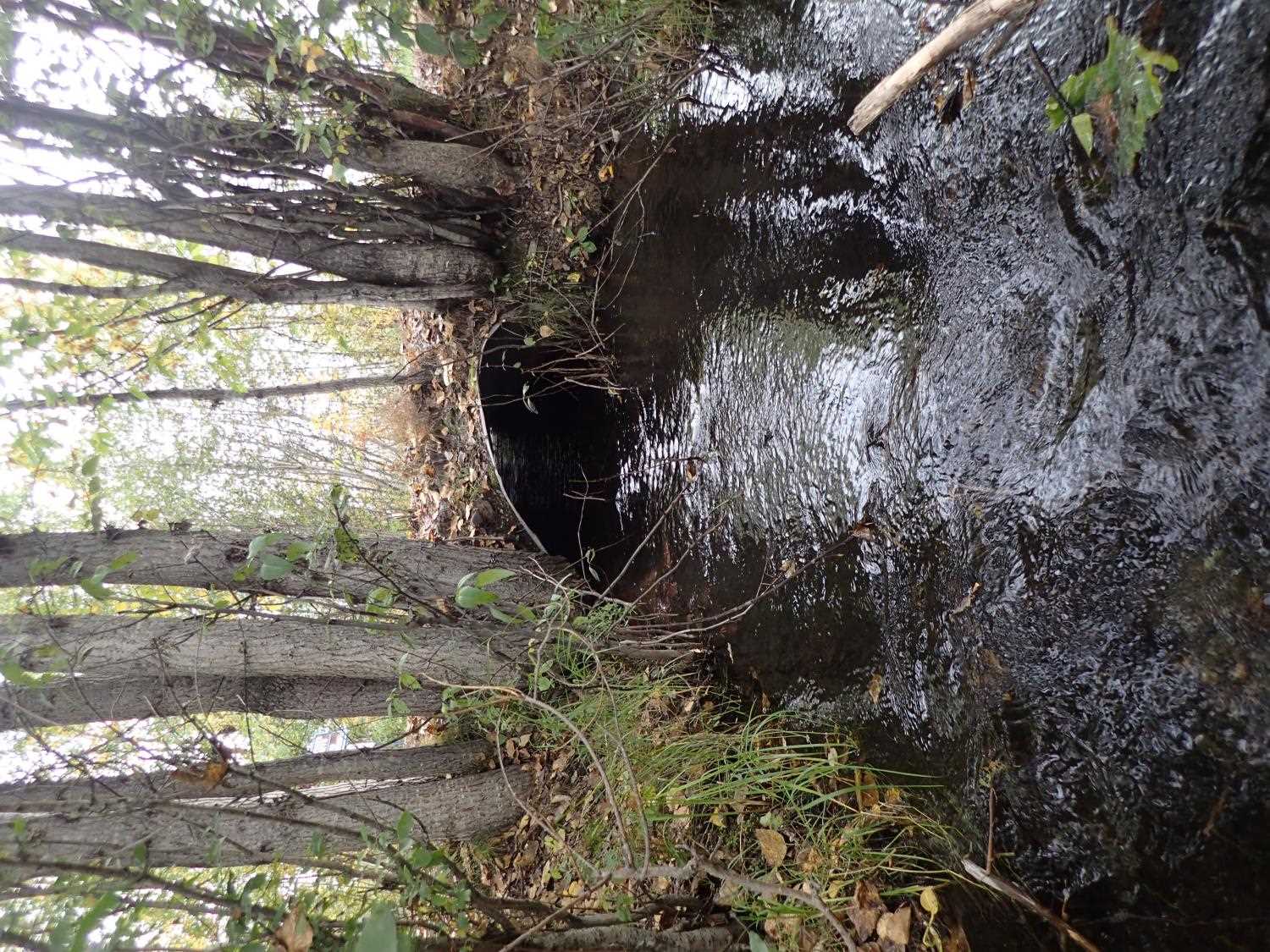
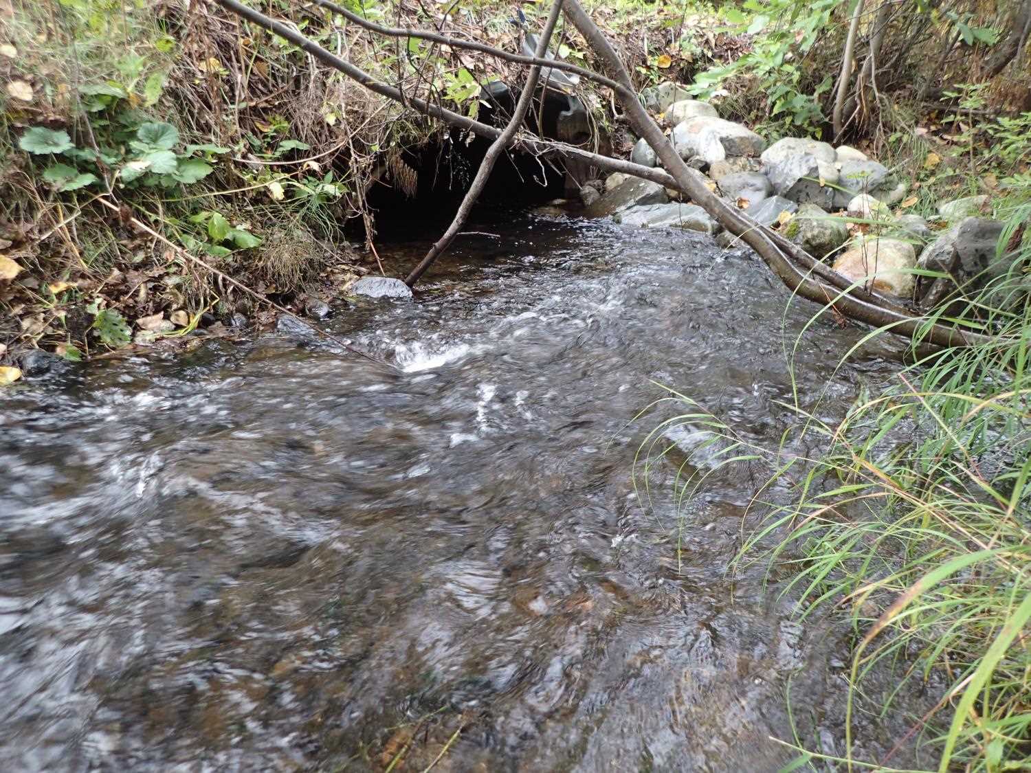
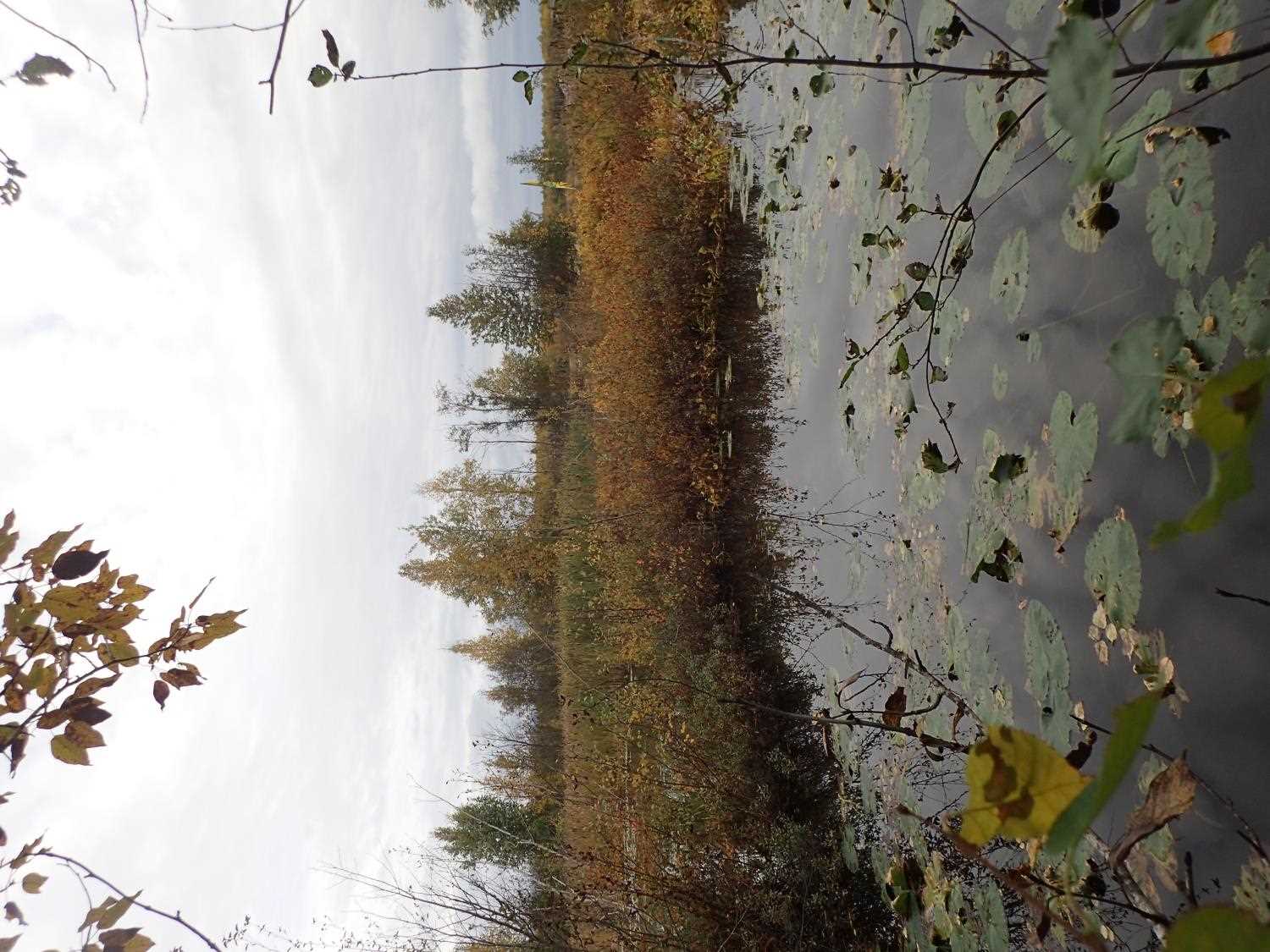
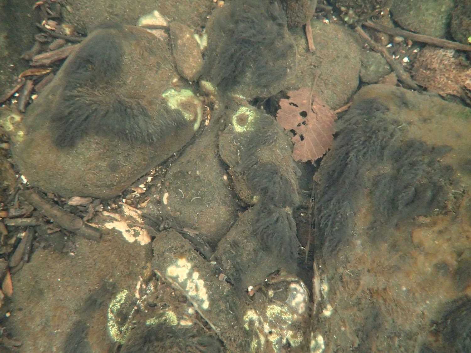
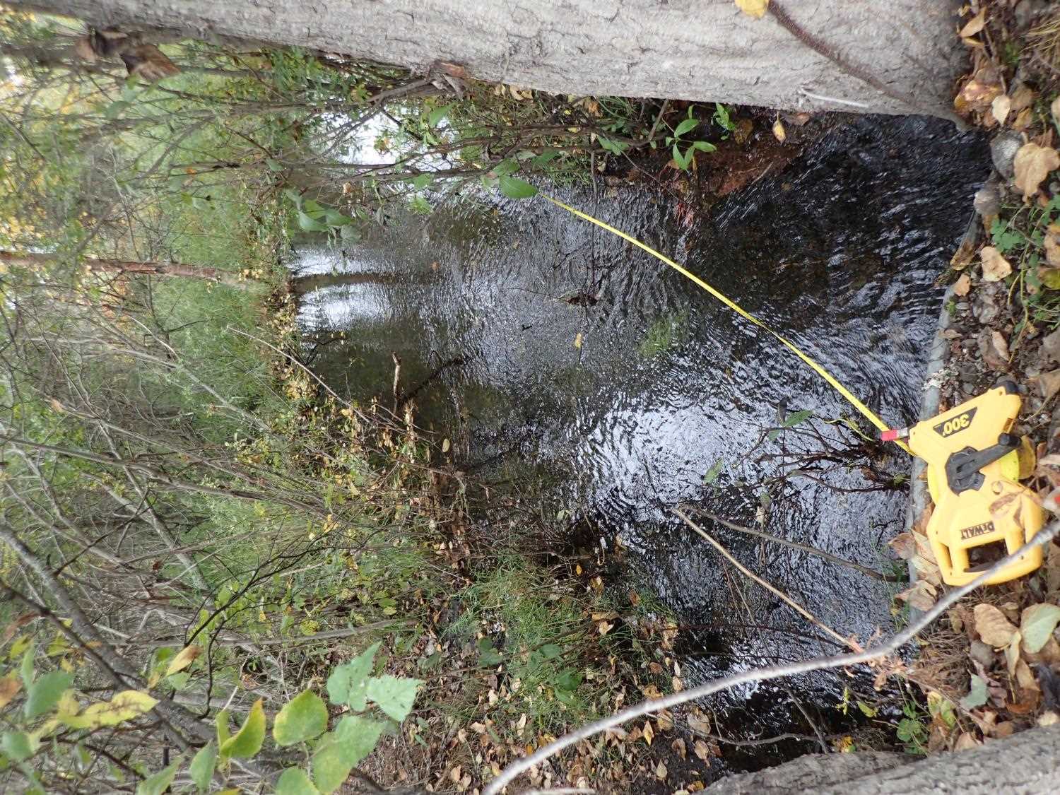
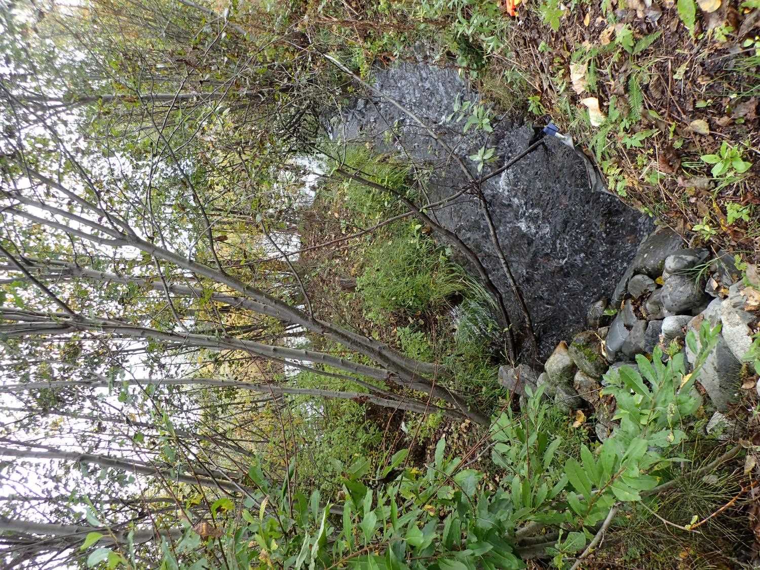
Comments: Outlet has tree growng into opening of culvert. Inlet has bent sides and showing signs of sagging. Culvert is between wetland and pond constructed stream 30ft into inlet.
Culvert Measurements
| ID: 1 | Structure Type: Circular pipe (Corrugated steel) | Fish Passage Rating: | ||||||||||||||||||||||||||||||||||||||||||
|
|
|
||||||||||||||||||||||||||||||||||||||||||
Comments: Used W/S to calculate stream gradient due to the tops of the culverts being too bent to use. |
||||||||||||||||||||||||||||||||||||||||||||
Culvert Observations:
|
||||||||||||||||||||||||||||||||||||||||||||
Stream Measurements
|
|
| Stream Width Type | Distance From Crossing (ft) |
Stream Width (ft) |
|---|---|---|
| Downstream ordinary high water | 8.0 | 18.00 |
| Downstream ordinary high water | 25.0 | 13.20 |
| Downstream ordinary high water | 50.0 | 13.10 |
Elevations
| Locator ID | Culvert Number |
River Distance (ft)1 |
Distance From Crossing (ft)2 |
Relative Elevation (ft) |
|---|---|---|---|---|
| Road Elev | 98.55 | |||
| D/S Thalweg | 0.00 | 94.19 | ||
| D/S Water Surface Elev | 0.00 | 96.04 | ||
| D/S Water Surface Elev | 75.00 | 96.10 | ||
| D/S Thalweg | 75.00 | 95.40 | ||
| D/S Thalweg | 83.00 | 94.82 | ||
| D/S Water Surface Elev | 83.00 | 96.10 | ||
| D/S Water Surface Elev | 102.00 | 96.16 | ||
| Outlet Invert | 102.00 | 95.47 | ||
| Outlet Culvert Top | 102.00 | 98.19 | ||
| Inlet Culvert Top | 134.10 | 97.90 | ||
| U/S Water Surface Elev | 134.10 | 96.24 | ||
| Inlet Culvert Invert | 134.10 | 95.65 | ||
| U/S Thalweg | 156.10 | 96.22 | ||
| U/S Water Surface Elev | 156.10 | 96.87 | ||
| U/S Water Surface Elev | 171.10 | 96.97 | ||
| U/S Thalweg | 171.10 | 95.23 |
Notes:
- River distance is measured continuously throughout the survey reach along the thalweg of the stream.
- Measured from each end of the crossing along the thalweg of the stream.
Fish Sampling Efforts
No fish sampling occurred during this survey.
Fish Observations
No fish observations occurred during this survey.
Photos
Questions or comments about this report can be directed to dfg.dsf.webmaster@alaska.gov