Fish Passage Site 20401298
Coordinates (dec. deg.): 61.52206°, -149.57157°
Legal Description: S017N002W35
Region: South Central
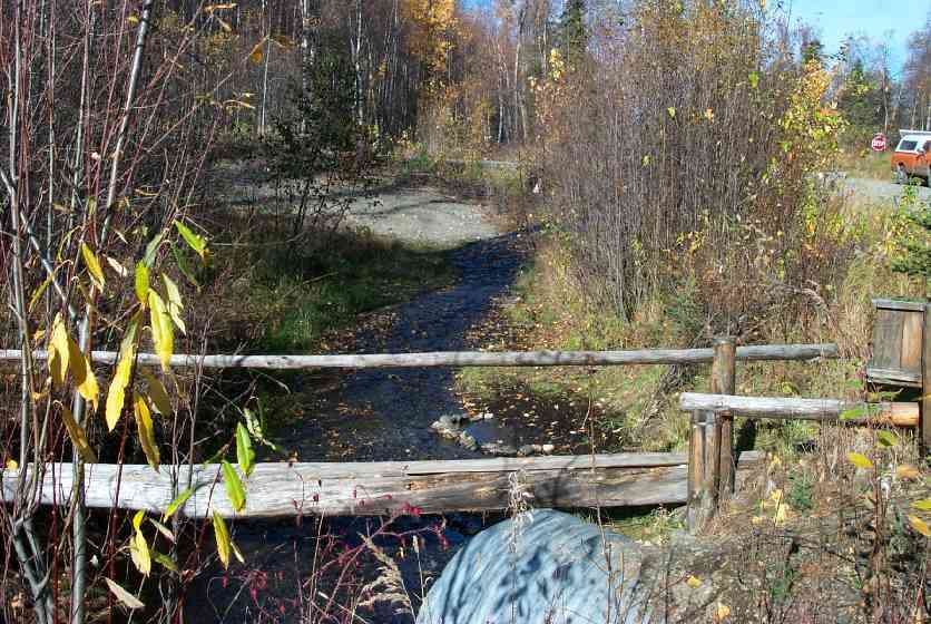
Road Name: Lupine Lane
Datum: NAD83
Quad Name / ITM: Anchorage C-7
AWC Stream #:
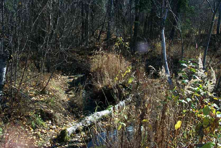
Stream Name: Lucy Creek tributary
Elevation:
Site Comments: Trib Lucy Ck; Site 149 & 148 are within 142' of each other,
arrow to the right of the survey date below to choose a different report for this site.
Survey MSCS1-CT149
Observers: Edward Weiss, Doug Hill
Overall Fish Passage Rating:
Tidal: No
Backwatered: No
Step Pools:
Construction Year:
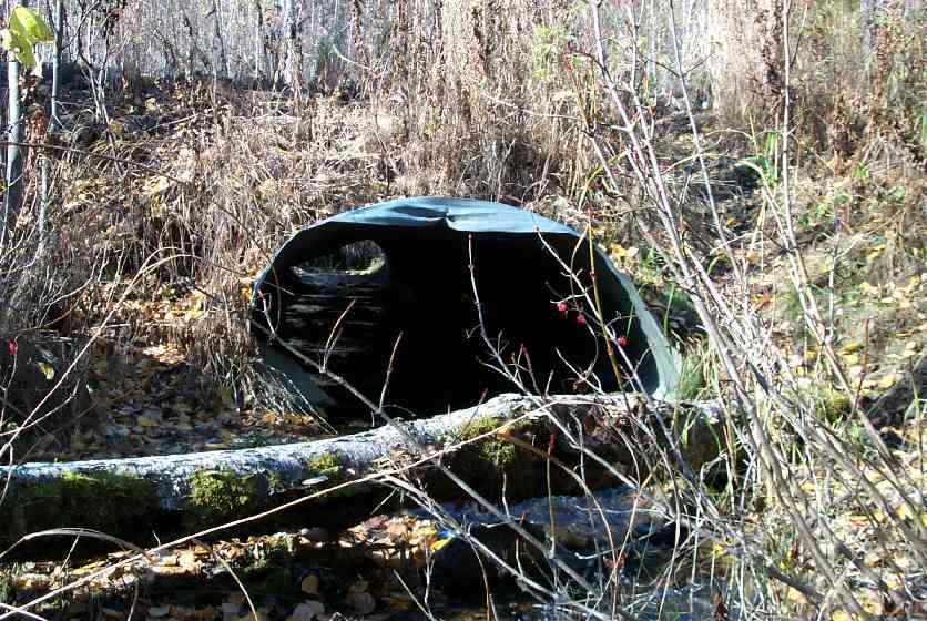
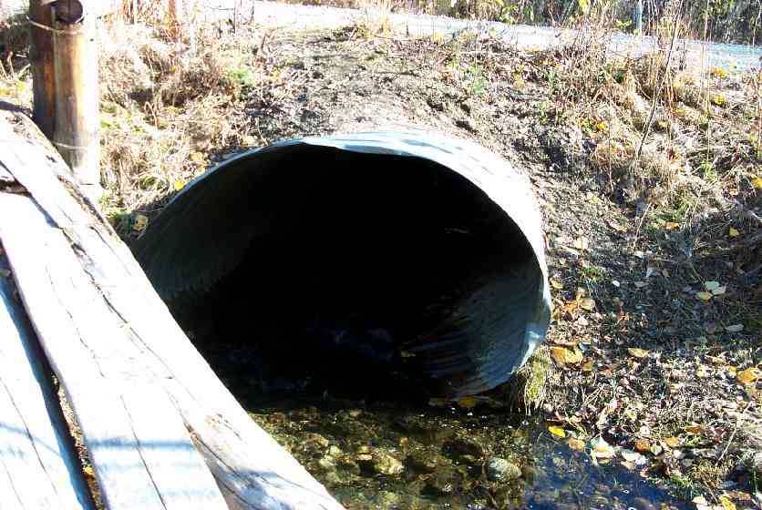
Site Observations:
- Culvert gradient red
- Mechanical damage or joints parting
- Structural Problem
- Improper bedding
Comments: Site 149 & 148 are within 142' of each other, downstream 148 data applies to uprstream site 149, sites tied together thru elevations Fine & coarse gravel & cobbles upstream - sand & cobble downstream; site149 & 148 w/in 142' of each other; downstrm 148 data applies to upstream 149; sites tied together thru elevtations. See 148 for upst/downst 50/100 elevation data
Culvert Measurements
| ID: 1 | Structure Type: Pipe-arch (Corrugated Metal) | Fish Passage Rating: | |||||||||||||||||||||||||||||||||||||||||
|
|
|
|||||||||||||||||||||||||||||||||||||||||
Culvert Observations:
|
|||||||||||||||||||||||||||||||||||||||||||
Stream Measurements
|
|
| Stream Width Type | Distance From Crossing (ft) |
Stream Width (ft) |
|---|---|---|
| Downstream ordinary high water | 50.0 | 3.00 |
| Downstream ordinary high water | 97.0 | 4.50 |
| Upstream ordinary high water | 44.0 | 9.00 |
| Upstream ordinary high water | 100.0 | 13.00 |
Elevations
| Locator ID | Culvert Number |
River Distance (ft)1 |
Distance From Crossing (ft)2 |
Relative Elevation (ft) |
|---|---|---|---|---|
| Outlet Culvert Top | 1 | 79.78 | ||
| Inlet Culvert Top | 1 | 82.09 | ||
| D/S Thalweg | 0.00 | 97.0 | 72.87 | |
| D/S Thalweg | 47.00 | 50.0 | 74.12 | |
| D/S Thalweg | 81.00 | 16.0 | 75.43 | |
| Outlet Invert | 1 | 97.00 | 0.0 | 76.52 |
| Outlet Thalweg | 1 | 97.00 | 0.0 | 76.52 |
| Road Elev | 120.00 | 83.02 | ||
| Road Elev | 120.00 | 83.11 | ||
| Inlet Thalweg | 1 | 143.00 | 0.0 | 78.50 |
| Inlet Culvert Invert | 1 | 143.00 | 0.0 | 78.53 |
| U/S Thalweg | 1 | 145.30 | 2.3 | 78.31 |
| U/S Thalweg | 185.00 | 42.0 | 79.98 | |
| U/S Thalweg | 235.00 | 92.0 | 72.97 |
Notes:
- River distance is measured continuously throughout the survey reach along the thalweg of the stream.
- Measured from each end of the crossing along the thalweg of the stream.
Fish Sampling Efforts
| Gear Type: Minnow Trap (B) | Trap Duration(h): 1 | |
| Gear Type: Visual Observation, Ground (C) | ||
Fish Observations
| Species: adult spawning Dolly Varden | Life History: Unknown (Suspected Spawning) | ||
| Total Fish Observed: 1 | Fish Measured: | Fork Lengths (mm) Min: Max: Mean: | |
| Collected/Observed by Gear Type: Upstream Visual Observation, Ground (1) | |||
| Comments: Approximately 8" DV, adult in spawning colors. Trap set upstream of 148 | |||
| Species: juvenile/adult Dolly Varden | Life History: Unknown | ||
| Total Fish Observed: 4 | Fish Measured: 2 | Fork Lengths (mm) Min: 127 Max: 142 Mean: 134 | |
| Collected/Observed by Gear Type: Downstream Minnow Trap (4) | |||
Photos
Questions or comments about this report can be directed to dfg.dsf.webmaster@alaska.gov