Fish Passage Site 20401297
Coordinates (dec. deg.): 61.52158°, -149.57146°
Legal Description: S017N002W35
Region: South Central
Road Name: South Starflower Drive
Datum: NAD83
Quad Name / ITM: Anchorage C-7
AWC Stream #:
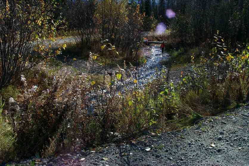
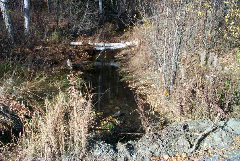
Stream Name: Lucy Creek tributary
Elevation:
Site Comments: None
Multiple surveys have been conducted at this site — click on the drop down
arrow to the right of the survey date below to choose a different report for this site.
arrow to the right of the survey date below to choose a different report for this site.
Survey MSCS1-CT148
Observers: Edward Weiss, Doug Hill
Overall Fish Passage Rating:
Tidal: No
Backwatered: No
Step Pools: No
Construction Year:
Site Observations:
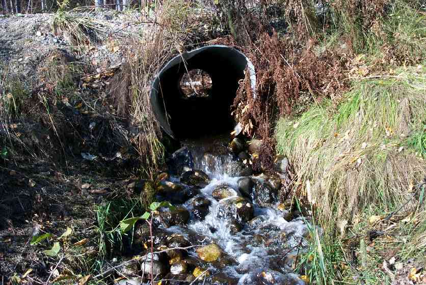
- Outfall height red
Comments: None
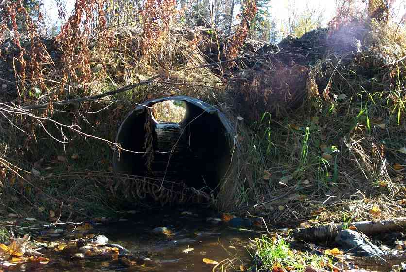
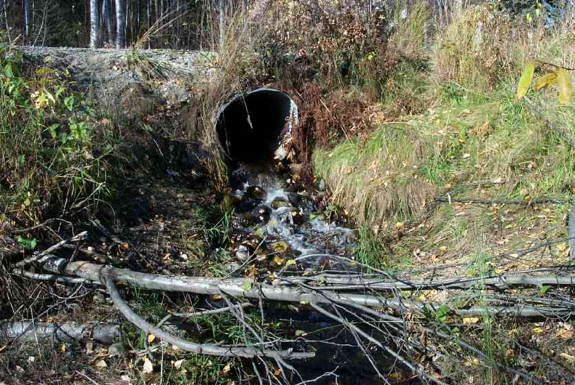
Culvert Measurements
| ID: 1 | Structure Type: Circular pipe (Corrugated steel) | Fish Passage Rating: | ||||||||||||||||||||||||||||||||||||||||||
|
|
|
||||||||||||||||||||||||||||||||||||||||||
Culvert Observations:
|
||||||||||||||||||||||||||||||||||||||||||||
Stream Measurements
|
|
| Stream Width Type | Distance From Crossing (ft) |
Stream Width (ft) |
|---|---|---|
| Downstream ordinary high water | 44.0 | 9.00 |
| Downstream ordinary high water | 100.0 | 13.00 |
| Upstream ordinary high water | 50.0 | 5.00 |
| Upstream ordinary high water | 100.0 | 5.80 |
Elevations
| Locator ID | Culvert Number |
River Distance (ft)1 |
Distance From Crossing (ft)2 |
Relative Elevation (ft) |
|---|---|---|---|---|
| D/S Thalweg | 79.98 | |||
| U/S Thalweg | 89.35 | |||
| U/S Thalweg | 89.59 | |||
| Outlet Culvert Top | 1 | 91.29 | ||
| Inlet Culvert Top | 1 | 92.56 | ||
| D/S Thalweg | 0.00 | 44.0 | 83.73 | |
| Outlet Thalweg | 1 | 44.00 | 0.0 | 88.02 |
| Outlet Invert | 1 | 44.00 | 0.0 | 88.39 |
| Road Elev | 64.00 | 92.98 | ||
| Road Elev | 64.00 | 93.92 | ||
| Inlet Culvert Invert | 1 | 84.00 | 0.0 | 89.55 |
| Inlet Thalweg | 1 | 84.00 | 0.0 | 89.56 |
| U/S Thalweg | 1 | 87.00 | 3.0 | 89.45 |
Notes:
- River distance is measured continuously throughout the survey reach along the thalweg of the stream.
- Measured from each end of the crossing along the thalweg of the stream.
Fish Sampling Efforts
| Gear Type: Minnow Trap (A) | Trap Duration(h): 1 | |
| Gear Type: Minnow Trap (B) | ||
| Gear Type: Visual Observation, Ground (D) | ||
Fish Observations
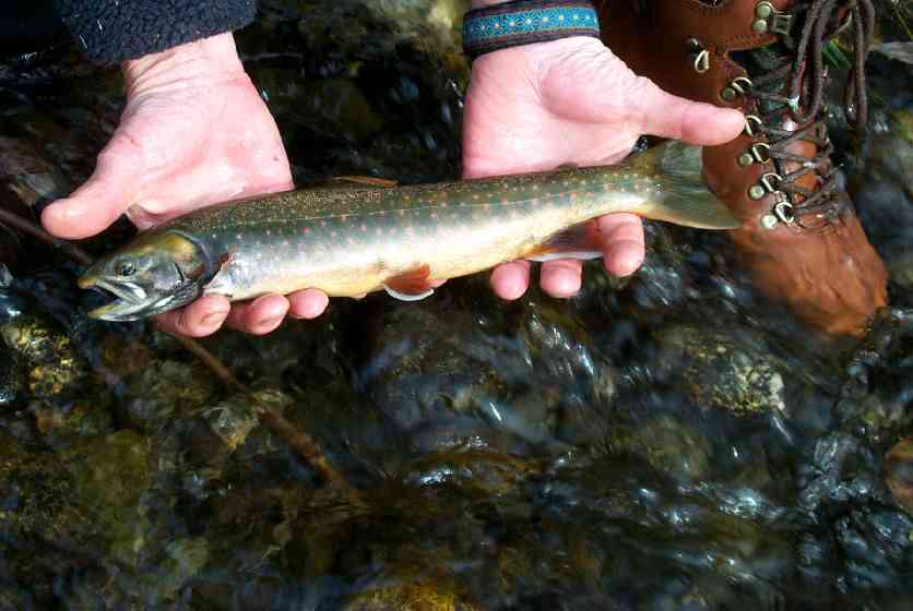
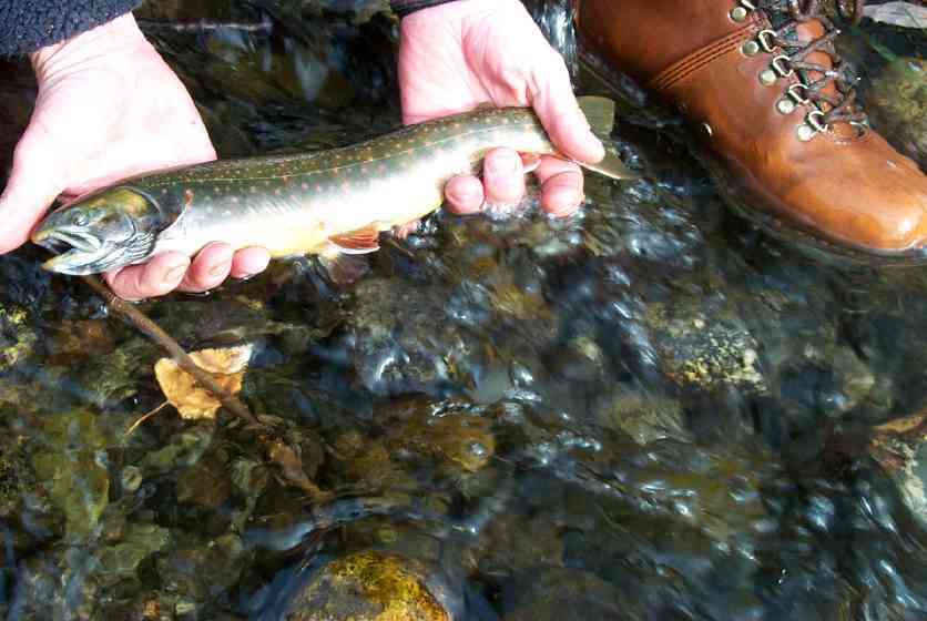
| Species: juvenile/adult Dolly Varden | Life History: Unknown (Suspected Spawning) | ||
| Total Fish Observed: | Fish Measured: | Fork Lengths (mm) Min: Max: Mean: | |
| Collected/Observed by Gear Type: Downstream Visual Observation, Ground () | |||
| Comments: Both adults in spawning colors and rearing jueniles aboserved visually | |||
| Species: no fish collected or observed | Life History: Not Applicable | ||
| Total Fish Observed: 0 | Fish Measured: | Fork Lengths (mm) Min: Max: Mean: | |
| Collected/Observed by Gear Type: Downstream Minnow Trap (0) Upstream Minnow Trap (0) | |||
Photos
Questions or comments about this report can be directed to dfg.dsf.webmaster@alaska.gov