Fish Passage Site 20401296
Coordinates (dec. deg.): 61.52290°, -149.57120°
Legal Description: S017N002W35
Region: South Central
Road Name: Cardiff Road
Datum: NAD83
Quad Name / ITM: Anchorage C-7
AWC Stream #:
Stream Name: Lucy Creek tributary
Elevation:
Site Comments: CAR01 is upstream from this site.
arrow to the right of the survey date below to choose a different report for this site.
Survey MSCS1-CT147
Observers: Edward Weiss, Doug Hill
Overall Fish Passage Rating:
Tidal: No
Backwatered: No
Step Pools:
Construction Year:
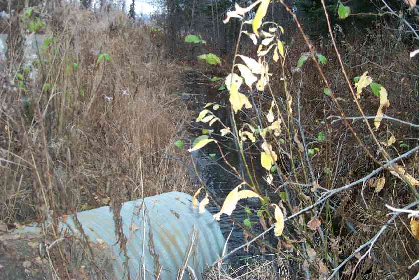
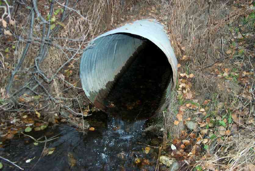
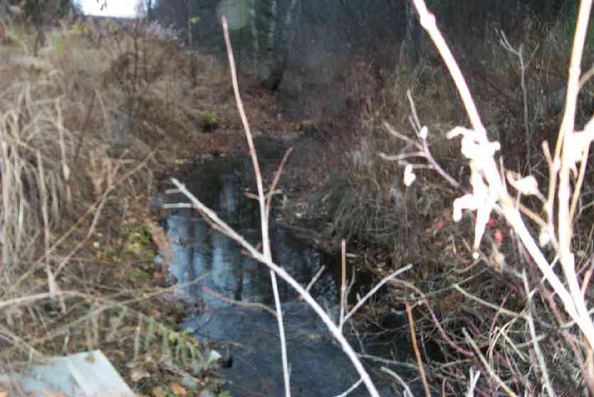
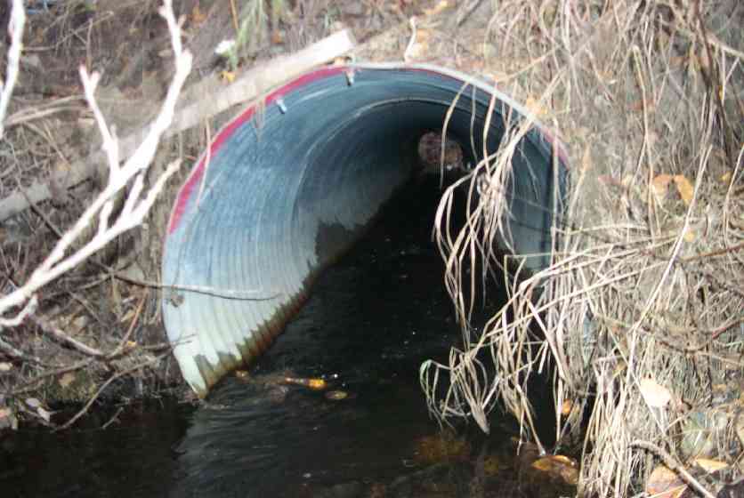
Comments: Major perch at culvert outlet Channel uspstrm in part & dwnstrm 80' constructed/altered in past to allow road construction; Channel width varies, channel entrenched w/lower banks & wide spots w/in higher banks.
Culvert Measurements
| ID: 1 | Structure Type: Circular pipe (Corrugated Metal) | Fish Passage Rating: | |||||||||||||||||||||||||||||||||||||||||
|
|
|
|||||||||||||||||||||||||||||||||||||||||
Culvert Observations:
|
|||||||||||||||||||||||||||||||||||||||||||
Stream Measurements
|
|
| Stream Width Type | Distance From Crossing (ft) |
Stream Width (ft) |
|---|---|---|
| Downstream ordinary high water | 50.0 | 8.00 |
| Downstream ordinary high water | 100.0 | 8.50 |
| Upstream ordinary high water | 50.0 | 16.00 |
| Upstream ordinary high water | 100.0 | 9.80 |
Elevations
| Locator ID | Culvert Number |
River Distance (ft)1 |
Distance From Crossing (ft)2 |
Relative Elevation (ft) |
|---|---|---|---|---|
| Outlet Culvert Top | 1 | 92.66 | ||
| Inlet Culvert Top | 1 | 93.19 | ||
| D/S Thalweg | 0.00 | 100.0 | 87.68 | |
| D/S Thalweg | 50.00 | 50.0 | 88.84 | |
| D/S Tailcrest or 1st Thalweg | 97.60 | 2.4 | 89.21 | |
| D/S Thalweg | 99.20 | 0.8 | 89.14 | |
| Outlet Thalweg | 1 | 100.00 | 0.0 | 89.33 |
| Outlet Invert | 1 | 100.00 | 0.0 | 89.60 |
| Road Elev | 124.00 | 94.18 | ||
| Road Elev | 124.00 | 94.75 | ||
| Inlet Culvert Invert | 1 | 148.00 | 0.0 | 90.33 |
| Inlet Thalweg | 1 | 148.00 | 0.0 | 90.33 |
| U/S Thalweg | 198.00 | 50.0 | 89.94 | |
| U/S Thalweg | 248.00 | 100.0 | 90.34 |
Notes:
- River distance is measured continuously throughout the survey reach along the thalweg of the stream.
- Measured from each end of the crossing along the thalweg of the stream.
Fish Sampling Efforts
| Gear Type: Minnow Trap (A) | Trap Duration(h): 78906 | |
| Gear Type: Minnow Trap (B) | Trap Duration(h): 18 | |
Fish Observations
| Species: juvenile/adult Dolly Varden | Life History: Unknown | ||
| Total Fish Observed: 2 | Fish Measured: 1 | Fork Lengths (mm) Min: 140 Max: 140 Mean: 140 | |
| Collected/Observed by Gear Type: Upstream Minnow Trap (2) | |||
| Species: no fish collected or observed | Life History: Not Applicable | ||
| Total Fish Observed: 0 | Fish Measured: | Fork Lengths (mm) Min: Max: Mean: | |
| Collected/Observed by Gear Type: Downstream Minnow Trap (0) | |||
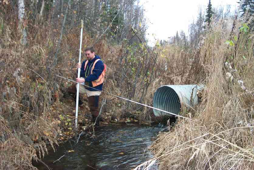
Photos
Questions or comments about this report can be directed to dfg.dsf.webmaster@alaska.gov