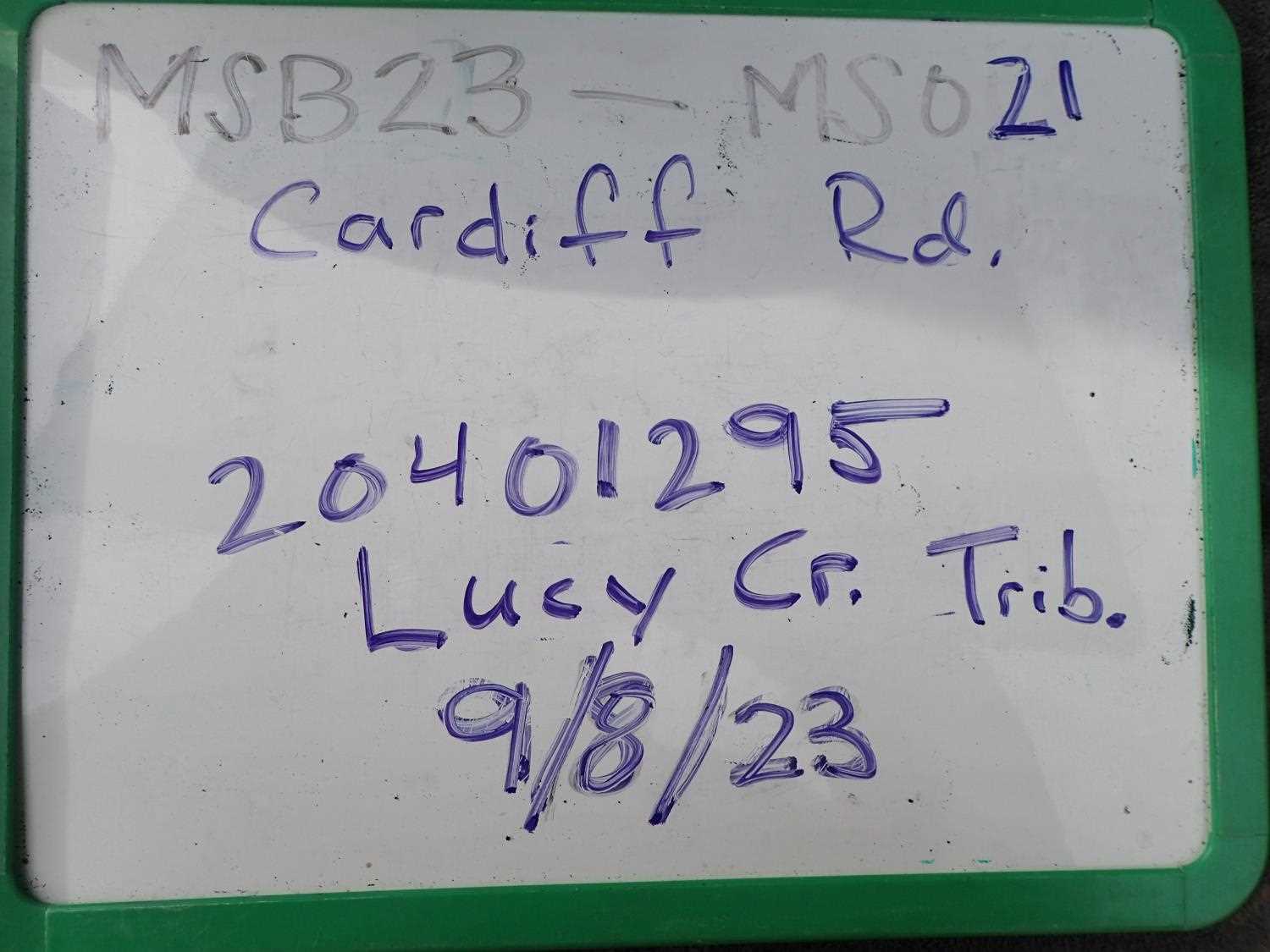
Fish Passage Site 20401295
Coordinates (dec. deg.): 61.52490°, -149.57124°
Legal Description: S017N002W35
Region: South Central
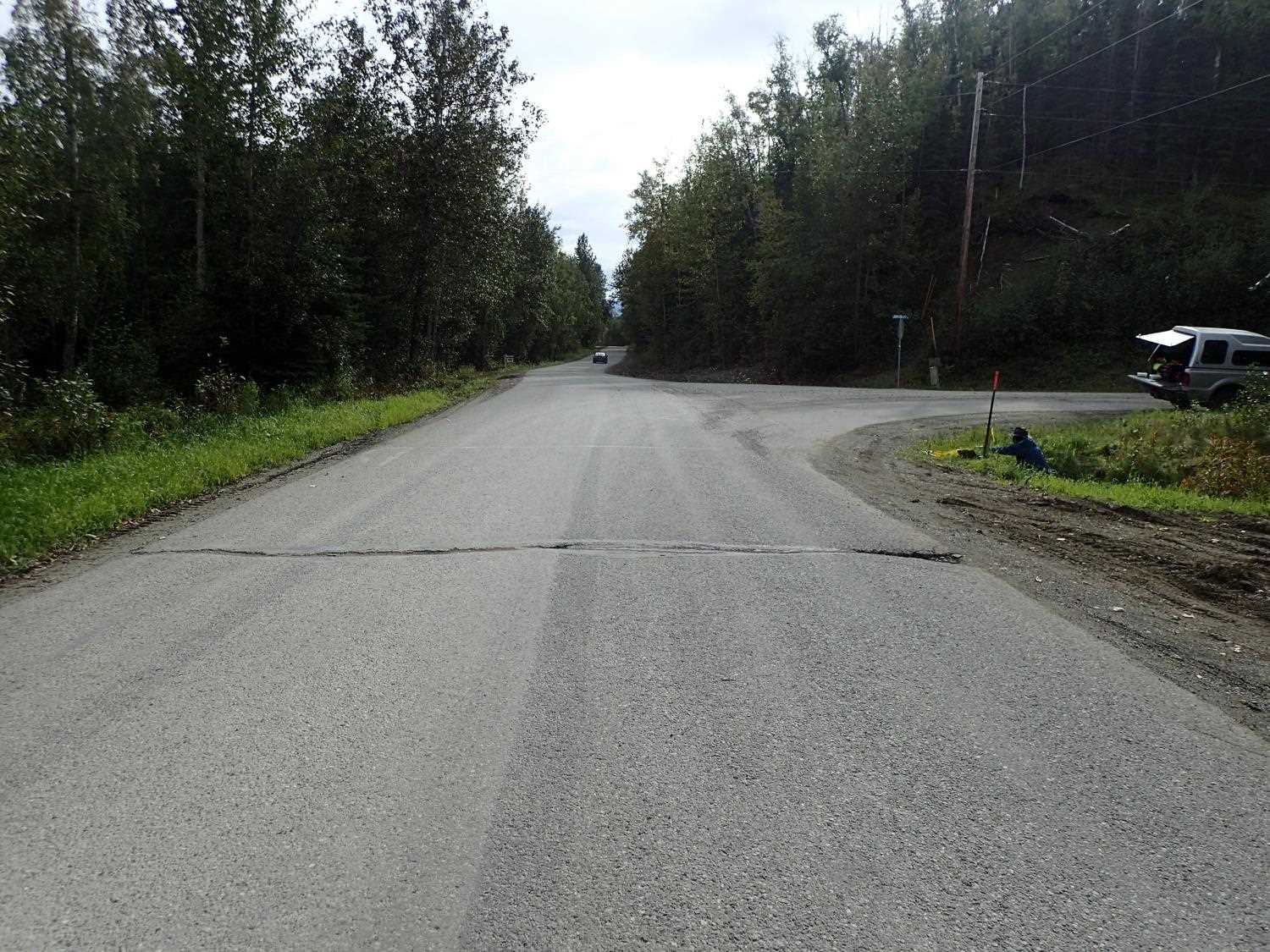
Road Name: Cardiff Road
Datum: NAD83
Quad Name / ITM: Anchorage C-7
AWC Stream #:
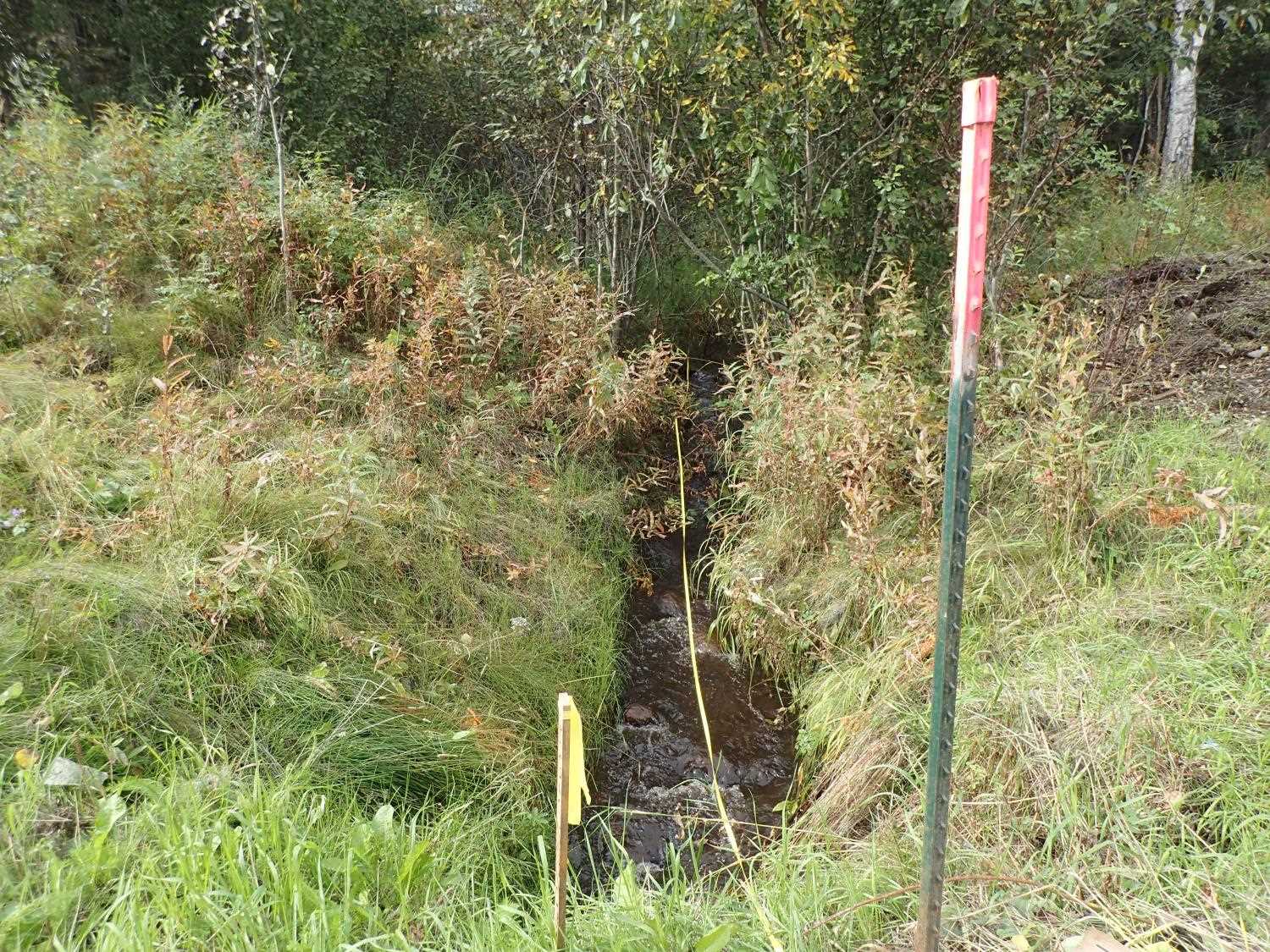
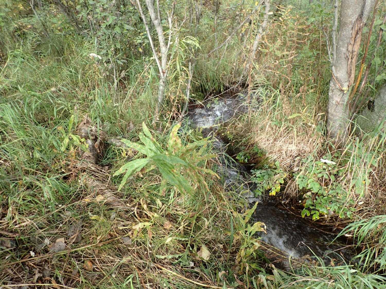
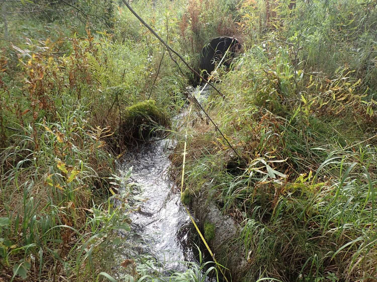
Stream Name: Lucy Creek tributary
Elevation:
Site Comments: None
arrow to the right of the survey date below to choose a different report for this site.
Survey MSB23-MS021
Project Supervisor: Michael Mazzacavallo, Alaska Department of Fish and Game
— Anchorage, AK
Observers: Kevin Keith, Kat Leavitt, Beth Evers
Overall Fish Passage Rating:
Tidal: No
Backwatered: No
Step Pools: No
Construction Year: 2004
Site Observations:
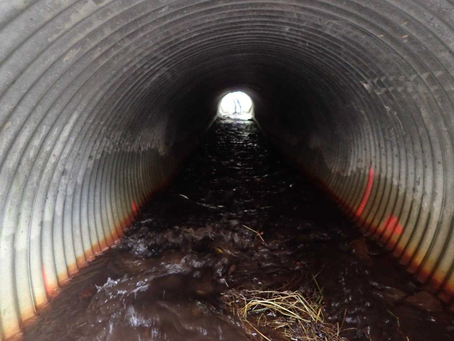
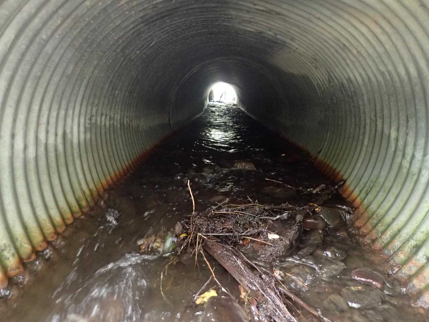
- Culvert gradient red
Comments: Noticable differences in stream gradient upstream compared to downstream thus stream gradient calculated seperately. Upstream gradient = 1.4% and downstream gradient = 6.1%. Looks like culvert was not able to hold onto substrate inside pipe.
Culvert Measurements
| ID: 1 | Structure Type: Circular pipe (Corrugated steel) | Fish Passage Rating: | ||||||||||||||||||||||||||||||||||||||||||
|
|
|
||||||||||||||||||||||||||||||||||||||||||
Culvert Observations:
|
||||||||||||||||||||||||||||||||||||||||||||
Stream Measurements
|
|
| Stream Width Type | Distance From Crossing (ft) |
Stream Width (ft) |
|---|---|---|
| Upstream ordinary high water | 50.0 | 5.00 |
| Upstream ordinary high water | 78.0 | 4.90 |
| Upstream ordinary high water | 94.0 | 5.00 |
Elevations
| Locator ID | Culvert Number |
River Distance (ft)1 |
Distance From Crossing (ft)2 |
Relative Elevation (ft) |
|---|---|---|---|---|
| Road Elev | 100.97 | |||
| U/S Water Surface Elev | 0.00 | 97.58 | ||
| U/S Thalweg | 0.00 | 96.81 | ||
| U/S Thalweg | 35.00 | 96.50 | ||
| U/S Water Surface Elev | 35.00 | 97.40 | ||
| Outlet Culvert Top | 52.30 | 97.71 | ||
| Outlet Invert | 52.30 | 93.84 | ||
| D/S Water Surface Elev | 52.30 | 94.09 | ||
| D/S Thalweg | 57.30 | 93.02 | ||
| D/S Water Surface Elev | 57.30 | 93.41 | ||
| U/S Thalweg | 67.00 | 96.73 | ||
| U/S Water Surface Elev | 67.00 | 97.37 | ||
| D/S Thalweg | 72.30 | 92.25 | ||
| D/S Water Surface Elev | 72.30 | 92.71 | ||
| Inlet Culvert Invert | 100.00 | 95.80 | ||
| U/S Water Surface Elev | 100.00 | 96.14 | ||
| Inlet Culvert Top | 100.00 | 98.99 | ||
| D/S Water Surface Elev | 122.30 | 88.36 | ||
| D/S Thalweg | 122.30 | 88.71 | ||
| D/S Water Surface Elev | 151.30 | 88.01 | ||
| D/S Thalweg | 151.30 | 88.59 |
Notes:
- River distance is measured continuously throughout the survey reach along the thalweg of the stream.
- Measured from each end of the crossing along the thalweg of the stream.
Fish Sampling Efforts
No fish sampling occurred during this survey.
Fish Observations
No fish observations occurred during this survey.
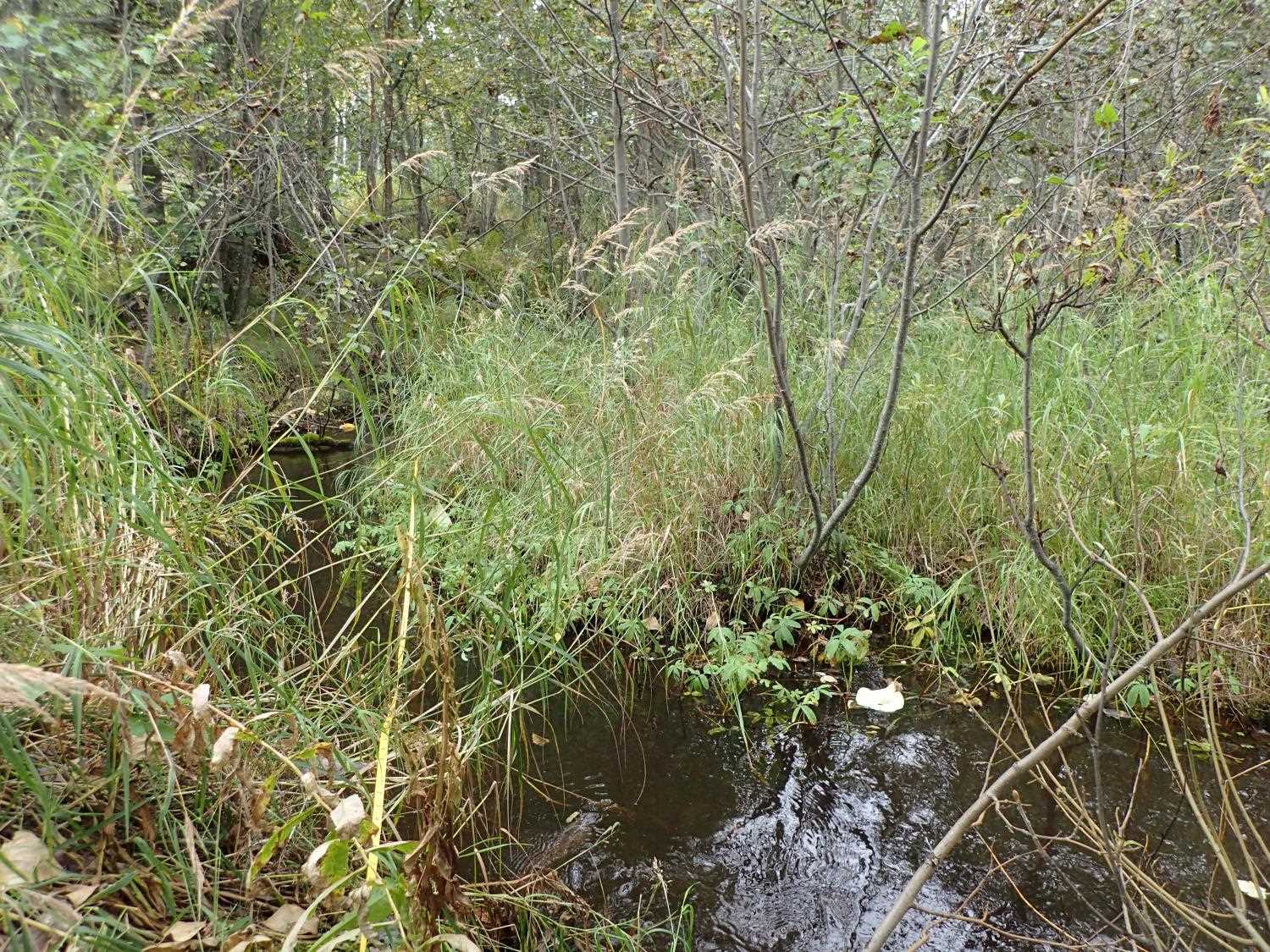
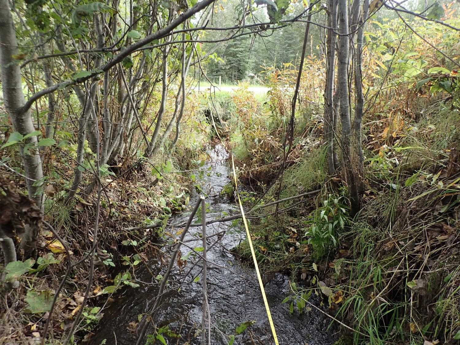
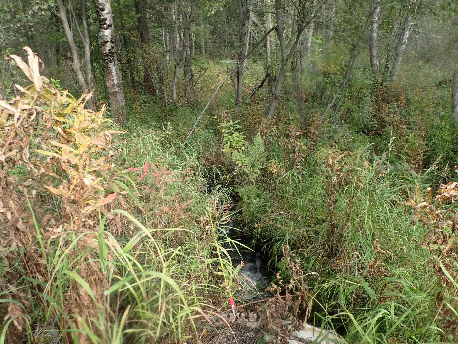
Photos
Questions or comments about this report can be directed to dfg.dsf.webmaster@alaska.gov