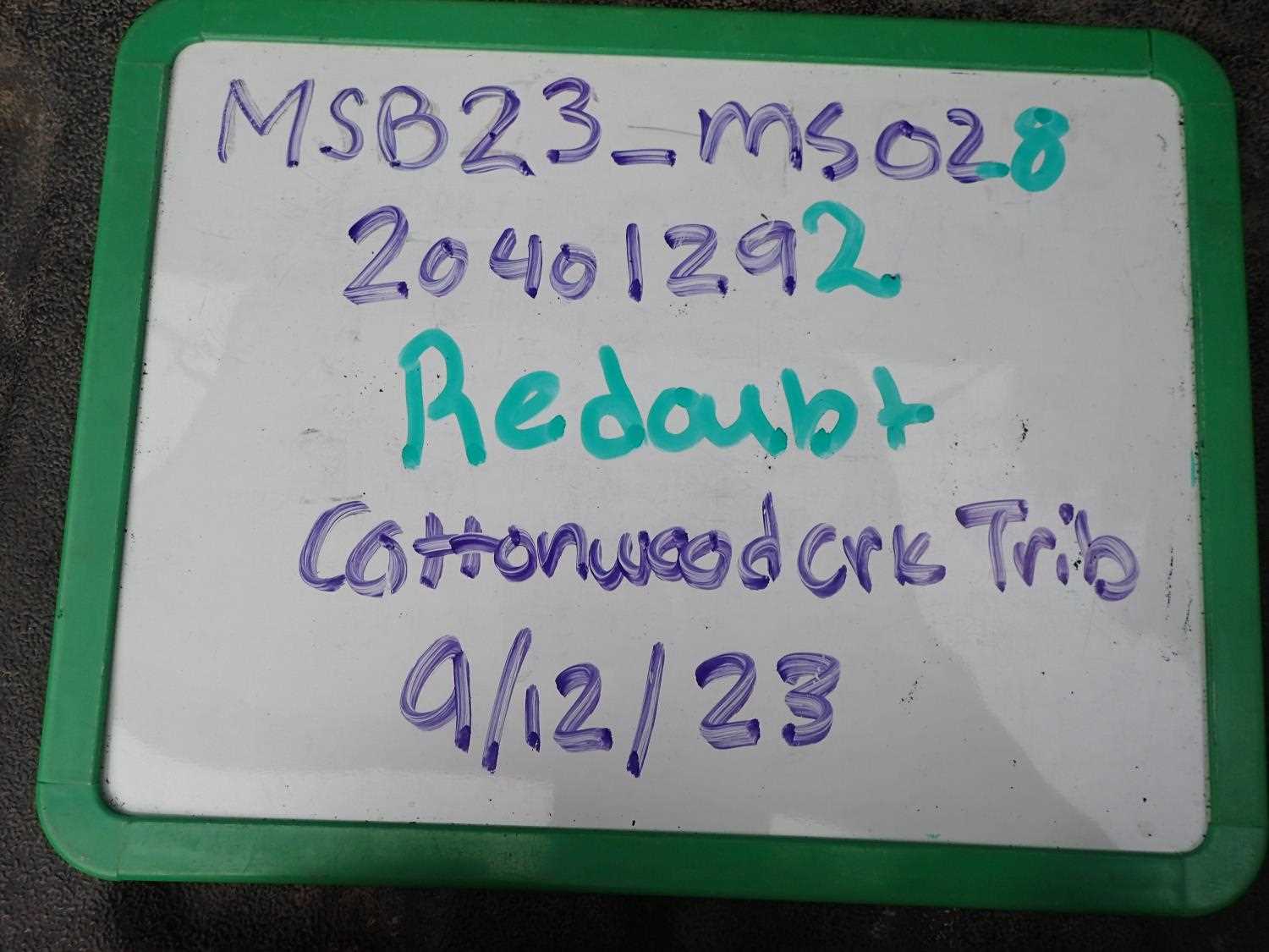
Fish Passage Site 20401292
Coordinates (dec. deg.): 61.53047°, -149.52480°
Legal Description: S017N001W30
Region: South Central
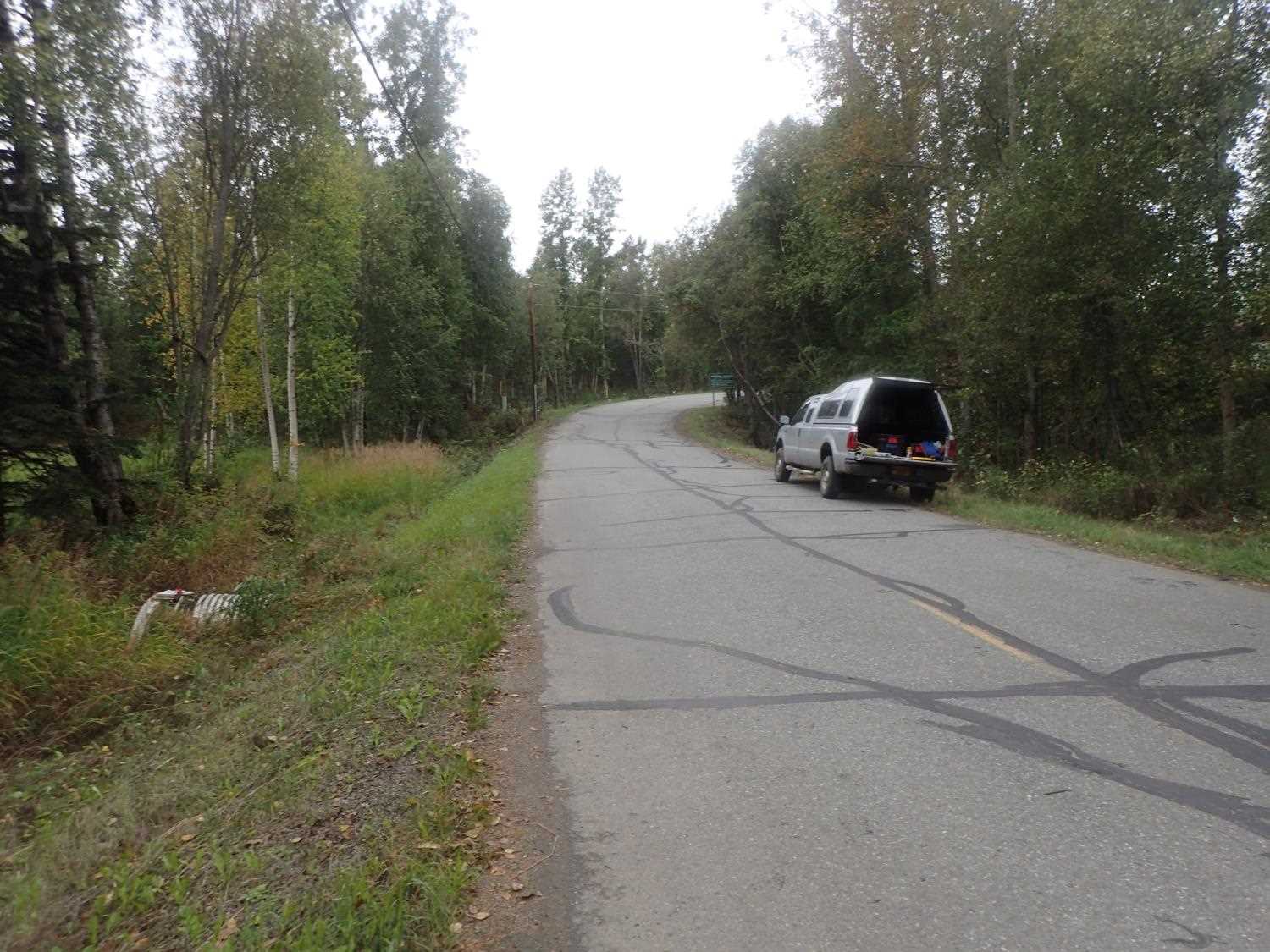
Road Name: Redoubt
Datum: NAD83
Quad Name / ITM: Anchorage C-7
AWC Stream #: 247-50-10300-2022
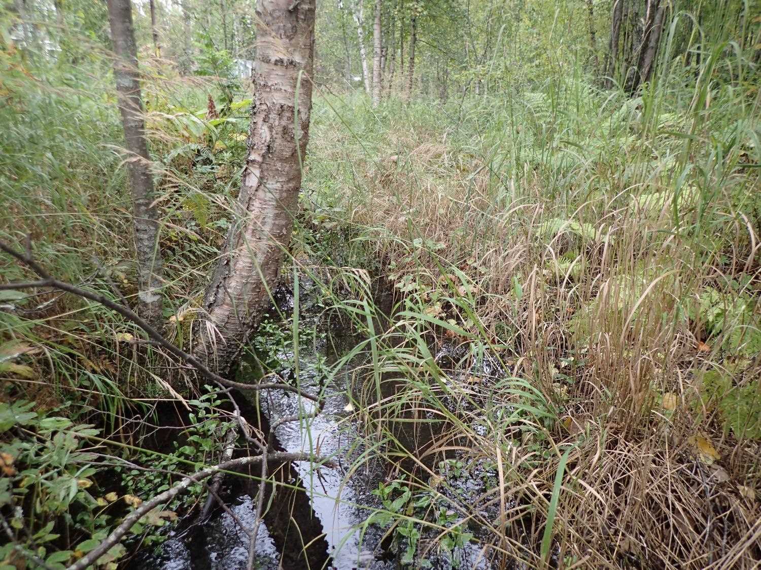
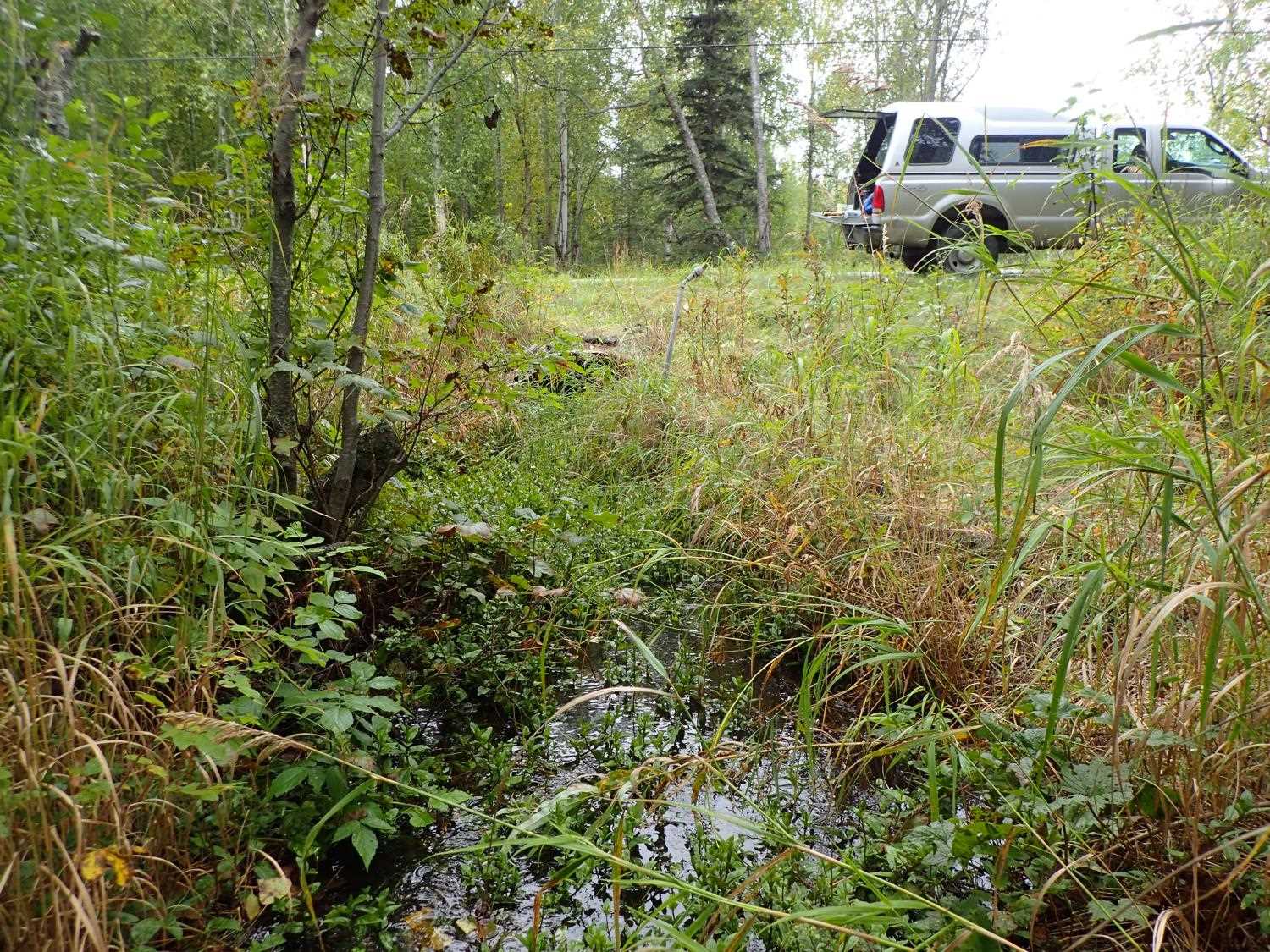
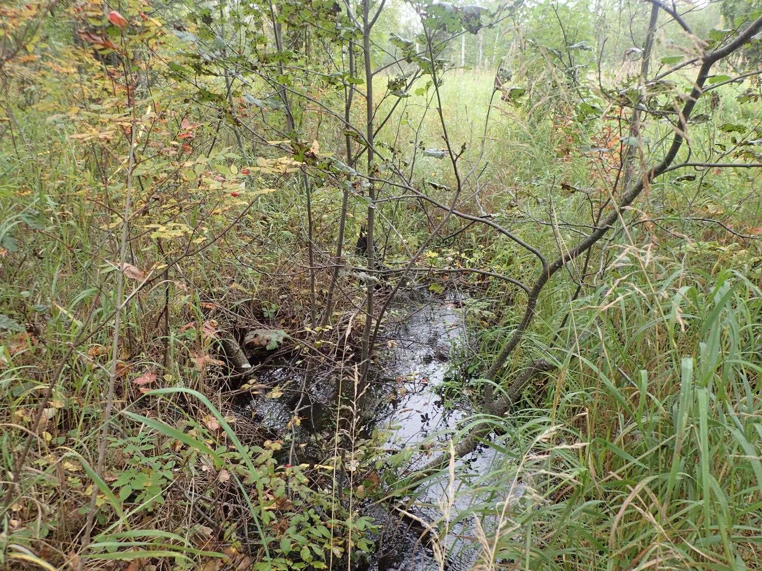
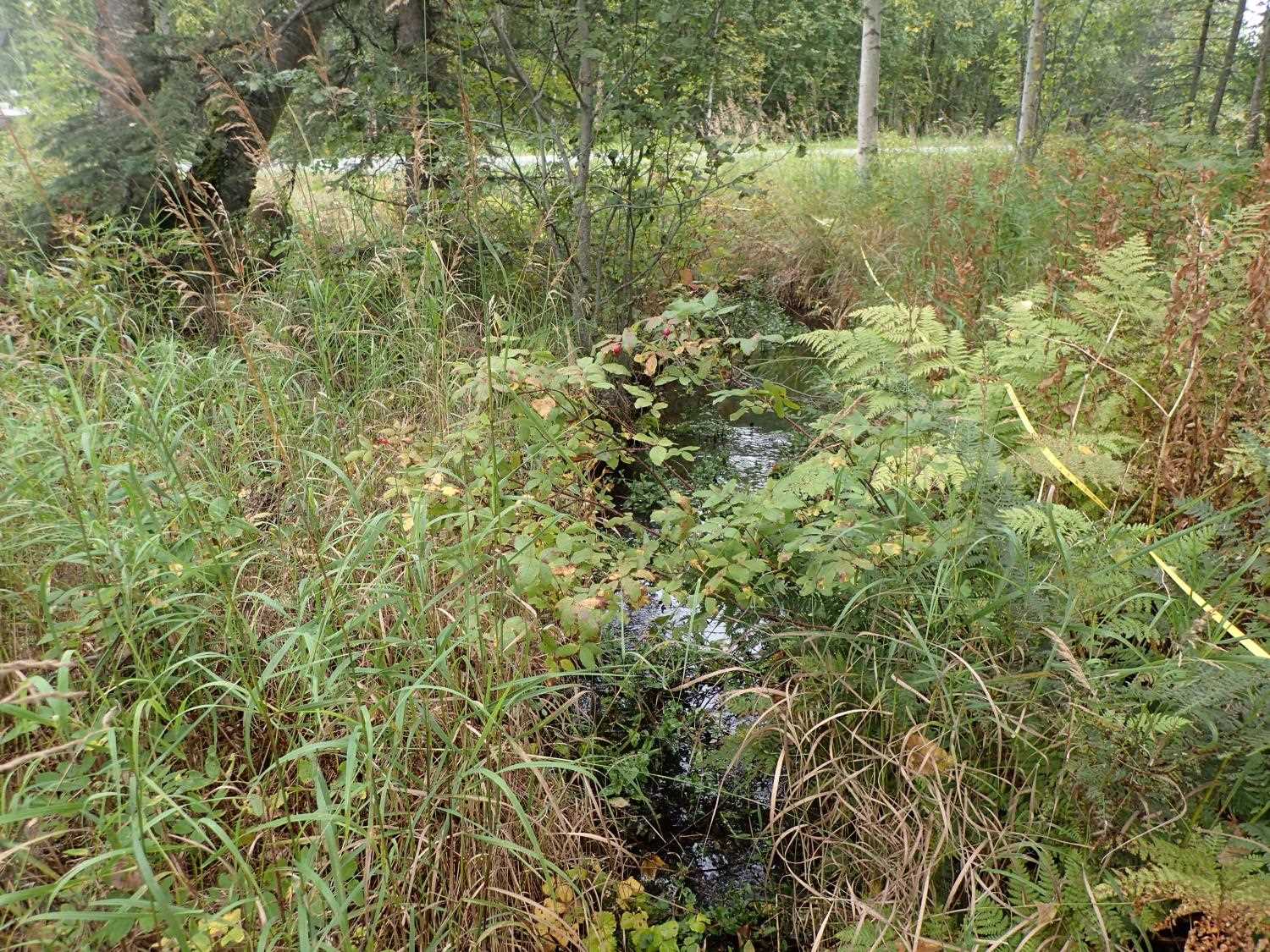
Stream Name: Cottonwood Creek tributary
Elevation:
Site Comments: None
arrow to the right of the survey date below to choose a different report for this site.
Survey MSB23-MS028
Project Supervisor: Michael Mazzacavallo, Alaska Department of Fish and Game
— Anchorage, AK
Observers: Michael Mazzacavallo, Kat Leavitt, Beth Evers
Overall Fish Passage Rating:
Tidal: No
Backwatered: No
Step Pools: No
Construction Year: 2013
Site Observations:
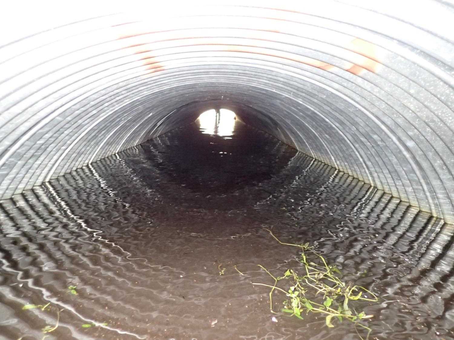
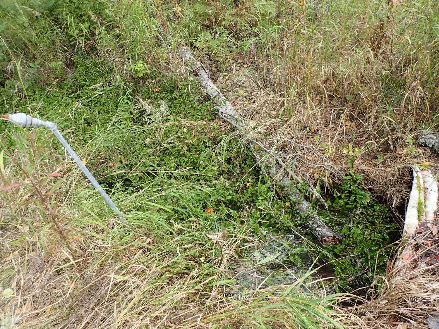
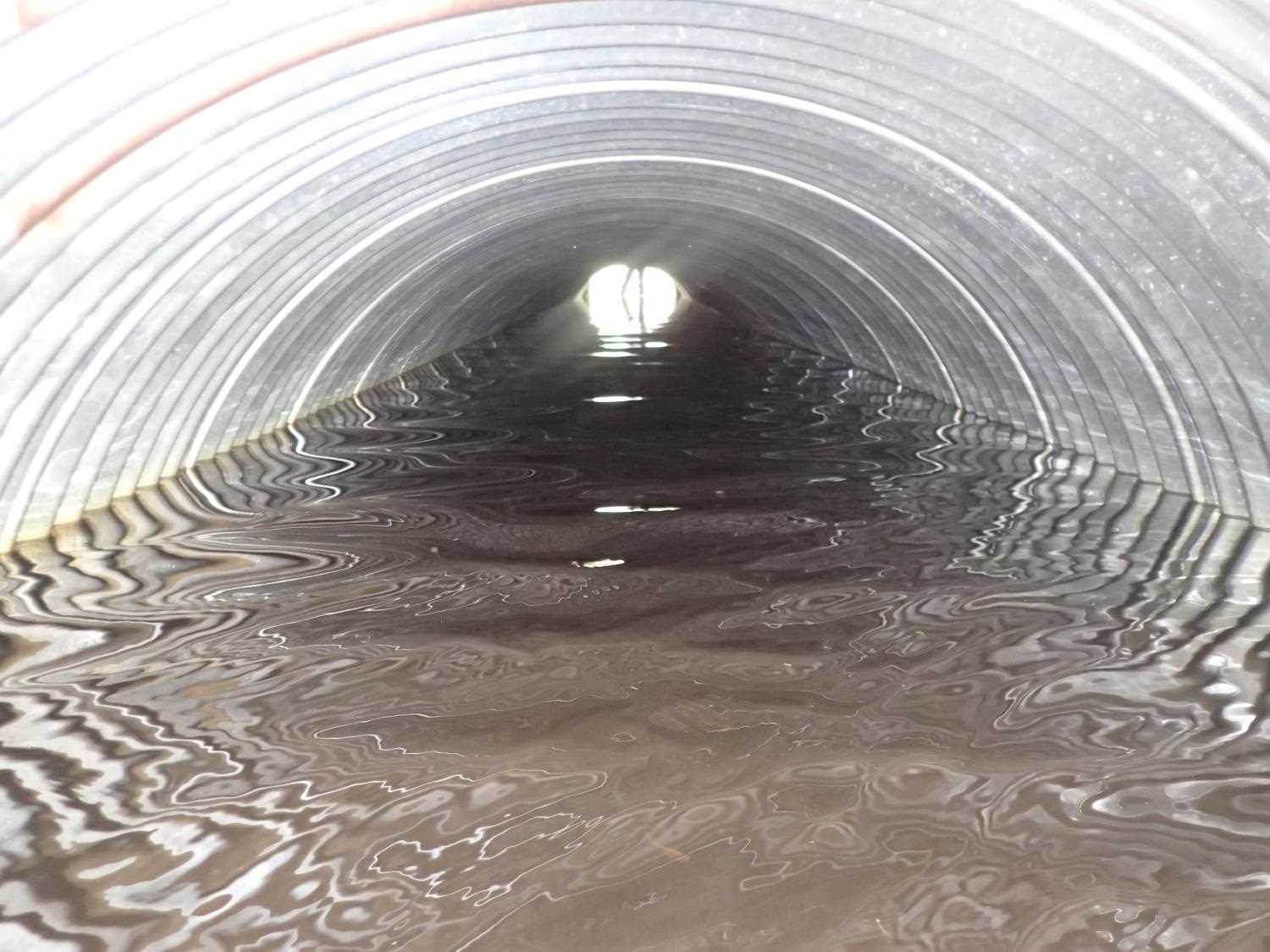
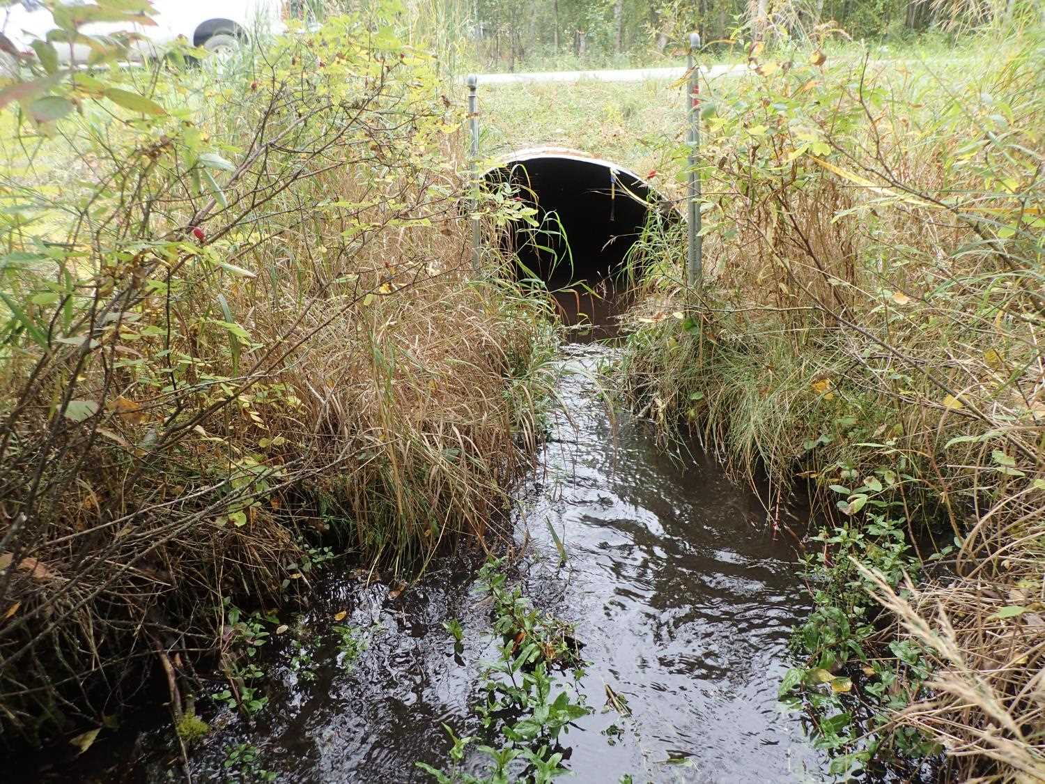
- Culvert sagging in middle
Comments: Juvenile fish spotted U/S. Pipe visually sagging severely under road.
Culvert Measurements
| ID: 1 | Structure Type: Circular pipe (Corrugated steel) | Fish Passage Rating: | ||||||||||||||||||||||||||||||||||||||||||
|
|
|
||||||||||||||||||||||||||||||||||||||||||
Comments: Culvert gradient calculated using WS due to warp in pipe. |
||||||||||||||||||||||||||||||||||||||||||||
Culvert Observations:
|
||||||||||||||||||||||||||||||||||||||||||||
Stream Measurements
|
|
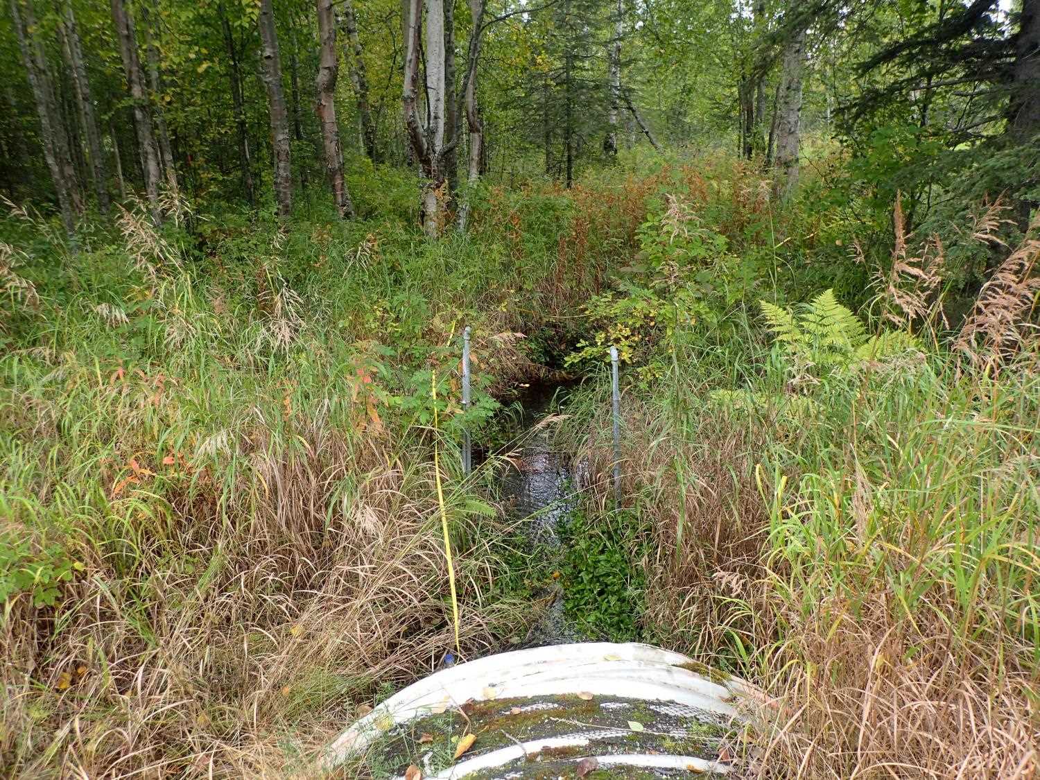
| Stream Width Type | Distance From Crossing (ft) |
Stream Width (ft) |
|---|---|---|
| Upstream ordinary high water | 29.0 | 6.75 |
| Upstream ordinary high water | 43.0 | 9.40 |
| Upstream ordinary high water | 54.0 | 7.40 |
| Upstream ordinary high water | 88.0 | 9.60 |
Elevations
| Locator ID | Culvert Number |
River Distance (ft)1 |
Distance From Crossing (ft)2 |
Relative Elevation (ft) |
|---|---|---|---|---|
| Road Elev | 100.33 | |||
| D/S Thalweg | 0.00 | 95.70 | ||
| D/S Water Surface Elev | 0.00 | 96.23 | ||
| D/S Water Surface Elev | 43.00 | 96.31 | ||
| D/S Thalweg | 43.00 | 95.24 | ||
| Outlet Culvert Top | 100.00 | 98.81 | ||
| D/S Water Surface Elev | 100.00 | 96.58 | ||
| Outlet Invert | 100.00 | 95.79 | ||
| Inlet Culvert Invert | 152.66 | 95.76 | ||
| U/S Water Surface Elev | 152.66 | 96.61 | ||
| Inlet Culvert Top | 152.66 | 98.54 | ||
| U/S Water Surface Elev | 204.66 | 96.87 | ||
| U/S Thalweg | 204.66 | 95.98 | ||
| U/S Thalweg | 251.66 | 96.11 | ||
| U/S Water Surface Elev | 251.66 | 96.94 |
Notes:
- River distance is measured continuously throughout the survey reach along the thalweg of the stream.
- Measured from each end of the crossing along the thalweg of the stream.
Fish Sampling Efforts
No fish sampling occurred during this survey.
Fish Observations
No fish observations occurred during this survey.
Photos

Questions or comments about this report can be directed to dfg.dsf.webmaster@alaska.gov