Fish Passage Site 20401290
Coordinates (dec. deg.): 61.52802°, -149.50688°
Legal Description: S017N001W29
Region: South Central
Road Name: Fairview Loop Road
Datum: NAD83
Quad Name / ITM: Anchorage C-7
AWC Stream #: 247-50-10300-2012
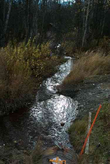
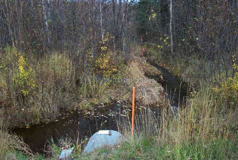
Stream Name: Cottonwood Slough
Elevation:
Site Comments: None
arrow to the right of the survey date below to choose a different report for this site.
Survey MSCS1-CT139
Observers: Edward Weiss, Doug Hill
Overall Fish Passage Rating:
Tidal: No
Backwatered: No
Step Pools:
Construction Year:
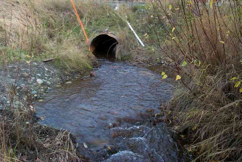
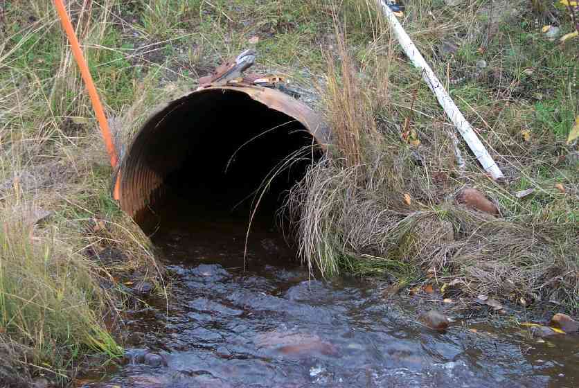
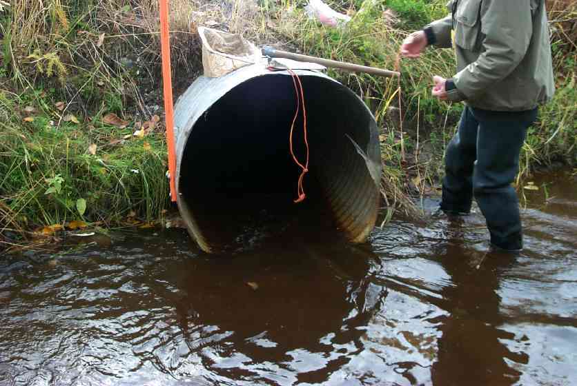
Comments: Original culv extended, upper 6' of culvert slightly different gradient, no substrate in 6' portion, apprears to have substrate below the 6';5-16' ATV crossing;0-53' powerline/rd cut clearing modified;54' natural
Culvert Measurements
| ID: 1 | Structure Type: Circular pipe (Corrugated steel) | Fish Passage Rating: | |||||||||||||||||||||||||||||||||||||||||
|
|
|
|||||||||||||||||||||||||||||||||||||||||
Culvert Observations:
|
|||||||||||||||||||||||||||||||||||||||||||
Stream Measurements
|
|
| Stream Width Type | Distance From Crossing (ft) |
Stream Width (ft) |
|---|---|---|
| Downstream ordinary high water | 54.0 | 5.00 |
| Downstream ordinary high water | 100.0 | 5.00 |
| Upstream ordinary high water | 43.0 | 5.00 |
| Upstream ordinary high water | 58.0 | 4.50 |
Elevations
| Locator ID | Culvert Number |
River Distance (ft)1 |
Distance From Crossing (ft)2 |
Relative Elevation (ft) |
|---|---|---|---|---|
| Outlet Culvert Top | 1 | 92.45 | ||
| Inlet Culvert Top | 1 | 93.98 | ||
| D/S Thalweg | 0.00 | 100.0 | 88.61 | |
| D/S Thalweg | 46.00 | 54.0 | 88.73 | |
| Outlet Invert | 1 | 100.00 | 0.0 | 89.86 |
| Outlet Thalweg | 1 | 100.00 | 0.0 | 89.95 |
| Road Elev | 123.50 | 95.44 | ||
| Road Elev | 123.50 | 95.54 | ||
| Inlet Thalweg | 1 | 147.00 | 0.0 | 90.73 |
| Inlet Culvert Invert | 1 | 147.00 | 0.0 | 90.99 |
| U/S Thalweg | 153.00 | 6.0 | 90.23 | |
| U/S Thalweg | 206.00 | 59.0 | 91.75 | |
| U/S Thalweg | 225.00 | 78.0 | 92.28 |
Notes:
- River distance is measured continuously throughout the survey reach along the thalweg of the stream.
- Measured from each end of the crossing along the thalweg of the stream.
Fish Sampling Efforts
| Gear Type: Minnow Trap (A) | Trap Duration(h): -3 | |
| Gear Type: Minnow Trap (B) | Trap Duration(h): -3 | |
Fish Observations
| Species: juvenile coho salmon | Life History: Anadromous | ||
| Total Fish Observed: 22 | Fish Measured: 16 | Fork Lengths (mm) Min: 65 Max: 105 Mean: 79 | |
| Collected/Observed by Gear Type: Downstream Minnow Trap (10) Upstream Minnow Trap (12) | |||
Photos
Questions or comments about this report can be directed to dfg.dsf.webmaster@alaska.gov