Fish Passage Site 20401289
Coordinates (dec. deg.): 61.60078°, -149.34192°
Legal Description: S018N001E31
Region: South Central
Road Name: East Larch Drive
Datum: NAD83
Quad Name / ITM: Anchorage C-7
AWC Stream #: 247-50-10300-2039
Stream Name: Cottonwood Creek tributary
Elevation:
Site Comments: None
arrow to the right of the survey date below to choose a different report for this site.
Survey MSCS1-CT138
Observers: Edward Weiss, Doug Hill
Overall Fish Passage Rating:
Tidal: No
Backwatered: No
Step Pools:
Construction Year:
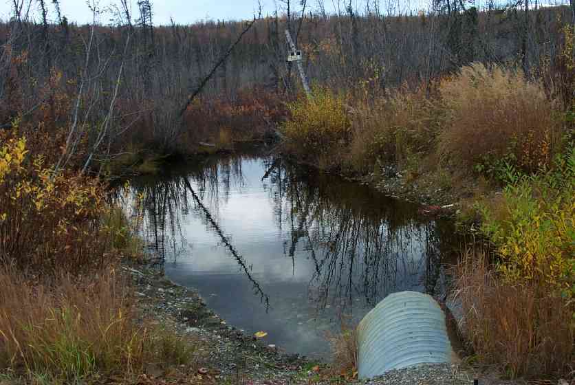
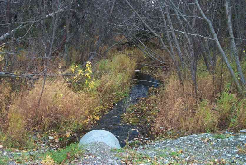
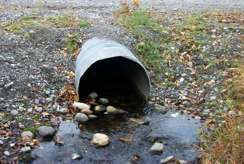
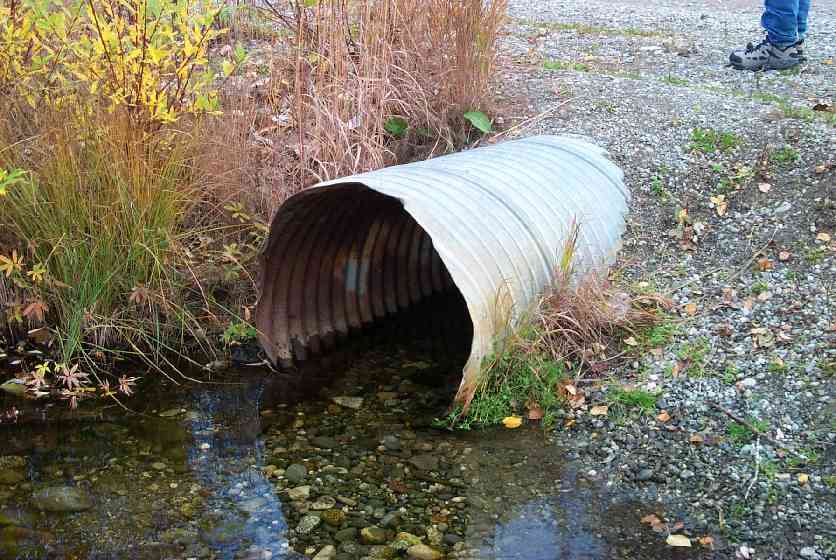
Comments: Ice damming & overflow in winter (according to local landowner);deep fine sediments in stream channel-flows through hummocks of bog; riffle at culvert outlet, then slower deep sediment area,then narrows to 2-3' with gravel
Culvert Measurements
| ID: 1 | Structure Type: Circular pipe (Corrugated Metal) | Fish Passage Rating: | |||||||||||||||||||||||||||||||||||||||||
|
|
|
|||||||||||||||||||||||||||||||||||||||||
Culvert Observations:
|
|||||||||||||||||||||||||||||||||||||||||||
Stream Measurements
|
|
| Stream Width Type | Distance From Crossing (ft) |
Stream Width (ft) |
|---|---|---|
| Downstream ordinary high water | 50.0 | 8.00 |
| Downstream ordinary high water | 100.0 | 4.50 |
| Upstream ordinary high water | 62.0 | 8.00 |
| Upstream ordinary high water | 106.0 | 3.00 |
Elevations
| Locator ID | Culvert Number |
River Distance (ft)1 |
Distance From Crossing (ft)2 |
Relative Elevation (ft) |
|---|---|---|---|---|
| Outlet Culvert Top | 1 | 94.01 | ||
| Inlet Culvert Top | 1 | 94.85 | ||
| D/S Thalweg | 0.00 | 100.0 | 90.66 | |
| D/S Thalweg | 50.00 | 50.0 | 90.63 | |
| D/S Thalweg (Downstream end of riffle) | 76.00 | 24.0 | 91.08 | |
| Outlet Invert | 1 | 100.00 | 0.0 | 91.90 |
| Outlet Thalweg | 1 | 100.00 | 0.0 | 91.90 |
| Road Elev | 120.00 | 94.34 | ||
| Road Elev | 120.00 | 94.83 | ||
| Inlet Culvert Invert | 1 | 140.00 | 0.0 | 92.33 |
| Inlet Thalweg | 1 | 140.00 | 0.0 | 92.40 |
| U/S Thalweg | 153.00 | 13.0 | 91.18 | |
| U/S Thalweg | 202.00 | 62.0 | 92.04 | |
| U/S Thalweg | 246.00 | 106.0 | 92.20 |
Notes:
- River distance is measured continuously throughout the survey reach along the thalweg of the stream.
- Measured from each end of the crossing along the thalweg of the stream.
Fish Sampling Efforts
| Gear Type: Minnow Trap (A) | Trap Duration(h): -7 | |
| Gear Type: Minnow Trap (B) | Trap Duration(h): 16 | |
Fish Observations
| Species: juvenile/adult Dolly Varden | Life History: Unknown | ||
| Total Fish Observed: 14 | Fish Measured: 7 | Fork Lengths (mm) Min: 105 Max: 155 Mean: 129 | |
| Collected/Observed by Gear Type: Upstream Minnow Trap (14) | |||
| Species: juvenile Dolly Varden | Life History: Unknown | ||
| Total Fish Observed: 2 | Fish Measured: 1 | Fork Lengths (mm) Min: 135 Max: 135 Mean: 135 | |
| Collected/Observed by Gear Type: Downstream Minnow Trap (2) | |||
| Species: juvenile coho salmon | Life History: Anadromous | ||
| Total Fish Observed: 30 | Fish Measured: 15 | Fork Lengths (mm) Min: 70 Max: 103 Mean: 83 | |
| Collected/Observed by Gear Type: Downstream Minnow Trap (12) Upstream Minnow Trap (18) | |||
Photos
Questions or comments about this report can be directed to dfg.dsf.webmaster@alaska.gov