Fish Passage Site 20401287
Coordinates (dec. deg.): 61.62344°, -149.31329°
Legal Description: S018N001E29
Region: South Central
Road Name: Caribou Street
Datum: NAD83
Quad Name / ITM: Anchorage C-7
AWC Stream #: 247-50-10300
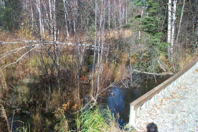
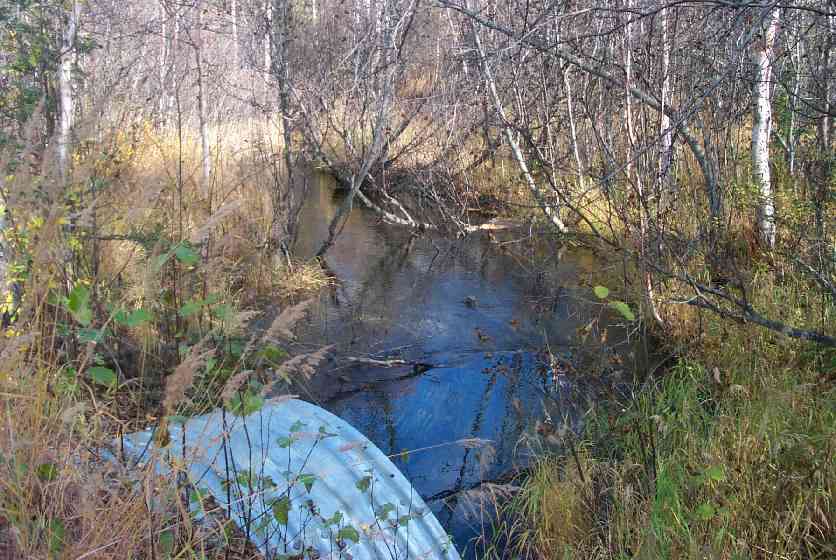
Stream Name: Cottonwood Creek
Elevation:
Site Comments: None
arrow to the right of the survey date below to choose a different report for this site.
Survey MSCS1-CT136
Observers: Edward Weiss, Joe Conner, Doug Hill
Overall Fish Passage Rating:
Tidal: No
Backwatered: No
Step Pools:
Construction Year:
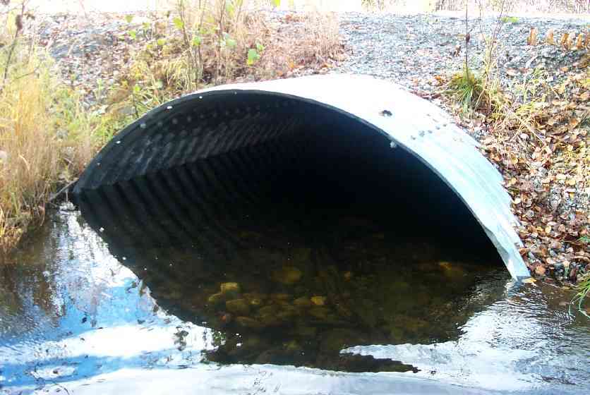
Comments: Sheet pile headwall on upstream side of culvert, X-section velocity taken 125' upstream above culvert due to woody debris
Culvert Measurements
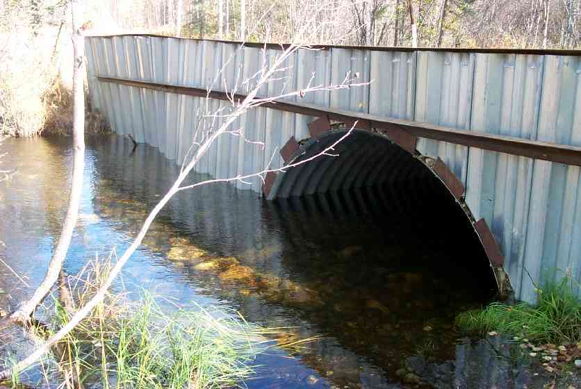
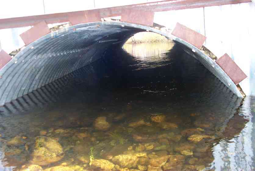
| ID: 1 | Structure Type: Open-bottom arch (Strutural Metal Plate) | Fish Passage Rating: | |||||||||||||||||||||||||||||||||||||||||
|
|
|
|||||||||||||||||||||||||||||||||||||||||
Culvert Observations:
|
|||||||||||||||||||||||||||||||||||||||||||
Stream Measurements
|
|
| Stream Width Type | Distance From Crossing (ft) |
Stream Width (ft) |
|---|---|---|
| Downstream ordinary high water | 50.0 | 19.00 |
| Downstream ordinary high water | 100.0 | 21.00 |
| Upstream ordinary high water | 52.0 | 15.50 |
| Upstream ordinary high water | 125.0 | 12.00 |
Elevations
| Locator ID | Culvert Number |
River Distance (ft)1 |
Distance From Crossing (ft)2 |
Relative Elevation (ft) |
|---|---|---|---|---|
| Outlet Culvert Top | 1 | 93.22 | ||
| Inlet Culvert Top | 1 | 93.30 | ||
| D/S Thalweg | 0.00 | 100.0 | 88.70 | |
| D/S Thalweg | 50.00 | 50.0 | 88.46 | |
| D/S Thalweg | 95.00 | 5.0 | 89.06 | |
| Outlet Invert | 1 | 100.00 | 0.0 | 88.78 |
| Outlet Thalweg | 1 | 100.00 | 0.0 | 88.78 |
| Road Elev | 120.50 | 94.43 | ||
| Road Elev | 120.50 | 94.46 | ||
| Inlet Thalweg | 1 | 141.00 | 0.0 | 88.79 |
| Inlet Culvert Invert | 1 | 141.00 | 0.0 | 88.92 |
| U/S Thalweg | 1 | 146.00 | 5.0 | 89.26 |
| U/S Thalweg | 193.00 | 52.0 | 89.08 | |
| U/S Thalweg | 266.00 | 125.0 | 88.86 |
Notes:
- River distance is measured continuously throughout the survey reach along the thalweg of the stream.
- Measured from each end of the crossing along the thalweg of the stream.
Fish Sampling Efforts
| Gear Type: Visual Observation, Ground (C) | ||
Fish Observations
| Species: adult coho salmon | Life History: Anadromous (Suspected Spawning) | ||
| Total Fish Observed: 1 | Fish Measured: | Fork Lengths (mm) Min: Max: Mean: | |
| Collected/Observed by Gear Type: Upstream Visual Observation, Ground (1) | |||
| Comments: Adult coho observed in culvert | |||
| Species: general fish observation, no species information | Life History: Not Recorded | ||
| Total Fish Observed: | Fish Measured: | Fork Lengths (mm) Min: Max: Mean: | |
| Collected/Observed by Gear Type: Upstream Visual Observation, Ground () | |||
| Comments: Juveniles observed in creek | |||
Photos
Questions or comments about this report can be directed to dfg.dsf.webmaster@alaska.gov