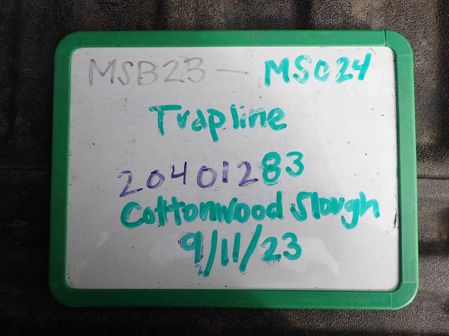
Fish Passage Site 20401283
Coordinates (dec. deg.): 61.52637°, -149.51404°
Legal Description: S017N001W31
Region: South Central
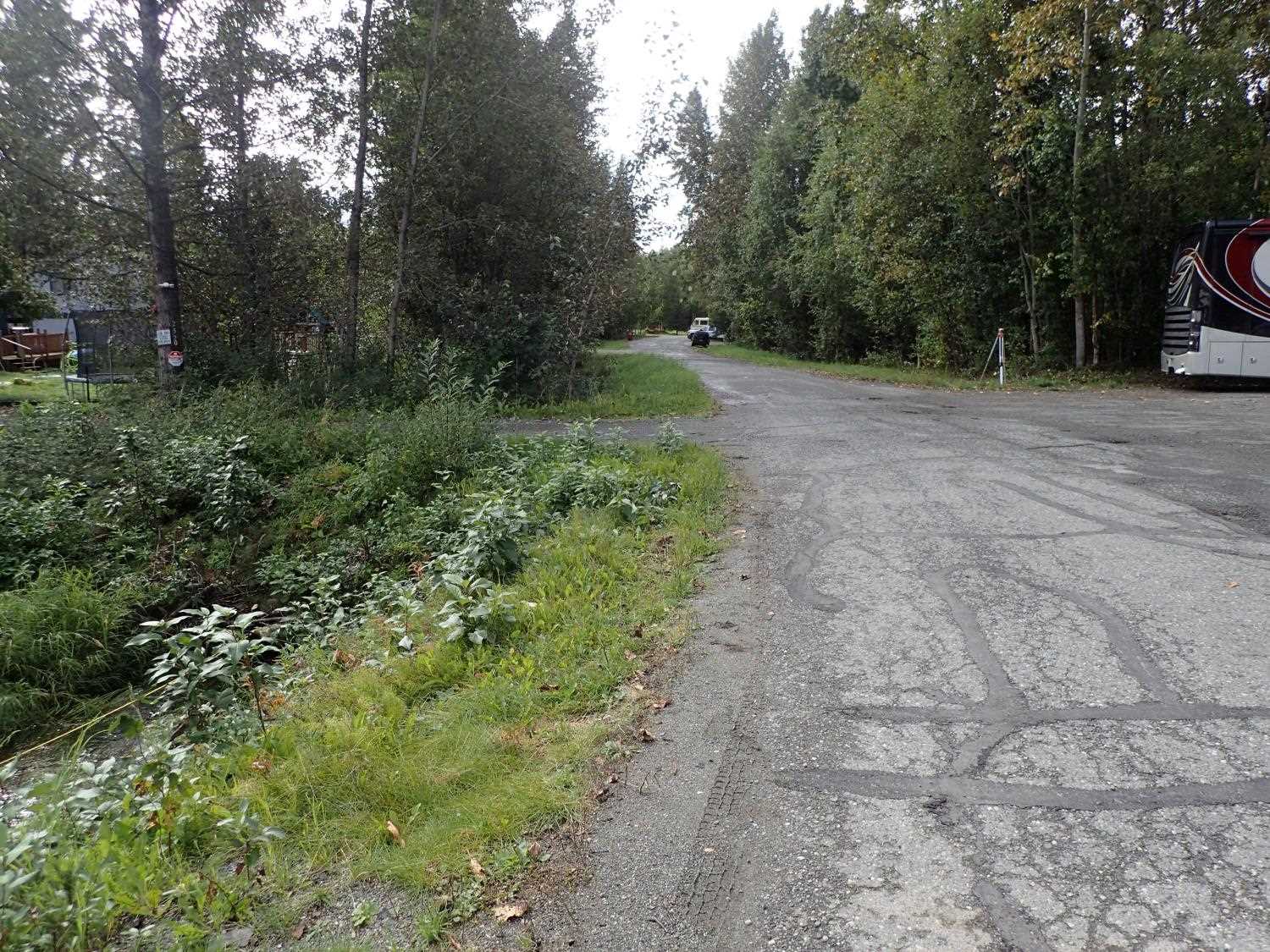
Road Name: Driveway off Trapline Drive
Datum: NAD83
Quad Name / ITM: Anchorage C-7
AWC Stream #: 247-50-10300-2012
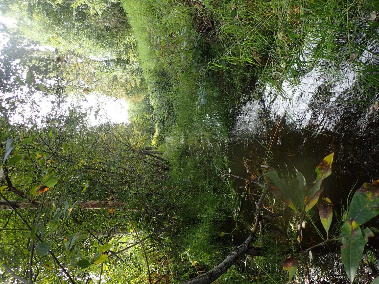
Stream Name: Cottonwood Slough
Elevation:
Site Comments: None
arrow to the right of the survey date below to choose a different report for this site.
Survey MSB23-MS024
Project Supervisor: Michael Mazzacavallo, Alaska Department of Fish and Game
— Anchorage, AK
Observers: Michael Mazzacavallo, Kat Leavitt, Beth Evers
Overall Fish Passage Rating:
Tidal: No
Backwatered: No
Step Pools: No
Construction Year:
Site Observations:
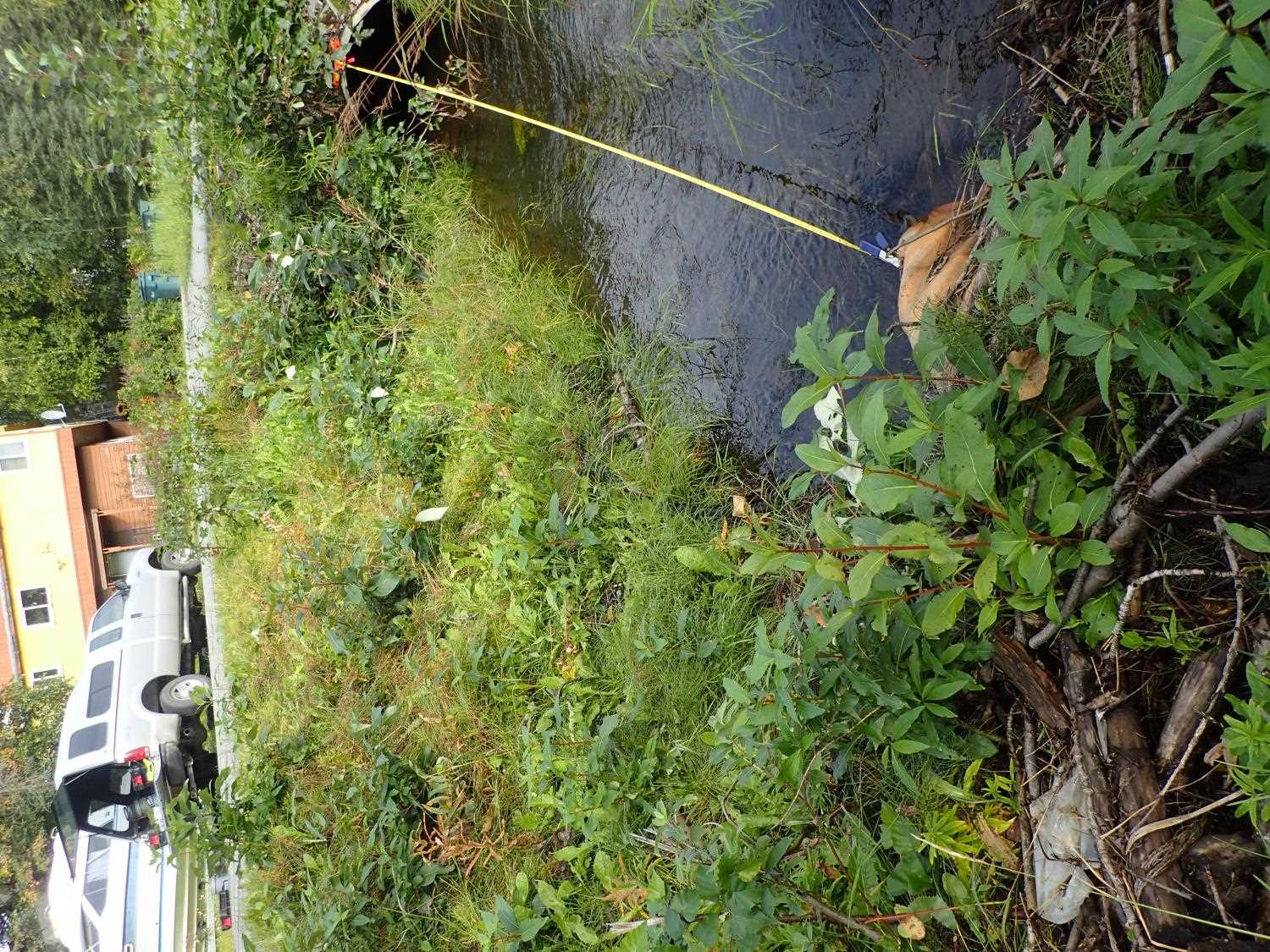
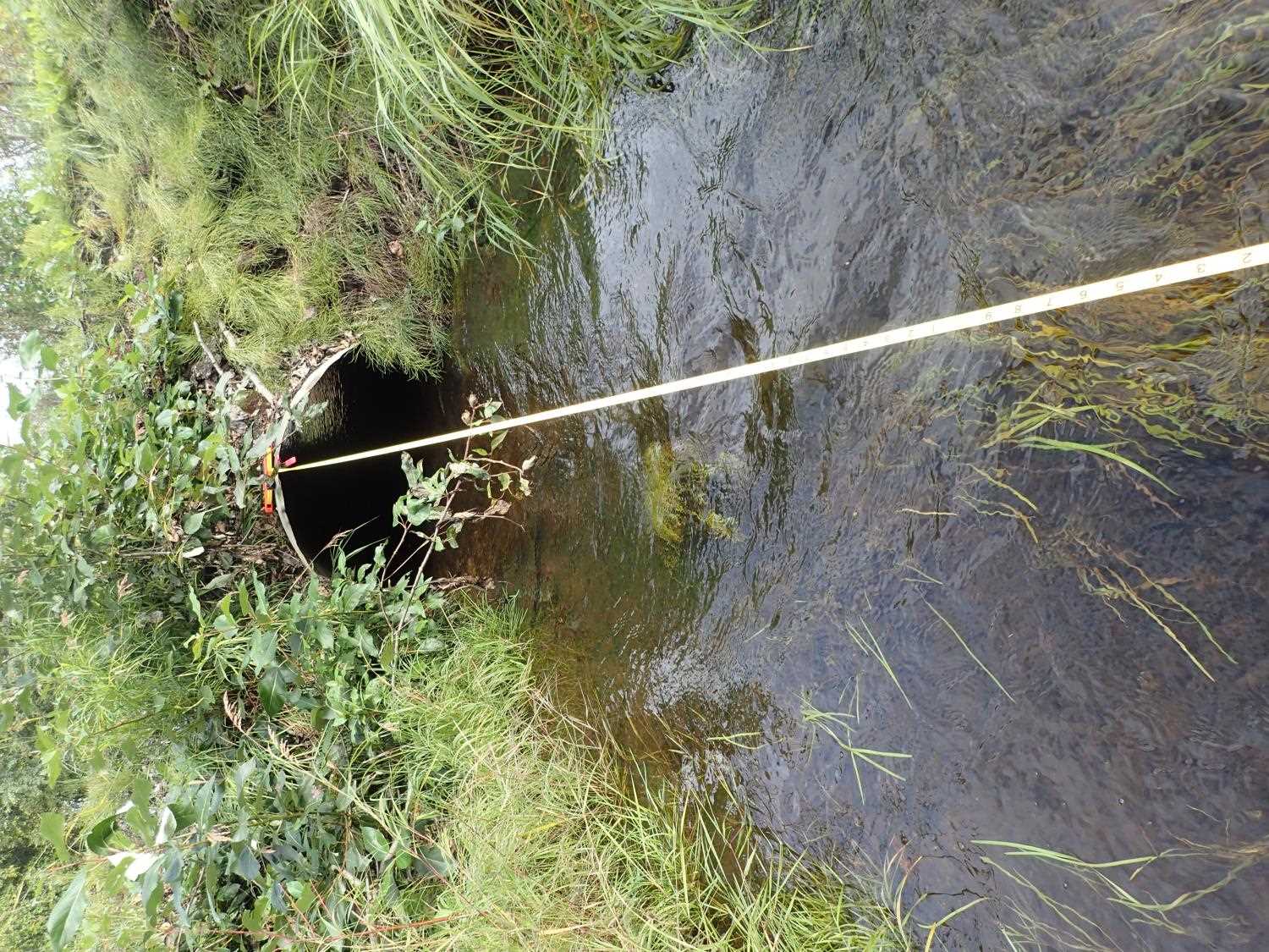
- Woody Debris
- Inlet perch
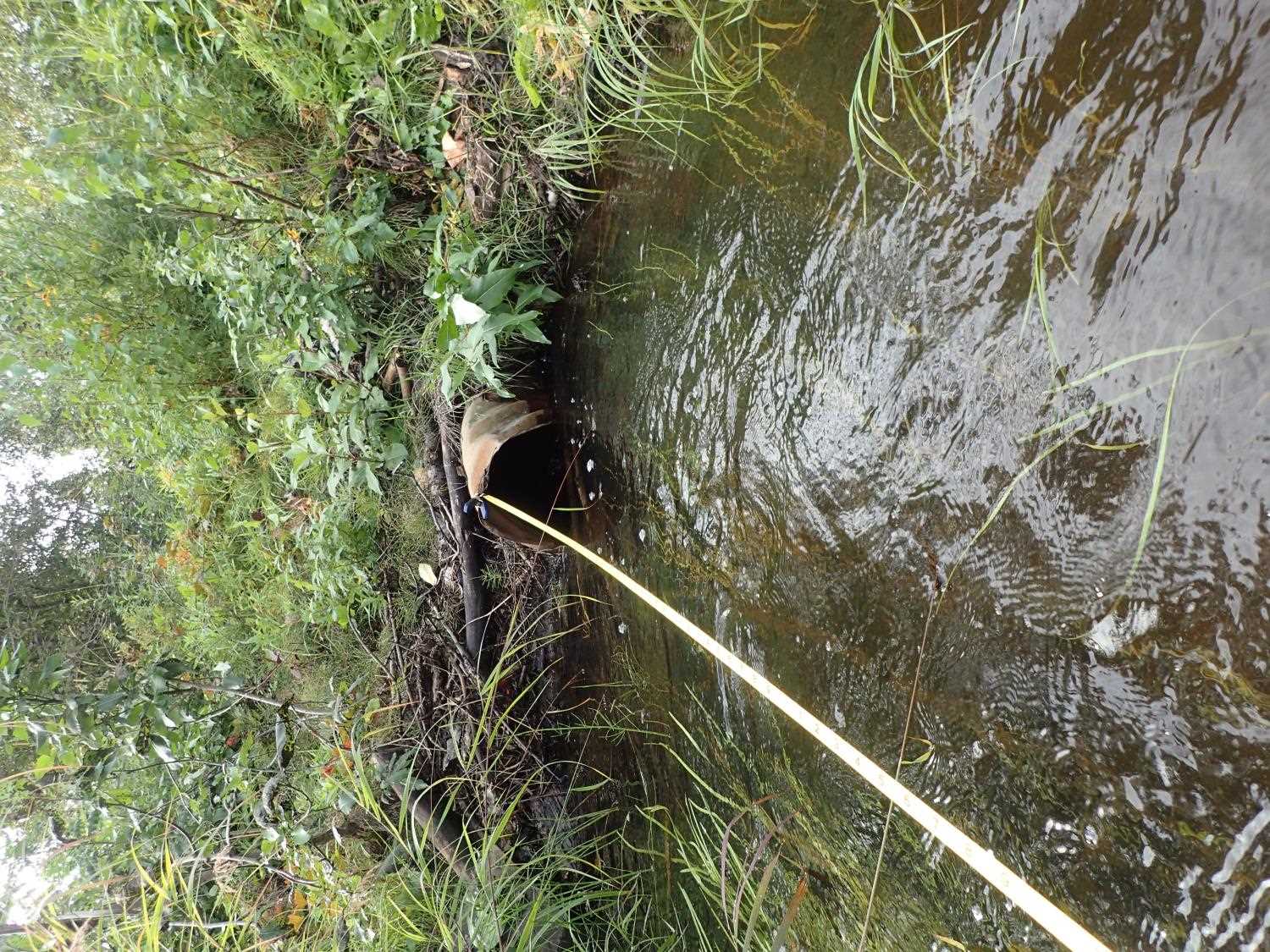
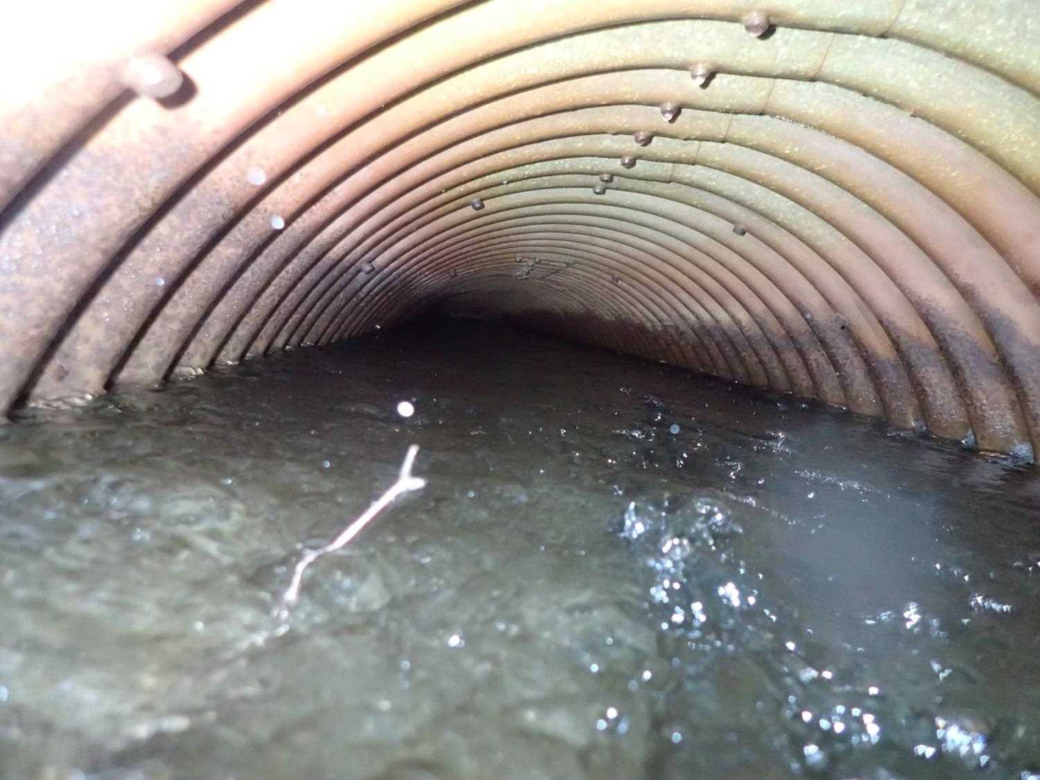
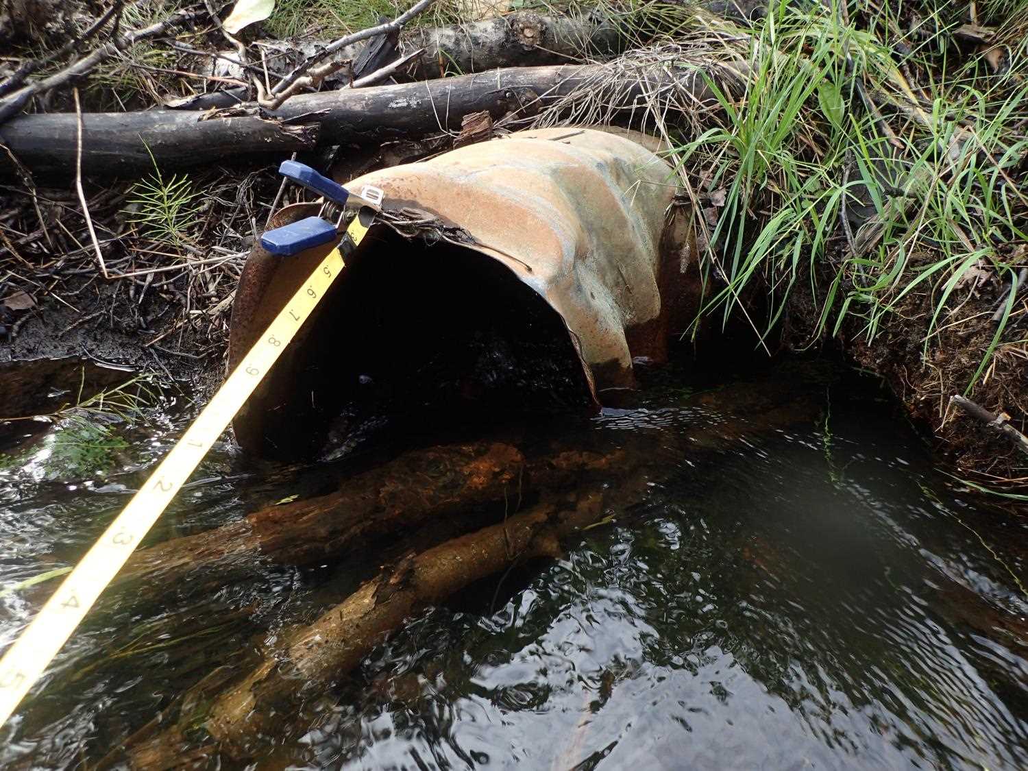
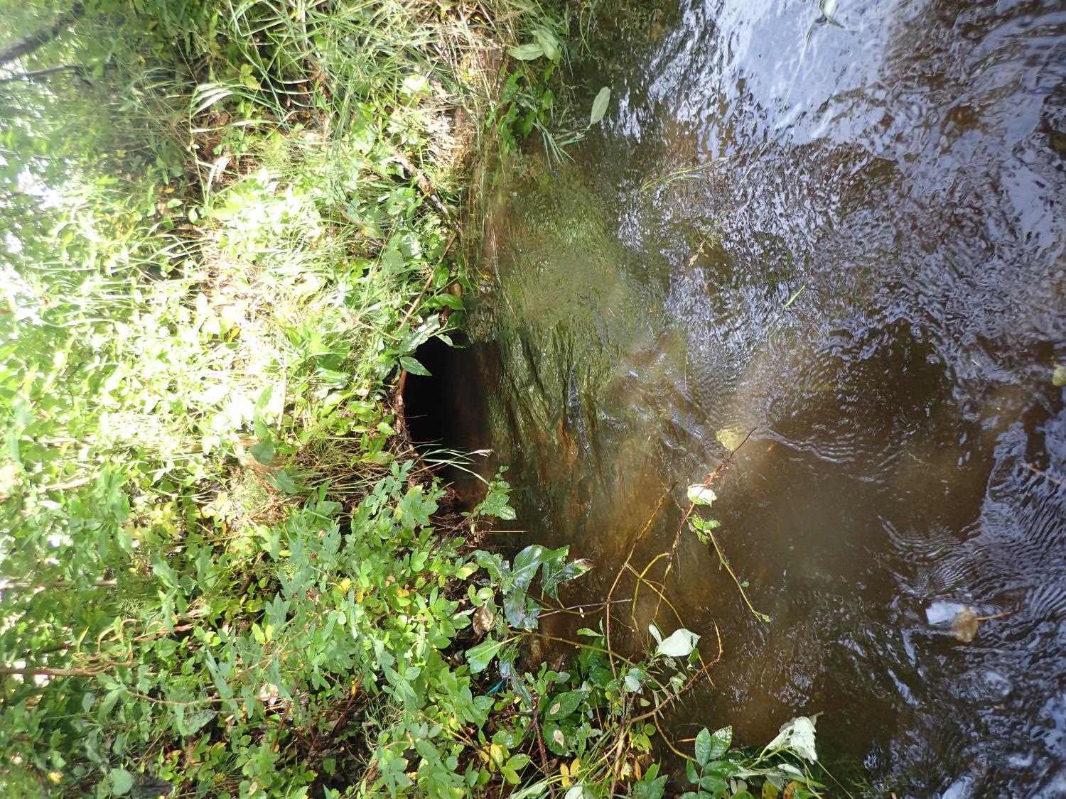
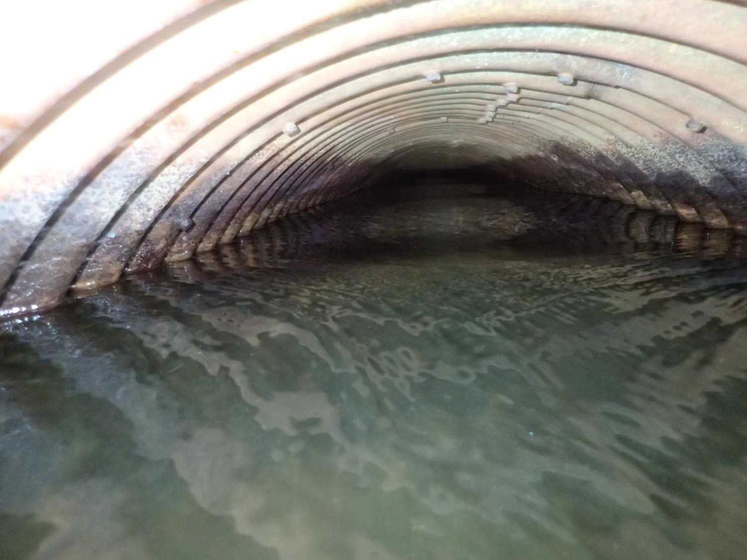
Comments: Landowner stated that adult salmon used to pass through, but not anymore. They stated that fish cannot pass through the culverts and die at times throughout the season, rather then just at spawning times. Inlet is severely crushed from right side and is jammed with debris.The entire culvert is rusted and cannot see through the culvert. There is a rusted hole at the bottom of the culvert on the inlet side.
Culvert Measurements
| ID: 1 | Structure Type: Circular pipe (Corrugated steel) | Fish Passage Rating: | ||||||||||||||||||||||||||||||||||||||||||
|
|
|
||||||||||||||||||||||||||||||||||||||||||
Culvert Observations:
|
||||||||||||||||||||||||||||||||||||||||||||
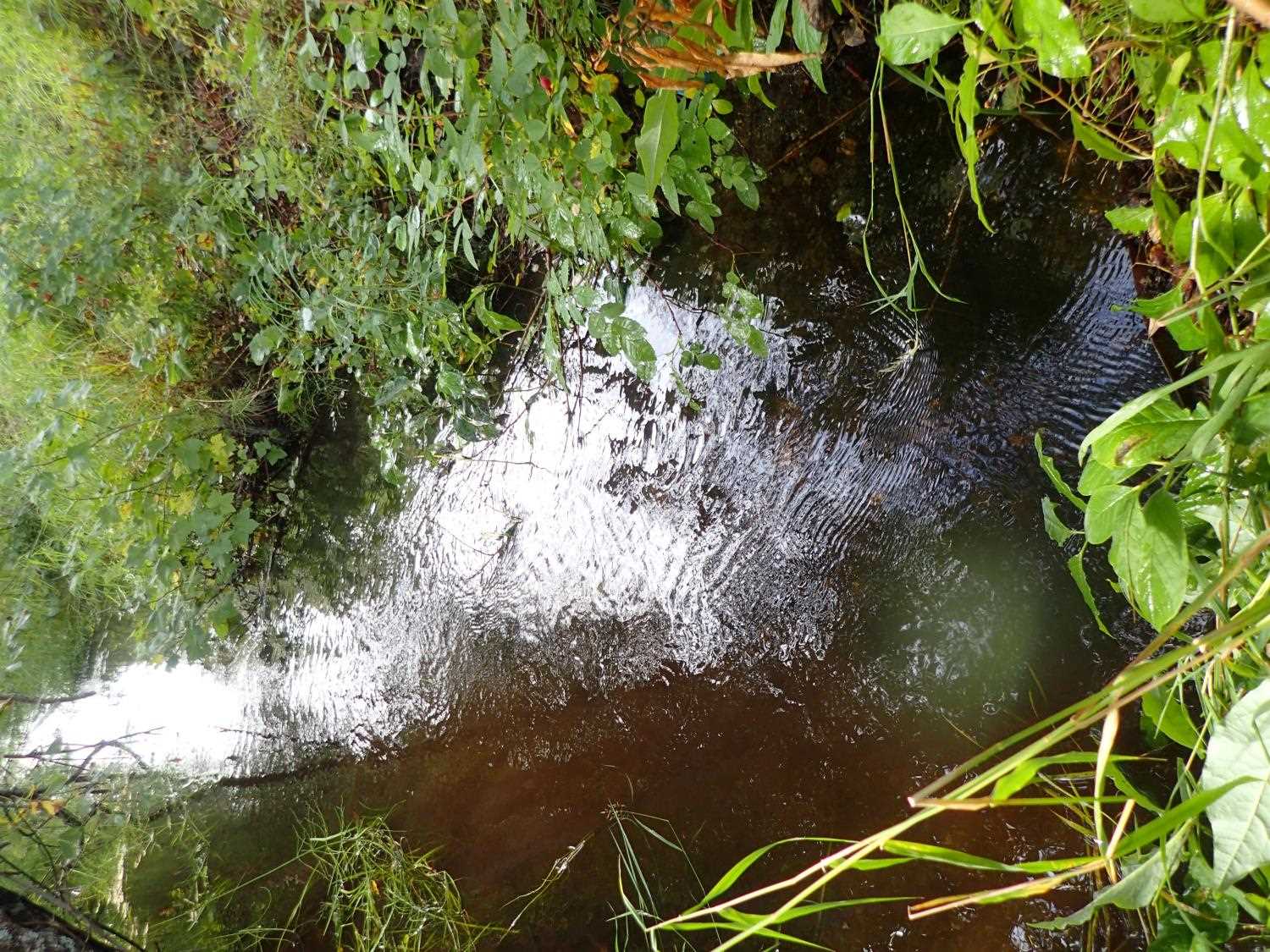
Stream Measurements
|
|
| Stream Width Type | Distance From Crossing (ft) |
Stream Width (ft) |
|---|---|---|
| Upstream ordinary high water | 44.0 | 8.90 |
| Upstream ordinary high water | 89.0 | 11.40 |
| Upstream ordinary high water | 131.0 | 10.90 |
| Upstream ordinary high water | 155.0 | 10.80 |
Elevations
| Locator ID | Culvert Number |
River Distance (ft)1 |
Distance From Crossing (ft)2 |
Relative Elevation (ft) |
|---|---|---|---|---|
| Road Elev | 99.43 | |||
| U/S Thalweg | 0.00 | 93.65 | ||
| U/S Water Surface Elev | 0.00 | 94.32 | ||
| Inlet Culvert Top | 16.85 | 95.26 | ||
| U/S Water Surface Elev | 18.00 | 94.30 | ||
| Inlet Culvert Invert | 18.00 | 93.07 | ||
| Outlet Invert | 58.50 | 93.14 | ||
| Outlet Culvert Top | 58.50 | 94.92 | ||
| D/S Water Surface Elev | 58.50 | 94.22 | ||
| D/S Thalweg | 221.50 | 92.62 | ||
| D/S Water Surface Elev | 221.50 | 93.66 |
Notes:
- River distance is measured continuously throughout the survey reach along the thalweg of the stream.
- Measured from each end of the crossing along the thalweg of the stream.
Fish Sampling Efforts
No fish sampling occurred during this survey.
Fish Observations
No fish observations occurred during this survey.
Photos

Questions or comments about this report can be directed to dfg.dsf.webmaster@alaska.gov