Fish Passage Site 20401279
Coordinates (dec. deg.): 61.57534°, -149.40413°
Legal Description: S017N001W11
Region: South Central
Road Name: Parks Highway
Datum: NAD83
Quad Name / ITM: Anchorage C-7
AWC Stream #: 247-50-10300
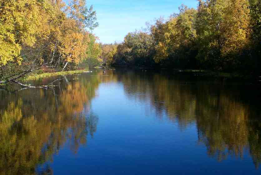
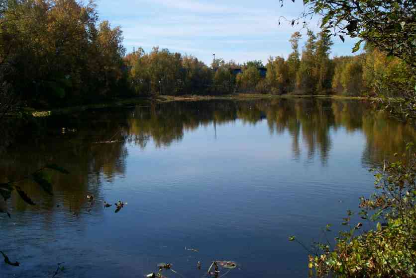
Stream Name: Cottonwood Creek
Elevation:
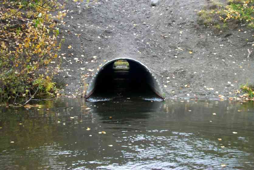
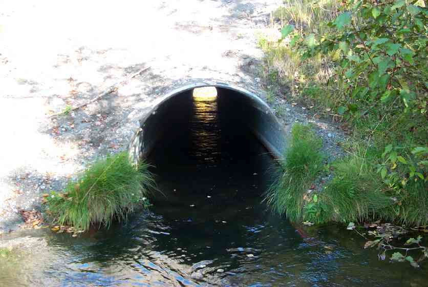
Site Comments: Pond upstream & downstream of culvert.
arrow to the right of the survey date below to choose a different report for this site.
Survey MSCS1-CT128
Observers: Doug Hill, Joe Conner, Michael Wheel
Overall Fish Passage Rating:
Tidal: No
Backwatered: No
Step Pools:
Construction Year:
Comments: Pond upstream & downstream of culvert. Site was revisited in 2011 and following notes are from that visit: ponded upstream and downstream. Culvert does appear to be undersize for location & there is significant current/ flow through culvert. Fish seen upstream, downstream and in culvert. Gradient appears fairly flat. Pipe is not embedded, but does have some substrate thoughout culvert.
Culvert Measurements
| ID: 1 | Structure Type: Circular pipe (Corrugated Metal) | Fish Passage Rating: | |||||||||||||||||||||||||||||||||||||||||
|
|
|
|||||||||||||||||||||||||||||||||||||||||
Culvert Observations:
|
|||||||||||||||||||||||||||||||||||||||||||
Stream Measurements
|
|
No stream width data available.
Elevations
| Locator ID | Culvert Number |
River Distance (ft)1 |
Distance From Crossing (ft)2 |
Relative Elevation (ft) |
|---|---|---|---|---|
| Outlet Culvert Top | 1 | 84.38 | ||
| Inlet Culvert Top | 1 | 84.50 | ||
| D/S Tailcrest or 1st Thalweg | 0.00 | 13.6 | 79.37 | |
| Outlet Invert | 1 | 13.60 | 0.0 | 78.94 |
| Road Elev | 68.10 | 97.71 | ||
| Road Elev | 68.10 | 98.09 | ||
| Inlet Culvert Invert | 1 | 122.60 | 0.0 | 79.43 |
| Inlet Thalweg | 1 | 122.60 | 0.0 | 79.43 |
Notes:
- River distance is measured continuously throughout the survey reach along the thalweg of the stream.
- Measured from each end of the crossing along the thalweg of the stream.
Fish Sampling Efforts
| Gear Type: Minnow Trap (A) | ||
| Gear Type: Visual Observation, Ground (C) | ||
Fish Observations
| Species: adult coho salmon | Life History: Anadromous (Suspected Spawning) | ||
| Total Fish Observed: 30 | Fish Measured: | Fork Lengths (mm) Min: Max: Mean: | |
| Collected/Observed by Gear Type: Upstream Visual Observation, Ground (30) | |||
| Comments: Approximately 30 adult coho observed moving thru culvert | |||
| Species: general fish observation, no species information | Life History: Not Recorded | ||
| Total Fish Observed: | Fish Measured: | Fork Lengths (mm) Min: Max: Mean: | |
| Collected/Observed by Gear Type: Upstream Minnow Trap () | |||
| Comments: Numerous juvenile fish observed upstream and downstream of culvert | |||
Photos
Questions or comments about this report can be directed to dfg.dsf.webmaster@alaska.gov