Fish Passage Site 20401275
Coordinates (dec. deg.): 61.62741°, -149.31067°
Legal Description: S018N001E29
Region: South Central
Road Name: Private- Camp Challenge Christ
Datum: NAD83
Quad Name / ITM: Anchorage C-7
AWC Stream #:
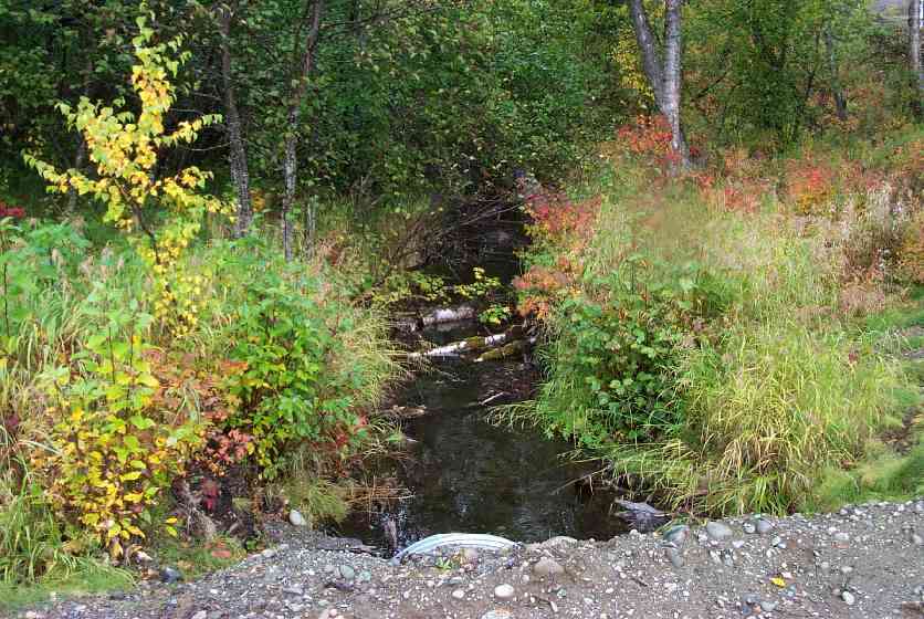
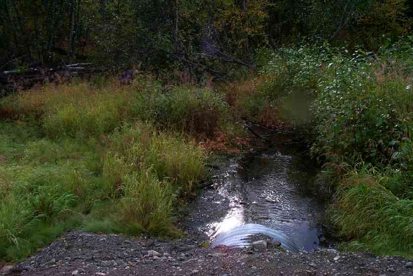
Stream Name: Wolf Lake outlet stream
Elevation:
Site Comments: The above lat/long for this culvert are incorrect. On private property and could not be located to resurvey in 2010 or 2011.
Survey MSCS1-CT118
Observers: Edward Weiss, Doug Hill, Joe Conner
Overall Fish Passage Rating:
Tidal: No
Backwatered: No
Step Pools:
Construction Year: 2001
Site Observations:
- Constriction ratio red
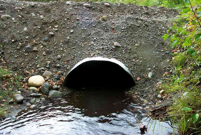
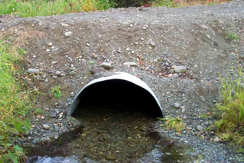
Comments: New road, new culvert (set last year) (2001)
Culvert Measurements
| ID: 1 | Structure Type: Open-bottom arch (Corrugated Metal) | Fish Passage Rating: | |||||||||||||||||||||||||||||||||||||||||
|
|
|
|||||||||||||||||||||||||||||||||||||||||
Culvert Observations:
|
|||||||||||||||||||||||||||||||||||||||||||
Stream Measurements
|
|
| Stream Width Type | Distance From Crossing (ft) |
Stream Width (ft) |
|---|---|---|
| Downstream ordinary high water | 50.0 | 8.00 |
| Downstream ordinary high water | 102.0 | 9.60 |
| Upstream ordinary high water | 50.0 | 9.50 |
| Upstream ordinary high water | 82.0 | 14.00 |
Elevations
| Locator ID | Culvert Number |
River Distance (ft)1 |
Distance From Crossing (ft)2 |
Relative Elevation (ft) |
|---|---|---|---|---|
| Inlet Culvert Top | 1 | 93.30 | ||
| Outlet Culvert Top | 1 | 93.49 | ||
| D/S Thalweg | 0.00 | 102.0 | 90.70 | |
| D/S Thalweg | 52.00 | 50.0 | 90.99 | |
| Outlet Invert | 1 | 102.00 | 0.0 | 91.45 |
| Outlet Thalweg | 1 | 102.00 | 0.0 | 91.45 |
| Road Elev | 117.50 | 94.49 | ||
| Road Elev | 117.50 | 95.62 | ||
| Inlet Culvert Invert | 1 | 133.00 | 0.0 | 91.25 |
| Inlet Thalweg | 1 | 133.00 | 0.0 | 91.25 |
| U/S Thalweg | 1 | 138.00 | 5.0 | 90.94 |
| U/S Thalweg | 183.00 | 50.0 | 91.20 | |
| U/S Thalweg | 215.00 | 82.0 | 91.45 |
Notes:
- River distance is measured continuously throughout the survey reach along the thalweg of the stream.
- Measured from each end of the crossing along the thalweg of the stream.
Fish Sampling Efforts
| Gear Type: Minnow Trap (A) | Trap Duration(h): 20 | |
Fish Observations
| Species: juvenile/adult Dolly Varden | Life History: Unknown | ||
| Total Fish Observed: 8 | Fish Measured: 4 | Fork Lengths (mm) Min: 78 Max: 115 Mean: 104 | |
| Collected/Observed by Gear Type: Upstream Minnow Trap (8) | |||
Photos
Questions or comments about this report can be directed to dfg.dsf.webmaster@alaska.gov