Fish Passage Site 20401272
Coordinates (dec. deg.): 61.62141°, -149.34364°
Legal Description: S018N001E30
Region: South Central
Road Name: Sierra Street
Datum: NAD83
Quad Name / ITM: Anchorage C-7
AWC Stream #:
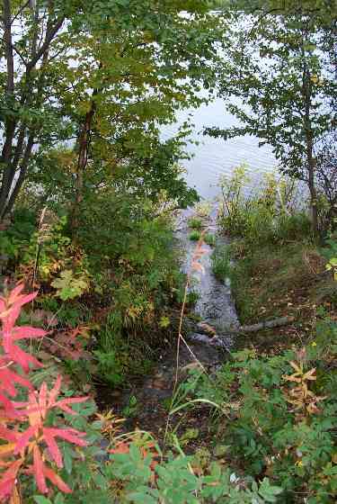
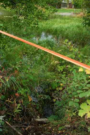
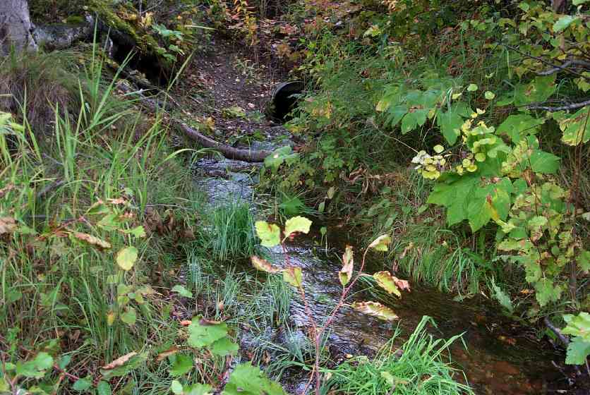
Stream Name: King Lake outlet
Elevation:
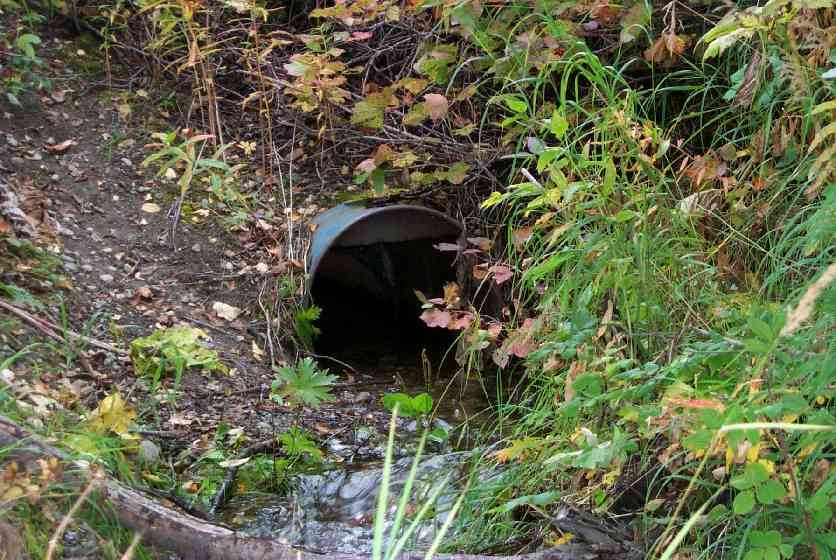
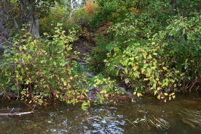
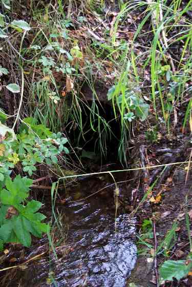
Site Comments: Culvert between Anderson and Kings Lake
arrow to the right of the survey date below to choose a different report for this site.
Survey MSCS1-CT115
Observers: Edward Weiss, Doug Hill, Joe Conner
Overall Fish Passage Rating:
Tidal: No
Backwatered: No
Step Pools:
Construction Year:
Site Observations:
- Culvert gradient gray
Comments: First time we have seen water flowing thru culvert. Hundreds of stickleback in Anderson Lk off outlet. Homemade barrel culvert. Inl/Outet Erosion Bank Protection needed; Lake uspstream/dowstream;
Culvert Measurements
| ID: 1 | Structure Type: Other (Unknown) | Fish Passage Rating: | |||||||||||||||||||||||||||||||||||||||||
|
|
|
|||||||||||||||||||||||||||||||||||||||||
Culvert Observations:
|
|||||||||||||||||||||||||||||||||||||||||||
Stream Measurements
|
|
No stream width data available.
Elevations
| Locator ID | Culvert Number |
River Distance (ft)1 |
Distance From Crossing (ft)2 |
Relative Elevation (ft) |
|---|---|---|---|---|
| Outlet Culvert Top | 1 | 90.33 | ||
| Inlet Culvert Top | 1 | 90.73 | ||
| Outlet Invert | 1 | 0.00 | 0.0 | 88.53 |
| Outlet Thalweg | 1 | 0.00 | 0.0 | 88.53 |
| Road Elev | 20.50 | 94.73 | ||
| Road Elev | 20.50 | 94.93 | ||
| Inlet Thalweg | 1 | 41.00 | 0.0 | 88.75 |
| Inlet Culvert Invert | 1 | 41.00 | 0.0 | 88.76 |
| U/S Thalweg | 1 | 47.30 | 6.3 | 88.63 |
Notes:
- River distance is measured continuously throughout the survey reach along the thalweg of the stream.
- Measured from each end of the crossing along the thalweg of the stream.
Fish Sampling Efforts
| Gear Type: Minnow Trap (A) | Trap Duration(h): 23 | |
| Gear Type: Minnow Trap (B) | Trap Duration(h): 0 | |
Fish Observations
| Species: juvenile/adult stickleback-unspecified | Life History: Resident | ||
| Total Fish Observed: 57 | Fish Measured: | Fork Lengths (mm) Min: Max: Mean: | |
| Collected/Observed by Gear Type: Downstream Minnow Trap (30) Upstream Minnow Trap (27) | |||
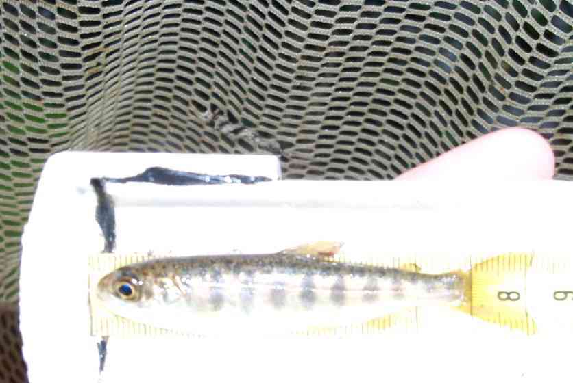
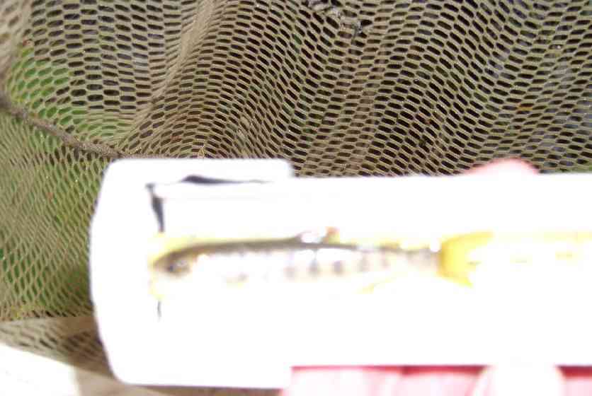
| Species: juvenile coho salmon | Life History: Anadromous | ||
| Total Fish Observed: 4 | Fish Measured: 2 | Fork Lengths (mm) Min: 73 Max: 78 Mean: 75 | |
| Collected/Observed by Gear Type: Upstream Minnow Trap (4) | |||
Photos
Questions or comments about this report can be directed to dfg.dsf.webmaster@alaska.gov