Fish Passage Site 20401271
Coordinates (dec. deg.): 61.62338°, -149.32395°
Legal Description: S018N001E29
Region: South Central
Road Name: North Charley Drive
Datum: NAD83
Quad Name / ITM: Anchorage C-7
AWC Stream #: 247-50-10300
Stream Name: Anderson Lake outlet
Elevation:
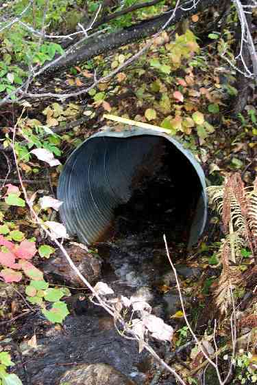
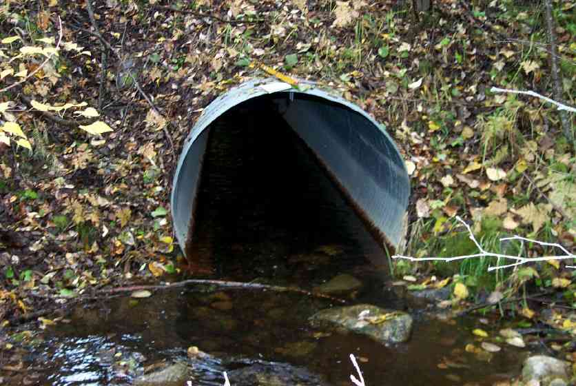
Site Comments: Culvert 200' below Anderson Lake outlet. Old ID CT114.
arrow to the right of the survey date below to choose a different report for this site.
Survey MSCS1-CT114
Observers: Edward Weiss, Doug Hill, Joe Conner
Overall Fish Passage Rating:
Tidal: No
Backwatered: No
Step Pools:
Construction Year:
Site Observations:
- Culvert gradient red
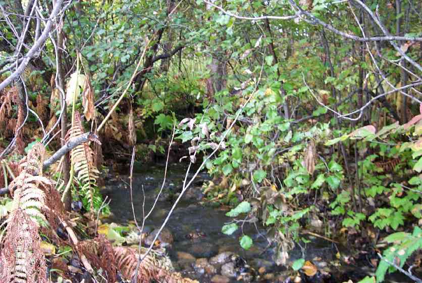
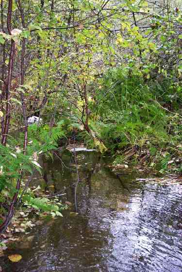
Comments: Water flowing through culver and downstream section - this section often ephemeral, fish present; Lake approx. 200' upstream
Culvert Measurements
| ID: 1 | Structure Type: Circular pipe (Corrugated Metal) | Fish Passage Rating: | |||||||||||||||||||||||||||||||||||||||||
|
|
|
|||||||||||||||||||||||||||||||||||||||||
Culvert Observations:
|
|||||||||||||||||||||||||||||||||||||||||||
Stream Measurements
|
|
| Stream Width Type | Distance From Crossing (ft) |
Stream Width (ft) |
|---|---|---|
| Downstream ordinary high water | 50.0 | 16.00 |
| Downstream ordinary high water | 100.0 | 10.50 |
| Upstream ordinary high water | 14.0 | 7.00 |
| Upstream ordinary high water | 100.0 | 9.30 |
Elevations
| Locator ID | Culvert Number |
River Distance (ft)1 |
Distance From Crossing (ft)2 |
Relative Elevation (ft) |
|---|---|---|---|---|
| D/S Thalweg | 81.28 | |||
| D/S Thalweg | 82.03 | |||
| Outlet Culvert Top | 1 | 85.90 | ||
| U/S Thalweg | 86.82 | |||
| Inlet Culvert Top | 1 | 88.47 | ||
| Outlet Invert | 1 | 0.00 | 0.0 | 82.25 |
| Outlet Thalweg | 1 | 0.00 | 0.0 | 82.25 |
| Road Elev | 44.00 | 97.00 | ||
| Road Elev | 44.00 | 98.07 | ||
| Inlet Culvert Invert | 1 | 88.00 | 0.0 | 84.56 |
| Inlet Thalweg | 1 | 88.00 | 0.0 | 84.56 |
| U/S Thalweg | 102.00 | 14.0 | 85.58 |
Notes:
- River distance is measured continuously throughout the survey reach along the thalweg of the stream.
- Measured from each end of the crossing along the thalweg of the stream.
Fish Sampling Efforts
| Gear Type: Minnow Trap (A) | Trap Duration(h): 1 | |
| Gear Type: Minnow Trap (B) | Trap Duration(h): 1 | |
Fish Observations
| Species: juvenile/adult Dolly Varden | Life History: Unknown | ||
| Total Fish Observed: 2 | Fish Measured: 1 | Fork Lengths (mm) Min: 90 Max: 90 Mean: 90 | |
| Collected/Observed by Gear Type: Downstream Minnow Trap (2) | |||
| Species: juvenile/adult stickleback-unspecified | Life History: Resident | ||
| Total Fish Observed: 17 | Fish Measured: | Fork Lengths (mm) Min: Max: Mean: | |
| Collected/Observed by Gear Type: Downstream Minnow Trap (12) Upstream Minnow Trap (5) | |||
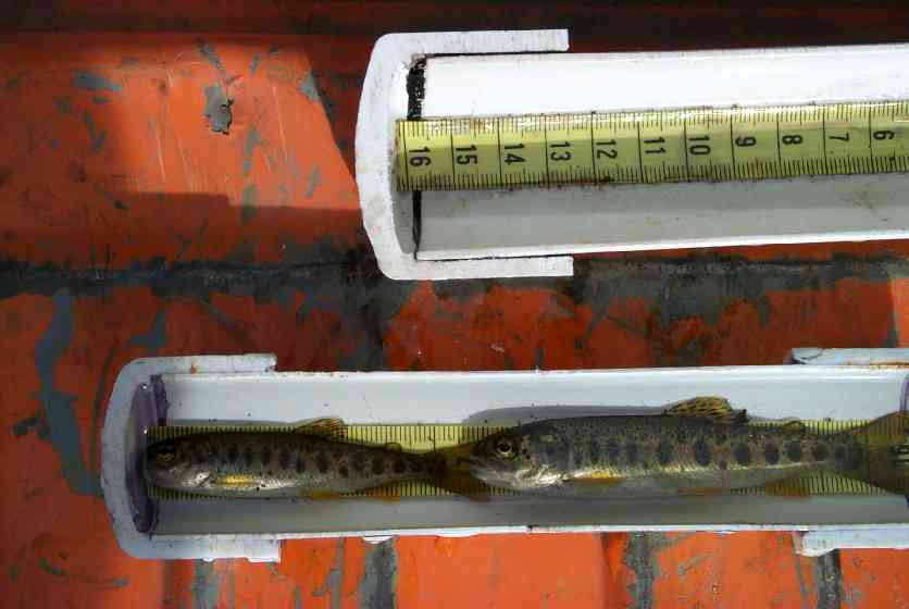
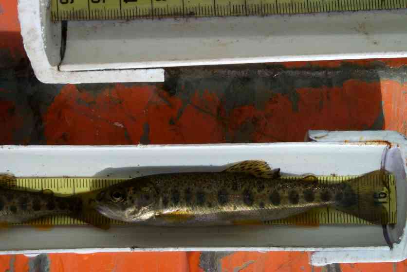
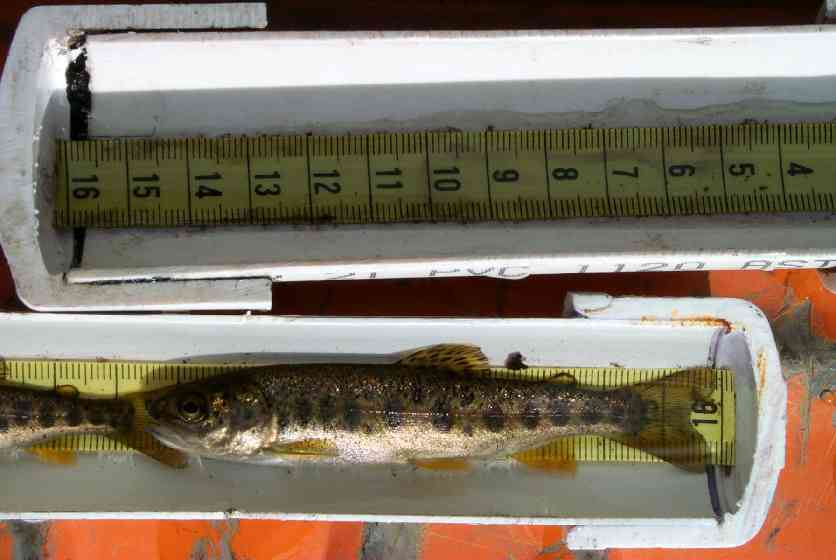
| Species: juvenile coho salmon | Life History: Anadromous | ||
| Total Fish Observed: 28 | Fish Measured: 14 | Fork Lengths (mm) Min: 59 Max: 88 Mean: 74 | |
| Collected/Observed by Gear Type: Downstream Minnow Trap (14) Upstream Minnow Trap (14) | |||
| Species: juvenile rainbow trout | Life History: Resident | ||
| Total Fish Observed: 16 | Fish Measured: 8 | Fork Lengths (mm) Min: 50 Max: 86 Mean: 71 | |
| Collected/Observed by Gear Type: Upstream Minnow Trap (16) | |||
Photos
Questions or comments about this report can be directed to dfg.dsf.webmaster@alaska.gov