Fish Passage Site 20401268
Coordinates (dec. deg.): 61.62885°, -149.26083°
Legal Description: S018N001E22
Region: South Central
Road Name: Engstrom Road
Datum: NAD83
Quad Name / ITM: Anchorage C-7
AWC Stream #: 247-50-10300-2054
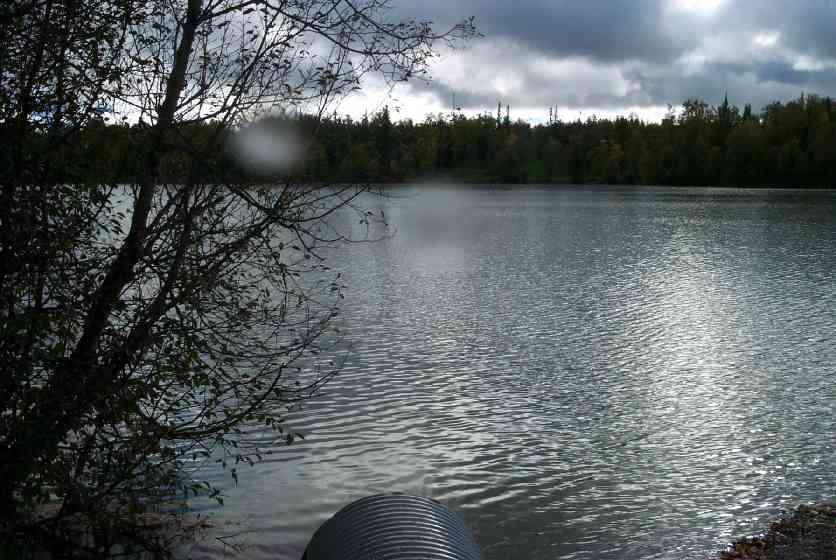
Stream Name: Cornelius and Nekleson Lakes
Elevation:
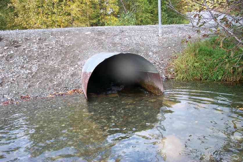
Site Comments: Culvert inlet at mouth of Cornelius Lake
arrow to the right of the survey date below to choose a different report for this site.
Survey MSCS1-CT111
Observers: Edward Weiss, Doug Hill, Joe Conner
Overall Fish Passage Rating:
Tidal: No
Backwatered: No
Step Pools:
Construction Year:
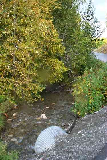
Comments: L. descending bank modified w/chain link fence; Stream abnormally wide in this section - wide and shallow; becomes more stream-like @200'. fill gravel in stream
Culvert Measurements
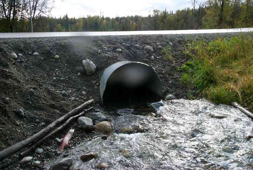
| ID: 1 | Structure Type: Circular pipe (Corrugated Metal) | Fish Passage Rating: | |||||||||||||||||||||||||||||||||||||||||
|
|
|
|||||||||||||||||||||||||||||||||||||||||
Culvert Observations:
|
|||||||||||||||||||||||||||||||||||||||||||
Stream Measurements
|
|
| Stream Width Type | Distance From Crossing (ft) |
Stream Width (ft) |
|---|---|---|
| Downstream ordinary high water | 50.0 | 22.00 |
| Downstream ordinary high water | 100.0 | 31.50 |
Elevations
| Locator ID | Culvert Number |
River Distance (ft)1 |
Distance From Crossing (ft)2 |
Relative Elevation (ft) |
|---|---|---|---|---|
| U/S Thalweg | 1 | 89.53 | ||
| Outlet Culvert Top | 1 | 92.63 | ||
| Inlet Culvert Top | 1 | 93.07 | ||
| D/S Water Surface Elev | 0.00 | 100.0 | 88.14 | |
| D/S Thalweg | 50.00 | 50.0 | 88.25 | |
| D/S Thalweg (riffle) | 85.00 | 15.0 | 89.27 | |
| D/S Thalweg | 97.00 | 3.0 | 89.55 | |
| Outlet Invert | 1 | 100.00 | 0.0 | 89.40 |
| Road Elev | 125.00 | 94.06 | ||
| Road Elev | 125.00 | 94.68 | ||
| Inlet Culvert Invert | 1 | 150.00 | 0.0 | 89.87 |
| Inlet Thalweg | 1 | 150.00 | 0.0 | 89.87 |
Notes:
- River distance is measured continuously throughout the survey reach along the thalweg of the stream.
- Measured from each end of the crossing along the thalweg of the stream.
Fish Sampling Efforts
| Gear Type: Visual Observation, Air-Not Recorded (C) | ||
Fish Observations
| Species: adult sockeye salmon | Life History: Anadromous (Suspected Spawning) | ||
| Total Fish Observed: | Fish Measured: | Fork Lengths (mm) Min: Max: Mean: | |
| Collected/Observed by Gear Type: Upstream Visual Observation, Air-Not Recorded () | |||
| Comments: Adult sockeye observed upstream and downstream of culvert | |||
Photos
Questions or comments about this report can be directed to dfg.dsf.webmaster@alaska.gov