Fish Passage Site 20401261
Coordinates (dec. deg.): 61.56419°, -149.04301°
Legal Description: S017N002E14
Region: South Central
Road Name: private drive
Datum: NAD83
Quad Name / ITM: Anchorage C-6
AWC Stream #: 247-50-10200-2071-3023
Stream Name: Bodenberg Creek
Elevation:
Site Comments: None
arrow to the right of the survey date below to choose a different report for this site.
Survey MSCS1-BB003
Observers: Edward Weiss, Olof Jacobsson
Overall Fish Passage Rating:
Tidal: No
Backwatered: No
Step Pools:
Construction Year:
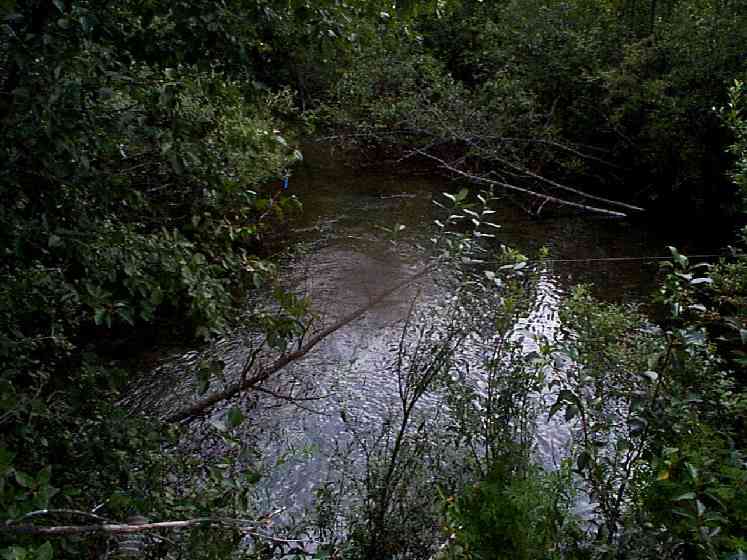
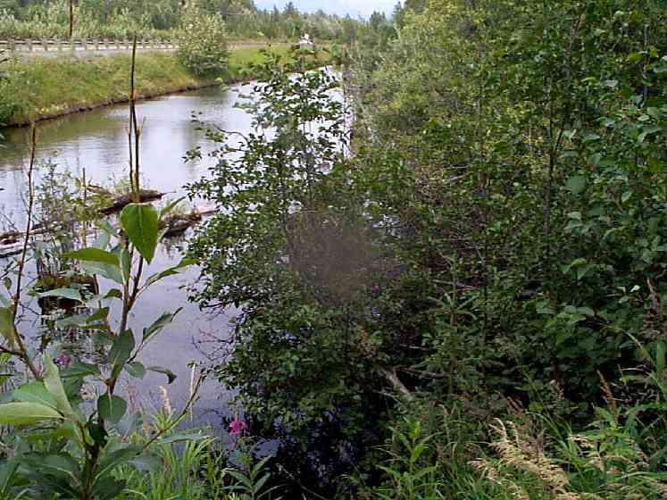
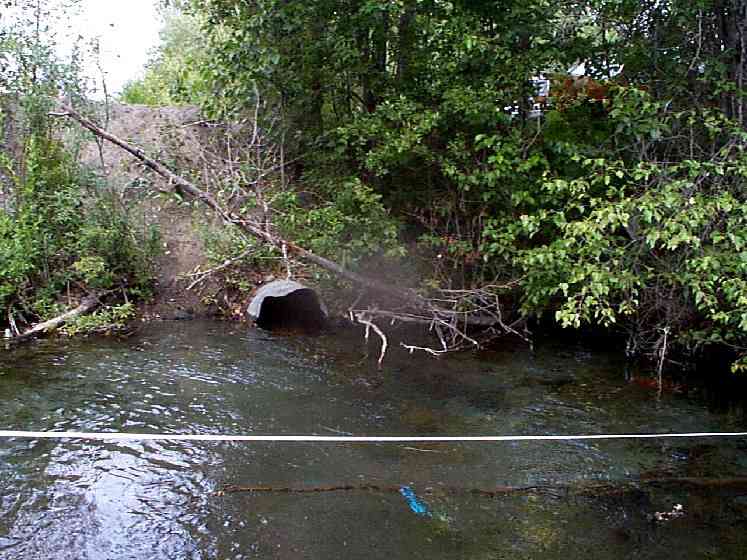
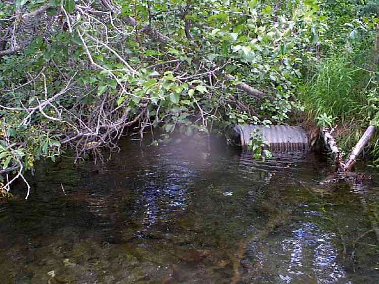
Comments: Fish pass upstream of this site. Primarily sand in slow water areas, ponds upstream and downstream of culvert. Coarse gravel at inlet and outlets of culverts where sand washed away.
Culvert Measurements
| ID: 1 | Structure Type: Circular pipe (Corrugated Metal) | Fish Passage Rating: | |||||||||||||||||||||||||||||||||||||||||
|
|
|
|||||||||||||||||||||||||||||||||||||||||
Culvert Observations:
|
|||||||||||||||||||||||||||||||||||||||||||
| ID: 2 | Structure Type: Circular pipe (Corrugated Metal) | Fish Passage Rating: | |||||||||||||||||||||||||||||||||||||||||
|
|
|
|||||||||||||||||||||||||||||||||||||||||
Culvert Observations:
|
|||||||||||||||||||||||||||||||||||||||||||
Stream Measurements
|
|
| Stream Width Type | Distance From Crossing (ft) |
Stream Width (ft) |
|---|---|---|
| Upstream ordinary high water | 150.0 | 75.00 |
Elevations
| Locator ID | Culvert Number |
River Distance (ft)1 |
Distance From Crossing (ft)2 |
Relative Elevation (ft) |
|---|---|---|---|---|
| U/S Thalweg | 84.95 | |||
| D/S Tailcrest or 1st Thalweg | 85.20 | |||
| D/S Thalweg | 85.35 | |||
| U/S Thalweg | 85.60 | |||
| Inlet Culvert Top | 1 | 87.05 | ||
| Outlet Culvert Top | 1 | 87.36 | ||
| Inlet Culvert Top | 2 | 88.25 | ||
| Outlet Culvert Top | 2 | 88.26 | ||
| D/S Thalweg | 84.36 | |||
| Outlet Invert | 1 | 0.00 | 0.0 | 84.85 |
| Road Elev | 22.50 | 94.44 | ||
| Road Elev | 22.50 | 94.52 | ||
| Inlet Culvert Invert | 1 | 45.00 | 0.0 | 85.70 |
| Inlet Culvert Invert | 2 | 45.00 | 0.0 | 85.80 |
| Inlet Thalweg | 2 | 45.00 | 0.0 | 84.67 |
Notes:
- River distance is measured continuously throughout the survey reach along the thalweg of the stream.
- Measured from each end of the crossing along the thalweg of the stream.
Fish Sampling Efforts
| Gear Type: Minnow Trap (A) | ||
| Gear Type: Minnow Trap (B) | Trap Duration(h): 1 | |
| Gear Type: Visual Observation, Ground (D) | ||
Fish Observations
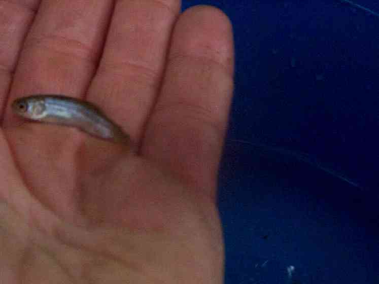
| Species: juvenile sockeye salmon | Life History: Anadromous | ||
| Total Fish Observed: 2 | Fish Measured: 1 | Fork Lengths (mm) Min: 43 Max: 43 Mean: 43 | |
| Collected/Observed by Gear Type: Downstream Minnow Trap (2) | |||
| Comments: Several other small salmonids seen is shallow pool downstream of culvert. | |||
| Species: no fish collected or observed | Life History: Not Applicable | ||
| Total Fish Observed: 0 | Fish Measured: | Fork Lengths (mm) Min: Max: Mean: | |
| Collected/Observed by Gear Type: Upstream Minnow Trap (0) | |||
| Species: general fish observation, no species information | Life History: Not Recorded | ||
| Total Fish Observed: | Fish Measured: | Fork Lengths (mm) Min: Max: Mean: | |
| Collected/Observed by Gear Type: Downstream Visual Observation, Ground () | |||
| Comments: Numerous small unidentified salmonids in shallow pool downstream of culvert | |||
Photos
Questions or comments about this report can be directed to dfg.dsf.webmaster@alaska.gov