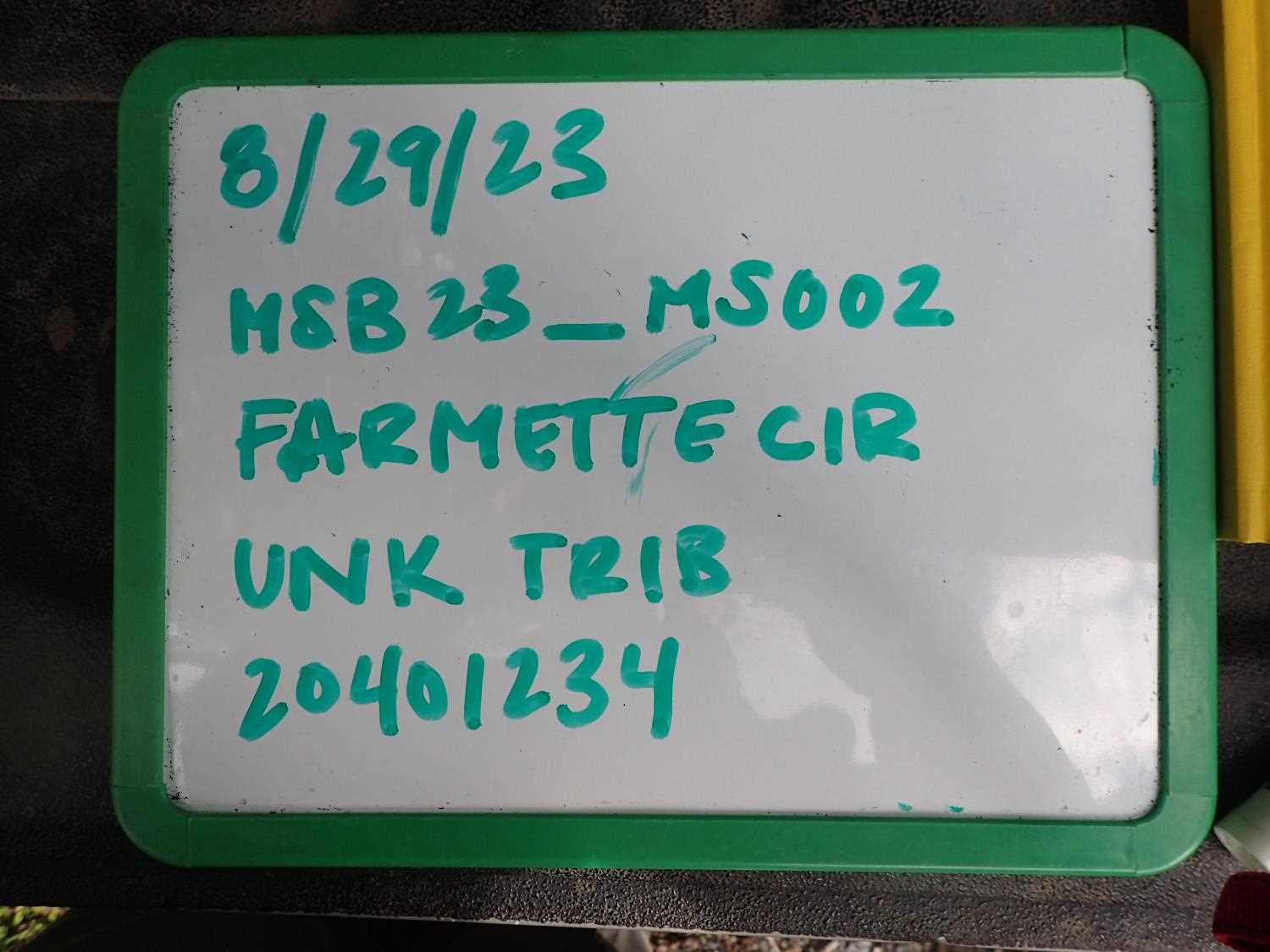
Fish Passage Site 20401234
Coordinates (dec. deg.): 61.45512°, -148.83777°
Legal Description: S016N003E25
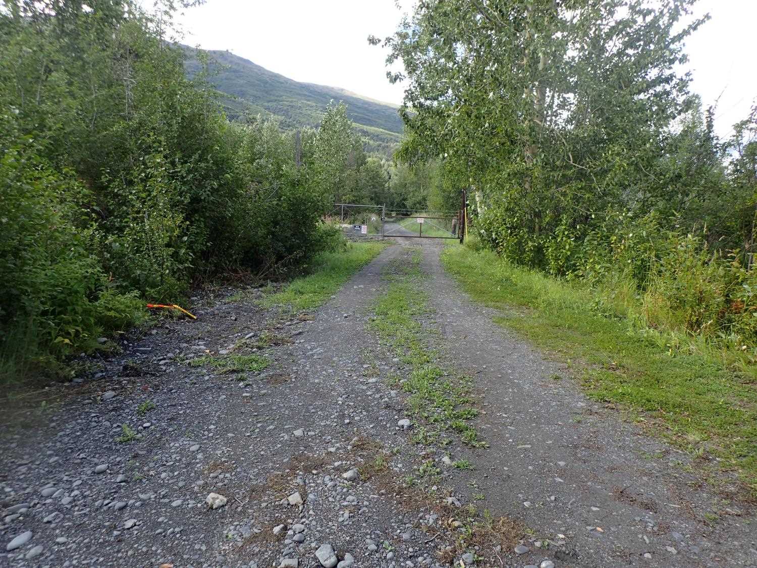
Region: South Central
Road Name: Farmettes Circle
Datum: WGS84
Quad Name / ITM: Anchorage B-5
AWC Stream #:
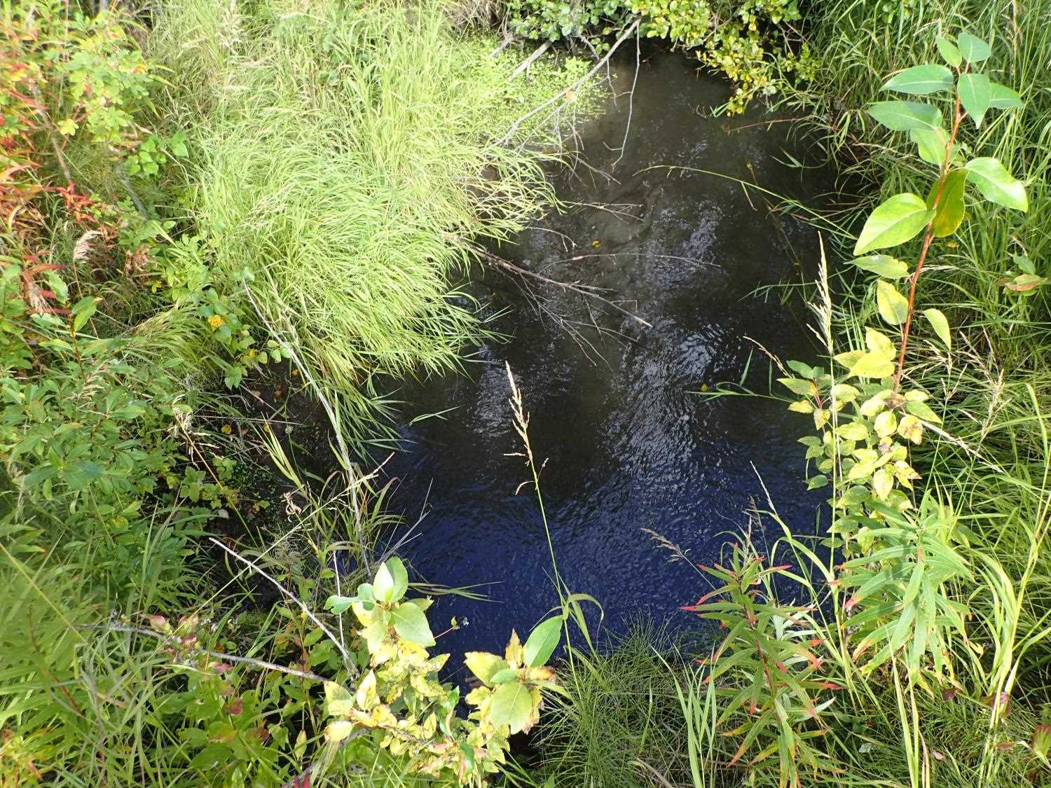
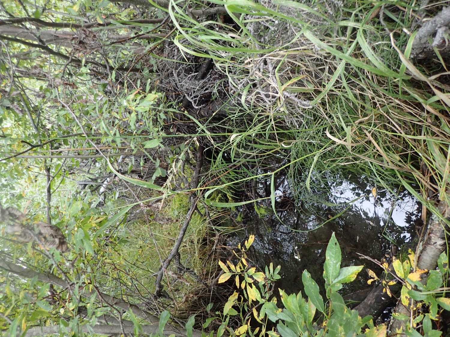
Stream Name: Knik River tributary
Elevation:
Site Comments: None
arrow to the right of the survey date below to choose a different report for this site.
Survey MSB23-MS002
Project Supervisor: Michael Mazzacavallo, Alaska Department of Fish and Game
— Anchorage, AK
Observers: Michael Mazzacavallo, Beth Evers, Kat Leavitt, Kevin Keith
Overall Fish Passage Rating:
Tidal: No
Backwatered: No
Step Pools: No
Construction Year:
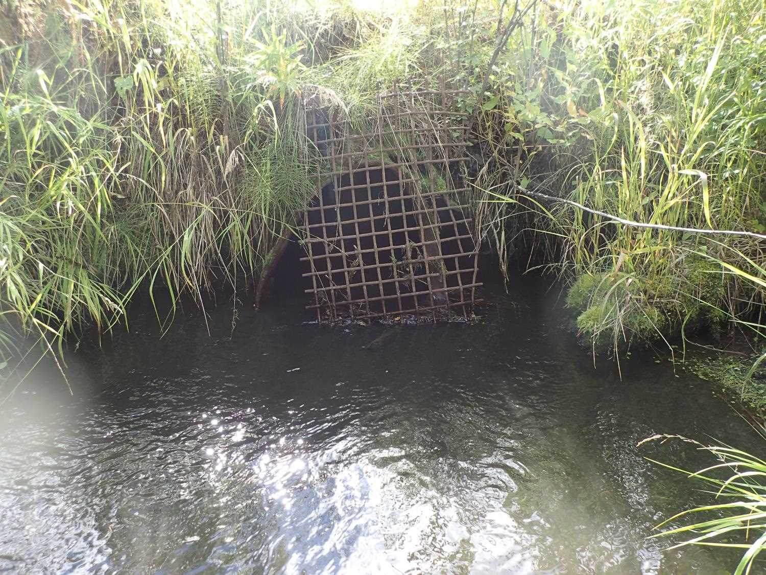
Site Observations:
- Constriction ratio gray
- Compound gradient in pipe
- Mechanical damage or joints parting
- Material inadequate for designed use
- Other, including vibrations, cavitation, etc.
- Culvert sagging in middle
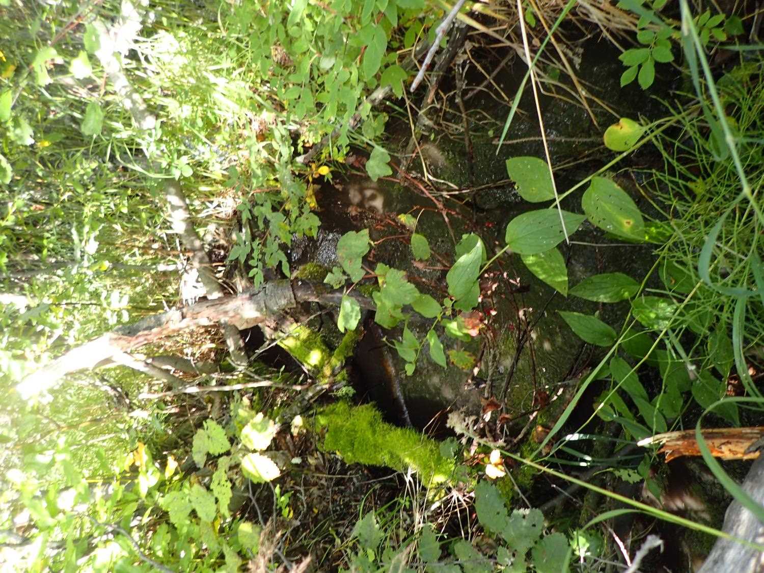
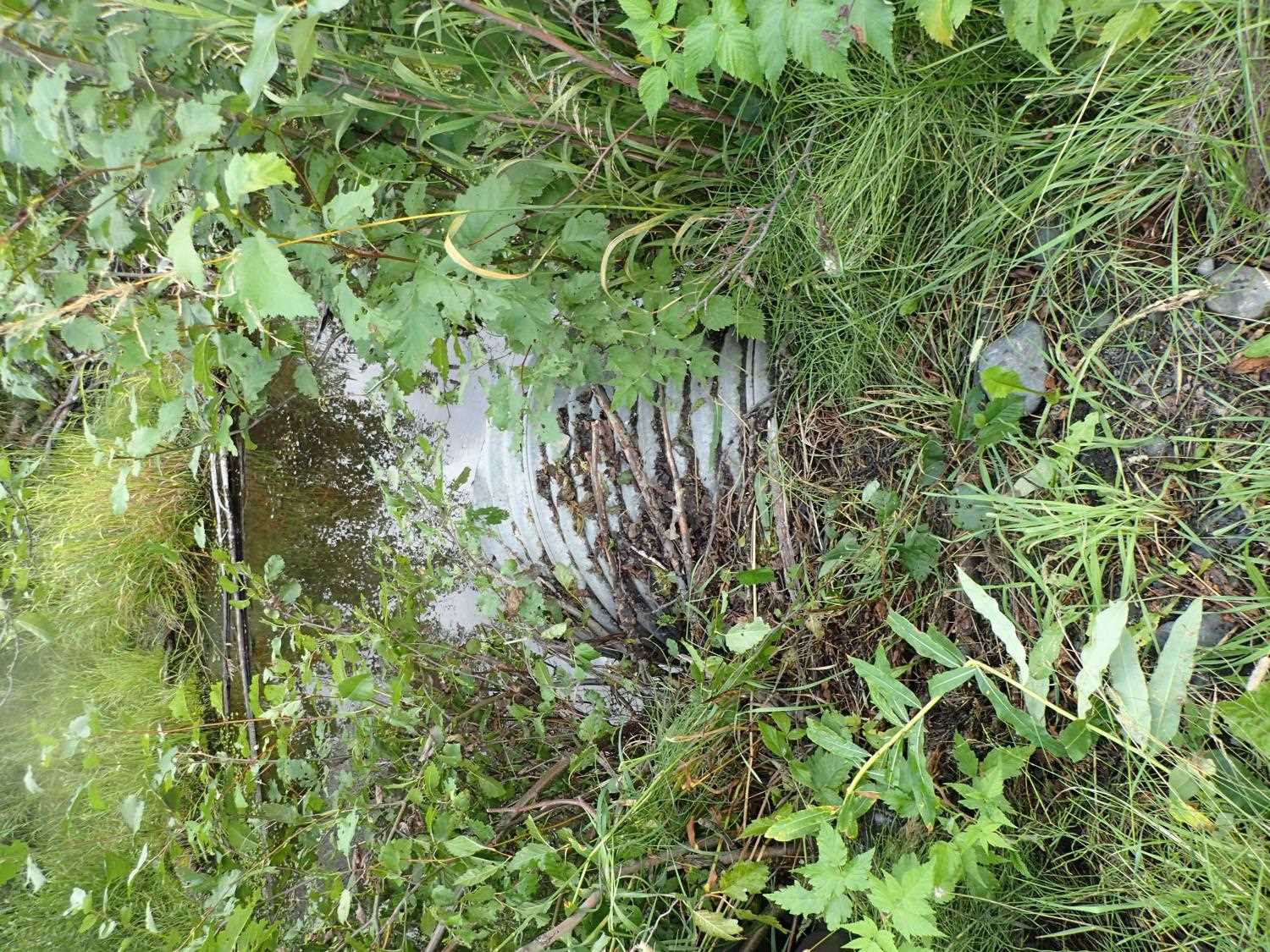
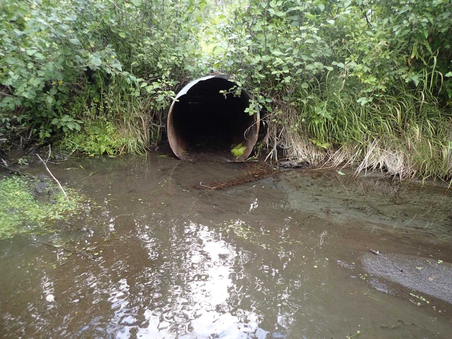
Comments: Landowner has witnessed adult salmon at the outlet of the culvert; pool u/s of culvert may or may not be caused by culvert installation
Culvert Measurements
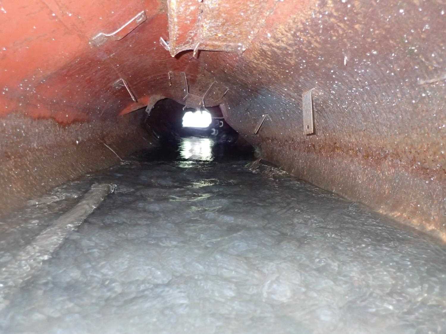
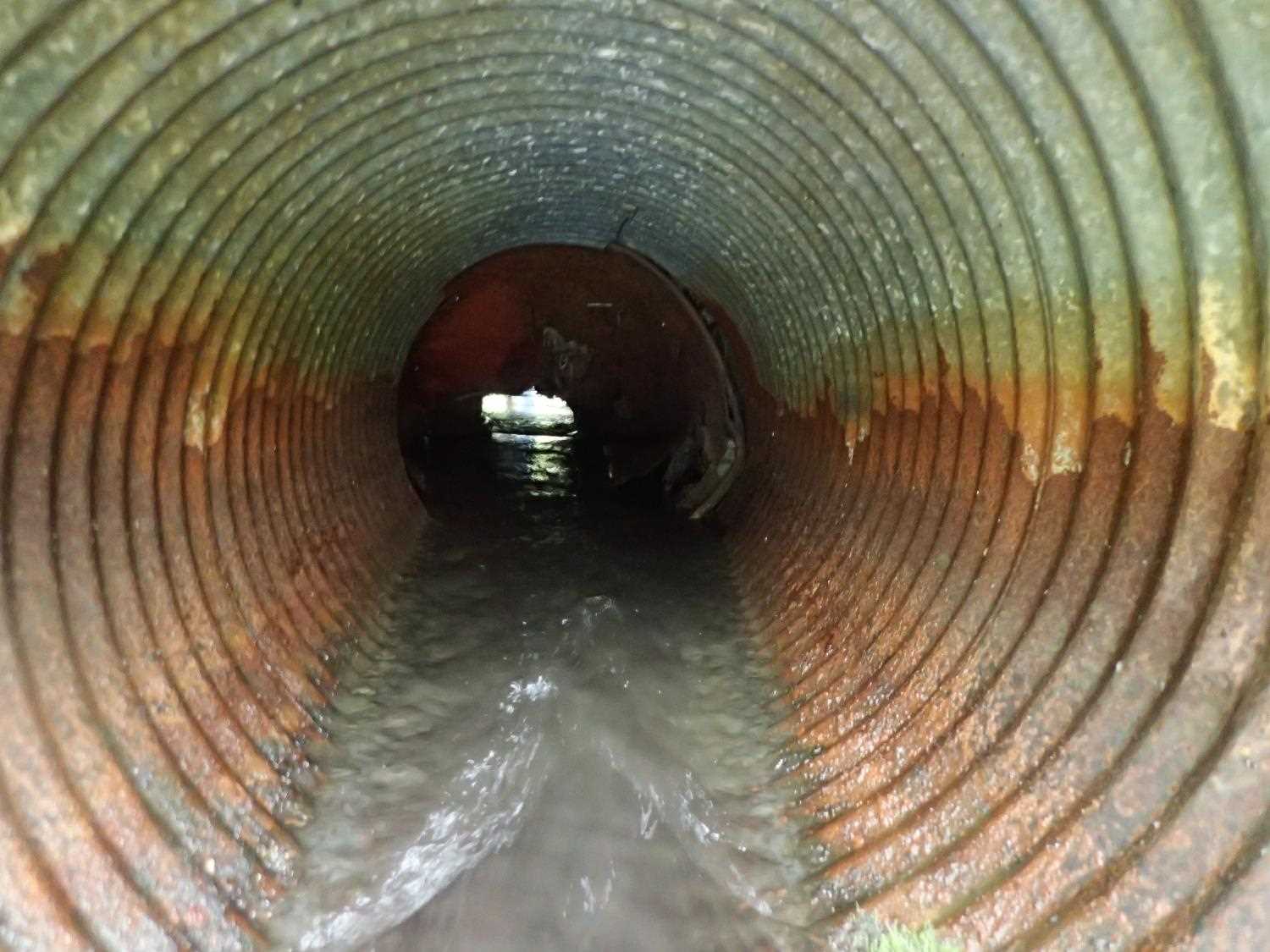
| ID: 1 | Structure Type: Circular pipe (Corrugated steel) | Fish Passage Rating: | ||||||||||||||||||||||||||||||||||||||||||
|
|
|
||||||||||||||||||||||||||||||||||||||||||
Comments: Structure Material: Inlet - CSP, Outlet - NCP; Failure Mechanism #7 - ST; 10ft from inlet culvert type CIR added/extended from a rusted falling apart round non-corrugated metal pipe (two different pipes put together); 1-2 ft drop in middle of pipe |
||||||||||||||||||||||||||||||||||||||||||||
Culvert Observations:
|
||||||||||||||||||||||||||||||||||||||||||||
Stream Measurements
|
|
| Stream Width Type | Distance From Crossing (ft) |
Stream Width (ft) |
|---|---|---|
| Downstream ordinary high water | 45.0 | 3.80 |
| Downstream ordinary high water | 65.0 | 3.50 |
| Downstream ordinary high water | 100.0 | 4.80 |
Elevations
| Locator ID | Culvert Number |
River Distance (ft)1 |
Distance From Crossing (ft)2 |
Relative Elevation (ft) |
|---|---|---|---|---|
| Road Elev | 99.82 | |||
| Inlet Culvert Top | 0.00 | 99.37 | ||
| Inlet Culvert Invert | 0.00 | 96.27 | ||
| U/S Water Surface Elev | 0.00 | 96.61 | ||
| Outlet Culvert Top | 32.78 | 97.57 | ||
| Outlet Invert | 32.78 | 95.25 | ||
| D/S Water Surface Elev | 32.78 | 95.78 | ||
| D/S Water Surface Elev | 82.78 | 95.15 | ||
| D/S Water Surface Elev (Pond) | 382.78 | 93.28 |
Notes:
- River distance is measured continuously throughout the survey reach along the thalweg of the stream.
- Measured from each end of the crossing along the thalweg of the stream.
Fish Sampling Efforts
No fish sampling occurred during this survey.
Fish Observations
No fish observations occurred during this survey.
Photos
Questions or comments about this report can be directed to dfg.dsf.webmaster@alaska.gov