Fish Passage Site 20300985
Coordinates (dec. deg.): 59.80045°, -151.63651°
Legal Description: S004S014W26
Region: South Central
Road Name: Nikolaevsk Road
Datum: NAD83
Quad Name / ITM: Seldovia D-5
AWC Stream #: 244-10-10010-2011
Stream Name: Anchor River North Fork
Elevation:
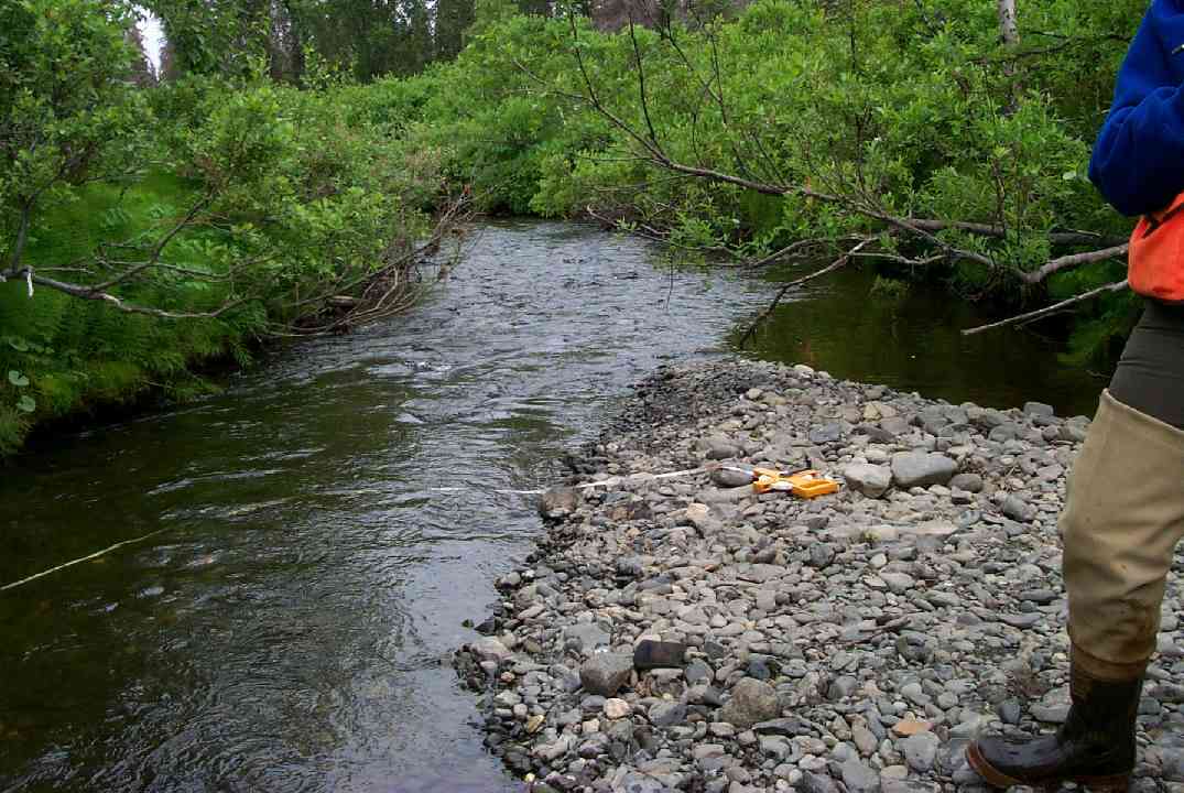
Site Comments: eep trail along outchannel and crosses 300 feet below culvert.
Survey KPCS1-NK020
Observers: Cecil Rich, Michael Lund, Tracy Smith
Overall Fish Passage Rating:
Tidal: No
Backwatered: No
Step Pools:
Construction Year:
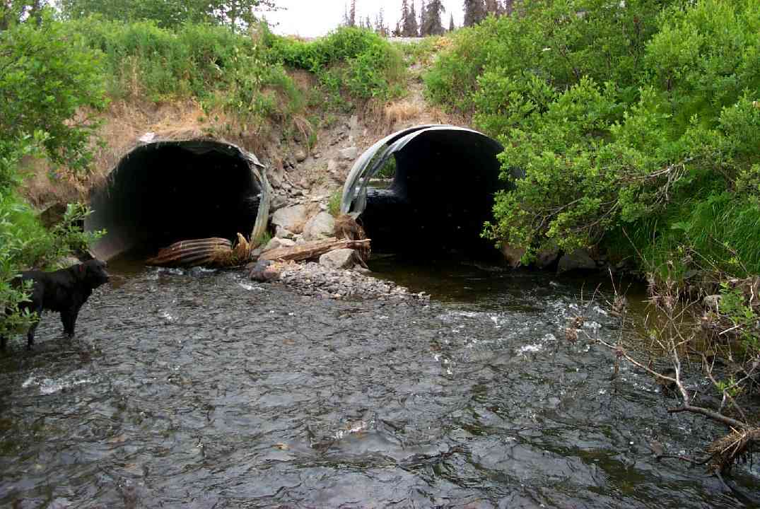
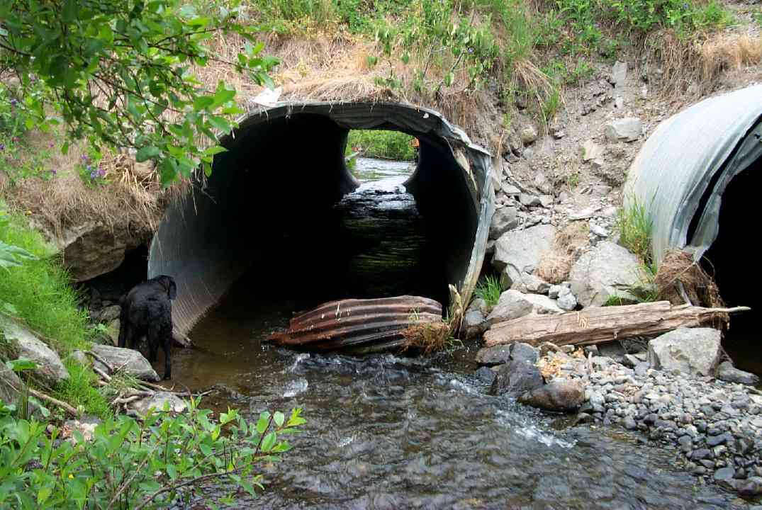
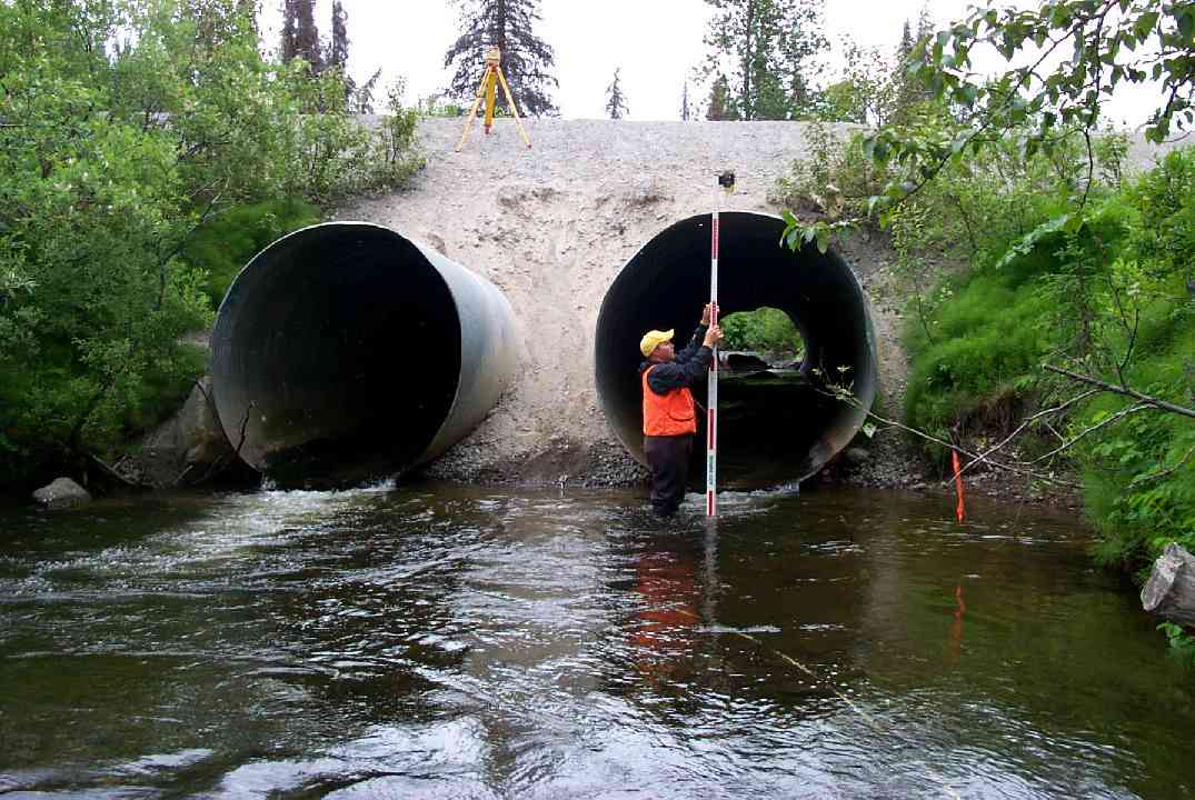
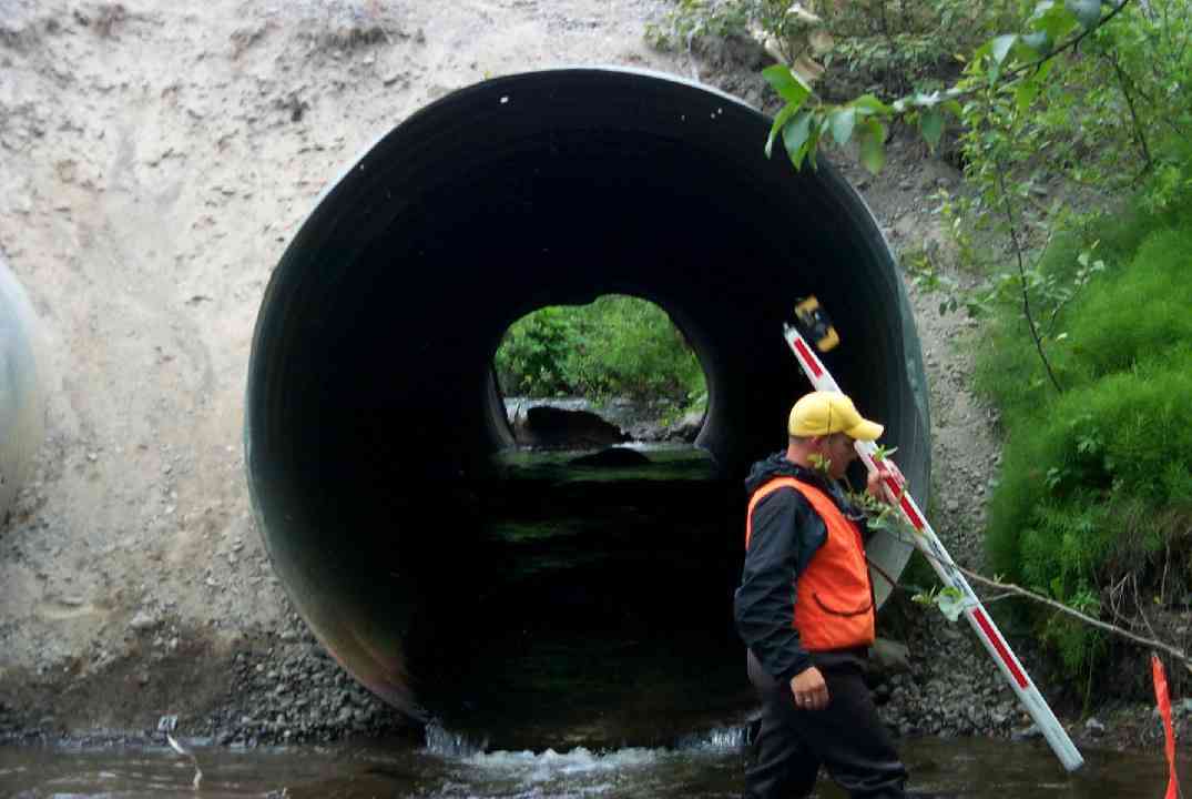
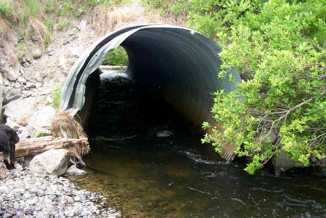
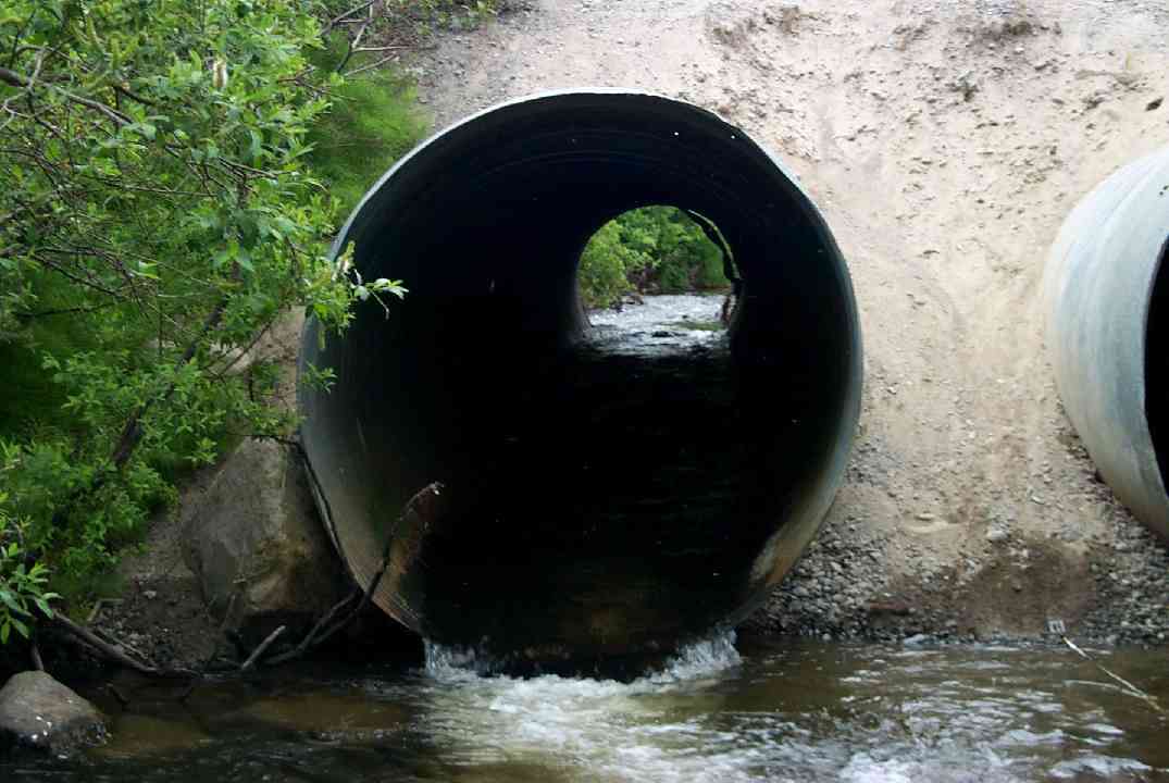
Comments: CP damage at inlet. Overly steep embankment. Fill eroding above pipes at outlet. Jeep trail along outchannel and crosses 300 feet below culvert. Boulders in culverts for good resting places for fish.
Culvert Measurements
| ID: 1 | Structure Type: Circular pipe (Corrugated Metal) | Fish Passage Rating: | |||||||||||||||||||||||||||||||||||||||||
|
|
|
|||||||||||||||||||||||||||||||||||||||||
Culvert Observations:
|
|||||||||||||||||||||||||||||||||||||||||||
| ID: 2 | Structure Type: Circular pipe (Corrugated Metal) | Fish Passage Rating: | |||||||||||||||||||||||||||||||||||||||||
|
|
|
|||||||||||||||||||||||||||||||||||||||||
Culvert Observations:
|
|||||||||||||||||||||||||||||||||||||||||||
Stream Measurements
|
|
| Stream Width Type | Distance From Crossing (ft) |
Stream Width (ft) |
|---|---|---|
| Downstream ordinary high water | 36.0 | 26.40 |
| Downstream ordinary high water | 62.0 | 19.40 |
| Downstream ordinary high water | 146.0 | 22.00 |
| Upstream ordinary high water | 5.0 | 26.40 |
| Upstream ordinary high water | 46.0 | 22.80 |
| Upstream ordinary high water | 150.0 | 21.20 |
Elevations
| Locator ID | Culvert Number |
River Distance (ft)1 |
Distance From Crossing (ft)2 |
Relative Elevation (ft) |
|---|---|---|---|---|
| D/S Thalweg | 79.37 | |||
| D/S Thalweg | 0.00 | 146.0 | 80.58 | |
| D/S Water Surface Elev | 0.00 | 146.0 | 82.12 | |
| D/S OHW Elev | 0.00 | 146.0 | 82.71 | |
| D/S Thalweg | 84.00 | 62.0 | 81.40 | |
| D/S OHW Elev | 84.00 | 62.0 | 82.71 | |
| D/S Water Surface Elev | 84.00 | 62.0 | 82.23 | |
| D/S Tailcrest or 1st Thalweg | 110.00 | 36.0 | 81.19 | |
| D/S Water Surface Elev | 110.00 | 36.0 | 82.56 | |
| OHW Left Bank | 110.00 | 36.0 | 83.44 | |
| OHW Left Bank | 141.00 | 5.0 | 82.96 | |
| OHW Left Bank | 141.00 | 5.0 | 82.65 | |
| Max Pool Depth | 141.00 | 5.0 | 80.15 | |
| Outlet Invert | 1 | 146.00 | 0.0 | 82.25 |
| Outlet Thalweg | 1 | 146.00 | 0.0 | 82.25 |
| Outlet Invert | 2 | 146.00 | 0.0 | 82.25 |
| Outlet Thalweg | 2 | 146.00 | 0.0 | 82.25 |
| Outlet Rustline Height | 1 | 146.00 | 0.0 | 83.67 |
| Outlet Rustline Height | 2 | 146.00 | 0.0 | 83.35 |
| Outlet Culvert Top | 2 | 146.00 | 0.0 | 90.33 |
| Outlet Culvert Top | 1 | 146.00 | 0.0 | 90.50 |
| Road Elev | 184.50 | 96.21 | ||
| Road Elev | 184.50 | 97.37 | ||
| Inlet Culvert Top | 1 | 223.00 | 0.0 | 89.79 |
| Inlet Culvert Top | 2 | 223.00 | 0.0 | 90.48 |
| Inlet Rustline Height | 1 | 223.00 | 0.0 | 84.56 |
| Inlet Rustline Height | 2 | 223.00 | 0.0 | 84.58 |
| Inlet Culvert Invert | 1 | 223.00 | 0.0 | 82.67 |
| Inlet Thalweg | 1 | 223.00 | 0.0 | 82.67 |
| Inlet Culvert Invert | 2 | 223.00 | 0.0 | 82.67 |
| Inlet Thalweg | 2 | 223.00 | 0.0 | 82.67 |
| U/S Thalweg | 2 | 224.00 | 1.0 | 82.87 |
| U/S Thalweg | 1 | 224.00 | 1.0 | 83.50 |
| U/S Thalweg | 2 | 228.00 | 5.0 | 83.17 |
| U/S Thalweg | 1 | 228.00 | 5.0 | 83.87 |
| U/S OHW elevation | 2 | 228.00 | 5.0 | 84.69 |
| U/S Water Surface Elev | 1 | 228.00 | 5.0 | 84.37 |
| U/S Water Surface Elev | 2 | 228.00 | 5.0 | 84.42 |
| U/S OHW elevation | 1 | 228.00 | 5.0 | 84.46 |
| U/S Thalweg | 2 | 239.60 | 16.6 | 84.04 |
| U/S Thalweg | 1 | 239.60 | 16.6 | 84.33 |
| U/S Thalweg | 269.00 | 46.0 | 84.42 | |
| U/S Water Surface Elev | 269.00 | 46.0 | 85.56 | |
| U/S Headwater | 269.00 | 46.0 | 85.83 | |
| U/S Water Surface Elev | 373.00 | 150.0 | 85.89 | |
| U/S Headwater | 373.00 | 150.0 | 86.39 | |
| U/S Thalweg | 373.00 | 150.0 | 84.43 |
Notes:
- River distance is measured continuously throughout the survey reach along the thalweg of the stream.
- Measured from each end of the crossing along the thalweg of the stream.
Fish Sampling Efforts
| Gear Type: Minnow Trap (A) | Trap Duration(h): 2.05 | |
| Gear Type: Minnow Trap (B) | Trap Duration(h): 2.15 | |
Fish Observations
| Species: juvenile Dolly Varden | Life History: Resident | ||
| Total Fish Observed: 78 | Fish Measured: 17 | Fork Lengths (mm) Min: 76 Max: 115 Mean: 98 | |
| Collected/Observed by Gear Type: Downstream Minnow Trap (27) Upstream Minnow Trap (51) | |||
| Species: juvenile Chinook salmon | Life History: Anadromous | ||
| Total Fish Observed: 2 | Fish Measured: 1 | Fork Lengths (mm) Min: 86 Max: 86 Mean: 86 | |
| Collected/Observed by Gear Type: Upstream Minnow Trap (2) | |||
| Species: juvenile coho salmon | Life History: Anadromous | ||
| Total Fish Observed: 6 | Fish Measured: 3 | Fork Lengths (mm) Min: 42 Max: 73 Mean: 60 | |
| Collected/Observed by Gear Type: Downstream Minnow Trap (2) Upstream Minnow Trap (4) | |||
Photos
Questions or comments about this report can be directed to dfg.dsf.webmaster@alaska.gov
