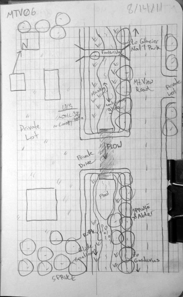
Fish Passage Site 10302260
Coordinates (dec. deg.): 58.44103°, -135.76404°
Legal Description: C040S058E01
Region: Southeast
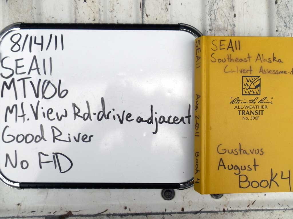
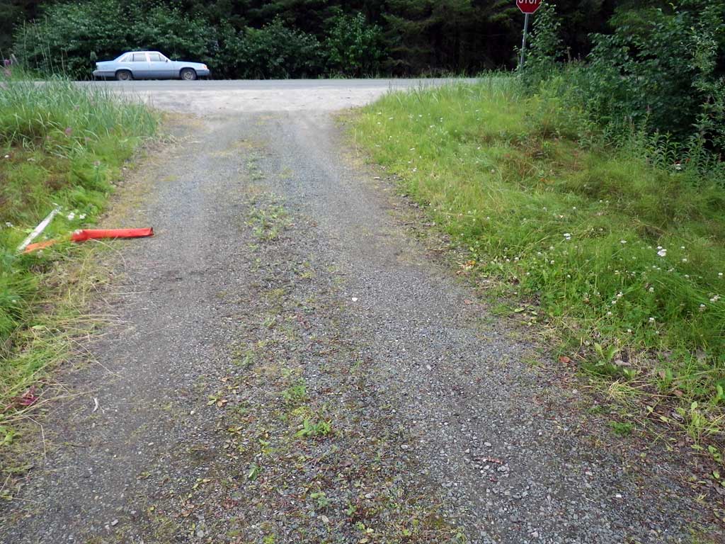
Road Name: Driveway off Mountain View Roa
Datum: NAD83
Quad Name / ITM: Juneau B-6
AWC Stream #:
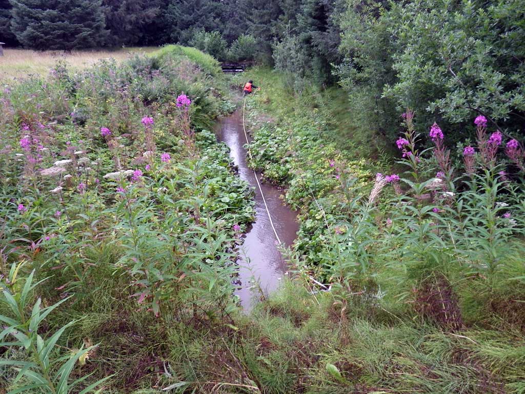
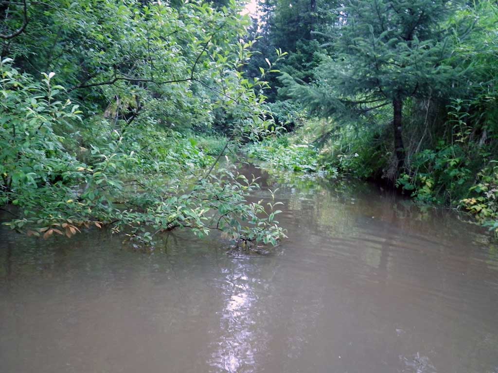
Stream Name: Good River
Elevation:
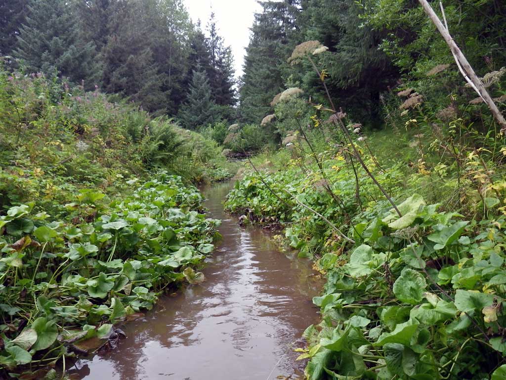
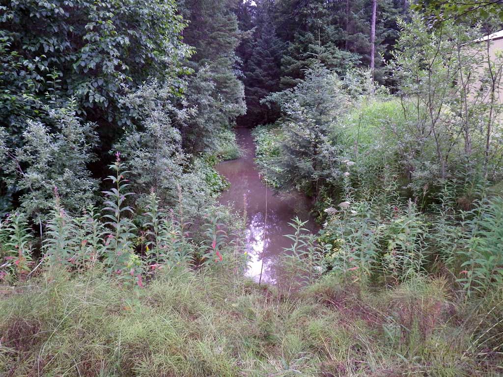
Site Comments: Located under private drive adjacent Mt. View. Property has multiple structures surrounding a relatively open field lot. Culvert is approximately 400 feet upstream of OWR01.
Survey SEA11-MTV06
Project Supervisor: Gillian O'Doherty, Alaska Department of Fish and Game
— Anchorage, AK
Observers: Jason Olds, Charmagne Gutierrez
Overall Fish Passage Rating:
Tidal: No
Backwatered: Yes
Step Pools: No
Construction Year:
Site Observations:
- Constriction ratio gray
- Culvert gradient gray
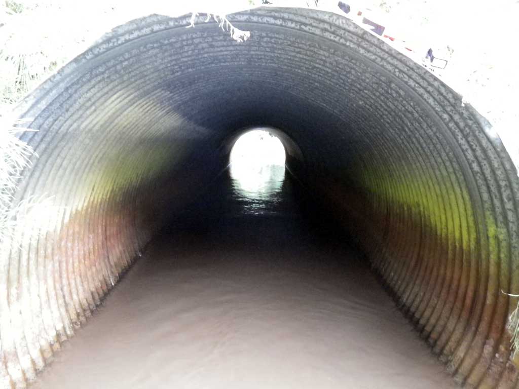
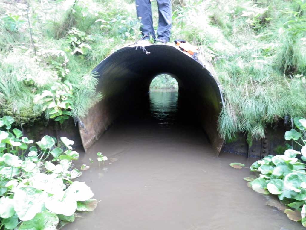
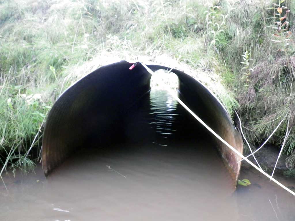
Comments: No fish data collected as stream is already in the AWC, none observed. Large pool at outlet.
Culvert Measurements
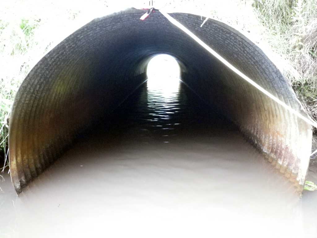
| ID: 1 | Structure Type: Circular pipe (Corrugated steel) | Fish Passage Rating: | |||||||||||||||||||||||||||||||||||||||||
|
|
|
|||||||||||||||||||||||||||||||||||||||||
Culvert Observations:
|
|||||||||||||||||||||||||||||||||||||||||||
Stream Measurements
|
|
| Stream Width Type | Distance From Crossing (ft) |
Stream Width (ft) |
|---|---|---|
| Upstream ordinary high water | 30.0 | 7.80 |
| Upstream ordinary high water | 60.0 | 6.80 |
| Upstream ordinary high water | 90.0 | 9.10 |
Elevations
| Locator ID | Culvert Number |
River Distance (ft)1 |
Distance From Crossing (ft)2 |
Relative Elevation (ft) |
|---|---|---|---|---|
| Road Elev | 104.33 | |||
| D/S Tailcrest or 1st Thalweg | 0.00 | 96.10 | ||
| D/S Water Surface Elev | 0.00 | 96.65 | ||
| Outlet Pool Water Elev | 20.00 | 96.65 | ||
| Max Pool Depth | 20.00 | 93.70 | ||
| Outlet Invert | 45.00 | 94.63 | ||
| D/S Water Surface Elev | 45.00 | 96.66 | ||
| Outlet Culvert Top | 45.00 | 100.00 | ||
| Inlet Culvert Top | 95.50 | 100.66 | ||
| Inlet Culvert Invert | 95.50 | 95.09 | ||
| U/S Water Surface Elev | 95.50 | 96.62 | ||
| U/S Headwater | 96.00 | 96.64 | ||
| U/S Water Surface Elev | 255.00 | 96.75 |
Notes:
- River distance is measured continuously throughout the survey reach along the thalweg of the stream.
- Measured from each end of the crossing along the thalweg of the stream.
Fish Sampling Efforts
| Gear Type: None (A) | ||
| Comments: No fish observed at site. | ||
Fish Observations
No fish observations occurred during this survey.
Photos
Questions or comments about this report can be directed to dfg.dsf.webmaster@alaska.gov