Fish Passage Site 10302257
Coordinates (dec. deg.): 58.41273°, -135.76134°
Legal Description: C040S058E12
Region: Southeast
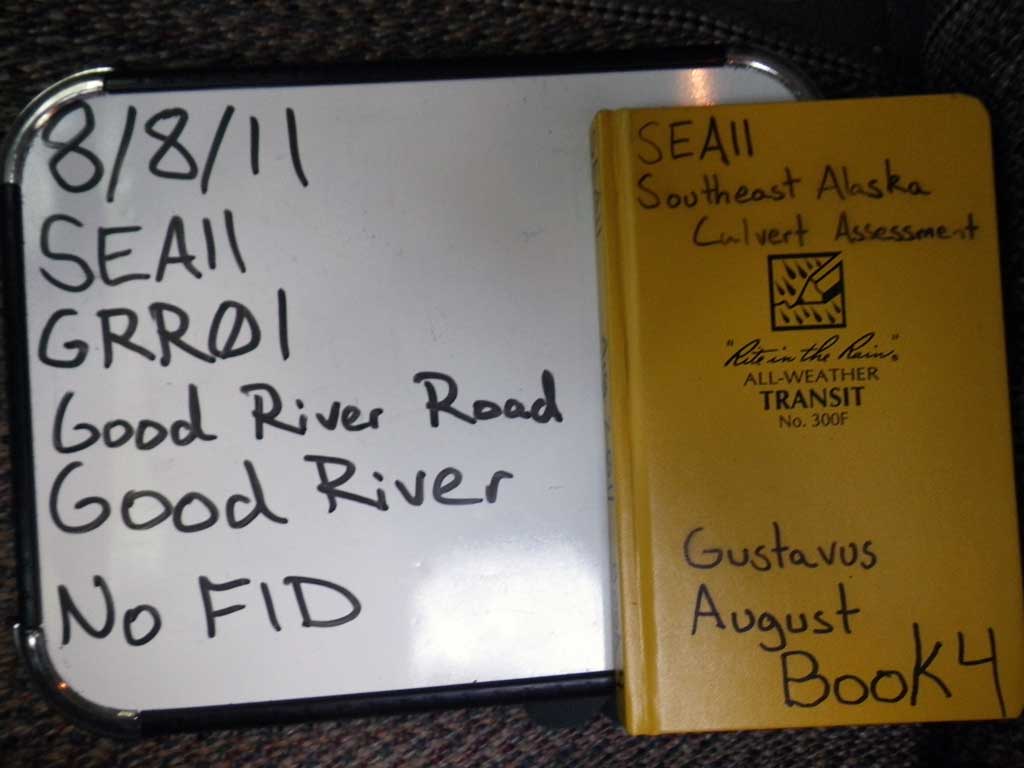
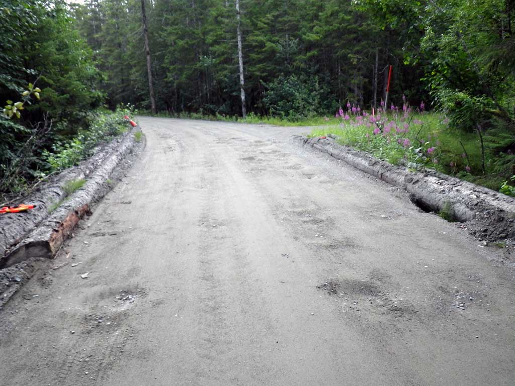
Road Name: Good River Road
Datum: NAD83
Quad Name / ITM: Juneau B-6
AWC Stream #:
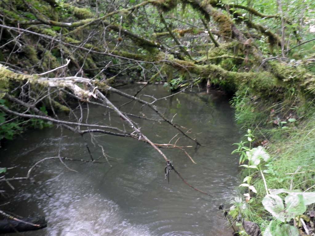
Stream Name: Good River
Elevation:
Site Comments: None
arrow to the right of the survey date below to choose a different report for this site.
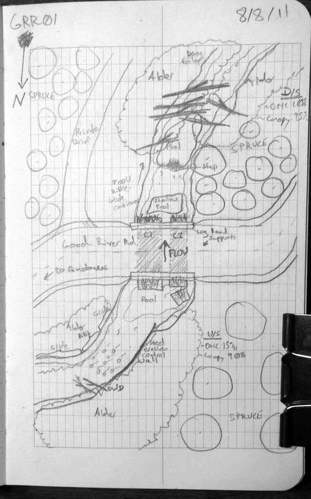
Survey SEA11-GRR01
Project Supervisor: Gillian O'Doherty, Alaska Department of Fish and Game
— Anchorage, AK
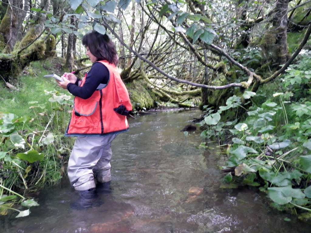
Observers: Jason Olds, Charmagne Gutierrez
Overall Fish Passage Rating:
Tidal: No
Backwatered: Yes
Step Pools: No
Construction Year:
Site Observations:
- Constriction ratio gray
- Culvert gradient gray
- Improper bedding
- Road bank erosion
- Structural Problem
- Culvert is too short
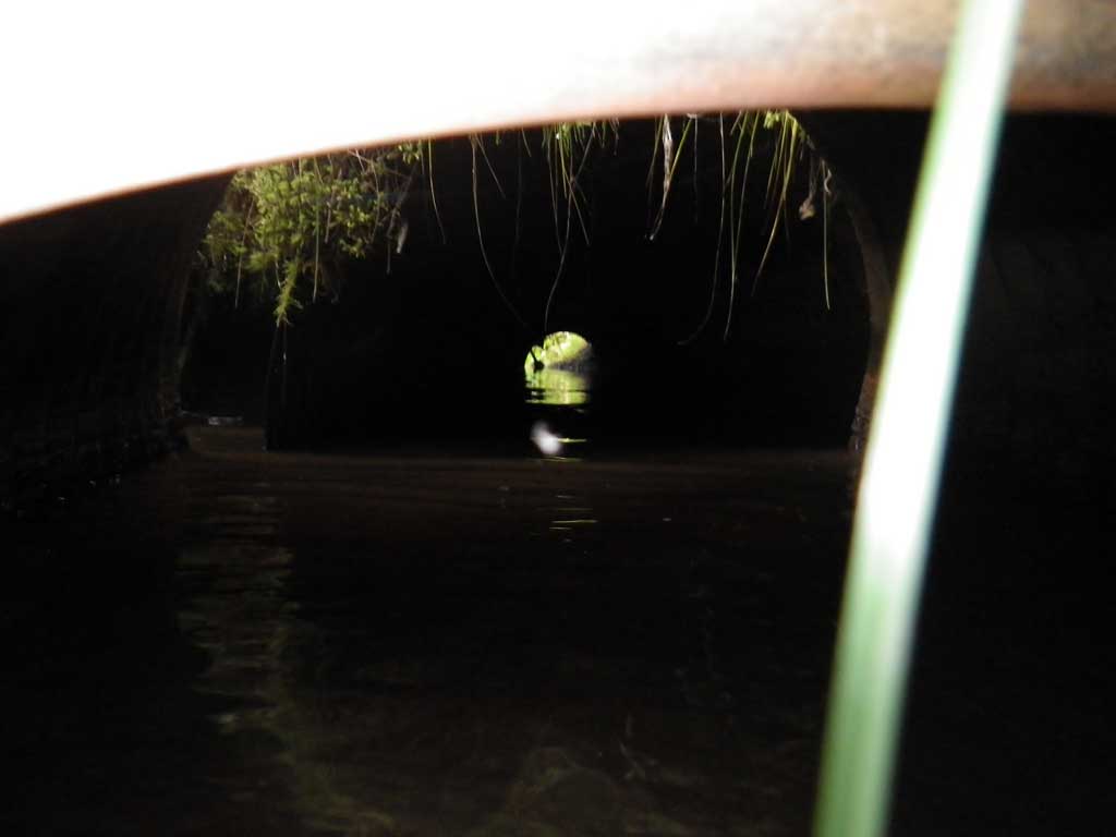
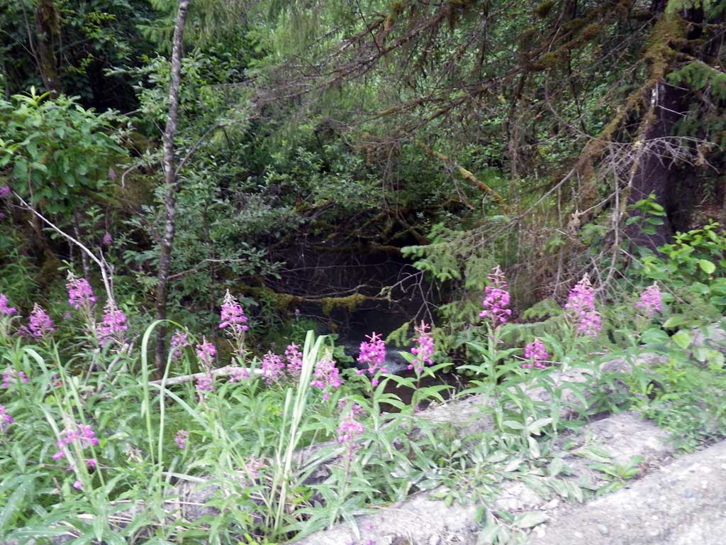
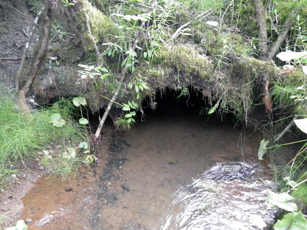
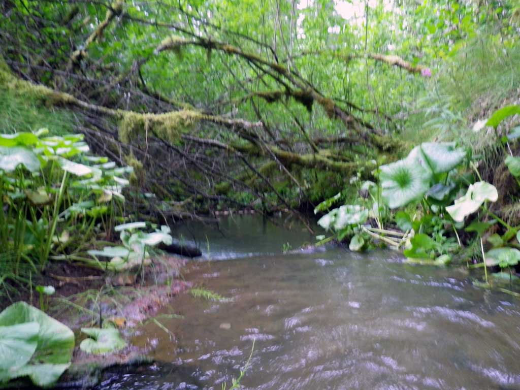
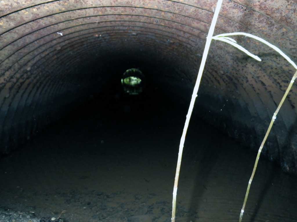
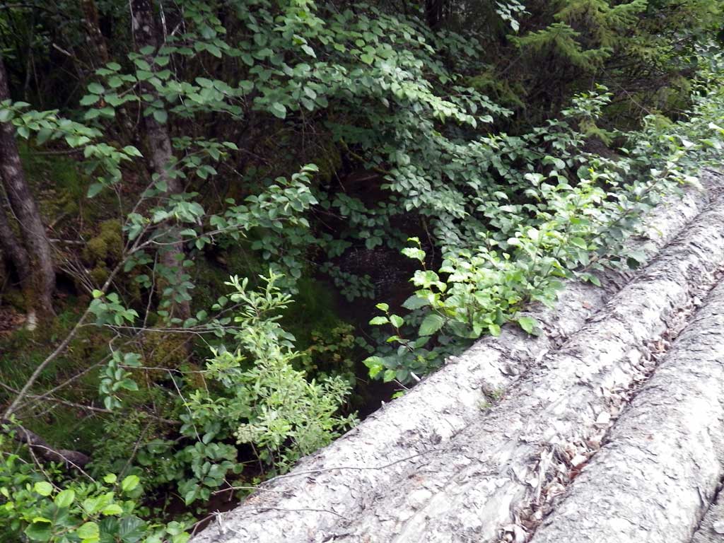
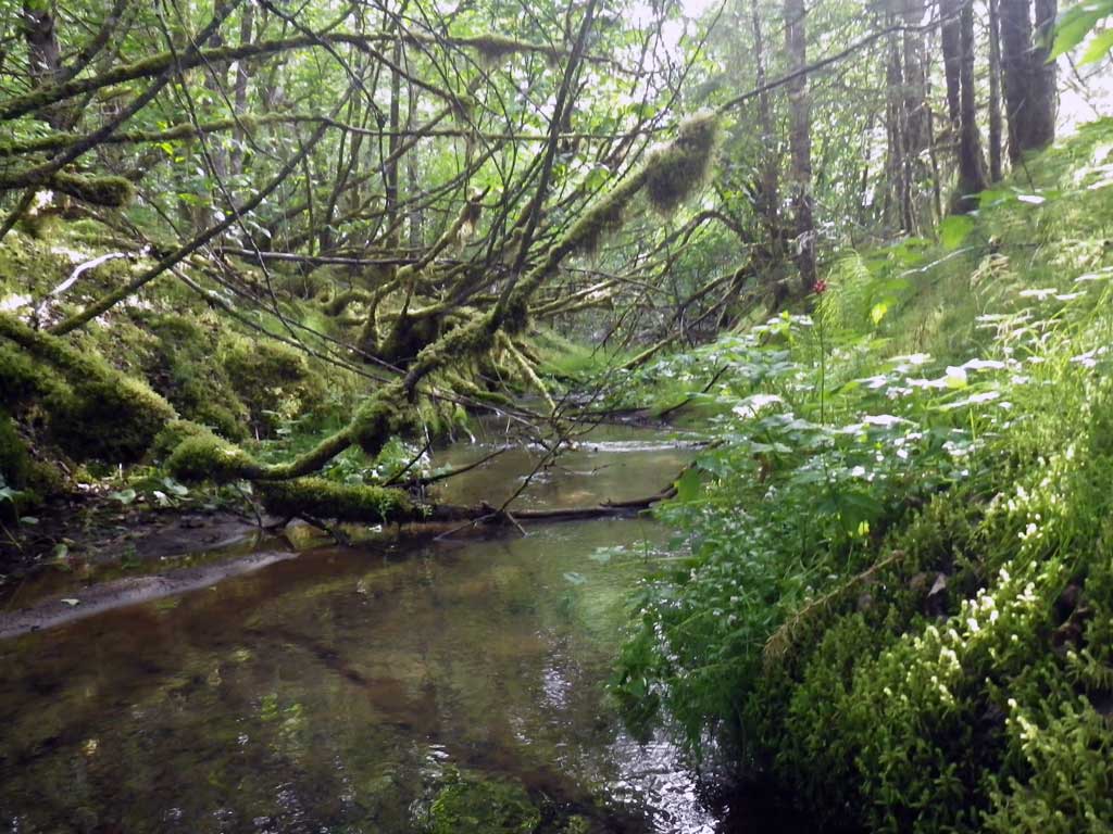
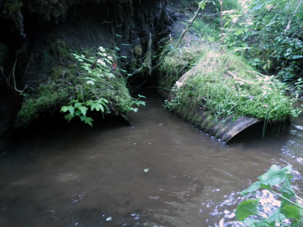
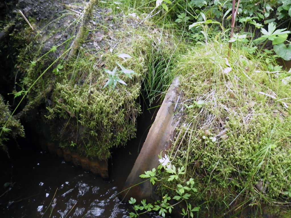
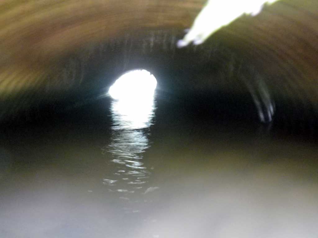
Comments: Culvert 1 Set to take most of flow. Upstream Salmonids observered. Steel erosion control on Right Bank looking downstream. Excellent Fish habitat up/down stream. Pipes too short. Circular Pipe upstream broken off from undercutting; needs replacement, but still allows for flows. Road fill falling into creek. At low water culvert 2 would take all flow and remain backwatered.
Culvert Measurements
| ID: 1 | Structure Type: Open-bottom arch (Structural steel plate) | Fish Passage Rating: | |||||||||||||||||||||||||||||||||||||||||
|
|
|
|||||||||||||||||||||||||||||||||||||||||
| ID: 2 | Structure Type: Circular pipe (Structural steel plate) | Fish Passage Rating: | ||||||||||||||||||||||||||||||||||||||||||
|
|
|
||||||||||||||||||||||||||||||||||||||||||
Culvert Observations:
|
||||||||||||||||||||||||||||||||||||||||||||
Stream Measurements
|
|
| Stream Width Type | Distance From Crossing (ft) |
Stream Width (ft) |
|---|---|---|
| Upstream ordinary high water | 77.0 | 8.70 |
| Upstream ordinary high water | 109.0 | 8.40 |
| Upstream ordinary high water | 138.0 | 6.90 |
Elevations
| Locator ID | Culvert Number |
River Distance (ft)1 |
Distance From Crossing (ft)2 |
Relative Elevation (ft) |
|---|---|---|---|---|
| Road Elev | 99.14 | |||
| Misc. (Survey pt, pool max) | 0.00 | 86.47 | ||
| D/S Water Surface Elev | 0.00 | 89.27 | ||
| D/S Water Surface Elev | 3.00 | 89.86 | ||
| D/S Tailcrest or 1st Thalweg | 3.00 | 89.32 | ||
| Outlet Pool Water Elev | 6.00 | 89.88 | ||
| Max Pool Depth | 6.00 | 88.88 | ||
| Outlet Invert (C1) | 1 | 14.00 | 89.27 | |
| D/S Water Surface Elev (C1) | 1 | 14.00 | 89.91 | |
| D/S Water Surface Elev (C2) | 2 | 14.00 | 89.91 | |
| Outlet Invert (C2) | 2 | 14.00 | 89.69 | |
| Inlet Culvert Invert (C1) | 1 | 47.10 | 89.32 | |
| U/S Headwater (C1 W/S @ Invert In, 1st resting) | 1 | 47.10 | 89.94 | |
| U/S Water Surface Elev (C2) | 2 | 49.60 | 89.93 | |
| Inlet Culvert Invert (C2) | 2 | 49.60 | 89.23 | |
| U/S Water Surface Elev | 79.50 | 89.94 | ||
| U/S Grade Ctrl (Thalweg) | 79.50 | 89.68 |
Notes:
- River distance is measured continuously throughout the survey reach along the thalweg of the stream.
- Measured from each end of the crossing along the thalweg of the stream.
Fish Sampling Efforts
| Gear Type: Visual Observation, Ground (A) | Trap Duration(h): 30.0 | |
| Channel Type: Main Channel (>50% of water flow) | ||
| Comments: Unidentified fish observed upstream from culvert. | ||
Fish Observations
No fish observations occurred during this survey.
Photos
Questions or comments about this report can be directed to dfg.dsf.webmaster@alaska.gov