Fish Passage Site 10302245
Coordinates (dec. deg.): 58.41943°, -135.68712°
Legal Description: C040S059E09
Region: Southeast
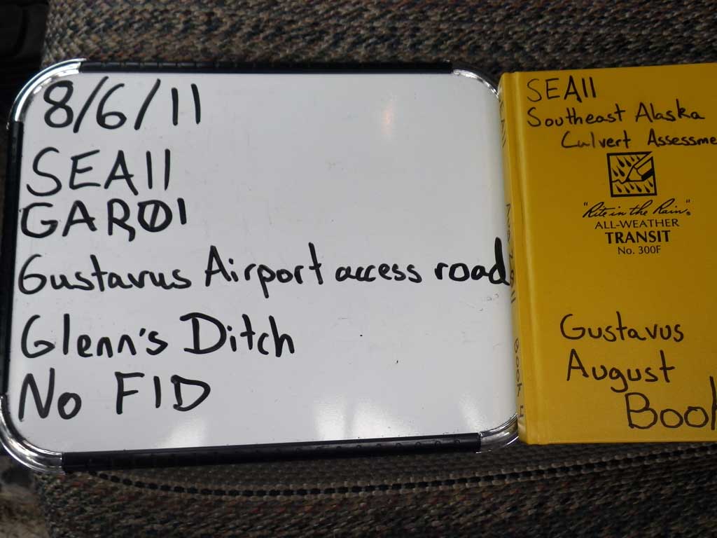
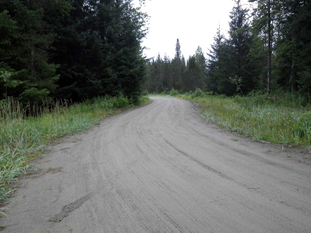
Road Name: Gustavus Airport Access Road
Datum: NAD83
Quad Name / ITM: Juneau B-6
AWC Stream #:
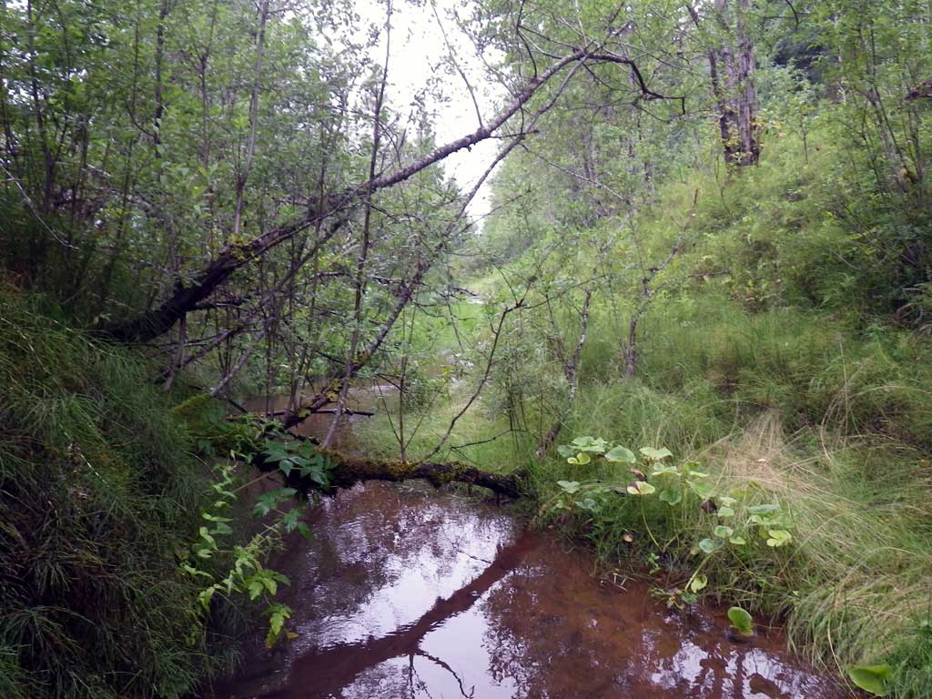
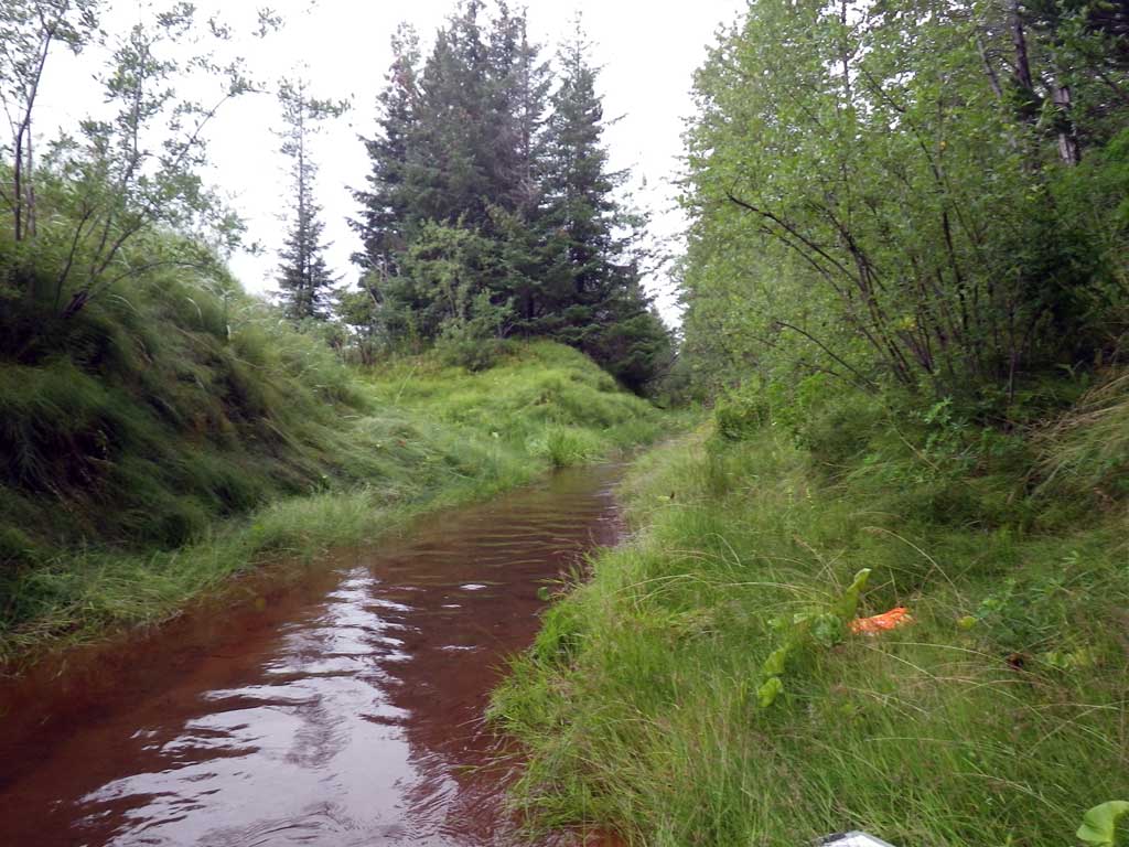
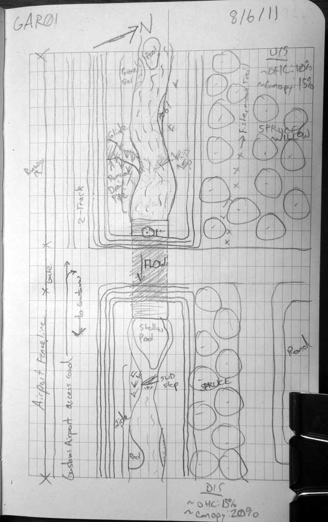
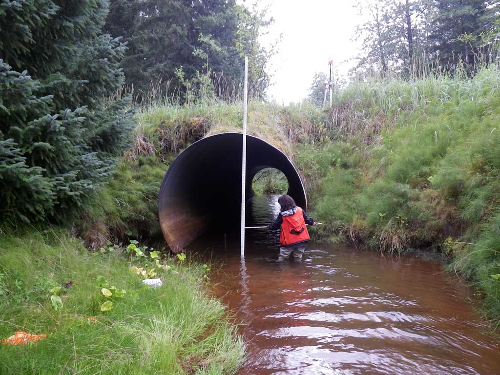
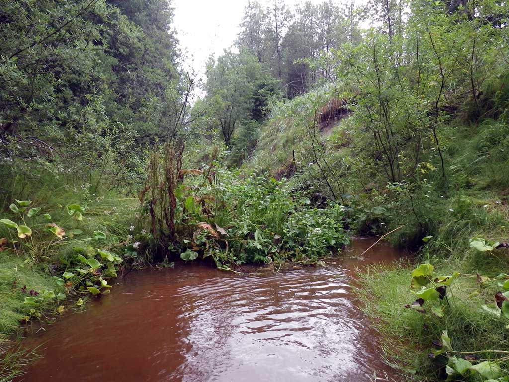
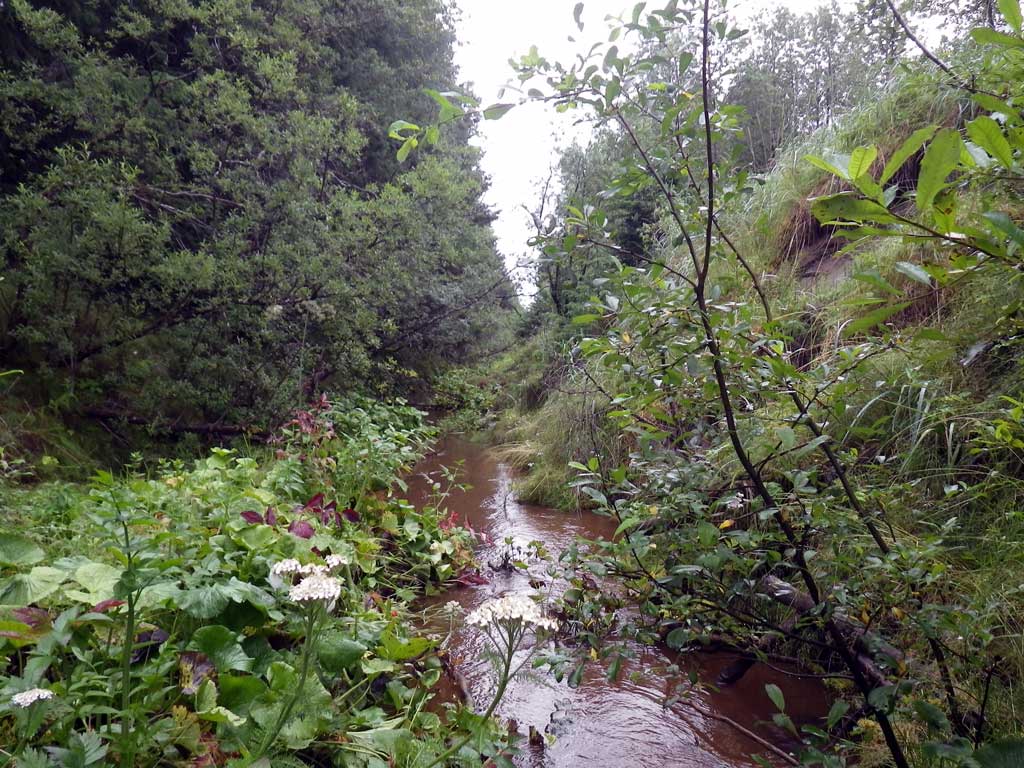
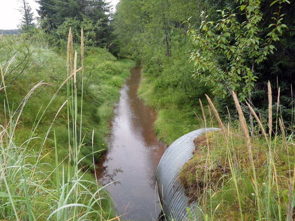
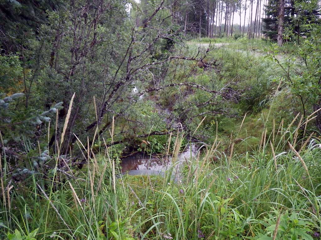
Stream Name: Glen's Ditch
Elevation:
Site Comments: Glen's Ditch near airport.
Survey SEA11-GAR01
Project Supervisor: Gillian O'Doherty, Alaska Department of Fish and Game
— Anchorage, AK
Observers: Jason Olds, Charmagne Gutierrez
Overall Fish Passage Rating:
Tidal: No
Backwatered: No
Step Pools: No
Construction Year:
Site Observations:
- None of this type
Comments: None
Culvert Measurements
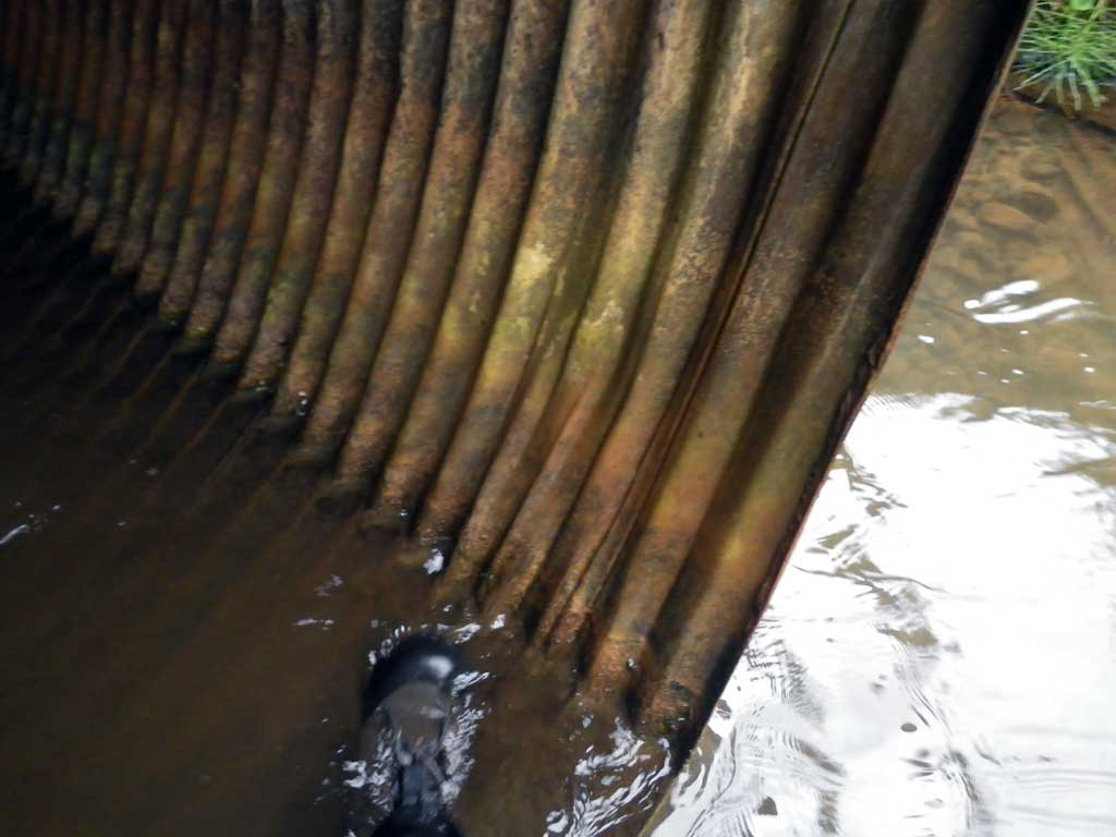
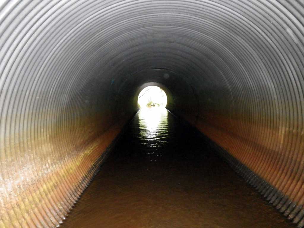
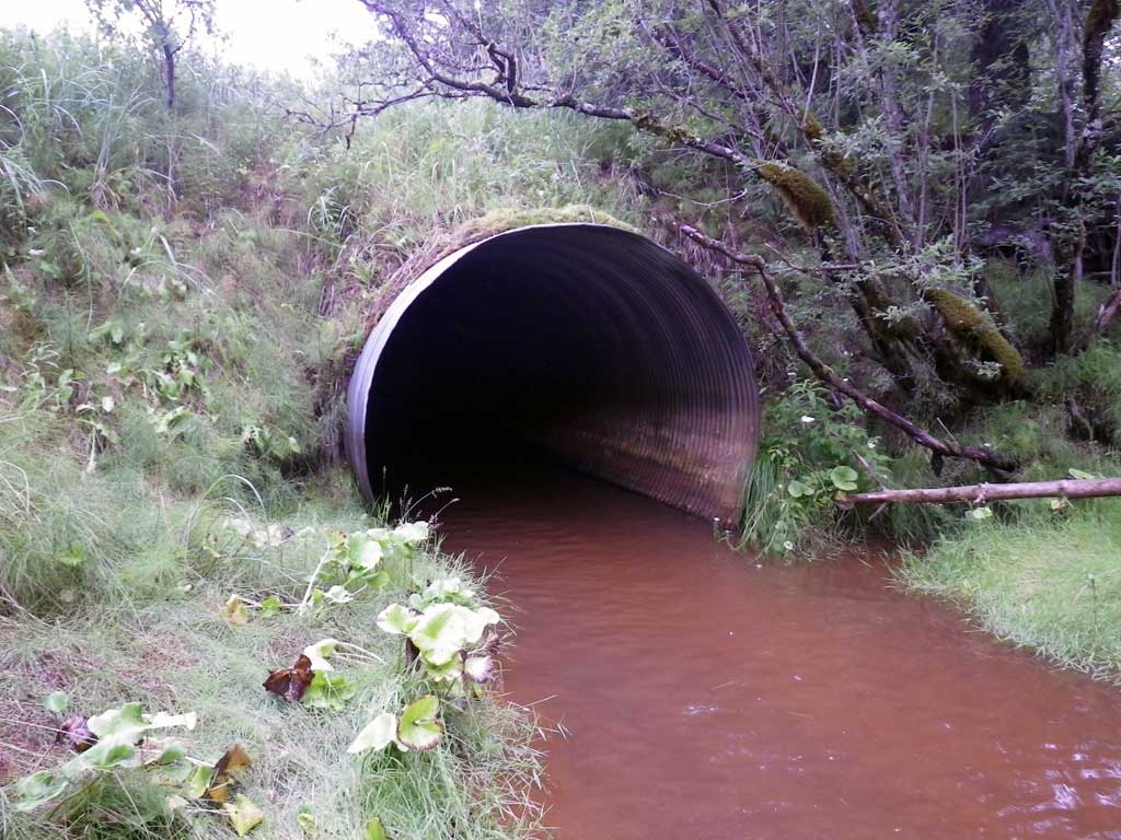
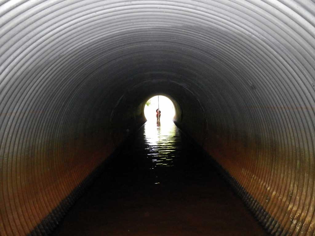
| ID: 1 | Structure Type: Circular pipe (Corrugated steel) | Fish Passage Rating: | |||||||||||||||||||||||||||||||||||||||||
|
|
|
|||||||||||||||||||||||||||||||||||||||||
Comments: Glen's Ditch Near Airport. Upstream/Downstream Visual Observations of Salmonids. Substrate grade using BOP actual measurments. * Using TOP, pipe set at 0.53% grade. |
|||||||||||||||||||||||||||||||||||||||||||
Culvert Observations:
|
|||||||||||||||||||||||||||||||||||||||||||
Stream Measurements
|
|
| Stream Width Type | Distance From Crossing (ft) |
Stream Width (ft) |
|---|---|---|
| Upstream ordinary high water | 70.0 | 6.70 |
| Upstream ordinary high water | 184.0 | 6.50 |
| Upstream ordinary high water | 225.0 | 9.40 |
Elevations
| Locator ID | Culvert Number |
River Distance (ft)1 |
Distance From Crossing (ft)2 |
Relative Elevation (ft) |
|---|---|---|---|---|
| Road Elev | 103.41 | |||
| D/S Grade Ctrl (Thalweg) | 0.00 | 91.33 | ||
| D/S Water Surface Elev | 0.00 | 92.14 | ||
| D/S Grade Ctrl (Thalweg) | 10.00 | 92.04 | ||
| D/S Water Surface Elev | 10.00 | 92.48 | ||
| D/S Water Surface Elev | 15.00 | 92.65 | ||
| D/S Tailcrest or 1st Thalweg | 15.00 | 92.28 | ||
| Max Pool Depth | 20.00 | 90.73 | ||
| Outlet Pool Water Elev | 20.00 | 92.68 | ||
| D/S Water Surface Elev | 39.00 | 92.68 | ||
| Outlet Culvert Top | 39.00 | 99.59 | ||
| Outlet Thalweg | 39.00 | 92.05 | ||
| Inlet Thalweg | 116.10 | 91.33 | ||
| Inlet Culvert Top | 116.10 | 100.00 | ||
| U/S Headwater (1st resting) | 116.10 | 92.69 | ||
| U/S Water Surface Elev | 146.00 | 92.67 | ||
| Misc. (upstream survey point, on substrate) | 146.00 | 92.04 |
Notes:
- River distance is measured continuously throughout the survey reach along the thalweg of the stream.
- Measured from each end of the crossing along the thalweg of the stream.
Fish Sampling Efforts
| Gear Type: Visual Observation, Ground (A) | Trap Duration(h): 30.0 | |
| Channel Type: Main Channel (>50% of water flow) | ||
| Gear Type: Visual Observation, Ground (B) | Trap Duration(h): 30.0 | |
| Channel Type: Main Channel (>50% of water flow) | ||
Fish Observations
No fish observations occurred during this survey.
Photos
Questions or comments about this report can be directed to dfg.dsf.webmaster@alaska.gov