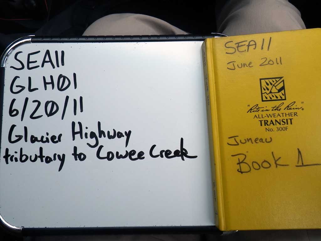
Fish Passage Site 10302239
Coordinates (dec. deg.): 58.65012°, -134.92123°
Legal Description: C037S064E19
Region: Southeast
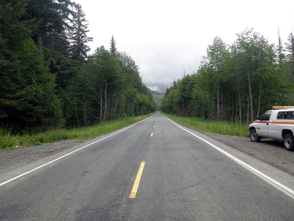
Road Name: Glacier Highway
Datum: NAD83
Quad Name / ITM: Juneau C-3
AWC Stream #: 115-20-10620-2004-3015
Stream Name: Cowee Creek tributary
Elevation:
Site Comments: None
Survey SEA11-GLH01
Project Supervisor: Gillian O'Doherty, Alaska Department of Fish and Game
— Anchorage, AK
Observers: Mark Eisenman, Jason Olds
Overall Fish Passage Rating:
Tidal: No
Backwatered: No
Step Pools: No
Construction Year:
Site Observations:
- Woody Debris
- Beaver Activity
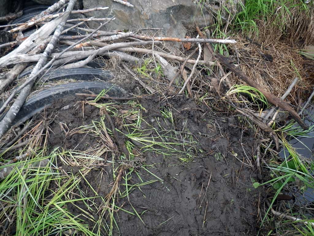
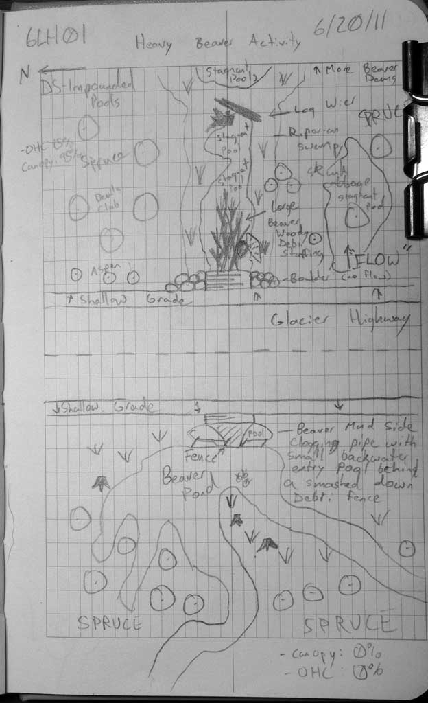
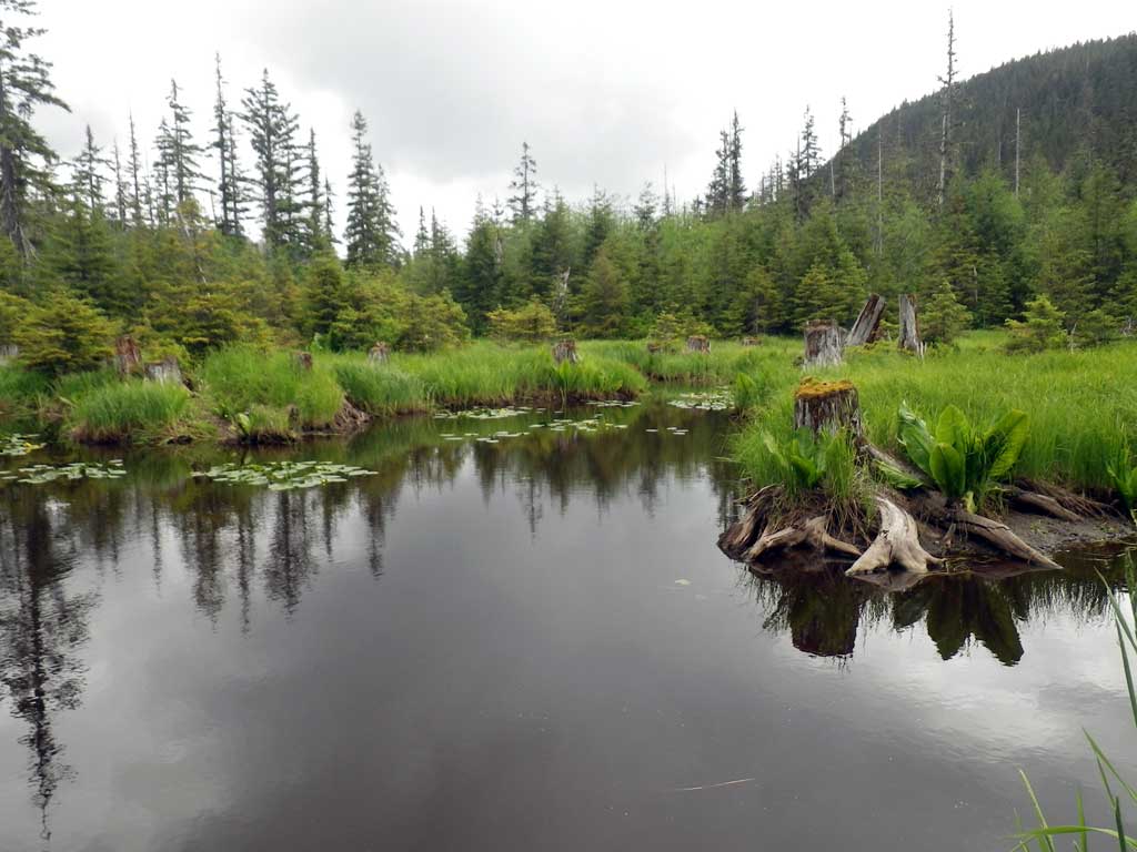
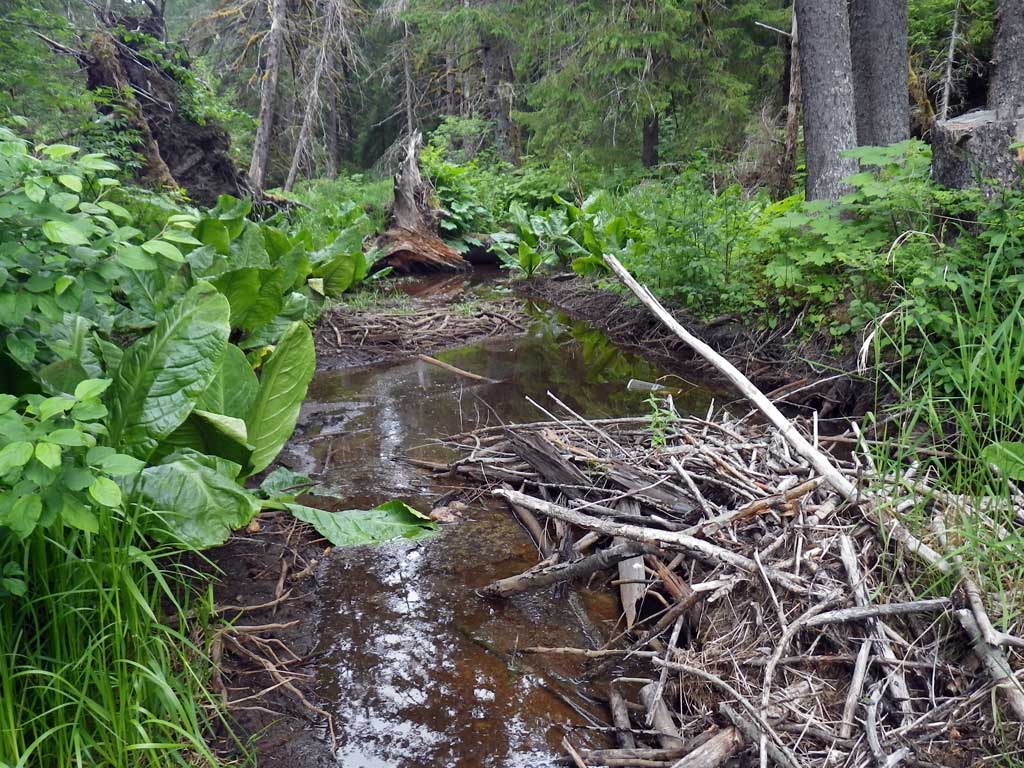
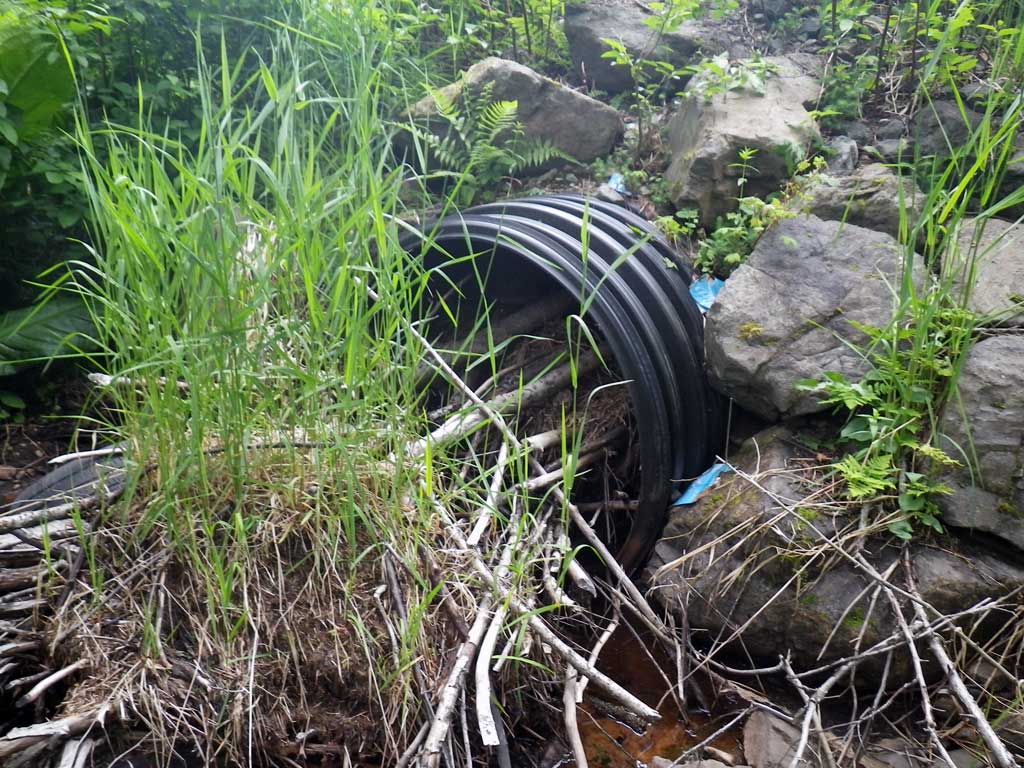
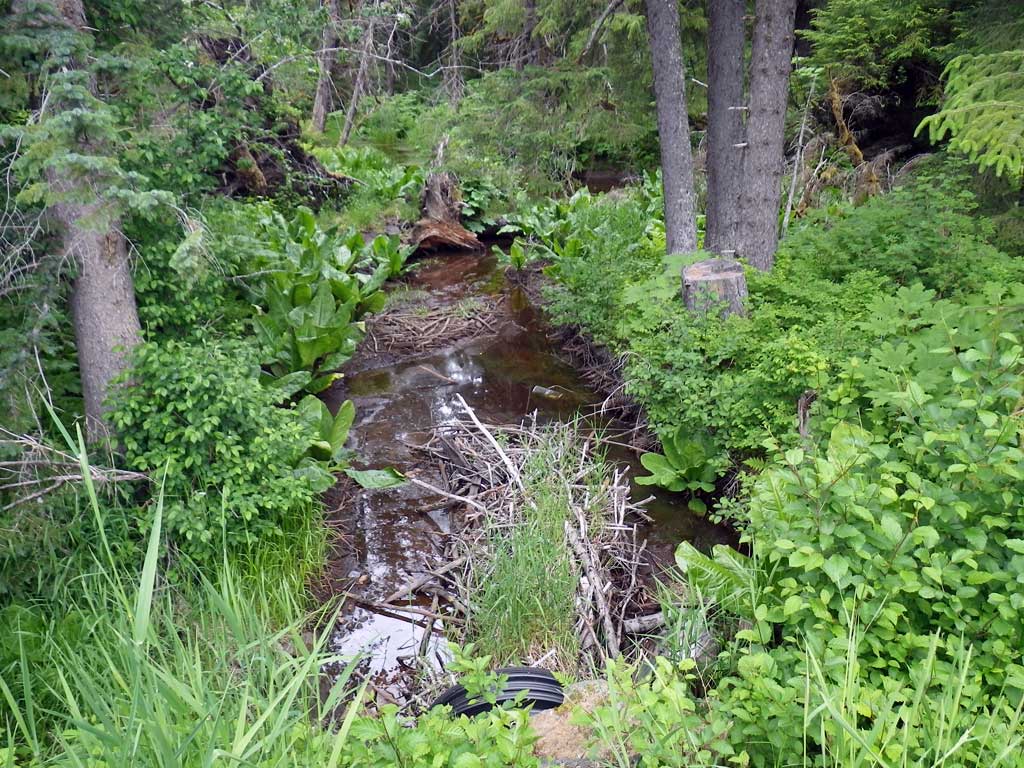
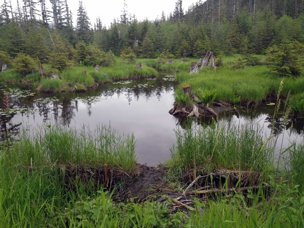
Comments: Pipe is completely plugged with debris from beaver activity. Upstream is impounded and has a fence structure used unsuccessfully to deter beavers, it is smashed down with mud and is now being used as a beaver slide and entrance pool to his den (the clogged culvert.) Stream is also impounded downstream with multiple beaver dams seperating muskeg/pool systems. Fish were observed both upstream and downstream of culvert with additional juvenile coho seen feeding on bits of roe from outside the downstream trap upon removal. Pipe appears to be a 4 foot corrugated plastic pipe but exact measurements were hindered by beaver activity. Muck layers downstream were not very deep with what feels like gravel not far below sediment suggesting quality habitat before impoundment in old stream channel. Water differential elevation between upstream and downstream ends measured at 2.65 feet.
Culvert Measurements
| ID: 1 | Structure Type: Circular pipe (Corrugated plastic) | Fish Passage Rating: | |||||||||||||||||||||||||||||||||||||||||
|
|
|
|||||||||||||||||||||||||||||||||||||||||
Comments: Many points are unknown or not-applicable because of beaver activity and ponding of upstream and downstream habitat. |
|||||||||||||||||||||||||||||||||||||||||||
Culvert Observations:
|
|||||||||||||||||||||||||||||||||||||||||||
Stream Measurements
|
|
No stream width data available.
Elevations
| Locator ID | Culvert Number |
River Distance (ft)1 |
Distance From Crossing (ft)2 |
Relative Elevation (ft) |
|---|---|---|---|---|
| Road Elev | 100.22 | |||
| D/S Tailcrest or 1st Thalweg (Stagnant pool) | 0.00 | 89.19 | ||
| D/S Water Surface Elev | 0.00 | 89.79 | ||
| Outlet Culvert Top (Invert out, on plastic) | 5.00 | 93.38 | ||
| Inlet Culvert Top (Invert In, on plastic) | 104.00 | 94.22 | ||
| U/S Grade Ctrl (Thalweg) (Pool substrate, beaver pond) | 113.00 | 91.70 | ||
| U/S Headwater (Beaver pond) | 113.00 | 92.44 |
Notes:
- River distance is measured continuously throughout the survey reach along the thalweg of the stream.
- Measured from each end of the crossing along the thalweg of the stream.
Fish Sampling Efforts
| Gear Type: Visual Observation, Ground (A) | Trap Duration(h): 10.0 | |
| Channel Type: Main Channel (>50% of water flow) | ||
| Comments: Visual observation, other juvenile coho seen outside of trap | ||
| Gear Type: Minnow Trap (B) | Trap Duration(h): 1.0 | |
| Channel Type: Main Channel (>50% of water flow) | ||
| Comments: Trap placed at 15 feet downstream of invert out | ||
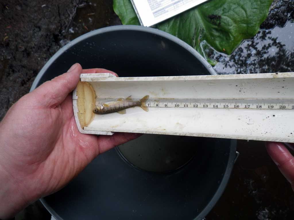
Fish Observations
| Species: juvenile coho salmon | Life History: Anadromous | ||
| Total Fish Observed: 1 | Fish Measured: 1 | Fork Lengths (mm) Min: 7 Max: 7 Mean: 7 | |
| Collected/Observed by Gear Type: Downstream Minnow Trap (1) | |||
Photos
Questions or comments about this report can be directed to dfg.dsf.webmaster@alaska.gov