Fish Passage Site 10302229
Coordinates (dec. deg.): 58.52148°, -134.79213°
Legal Description: C039S064E02
Region: Southeast
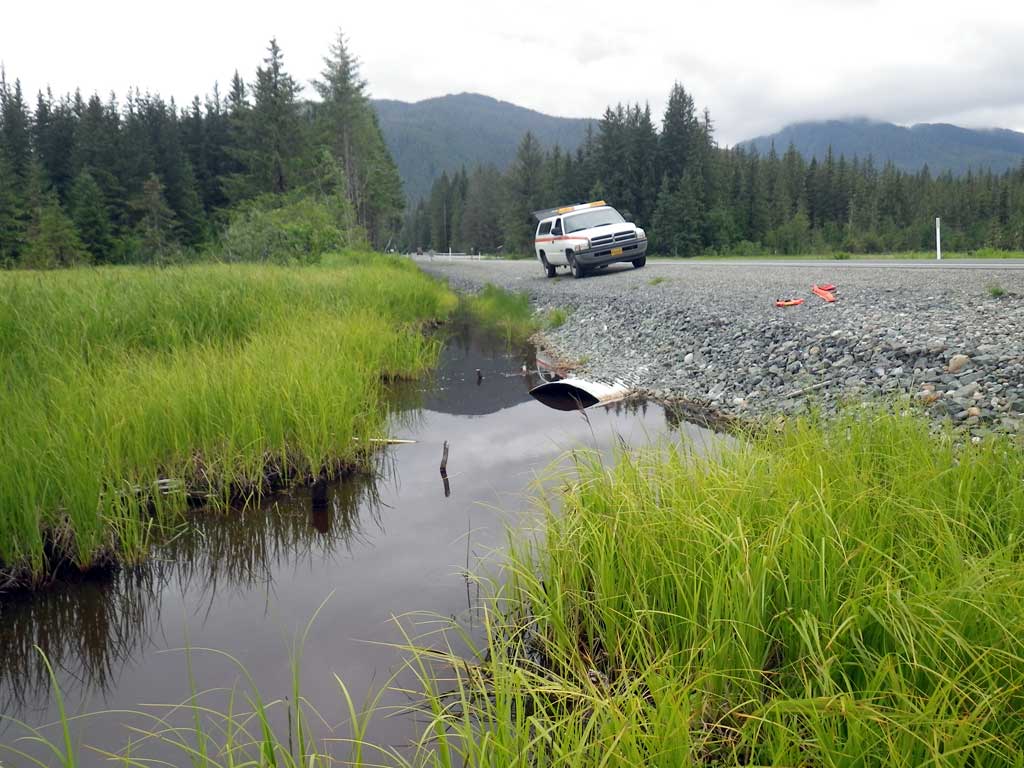
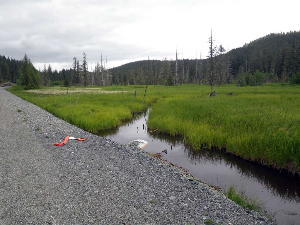
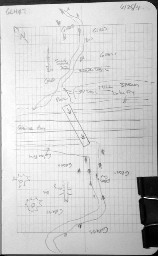
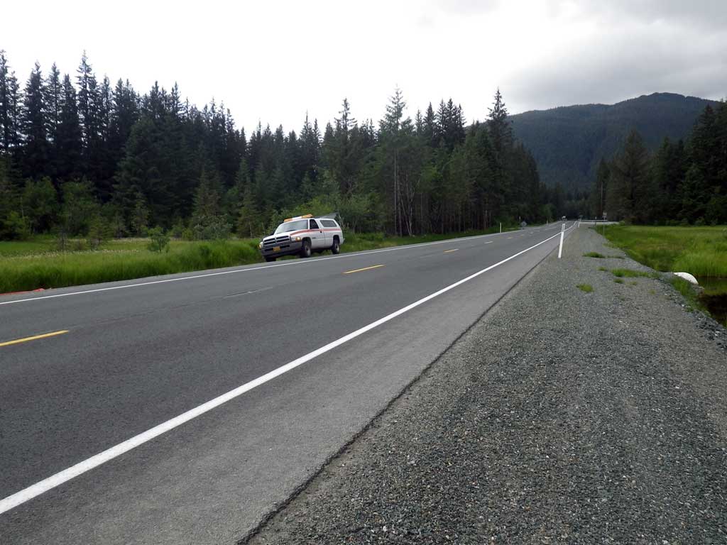
Road Name: Glacier Highway
Datum: NAD83
Quad Name / ITM: Juneau C-3
AWC Stream #:
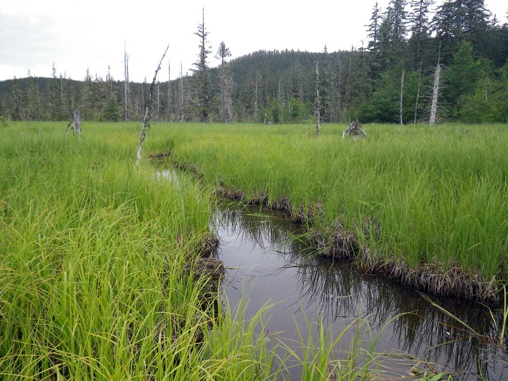
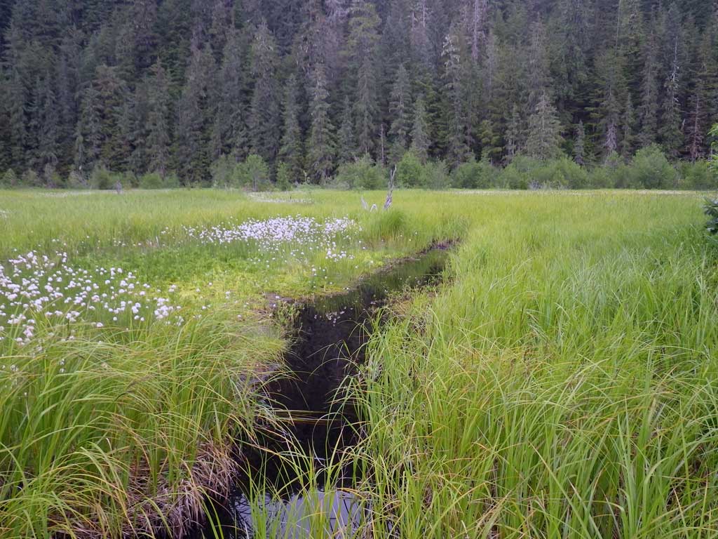
Stream Name: Herbert River tributary
Elevation:
Site Comments: None
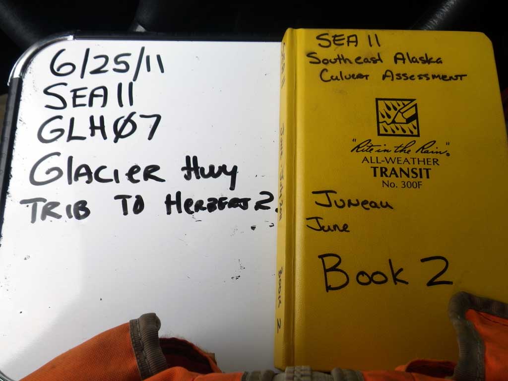
Survey SEA11-GLH07
Project Supervisor: Gillian O'Doherty, Alaska Department of Fish and Game
— Anchorage, AK
Observers: Mark Eisenman, Jason Olds
Overall Fish Passage Rating:
Tidal: No
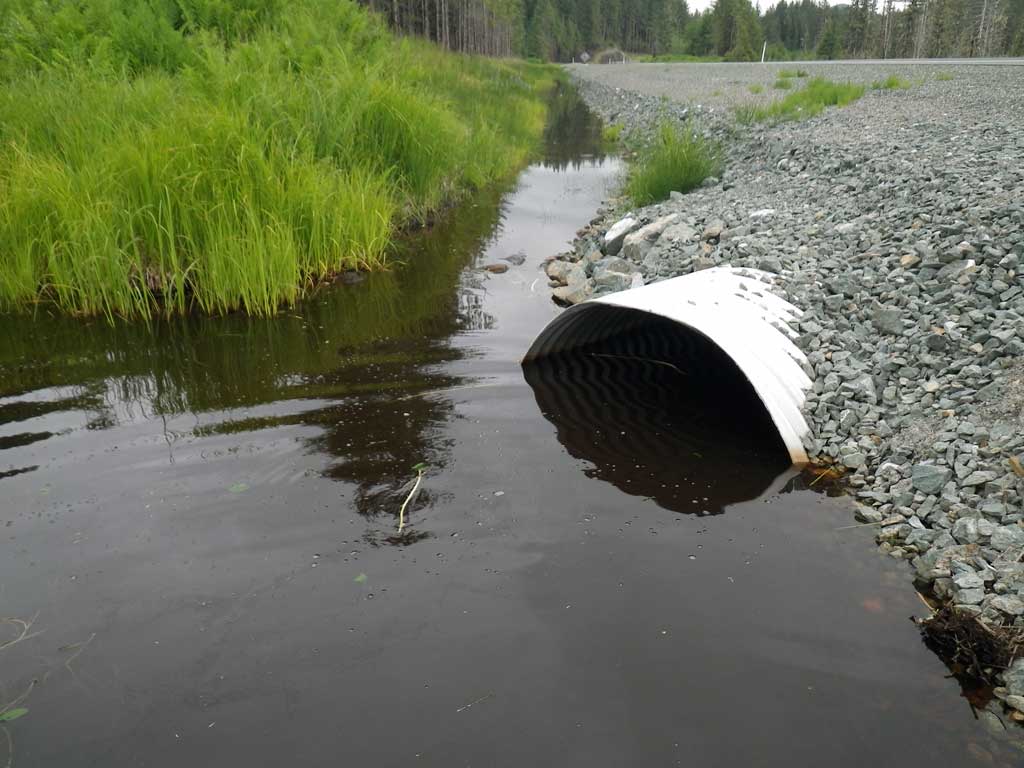
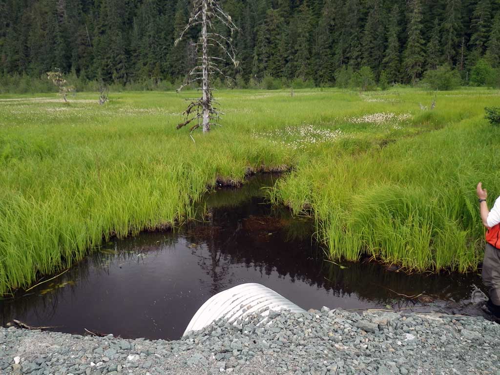
Backwatered: Yes
Step Pools: No
Construction Year:
Site Observations:
- Beaver Activity
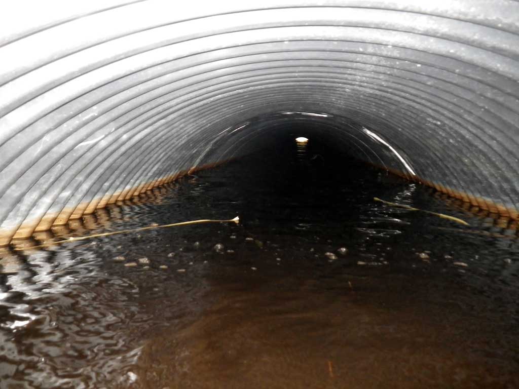
- Culvert is poorly aligned
Comments: No traps were set as area is already in the AWC. Juvenile coho were observed upstream and downstream of culvert. Backwatered from somewhere far downstream. Active beaver in area. Nearly right angle approach. Ordinary high water measurement difficult to obtain as system is ponded on both sides of culvert, likely from beavers. Both upstream and downstream were muskeg/bog.
Culvert Measurements
| ID: 1 | Structure Type: Circular pipe (Corrugated steel) | Fish Passage Rating: | ||||||||||||||||||||||||||||||||||||||||||
|
|
|
||||||||||||||||||||||||||||||||||||||||||
Culvert Observations:
|
||||||||||||||||||||||||||||||||||||||||||||
Stream Measurements
|
|
No stream width data available.
Elevations
| Locator ID | Culvert Number |
River Distance (ft)1 |
Distance From Crossing (ft)2 |
Relative Elevation (ft) |
|---|---|---|---|---|
| Road Elev | 103.32 | |||
| Misc. (Downstream profile point, ponded. On substrate) | 0.00 | 97.65 | ||
| D/S Water Surface Elev | 0.00 | 99.47 | ||
| Outlet Invert (Invert out, on substrate) | 2.00 | 96.71 | ||
| D/S Water Surface Elev (Invert out) | 2.00 | 99.53 | ||
| Outlet Culvert Top | 2.00 | 100.00 | ||
| Inlet Culvert Top | 91.10 | 100.85 | ||
| U/S Water Surface Elev (Invert in) | 91.10 | 99.52 | ||
| Inlet Culvert Invert (Invert in, on substrate) | 91.10 | 97.65 | ||
| Misc. (Upstream profile point, ponded. On substrate) | 104.10 | 97.74 | ||
| U/S Water Surface Elev | 104.10 | 99.52 |
Notes:
- River distance is measured continuously throughout the survey reach along the thalweg of the stream.
- Measured from each end of the crossing along the thalweg of the stream.
Fish Sampling Efforts
| Gear Type: Visual Observation, Ground (A) | ||
| Comments: Juvenile Coho observed. | ||
| Gear Type: Visual Observation, Ground (B) | ||
| Comments: Juvenile Coho observed. | ||
Fish Observations
No fish observations occurred during this survey.
Photos
Questions or comments about this report can be directed to dfg.dsf.webmaster@alaska.gov