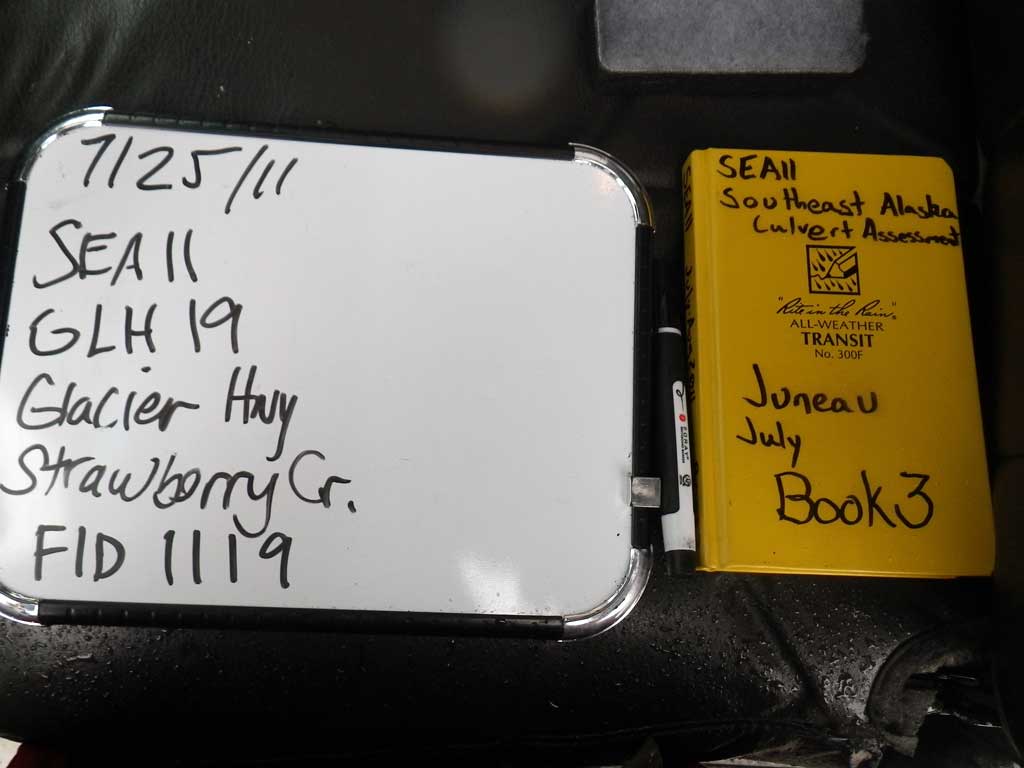
Fish Passage Site 10302225
Coordinates (dec. deg.): 58.50771°, -134.77840°
Legal Description: C039S064E12
Region: Southeast
Road Name: Glacier Highway
Datum: NAD83
Quad Name / ITM: Juneau C-3
AWC Stream #:
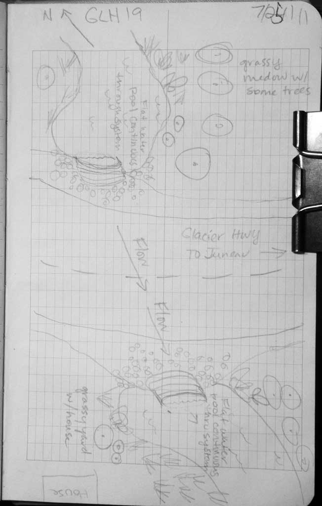
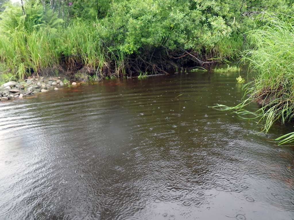
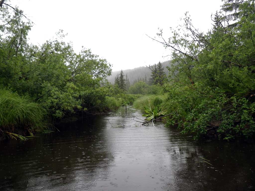
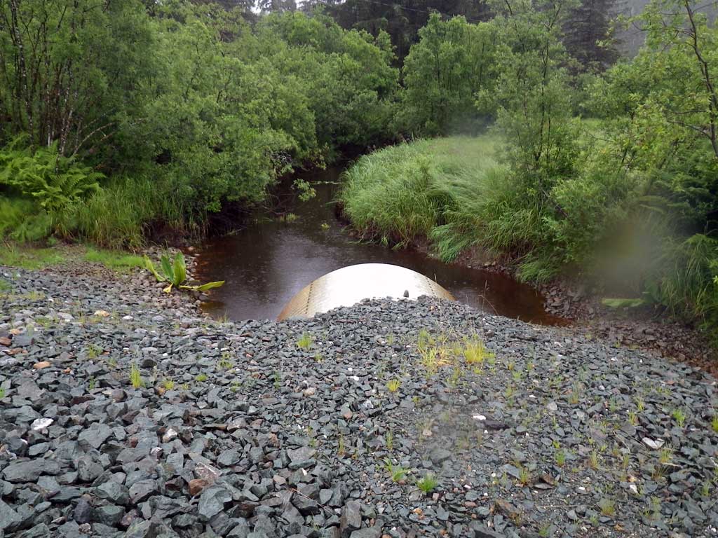
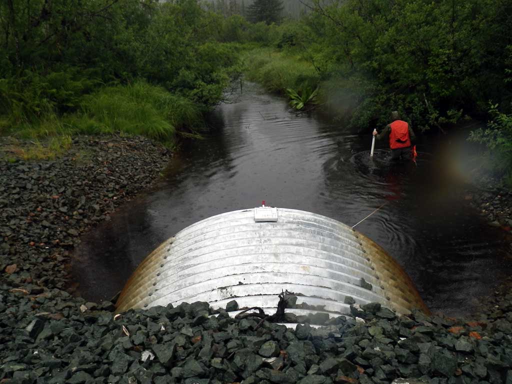
Stream Name: Strawberry Creek
Elevation:
Site Comments: None
Survey SEA11-GLH19
Project Supervisor: Gillian O'Doherty, Alaska Department of Fish and Game
— Anchorage, AK
Observers: Jason Olds, Charmagne Gutierrez
Overall Fish Passage Rating:
Tidal: No
Backwatered: Yes
Step Pools: No
Construction Year:
Site Observations:
- None of this type
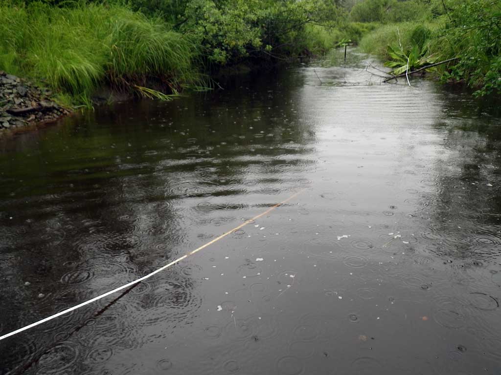
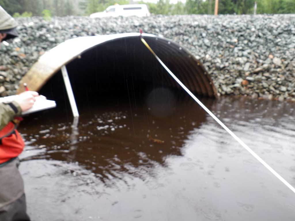
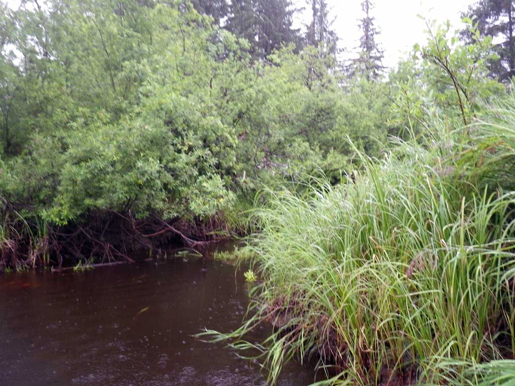
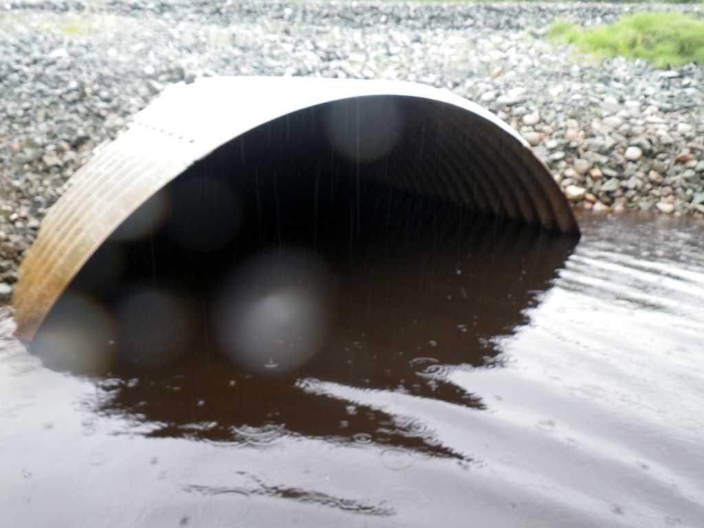
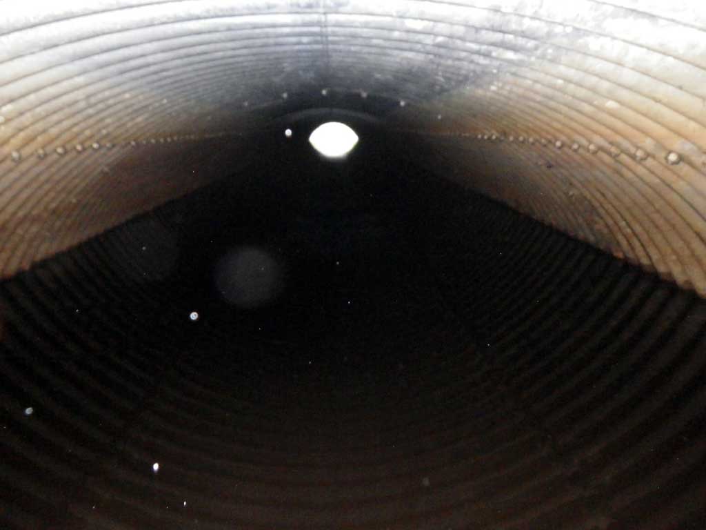
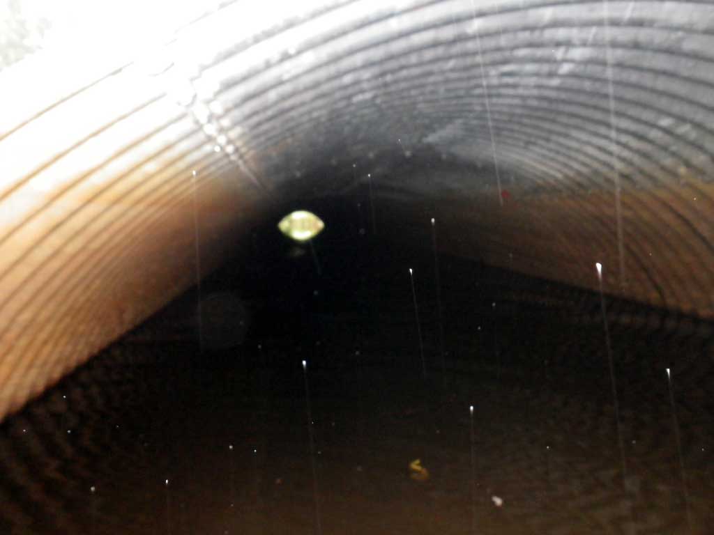
Comments: New Pipe. Water, tannen rich. Nearly flatwatered, no grade points to speak of. May be backwatered from beavers or other cause further downstream at some point. No grade points 300 feet downstream from culvert. No fish observed. Water surface through pipe is flat, site is backwatered.
Culvert Measurements
| ID: 1 | Structure Type: Open-bottom arch (Structural steel plate) | Fish Passage Rating: | |||||||||||||||||||||||||||||||||||||||||
|
|
|
|||||||||||||||||||||||||||||||||||||||||
Comments: Tail water surface and headwater surface equal, site is backwatered. |
|||||||||||||||||||||||||||||||||||||||||||
Culvert Observations:
|
|||||||||||||||||||||||||||||||||||||||||||
Stream Measurements
|
|
| Stream Width Type | Distance From Crossing (ft) |
Stream Width (ft) |
|---|---|---|
| Upstream ordinary high water | 130.0 | 9.20 |
| Upstream ordinary high water | 180.0 | 10.30 |
| Upstream ordinary high water | 230.0 | 8.50 |
Elevations
| Locator ID | Culvert Number |
River Distance (ft)1 |
Distance From Crossing (ft)2 |
Relative Elevation (ft) |
|---|---|---|---|---|
| Road Elev | 105.01 | |||
| Misc. (End of cobble, continuous flatwater, survey point D/S) | 0.00 | 95.34 | ||
| D/S Water Surface Elev | 0.00 | 97.42 | ||
| Outlet Culvert Top (Invert out, on metal) | 11.00 | 100.04 | ||
| Outlet Invert (Invert out, on substrate) | 11.00 | 94.03 | ||
| D/S Water Surface Elev (Invert out) | 11.00 | 97.01 | ||
| U/S Headwater (Invert in, first resting) | 145.00 | 97.01 | ||
| Inlet Culvert Invert (Invert in, on substrate) | 145.00 | 94.79 | ||
| Inlet Culvert Top (Invert in, on metal) | 145.00 | 100.64 | ||
| U/S Water Surface Elev (Stream gradient start) | 158.00 | 97.02 | ||
| U/S Water Surface Elev (Stream gradient end) | 380.00 | 97.03 |
Notes:
- River distance is measured continuously throughout the survey reach along the thalweg of the stream.
- Measured from each end of the crossing along the thalweg of the stream.
Fish Sampling Efforts
| Gear Type: None (A) | ||
| Comments: No traps set no fish observed | ||
Fish Observations
No fish observations occurred during this survey.
Photos
Questions or comments about this report can be directed to dfg.dsf.webmaster@alaska.gov