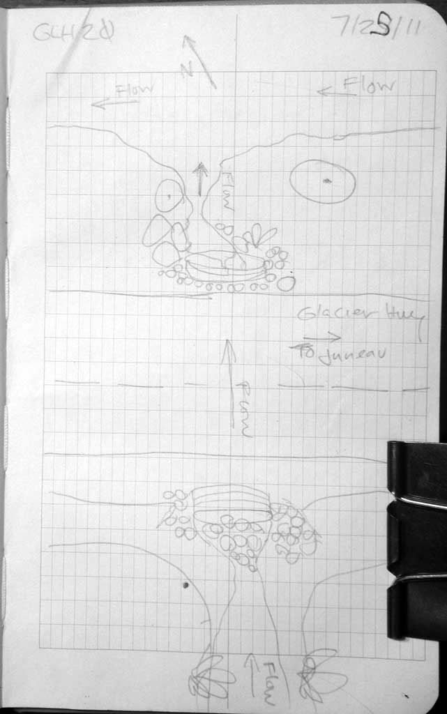
Fish Passage Site 10302224
Coordinates (dec. deg.): 58.50625°, -134.77419°
Legal Description: C039S064E12
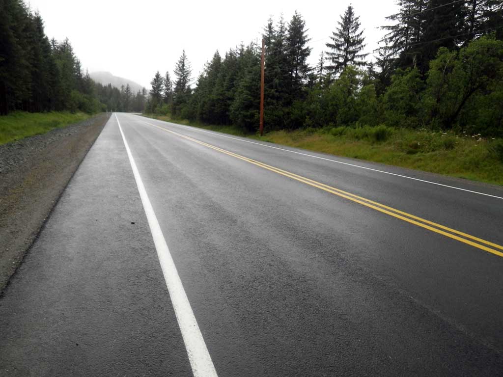
Region: Southeast
Road Name: Glacier Highway
Datum: NAD83
Quad Name / ITM: Juneau C-3
AWC Stream #:
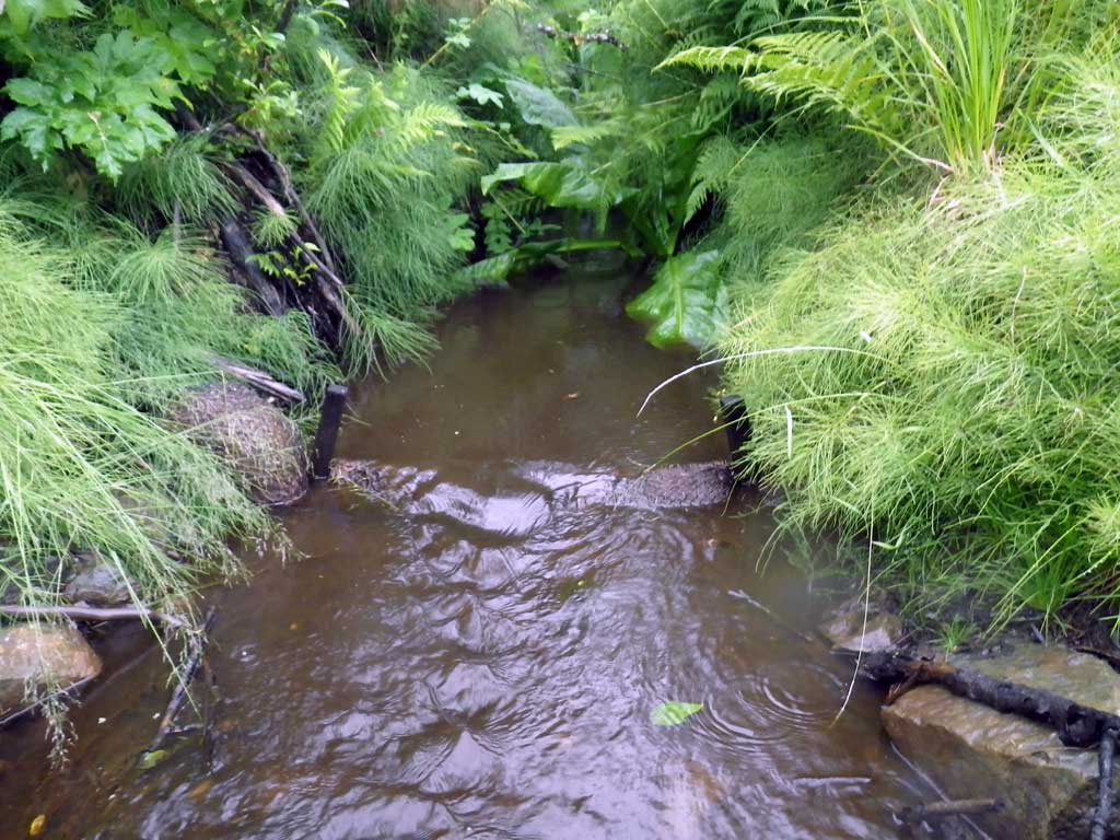
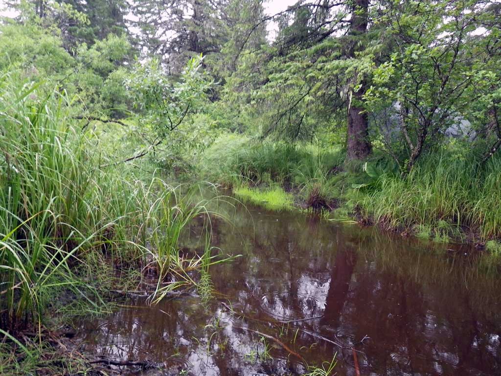
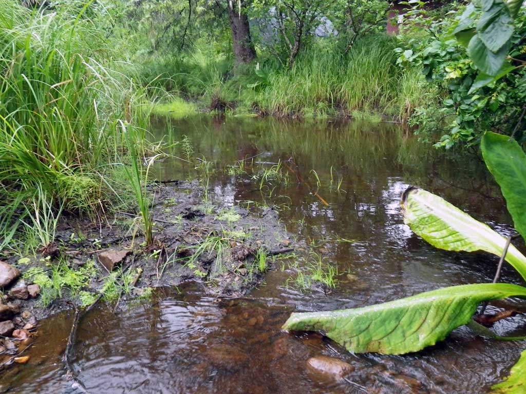
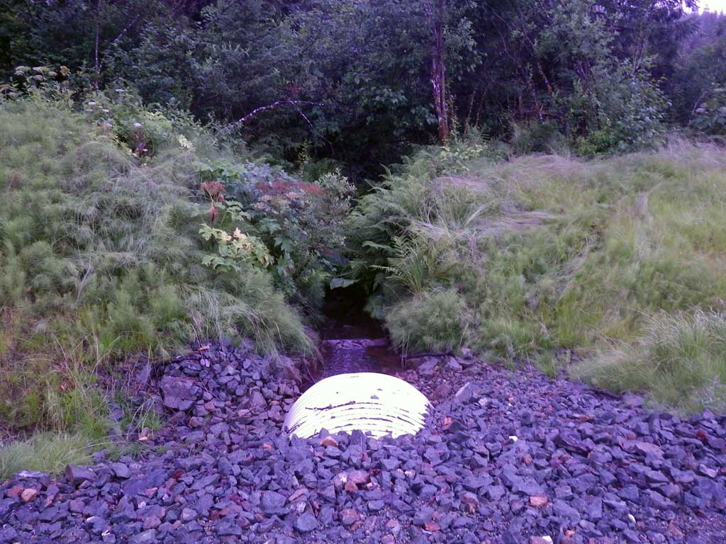
Stream Name: Strawberry Creek side channel
Elevation:
Site Comments: None
Survey SEA11-GLH20
Project Supervisor: Gillian O'Doherty, Alaska Department of Fish and Game
— Anchorage, AK
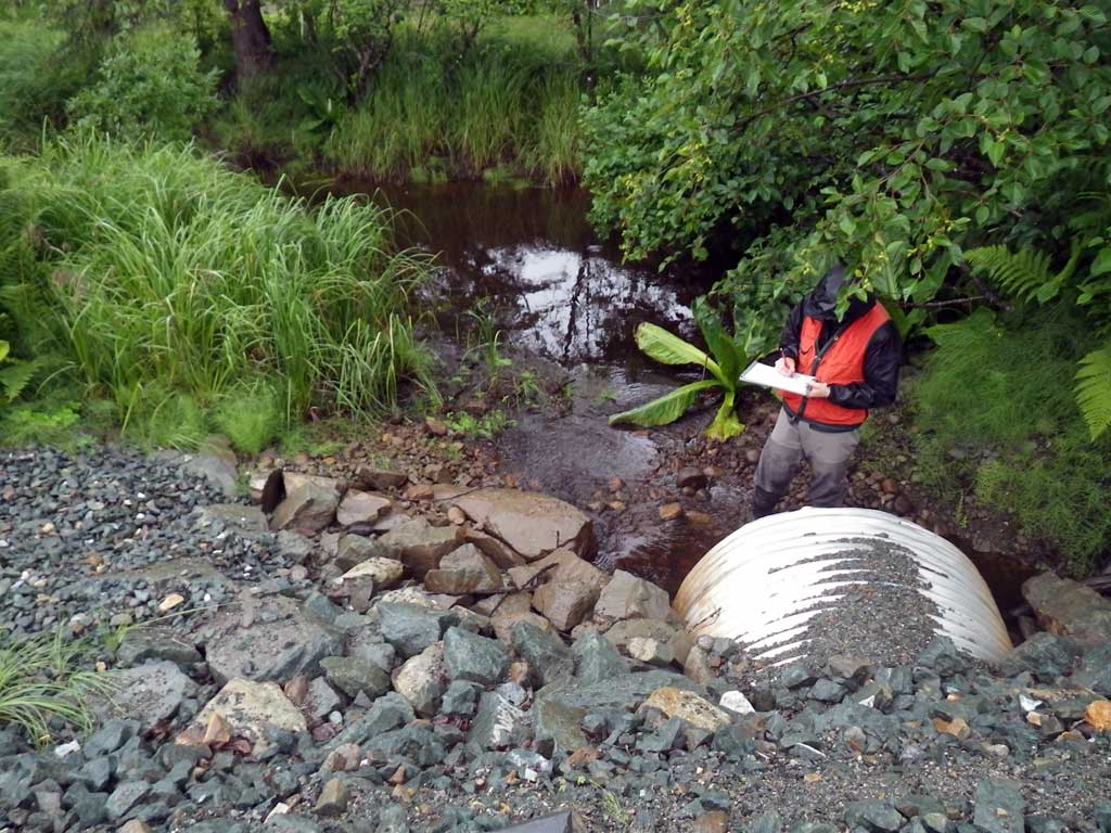
Observers: Jason Olds, Charmagne Gutierrez
Overall Fish Passage Rating:
Tidal: No
Backwatered: No
Step Pools: No
Construction Year:
Site Observations:
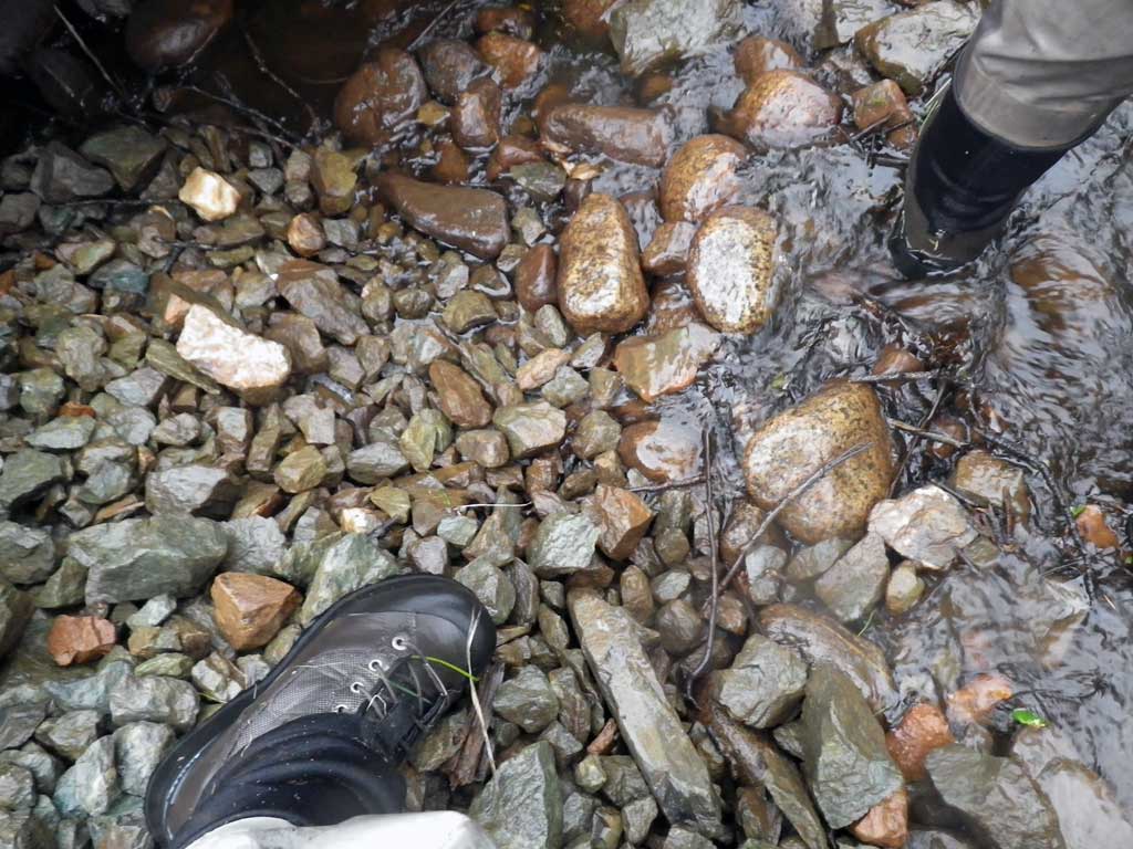
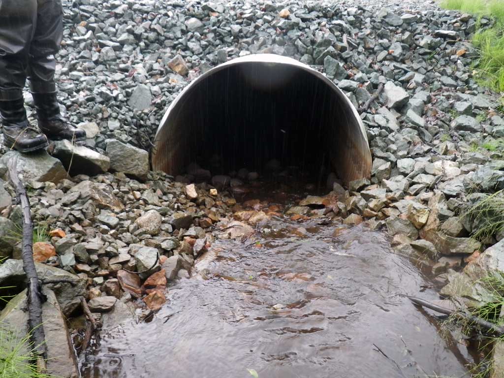
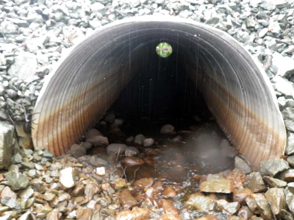
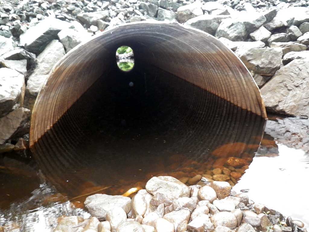
- Culvert gradient gray
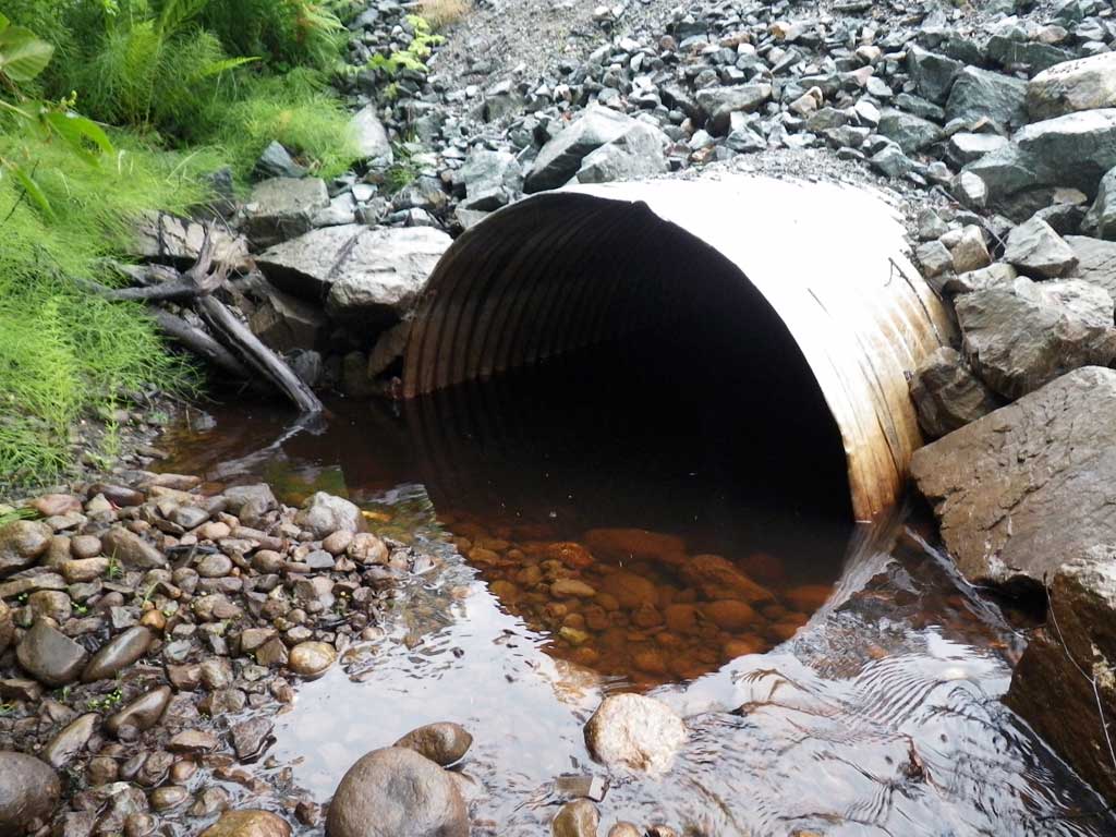
- Inlet perch
- Road Fill (pushed off road by grader)
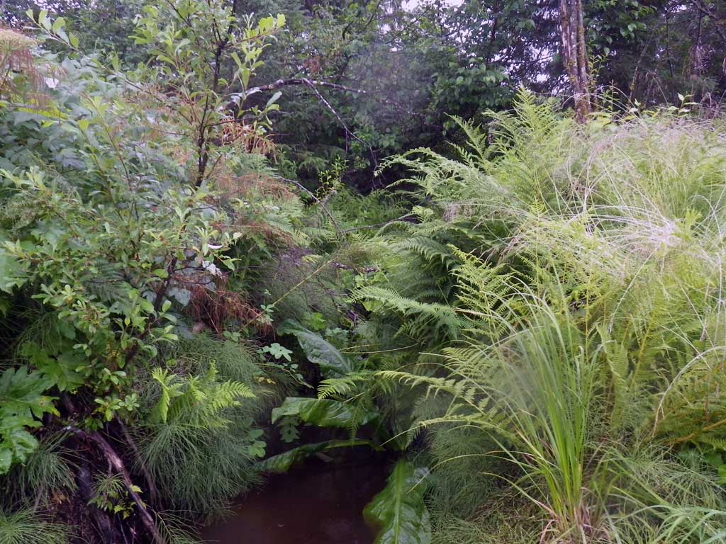
Comments: Inlet perch, imbedded at invert, substrate drops out inside pipe 4 feet inside. Juvenile salmonids visually observed down stream. No stream grade taken; too much brush and foliage.
Culvert Measurements
| ID: 1 | Structure Type: Circular pipe (Corrugated aluminum) | Fish Passage Rating: | |||||||||||||||||||||||||||||||||||||||||
|
|
|
|||||||||||||||||||||||||||||||||||||||||
Culvert Observations:
|
|||||||||||||||||||||||||||||||||||||||||||
Stream Measurements
|
|
| Stream Width Type | Distance From Crossing (ft) |
Stream Width (ft) |
|---|---|---|
| Upstream ordinary high water | 20.0 | 3.10 |
| Upstream ordinary high water | 30.0 | 3.00 |
| Upstream ordinary high water | 40.0 | 4.10 |
Elevations
| Locator ID | Culvert Number |
River Distance (ft)1 |
Distance From Crossing (ft)2 |
Relative Elevation (ft) |
|---|---|---|---|---|
| Road Elev | 104.76 | |||
| D/S Water Surface Elev (continuous pool/glide system continues) | 0.00 | 97.69 | ||
| D/S Water Surface Elev | 4.00 | 97.77 | ||
| D/S Grade Ctrl (Thalweg) | 4.00 | 97.47 | ||
| D/S Tailcrest or 1st Thalweg | 7.50 | 97.65 | ||
| D/S Water Surface Elev | 7.50 | 97.86 | ||
| D/S Water Surface Elev | 11.00 | 97.84 | ||
| Outlet Invert (on substrate) | 11.00 | 96.70 | ||
| Outlet Culvert Top | 11.00 | 100.00 | ||
| Inlet Culvert Top | 82.00 | 101.43 | ||
| Inlet Culvert Invert (On substrate) | 82.00 | 98.14 | ||
| U/S Water Surface Elev | 82.00 | 98.19 | ||
| U/S Grade Ctrl (Thalweg) | 86.00 | 98.75 | ||
| U/S Water Surface Elev | 86.00 | 98.93 | ||
| U/S Headwater | 86.50 | 98.94 |
Notes:
- River distance is measured continuously throughout the survey reach along the thalweg of the stream.
- Measured from each end of the crossing along the thalweg of the stream.
Fish Sampling Efforts
| Gear Type: Visual Observation, Ground (A) | ||
| Channel Type: Main Channel (>50% of water flow) | ||
| Comments: Juvenile salmonids observed downstream from culvert. | ||
Fish Observations
No fish observations occurred during this survey.
Photos
Questions or comments about this report can be directed to dfg.dsf.webmaster@alaska.gov