Fish Passage Site 10302221
Coordinates (dec. deg.): 58.50359°, -134.76936°
Legal Description: C039S064E12
Region: Southeast
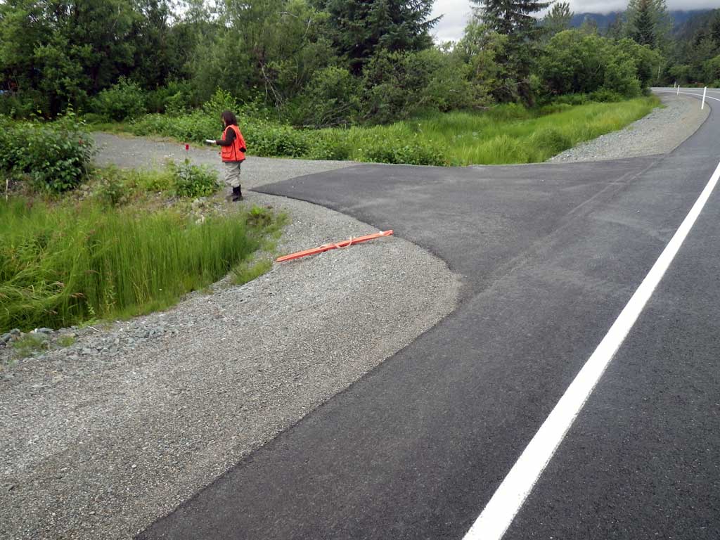
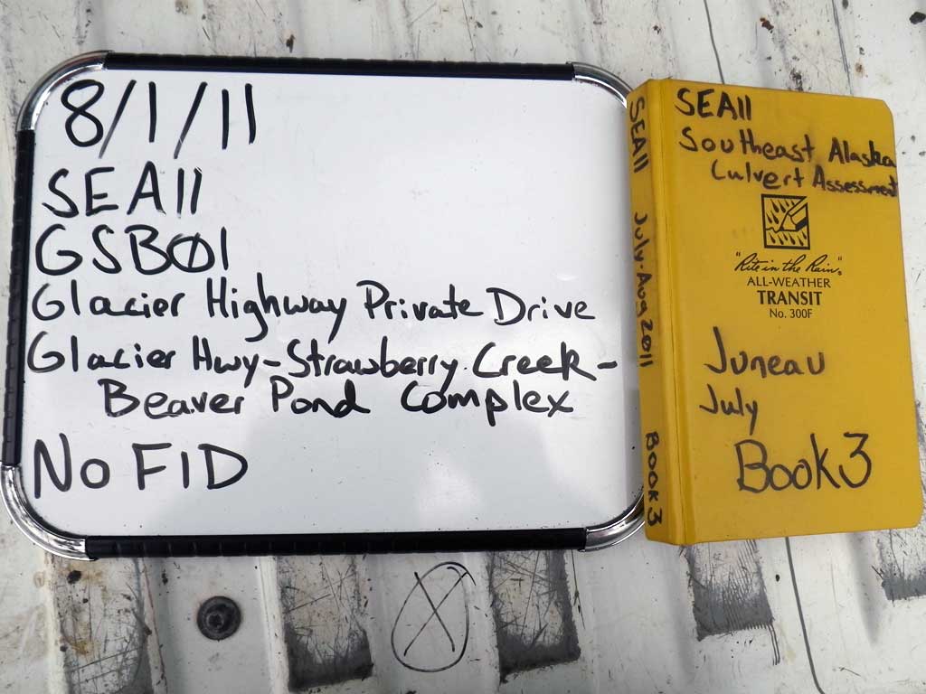
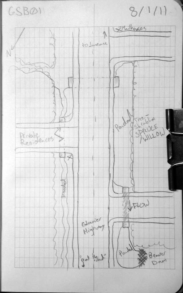
Road Name: Glacier Highway
Datum: NAD83
Quad Name / ITM: Juneau C-3
AWC Stream #:
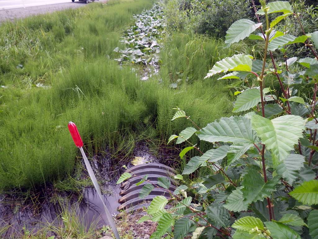
Stream Name: Strawberry Creek tributary
Elevation:
Site Comments: Site is near MP25 on the Glacier Highway. Culvert is on a private driveway off of the Glacier Highway
Survey SEA11-GSB01
Project Supervisor: Gillian O'Doherty, Alaska Department of Fish and Game
— Anchorage, AK
Observers: Jason Olds, Charmagne Gutierrez
Overall Fish Passage Rating:
Tidal: No
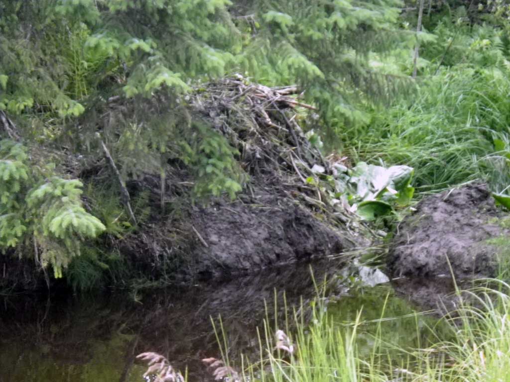
Backwatered: Yes
Step Pools: No
Construction Year:
Site Observations:
- Hydraulic flows exceeded capacity
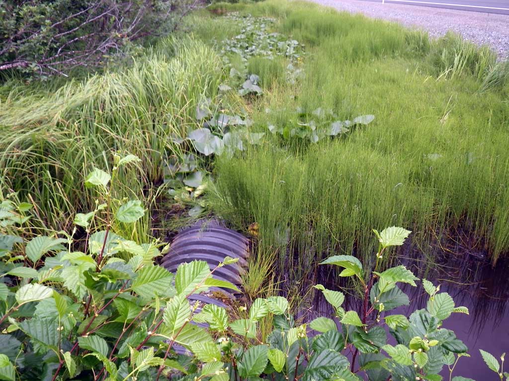
Comments: Smooth Bore Plastic Pipe: Ponded with Beaver slide/dam. Hydrolic flow exceeds culvert capacity.
Culvert Measurements
| ID: 1 | Structure Type: Circular pipe (Corrugated plastic) | Fish Passage Rating: | |||||||||||||||||||||||||||||||||||||||||
|
|
|
|||||||||||||||||||||||||||||||||||||||||
Culvert Observations:
|
|||||||||||||||||||||||||||||||||||||||||||
Stream Measurements
|
|
No stream width data available.
Elevations
| Locator ID | Culvert Number |
River Distance (ft)1 |
Distance From Crossing (ft)2 |
Relative Elevation (ft) |
|---|---|---|---|---|
| Road Elev | 99.48 | |||
| Misc. (No discernable grade points, survey point on substrate) | 0.00 | 94.91 | ||
| D/S Water Surface Elev | 0.00 | 96.84 | ||
| D/S Water Surface Elev | 1.00 | 96.85 | ||
| Outlet Invert | 1.00 | 94.42 | ||
| Outlet Culvert Top | 1.00 | 97.44 | ||
| Inlet Culvert Invert | 36.70 | 97.81 | ||
| U/S Headwater | 36.70 | 96.86 | ||
| Inlet Culvert Top | 36.70 | 97.39 |
Notes:
- River distance is measured continuously throughout the survey reach along the thalweg of the stream.
- Measured from each end of the crossing along the thalweg of the stream.
Fish Sampling Efforts
| Gear Type: None (A) | ||
| Comments: No traps set no fish observed. | ||
Fish Observations
No fish observations occurred during this survey.
Photos
Questions or comments about this report can be directed to dfg.dsf.webmaster@alaska.gov