Fish Passage Site 10302217
Coordinates (dec. deg.): 58.39279°, -134.75055°
Legal Description: C040S065E19
Region: Southeast
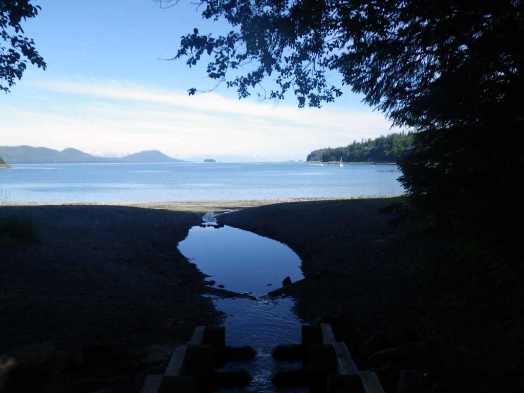
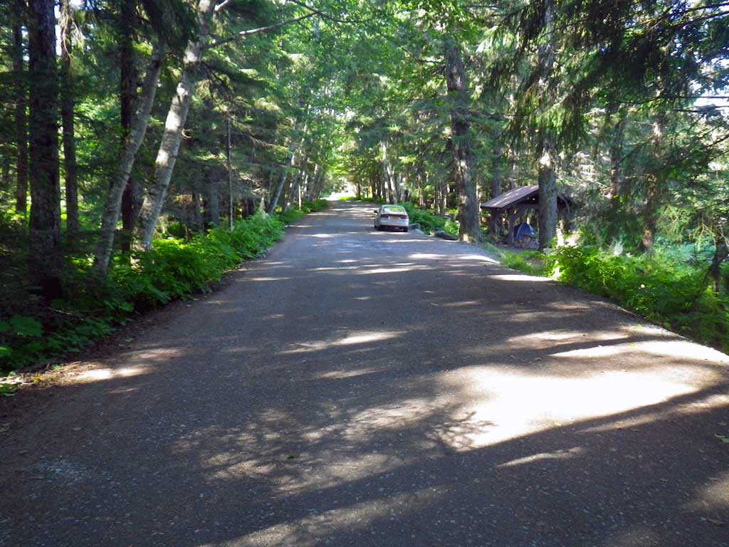
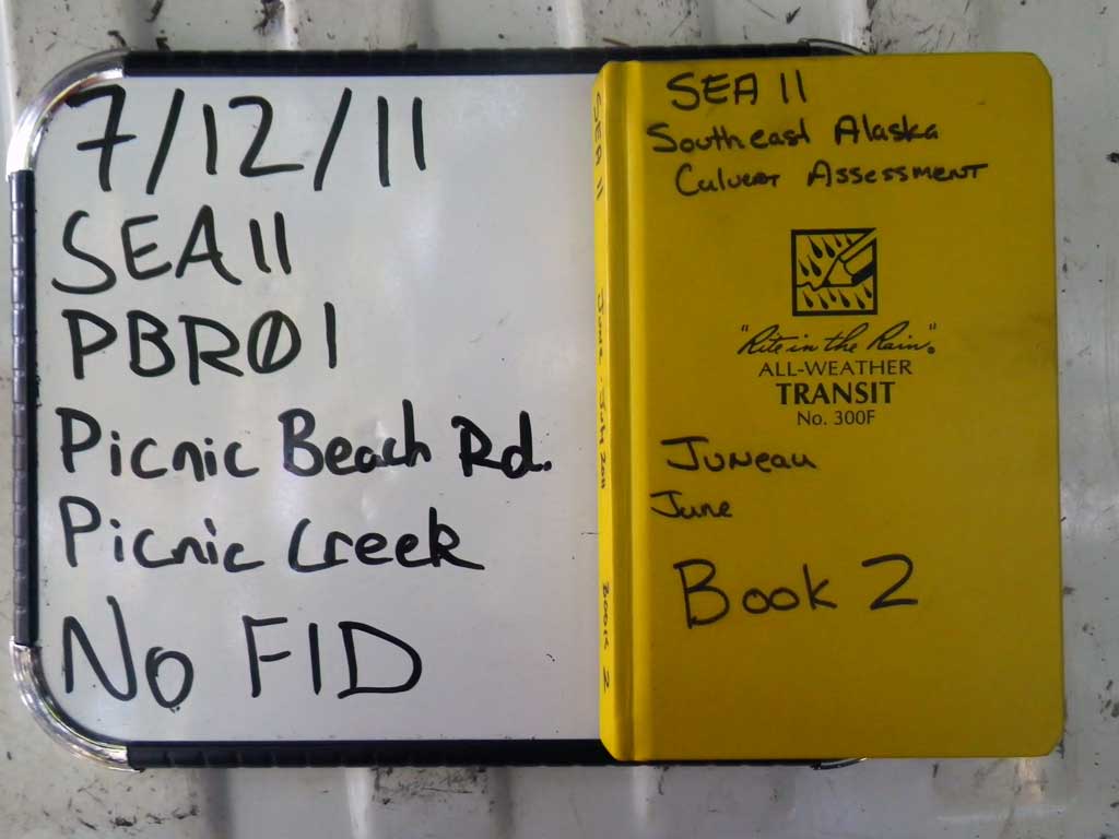
Road Name: Picnic Beach Road
Datum: NAD83
Quad Name / ITM: Juneau B-3
AWC Stream #: 111-50-10310
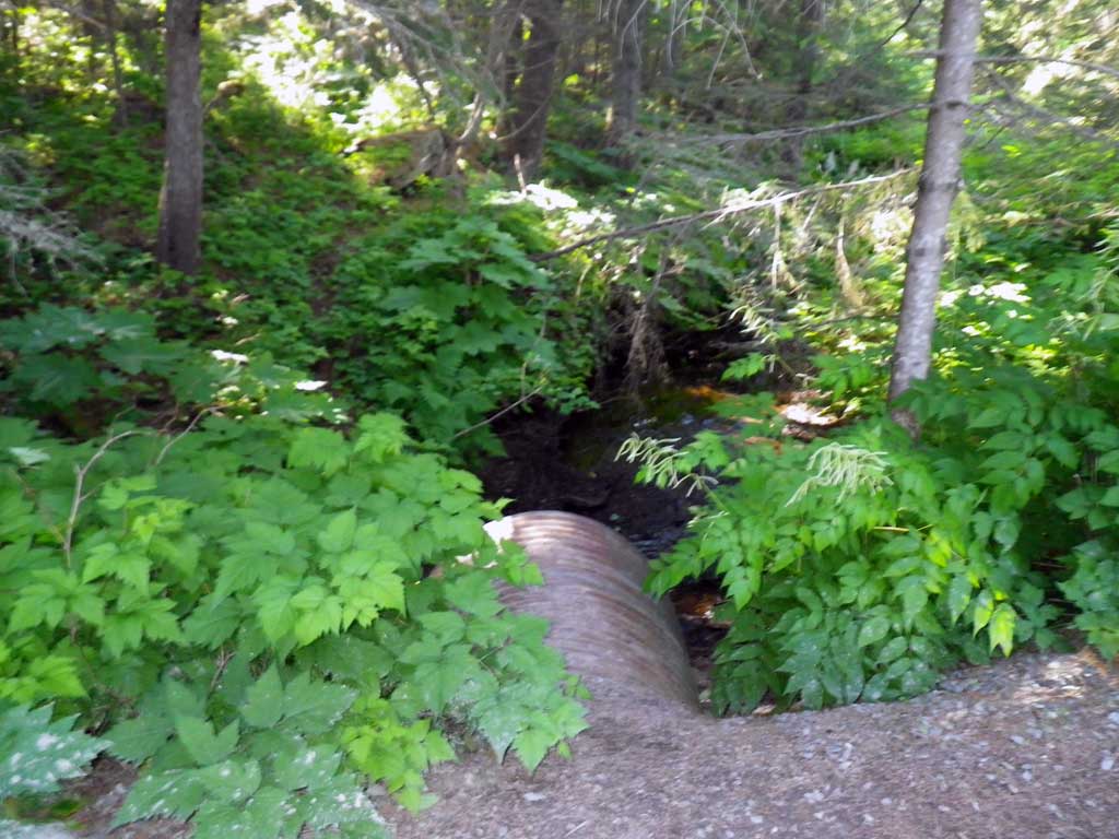
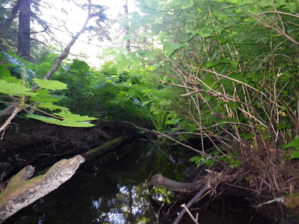
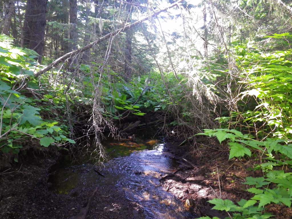
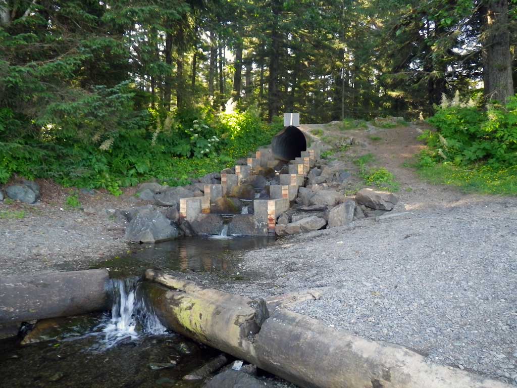
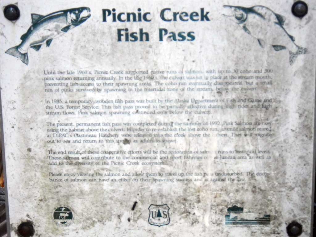
Stream Name: Picnic Creek
Elevation:
Site Comments: None
arrow to the right of the survey date below to choose a different report for this site.
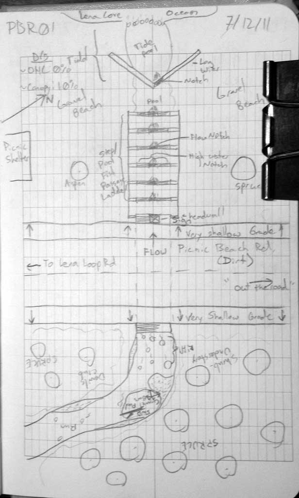
Survey SEA11-PBR01
Project Supervisor: Gillian O'Doherty, Alaska Department of Fish and Game
— Anchorage, AK
Observers: Jason Olds, Charmagne Gutierrez
Overall Fish Passage Rating:
Tidal: Maybe
Backwatered: No
Step Pools: No
Construction Year:
Site Observations:
- Constriction ratio gray
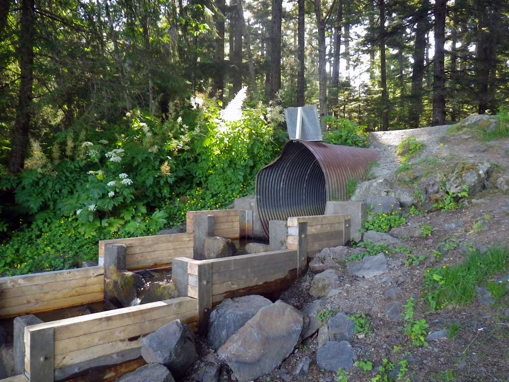
Comments: Visual observation: Juvenile salmonids upstream/downstream. Footer/Headwall at outlet-Fish Passage Structure. Stream grade calculated 14 x OHW.
Culvert Measurements
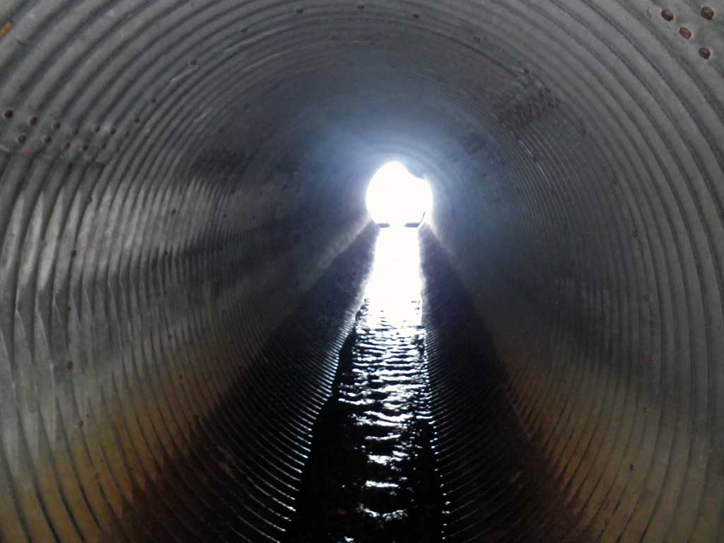
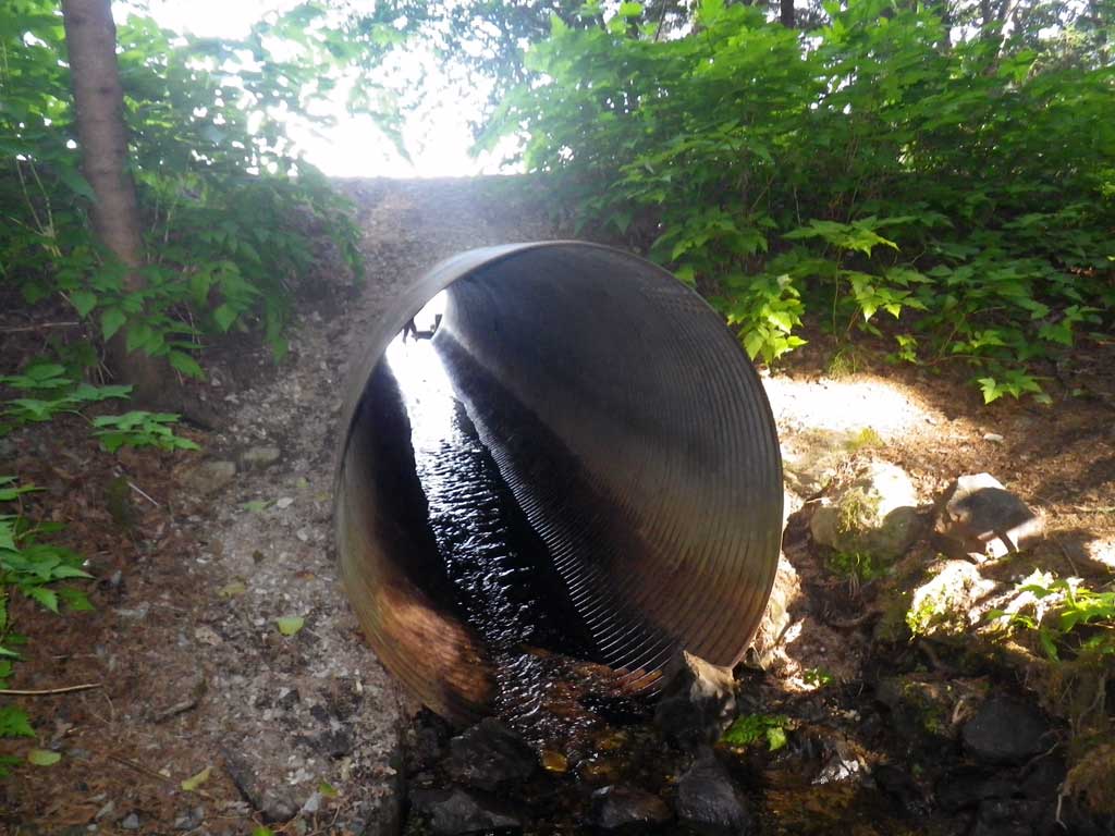
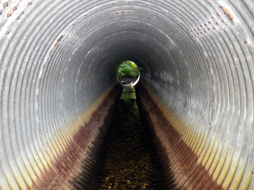
| ID: 1 | Structure Type: Oval (Structural steel plate) | Fish Passage Rating: | |||||||||||||||||||||||||||||||||||||||||
|
|
|
|||||||||||||||||||||||||||||||||||||||||
Comments: Visual observation: Juvenile salmonids upstream/downstream. Footer/Headwall at outlet-Fish Passage Structure. Stream grade calculated 14 x OHW. |
|||||||||||||||||||||||||||||||||||||||||||
Culvert Observations:
|
|||||||||||||||||||||||||||||||||||||||||||
Stream Measurements
|
|
| Stream Width Type | Distance From Crossing (ft) |
Stream Width (ft) |
|---|---|---|
| Upstream ordinary high water | 20.0 | 10.30 |
| Upstream ordinary high water | 48.0 | 7.20 |
| Upstream ordinary high water | 81.0 | 8.70 |
Elevations
| Locator ID | Culvert Number |
River Distance (ft)1 |
Distance From Crossing (ft)2 |
Relative Elevation (ft) |
|---|---|---|---|---|
| Road Elev | 104.89 | |||
| D/S Grade Ctrl (Thalweg) (Tide Pool Tailwater control) | 0.00 | 89.47 | ||
| D/S Water Surface Elev | 0.00 | 89.66 | ||
| D/S Water Surface Elev | 36.00 | 89.65 | ||
| Max Pool Depth | 36.00 | 88.83 | ||
| D/S Grade Ctrl (Thalweg) (log weir on notch) | 55.00 | 91.60 | ||
| D/S Water Surface Elev | 65.00 | 91.84 | ||
| Max Pool Depth | 65.00 | 91.06 | ||
| D/S Grade Ctrl (Thalweg) (notch in Weir 1) | 66.00 | 92.62 | ||
| D/S Water Surface Elev | 71.00 | 92.95 | ||
| Max Pool Depth | 71.00 | 92.26 | ||
| D/S Grade Ctrl (Thalweg) (Notch in weir 2) | 73.00 | 93.62 | ||
| D/S Water Surface Elev | 75.00 | 93.97 | ||
| Max Pool Depth | 75.00 | 93.18 | ||
| D/S Grade Ctrl (Thalweg) (Notch in weir 3) | 79.00 | 93.61 | ||
| Max Pool Depth | 80.00 | 94.27 | ||
| D/S Water Surface Elev | 80.00 | 94.93 | ||
| D/S Grade Ctrl (Thalweg) (Notch in weir 4) | 82.00 | 95.64 | ||
| D/S Water Surface Elev | 85.00 | 95.99 | ||
| Max Pool Depth | 85.00 | 95.34 | ||
| D/S Grade Ctrl (Thalweg) (Notch weir 5) | 87.00 | 96.62 | ||
| D/S Water Surface Elev | 90.00 | 97.00 | ||
| Max Pool Depth | 90.00 | 96.30 | ||
| D/S Grade Ctrl (Thalweg) (notch in weir 6 also tailwater control for culvert) | 92.00 | 97.60 | ||
| D/S Water Surface Elev | 94.00 | 97.92 | ||
| Max Pool Depth | 94.00 | 97.58 | ||
| Outlet Invert (on metal) | 96.00 | 97.52 | ||
| D/S Water Surface Elev | 96.00 | 97.92 | ||
| Outlet Culvert Top | 96.00 | 102.97 | ||
| Inlet Culvert Top | 141.00 | 103.41 | ||
| Inlet Culvert Invert (on metal) | 141.00 | 98.17 | ||
| U/S Water Surface Elev | 141.00 | 98.29 | ||
| U/S Water Surface Elev (1st resting) | 143.00 | 98.43 | ||
| U/S Grade Ctrl (Thalweg) (top of riffle step) | 143.00 | 98.16 |
Notes:
- River distance is measured continuously throughout the survey reach along the thalweg of the stream.
- Measured from each end of the crossing along the thalweg of the stream.
Fish Sampling Efforts
| Gear Type: Visual Observation, Ground (A) | Trap Duration(h): 30.0 | |
| Channel Type: Main Channel (>50% of water flow) | ||
| Comments: Unidentified juvenile salmonids observed upstream and downstream from culvert. | ||
| Gear Type: (B) | ||
Fish Observations
No fish observations occurred during this survey.
Photos
Questions or comments about this report can be directed to dfg.dsf.webmaster@alaska.gov