Fish Passage Site 10302199
Coordinates (dec. deg.): 58.37079°, -134.61806°
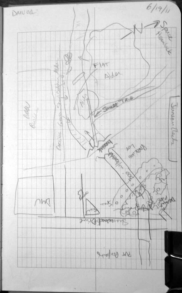
Legal Description: C040S065E25
Region: Southeast
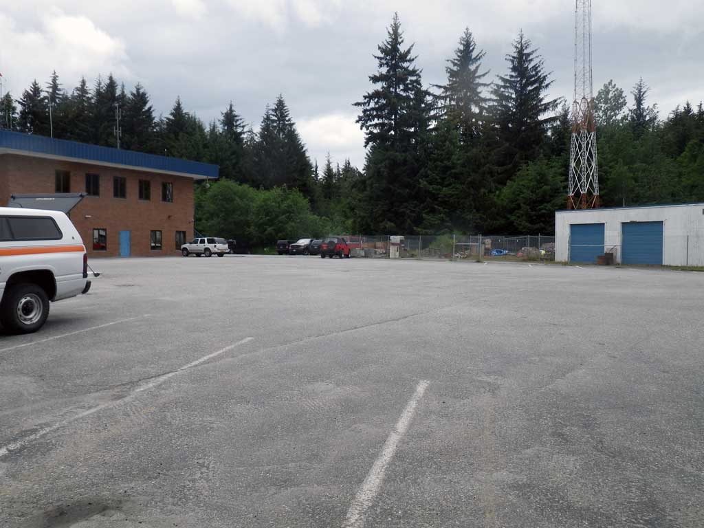
Road Name: Sherwood Drive
Datum: NAD83
Quad Name / ITM: Juneau B-2
AWC Stream #:
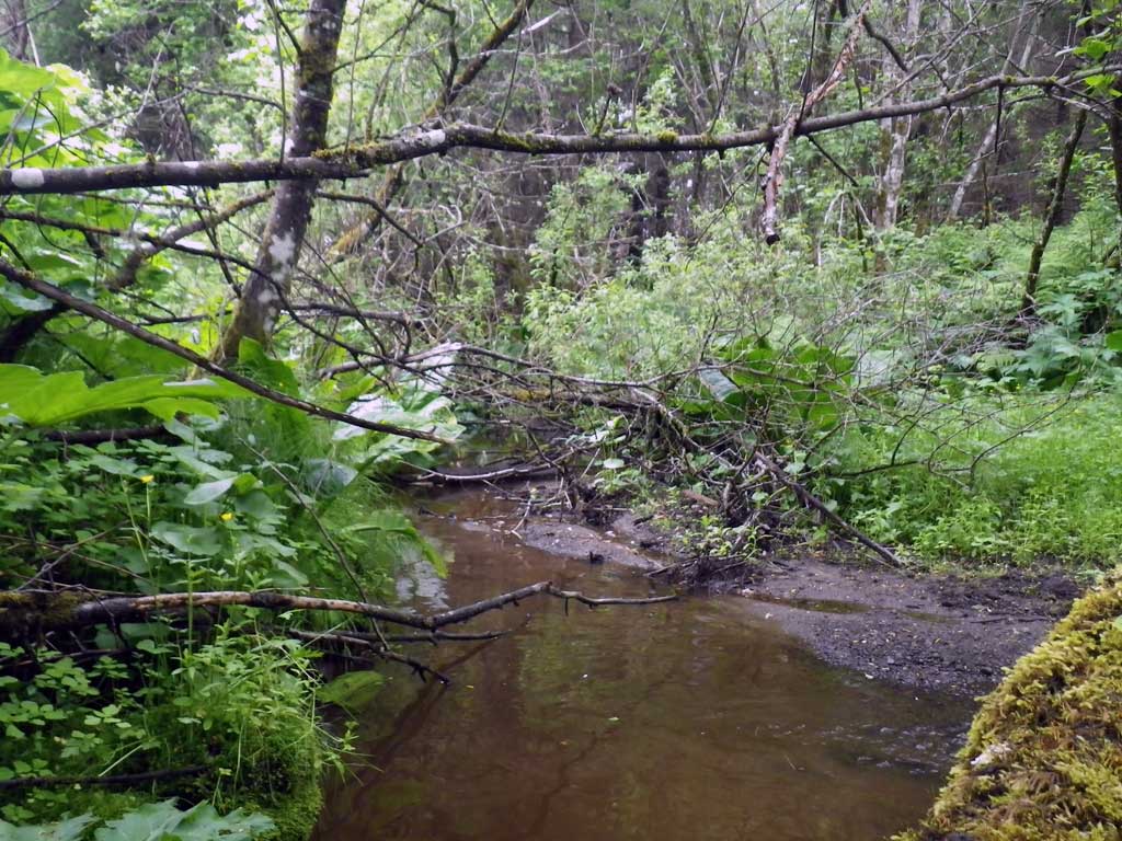
Stream Name: Casa Del Sol tributary
Elevation:
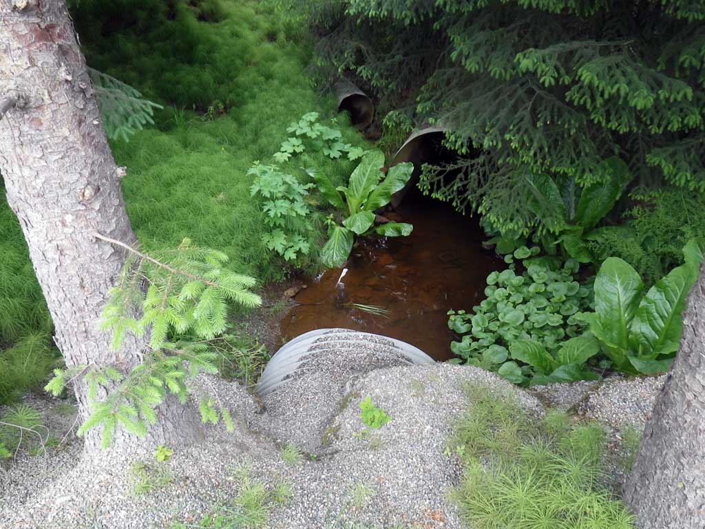
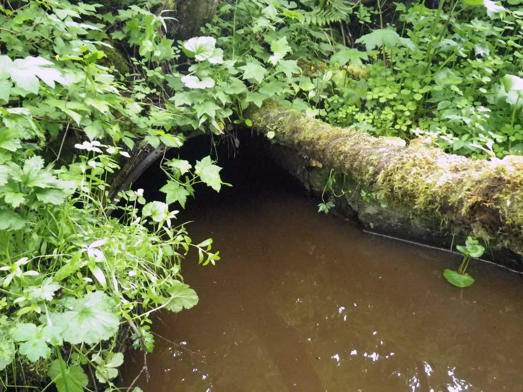
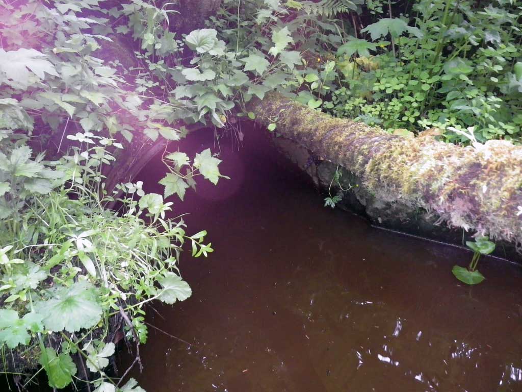
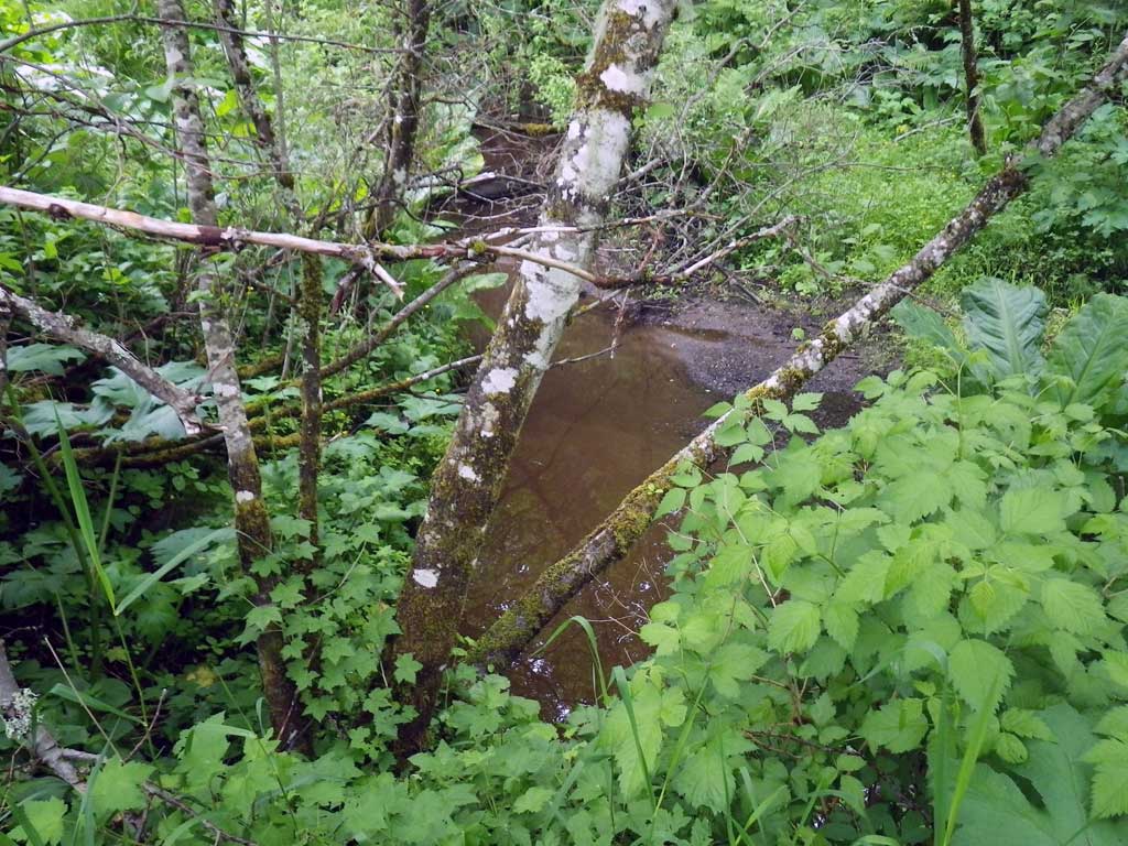
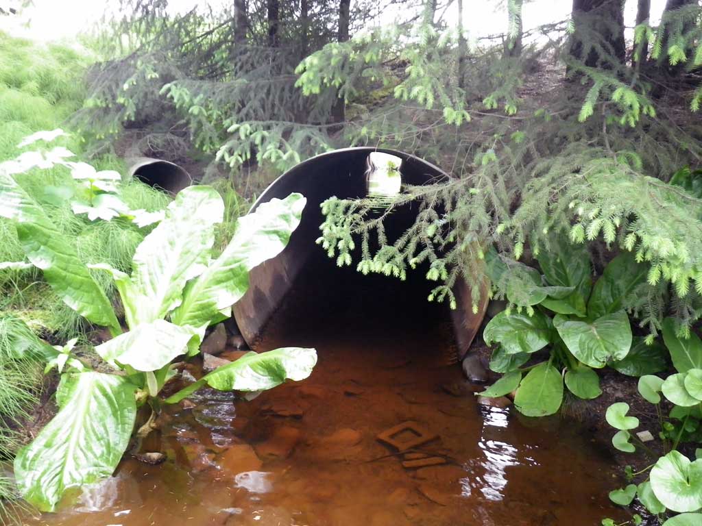
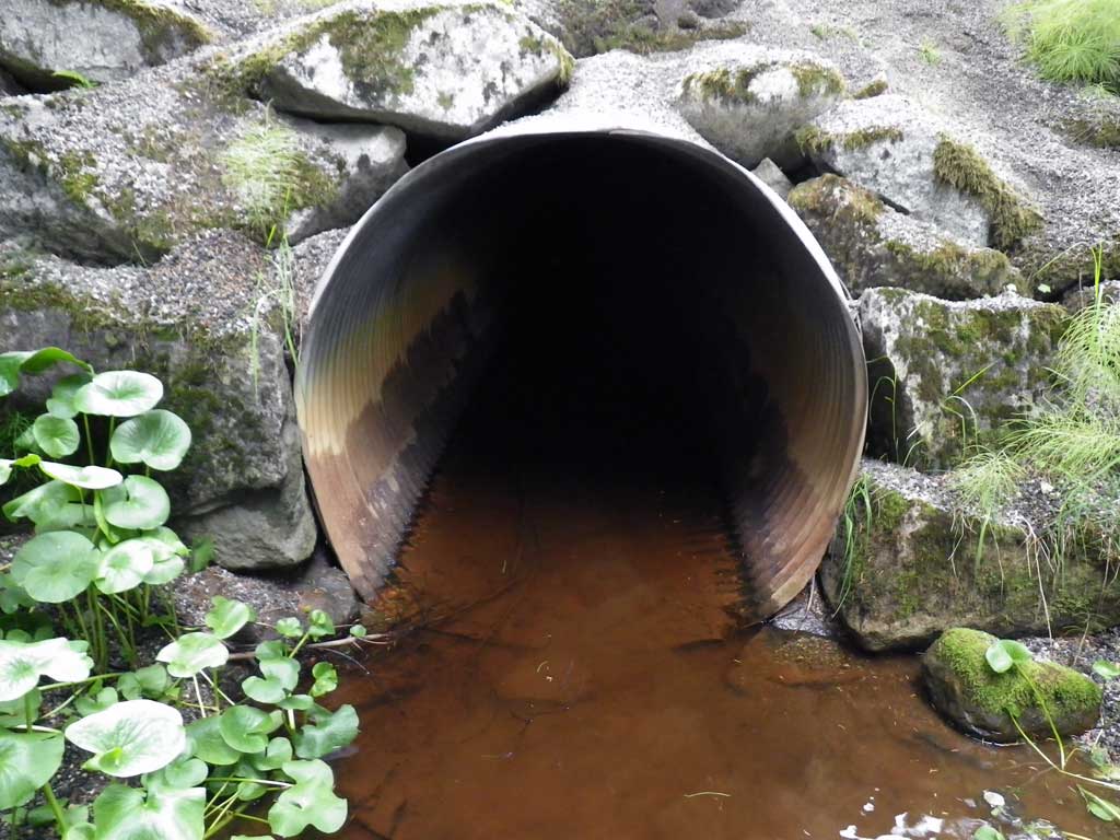
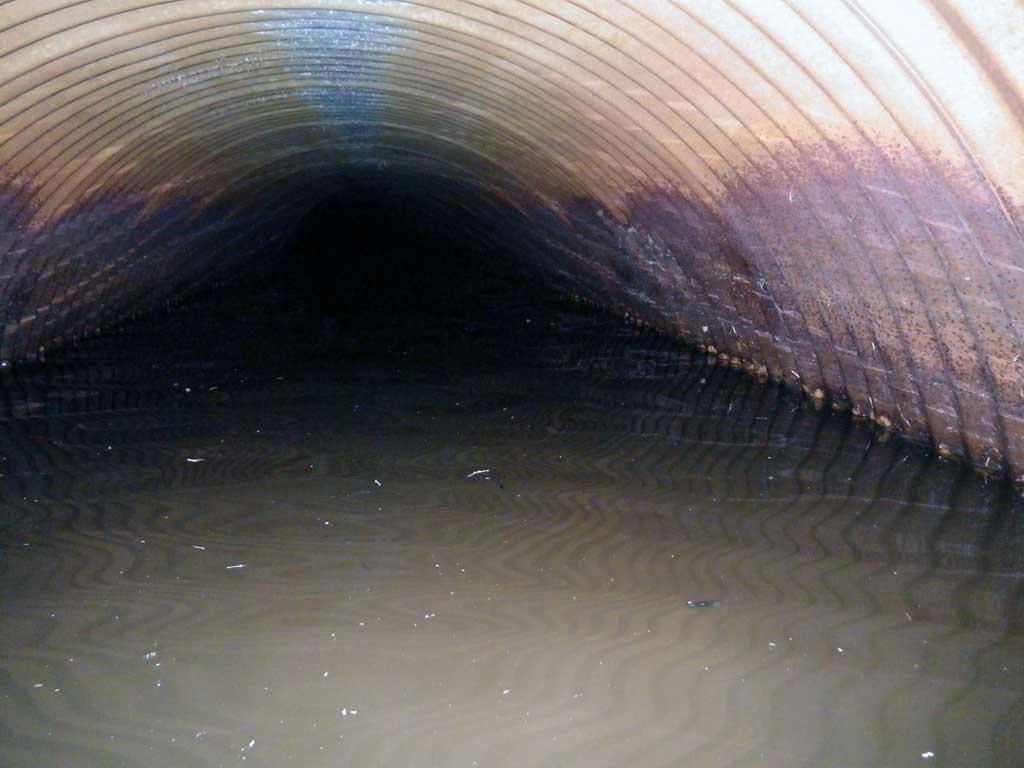
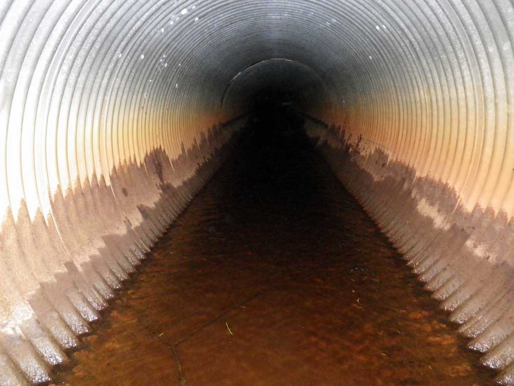
Site Comments: Pipe turns somewhere throughout and gradually in it's 300 feet of length. Crosses under DMV parking lot. 1 drain pipe entering approximately 100 feet downstream from invert in. Christmas tree half burried in substrate somewhere in middle of pipe. SHD01 about 15 feet upstream from culvert.
Survey SEA11-DMV01
Project Supervisor: Gillian O'Doherty, Alaska Department of Fish and Game
— Anchorage, AK
Observers: Mark Eisenman, Jason Olds
Overall Fish Passage Rating:
Tidal: Maybe
Backwatered: Yes
Step Pools: No
Construction Year:
Site Observations:
- Culvert gradient gray
- Constriction ratio gray
- Sediment accumulation
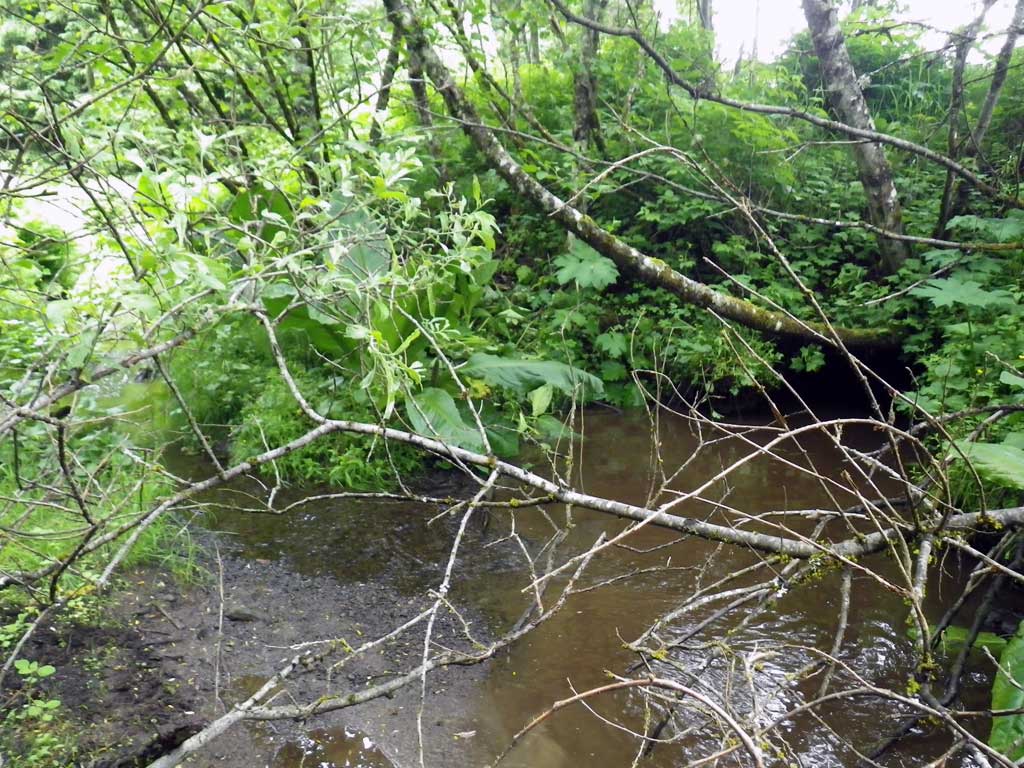
Comments: Pipe turns somewhere throughout and gradually in it's 300 feet of length. Crosses under DMV parking lot. 1 drain pipe entering approximately 100 feet downstream from invert in. Christmas tree half burried in substrate somewhere in middle of pipe. Very slow moving or potentially backwatered from a tailwater control somewhere further downstream than we could survey. Another culvert approximately 15 feet upstream of invert in. Downstream width used because of urbanized upstream area, however muskeg begins approximately 85 feet upstream through other side of culvert. Top of pipe used to estimate gradient. Water surface grade of .04% over length of pipe. Juvenile salmonids observed upstream and downstream of pipe. Heavy iron and organic sedimentation, muck accumulation through pipe.
Culvert Measurements
| ID: 1 | Structure Type: Circular pipe (Corrugated steel) | Fish Passage Rating: | |||||||||||||||||||||||||||||||||||||||||
|
|
|
|||||||||||||||||||||||||||||||||||||||||
Culvert Observations:
|
|||||||||||||||||||||||||||||||||||||||||||
Stream Measurements
|
|
| Stream Width Type | Distance From Crossing (ft) |
Stream Width (ft) |
|---|---|---|
| Downstream ordinary high water | 60.0 | 7.80 |
| Downstream ordinary high water | 85.0 | 11.20 |
| Downstream ordinary high water | 112.0 | 7.00 |
Elevations
| Locator ID | Culvert Number |
River Distance (ft)1 |
Distance From Crossing (ft)2 |
Relative Elevation (ft) |
|---|---|---|---|---|
| Road Elev | 99.22 | |||
| D/S Grade Ctrl (Thalweg) | 0.00 | 89.42 | ||
| D/S Water Surface Elev | 0.00 | 90.06 | ||
| D/S Water Surface Elev (Invert out) | 12.00 | 90.05 | ||
| Outlet Thalweg | 12.00 | 88.28 | ||
| Outlet Culvert Top | 12.00 | 91.94 | ||
| Inlet Culvert Top | 312.70 | 94.56 | ||
| Inlet Culvert Invert (On metal) | 312.70 | 89.40 | ||
| U/S Water Surface Elev (Invert in) | 312.70 | 90.16 | ||
| U/S Water Surface Elev | 317.70 | 90.15 | ||
| U/S Grade Ctrl (Thalweg) | 317.70 | 89.48 |
Notes:
- River distance is measured continuously throughout the survey reach along the thalweg of the stream.
- Measured from each end of the crossing along the thalweg of the stream.
Fish Sampling Efforts
| Gear Type: Visual Observation, Ground (A) | ||
| Comments: Juvenile salmonids observed upstream of culvert | ||
Fish Observations
No fish observations occurred during this survey.
Photos

Questions or comments about this report can be directed to dfg.dsf.webmaster@alaska.gov