Fish Passage Site 10302171
Coordinates (dec. deg.): 58.40808°, -134.54712°
Legal Description: C040S066E17
Region: Southeast
Road Name: Glacier Spur Road
Datum: NAD83
Quad Name / ITM: Juneau B-2
AWC Stream #:
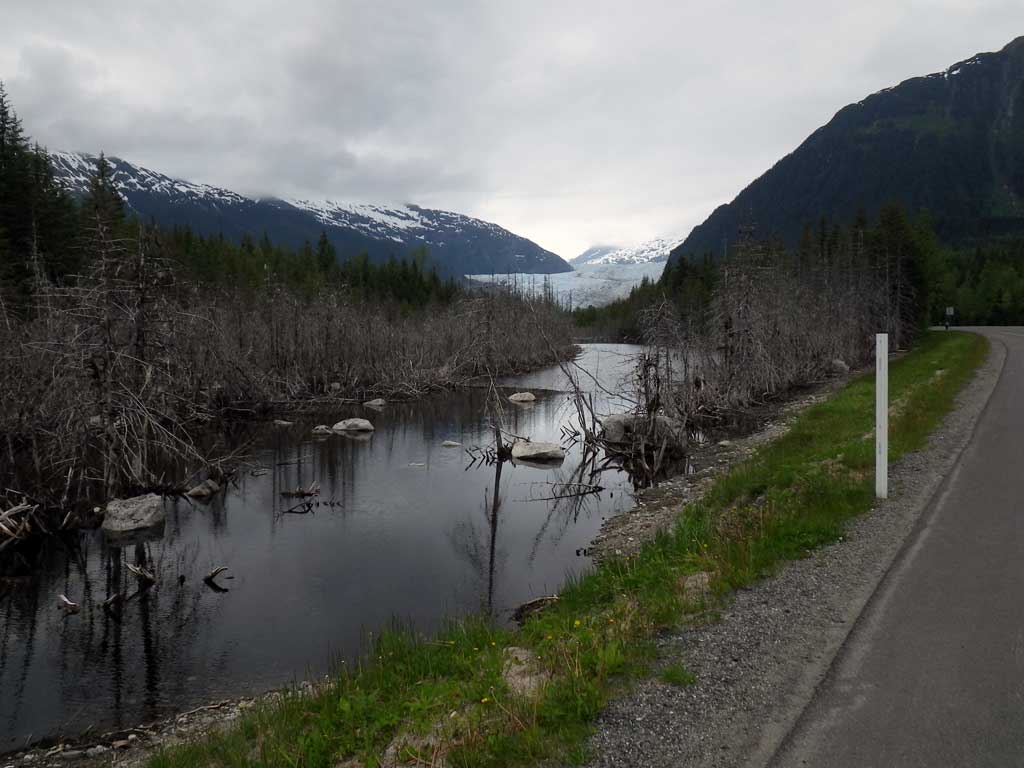
Stream Name: Mendenhall River tributary
Elevation:
Site Comments: None
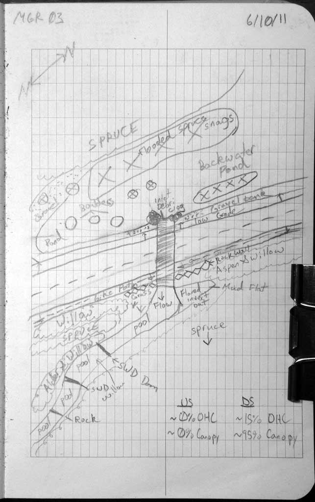
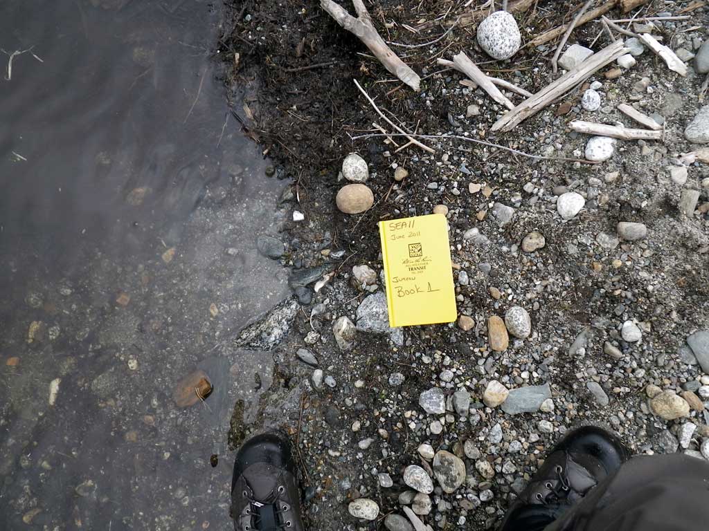
Survey SEA11-MGR03
Project Supervisor: Gillian O'Doherty, Alaska Department of Fish and Game
— Anchorage, AK
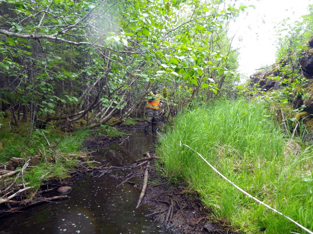
Observers: Mark Eisenman, Jason Olds
Overall Fish Passage Rating:
Tidal: No
Backwatered: No
Step Pools: No
Construction Year:
Site Observations:
- Culvert gradient red
- Constriction ratio red
- Beaver Activity
- Debris Flow
- Mechanical damage or joints parting
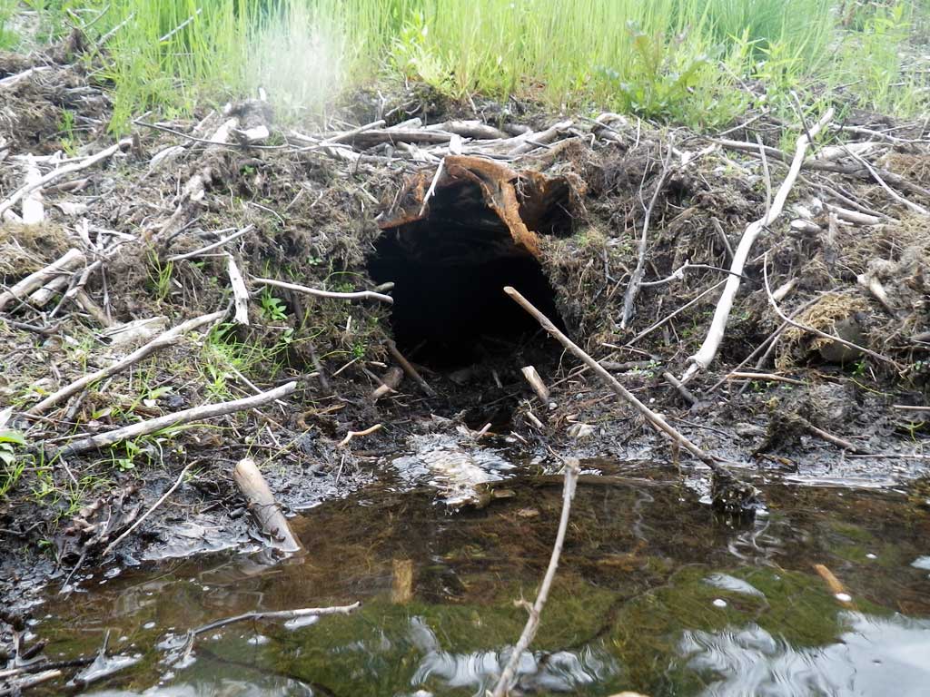
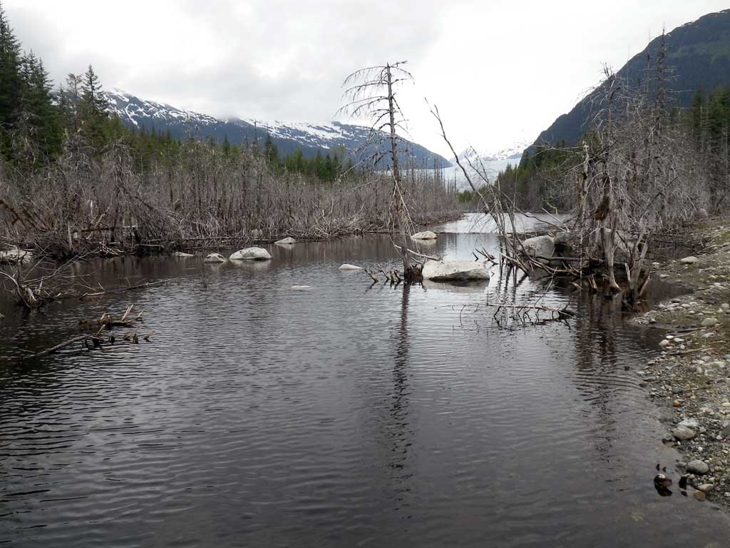
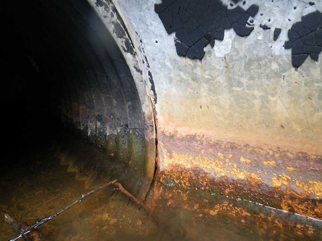
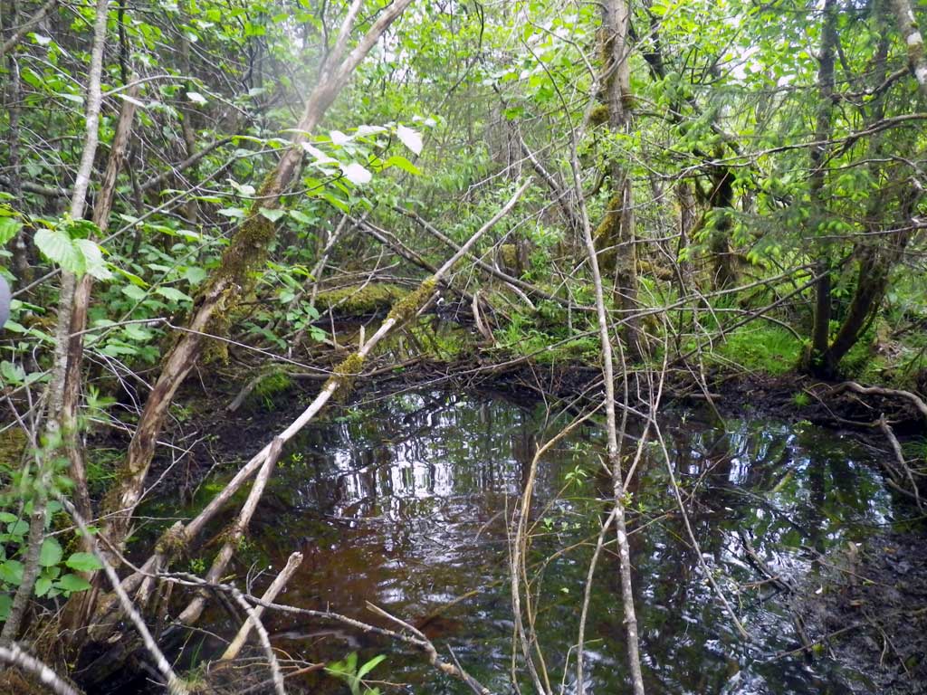
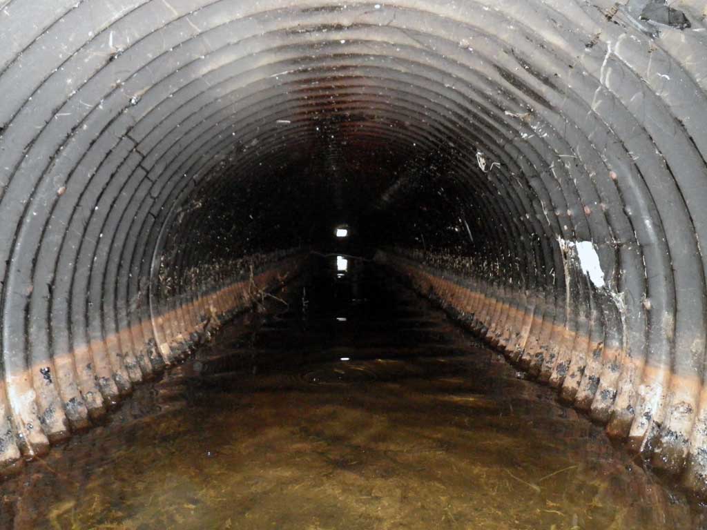
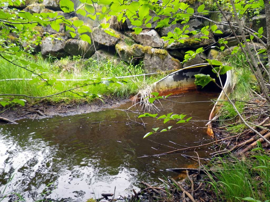
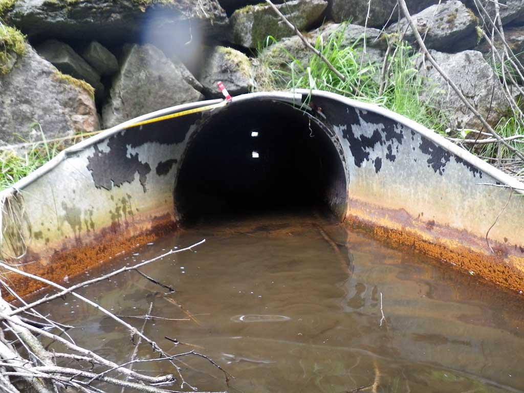
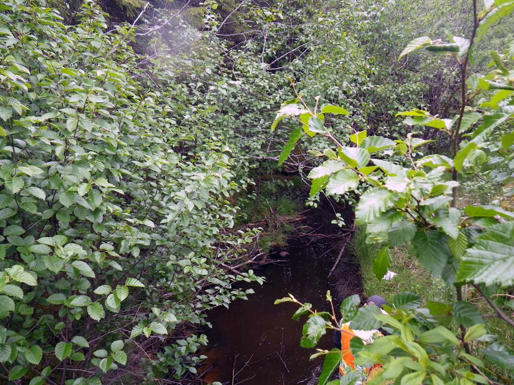
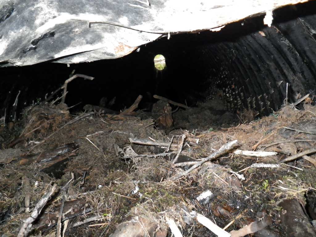
Comments: No traps were set as stream is already in AWC. Fish were observed downstream from culvert, likely a Dolly Varden. Inlet has extensive damage and is clogged with debris, looks like old beaver activity. Downstream has lots of pools and small barriers. If flow was not down to a trickle, habitat would likely be condusive for anadromous fish. Upstream looks like a beaver pond with extensive riparian flooding of the old stream channel.
Culvert Measurements
| ID: 1 | Structure Type: Circular pipe (Corrugated steel) | Fish Passage Rating: | |||||||||||||||||||||||||||||||||||||||||
|
|
|
|||||||||||||||||||||||||||||||||||||||||
Comments: Inlet damaged and plugged. |
|||||||||||||||||||||||||||||||||||||||||||
Culvert Observations:
|
|||||||||||||||||||||||||||||||||||||||||||
Stream Measurements
|
|
| Stream Width Type | Distance From Crossing (ft) |
Stream Width (ft) |
|---|---|---|
| Downstream ordinary high water | 31.0 | 6.50 |
| Downstream ordinary high water | 95.0 | 12.00 |
| Downstream ordinary high water | 140.0 | 4.90 |
Elevations
| Locator ID | Culvert Number |
River Distance (ft)1 |
Distance From Crossing (ft)2 |
Relative Elevation (ft) |
|---|---|---|---|---|
| Road Elev | 99.02 | |||
| Misc. (Survey point d/s) | 0.00 | 91.47 | ||
| D/S Water Surface Elev | 0.00 | 91.68 | ||
| D/S Grade Ctrl (Thalweg) | 6.00 | 91.61 | ||
| D/S Water Surface Elev | 6.00 | 91.91 | ||
| Max Pool Depth | 18.00 | 90.63 | ||
| Outlet Pool Water Elev | 18.00 | 91.68 | ||
| D/S Water Surface Elev | 21.00 | 91.69 | ||
| D/S Grade Ctrl (Thalweg) (End of apron at invert out on metal) | 21.00 | 90.95 | ||
| Outlet Culvert Top (On metal) | 26.00 | 93.90 | ||
| D/S Water Surface Elev (Invert out) | 26.00 | 91.69 | ||
| Outlet Thalweg (Invert out, on substrate) | 26.00 | 90.94 | ||
| Inlet Culvert Top (Mangled) | 99.40 | 94.38 | ||
| U/S Headwater (Invert in, 1st resting) | 99.40 | 93.18 | ||
| Inlet Thalweg (Invert in, on substrate, 1st resting) | 99.40 | 92.73 | ||
| U/S Water Surface Elev | 102.40 | 93.16 | ||
| U/S Thalweg | 102.40 | 92.52 |
Notes:
- River distance is measured continuously throughout the survey reach along the thalweg of the stream.
- Measured from each end of the crossing along the thalweg of the stream.
Fish Sampling Efforts
| Gear Type: Visual Observation, Ground (A) | ||
| Comments: Fish observed downstream from culvert, most likely dolly varden. | ||
Fish Observations
No fish observations occurred during this survey.
Photos

Questions or comments about this report can be directed to dfg.dsf.webmaster@alaska.gov