Fish Passage Site 10302167
Coordinates (dec. deg.): 58.41321°, -134.54526°
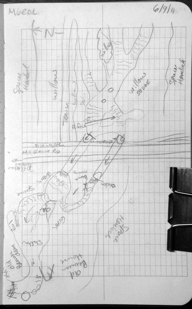
Legal Description: C040S066E08
Region: Southeast
Road Name: Glacier Spur Road
Datum: NAD83
Quad Name / ITM: Juneau B-2
AWC Stream #:
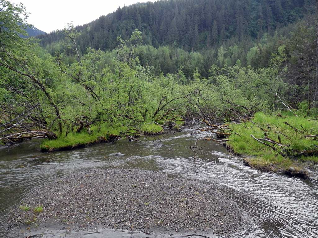
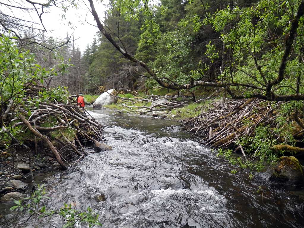
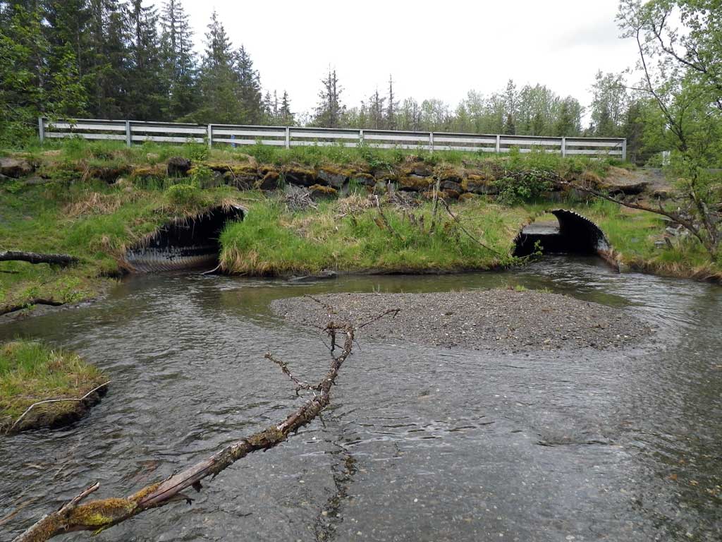
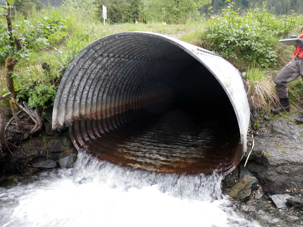
Stream Name: Steep Creek
Elevation:
Site Comments: None
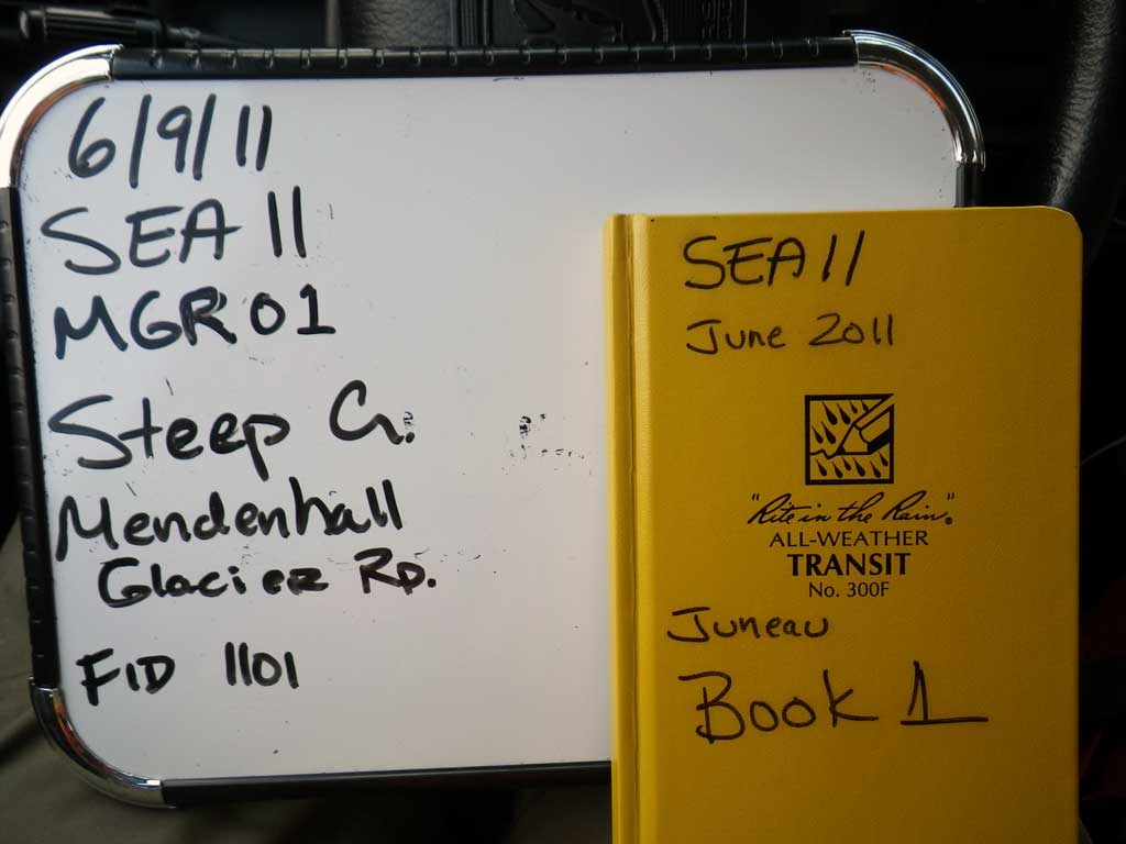
Survey SEA11-MGR01
Project Supervisor: Gillian O'Doherty, Alaska Department of Fish and Game
— Anchorage, AK
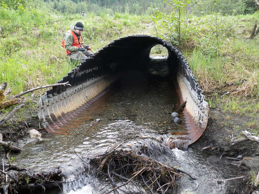
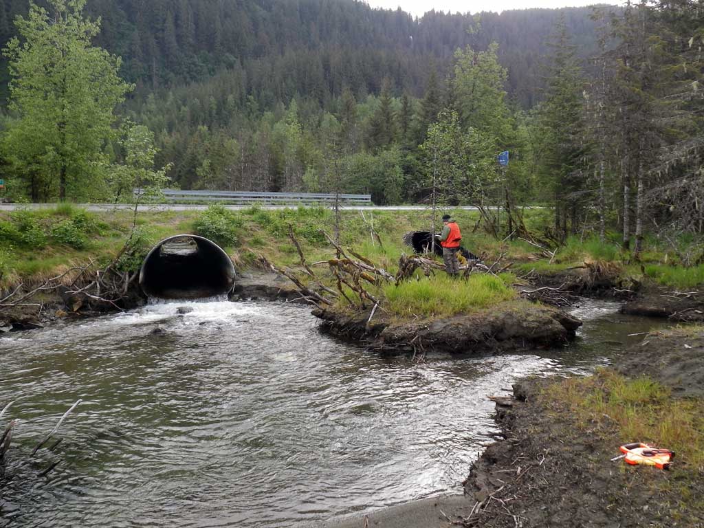
Observers: Mark Eisenman, Jason Olds
Overall Fish Passage Rating:
Tidal: No
Backwatered: No
Step Pools: No
Construction Year:
Site Observations:
- Outfall height red
- Culvert gradient gray
- Debris Flow
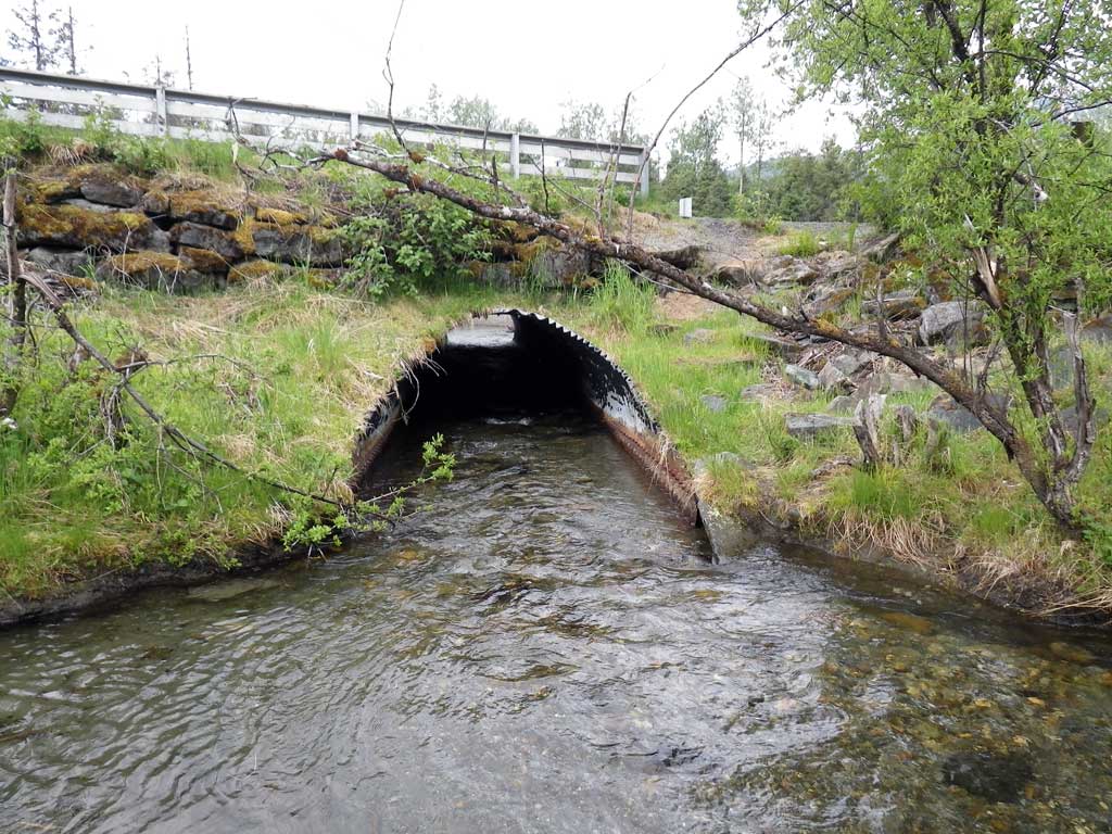
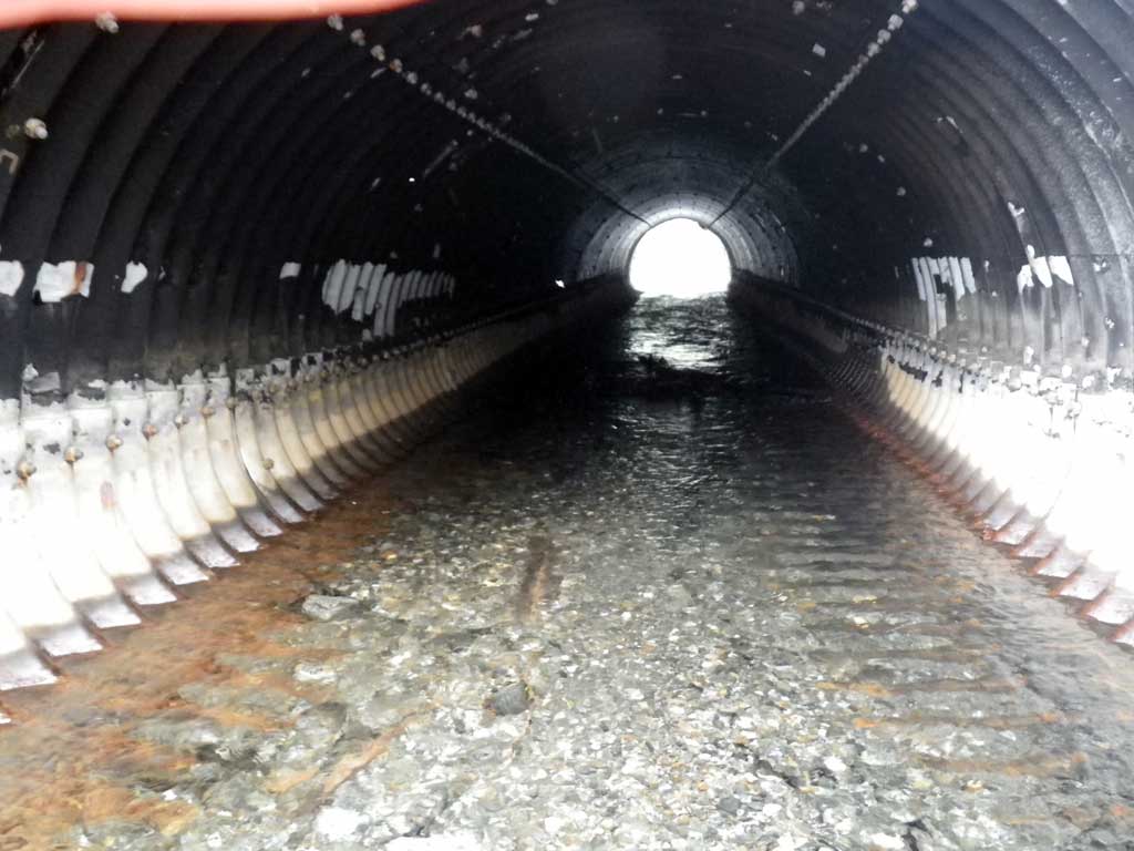
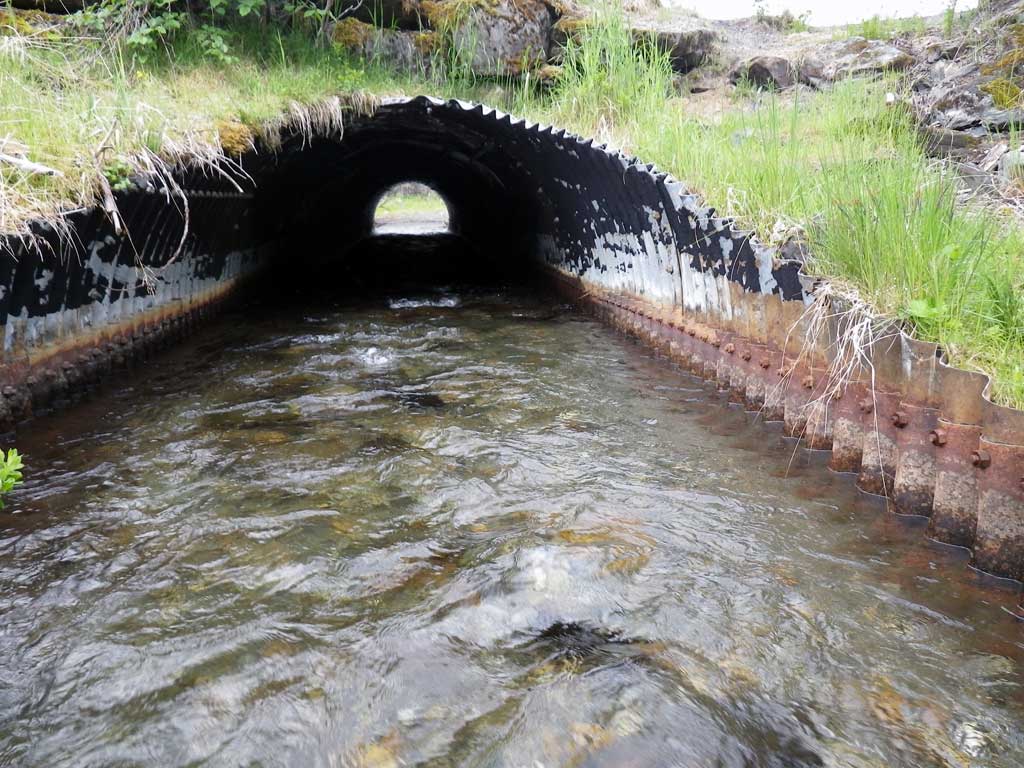
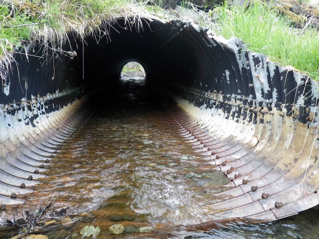
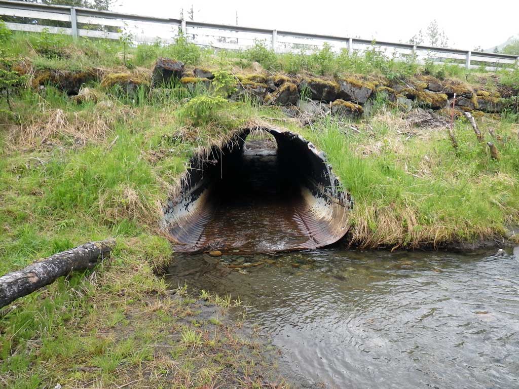
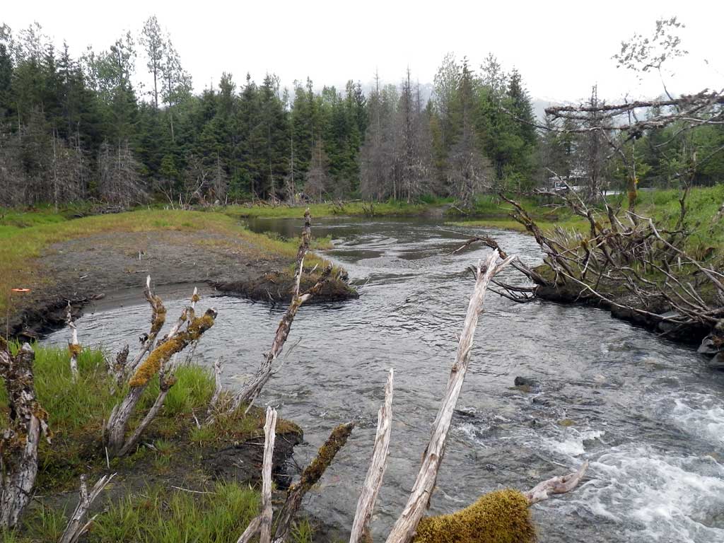
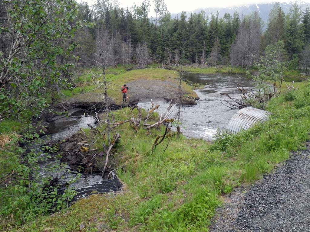
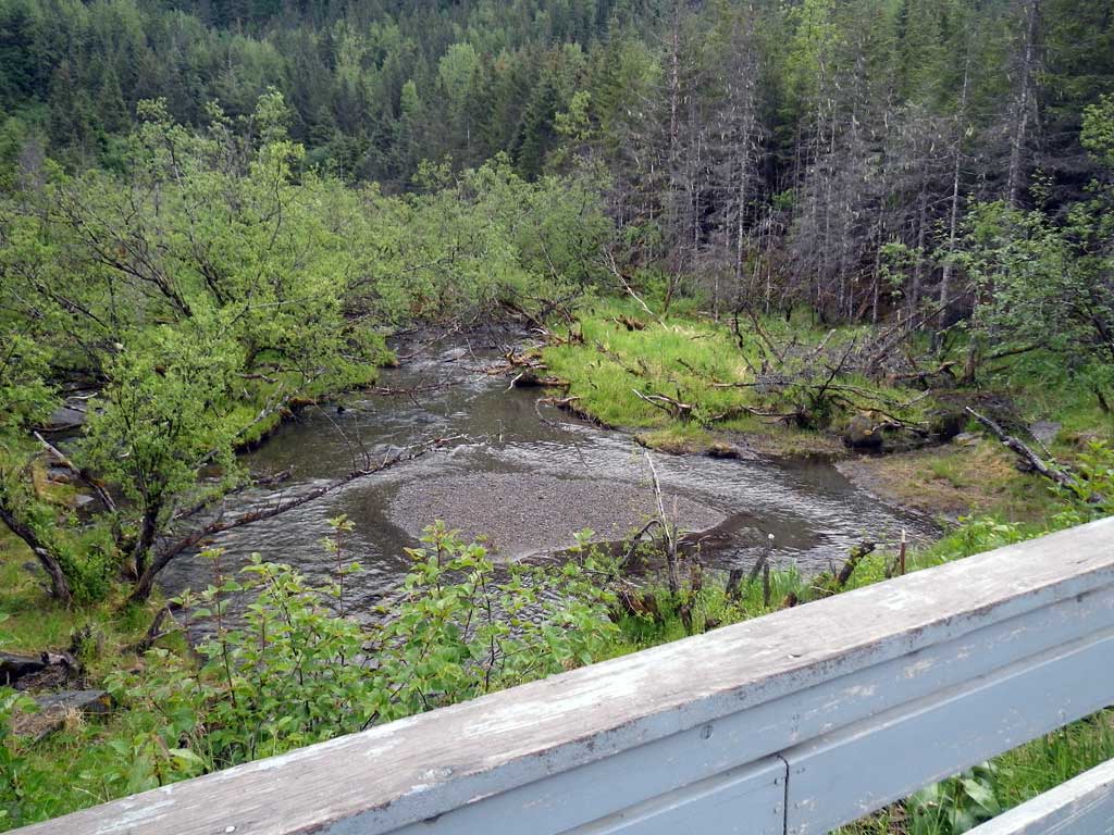
Comments: No fish data recorded, no traps set as stream is already in the AWC. Stream begins to braid quickly upstream after end of pipe so downstream widths were used. Old beaver activity in area. Majority of flow is through C2.
Culvert Measurements
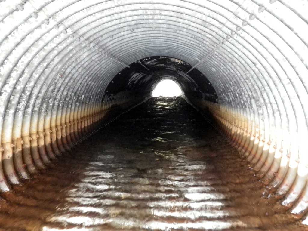
| ID: 1 | Structure Type: Pipe-arch (Structural steel plate) | Fish Passage Rating: | |||||||||||||||||||||||||||||||||||||||||
|
|
|
|||||||||||||||||||||||||||||||||||||||||
Comments: Total length of pipe is 93.3 with the inlet miter length measuring 9.1 and the outlet measuring 9.2. Pipe gradient determined with the invert at the end of the enclosed section of pipe. |
|||||||||||||||||||||||||||||||||||||||||||
Culvert Observations:
|
|||||||||||||||||||||||||||||||||||||||||||
| ID: 2 | Structure Type: Pipe-arch (Structural steel plate) | Fish Passage Rating: | |||||||||||||||||||||||||||||||||||||||||
|
|
|
|||||||||||||||||||||||||||||||||||||||||
Comments: Total length of pipe is 91.2 with the inlet miter measuring 15.2'. Pipe gradient determined with invert at the end of the enclosed section of pipe. |
|||||||||||||||||||||||||||||||||||||||||||
Culvert Observations:
|
|||||||||||||||||||||||||||||||||||||||||||
Stream Measurements
|
|
| Stream Width Type | Distance From Crossing (ft) |
Stream Width (ft) |
|---|---|---|
| Downstream ordinary high water | 222.0 | 15.90 |
| Downstream ordinary high water | 309.0 | 16.80 |
| Downstream ordinary high water | 391.0 | 18.50 |
Elevations
| Locator ID | Culvert Number |
River Distance (ft)1 |
Distance From Crossing (ft)2 |
Relative Elevation (ft) |
|---|---|---|---|---|
| Road Elev | 97.52 | |||
| D/S Grade Ctrl (Thalweg) | 0.00 | 84.83 | ||
| D/S Water Surface Elev | 0.00 | 86.56 | ||
| D/S Grade Ctrl (Thalweg) | 156.00 | 85.00 | ||
| D/S Water Surface Elev | 156.00 | 86.89 | ||
| D/S Tailcrest or 1st Thalweg (C2, Tailwater control) | 2 | 193.00 | 86.66 | |
| Max Pool Depth (C2) | 2 | 196.00 | 85.87 | |
| Outlet Culvert Top (C2 Invert out TOP on metal) | 2 | 198.00 | 93.49 | |
| D/S Grade Ctrl (Thalweg) (C1) | 1 | 199.00 | 86.58 | |
| D/S Water Surface Elev (C1) | 1 | 199.00 | 87.13 | |
| Outlet Pool Water Elev (C2, Invert out water surface of pool below pipe) | 2 | 199.10 | 87.21 | |
| Outlet Invert (C2, Invert out BOP on metal) | 2 | 199.10 | 87.45 | |
| D/S Water Surface Elev (C2, Invert out) | 2 | 199.10 | 87.97 | |
| D/S Water Surface Elev (C1, Invert out, BOP on metal) | 1 | 244.00 | 88.27 | |
| Outlet Invert (C1, Invert out, BOP on metal) | 1 | 244.00 | 87.96 | |
| Misc. (C1, Invert out top of miter) | 1 | 253.20 | 93.80 | |
| Misc. (C2, Invert in top of miter) | 2 | 274.00 | 94.13 | |
| Inlet Thalweg (C2, Invert in on substrate) | 2 | 289.20 | 88.44 | |
| U/S Water Surface Elev (C2, Invert in) | 2 | 289.20 | 89.63 | |
| U/S Thalweg (C2, Invert in) | 2 | 292.20 | 88.72 | |
| U/S Headwater (C2, Headwater surface, Invert in) | 2 | 292.20 | 89.79 | |
| Misc. (C1, Invert in top of miter) | 1 | 328.20 | 95.03 | |
| U/S Water Surface Elev (C1, Invert in) | 1 | 337.30 | 89.78 | |
| Inlet Culvert Invert (C1, Invert in BOP on metal) | 1 | 337.30 | 89.36 | |
| U/S Headwater (C1, Headwater surface, Invert in) | 1 | 338.30 | 89.78 | |
| U/S Thalweg (C1, Invert in) | 1 | 338.30 | 89.33 |
Notes:
- River distance is measured continuously throughout the survey reach along the thalweg of the stream.
- Measured from each end of the crossing along the thalweg of the stream.
Fish Sampling Efforts
| Gear Type: None (A) | ||
| Comments: No traps set no fish observed. | ||
Fish Observations
No fish observations occurred during this survey.
Photos
Questions or comments about this report can be directed to dfg.dsf.webmaster@alaska.gov