Fish Passage Site 10302163
Coordinates (dec. deg.): 58.35802°, -134.52301°
Legal Description: C040S066E33
Region: Southeast
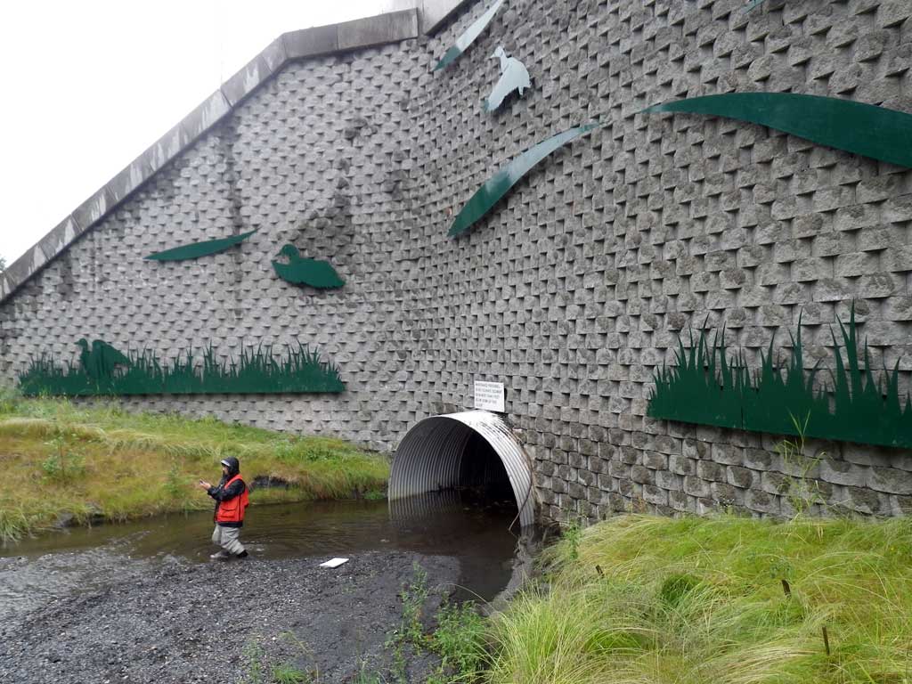
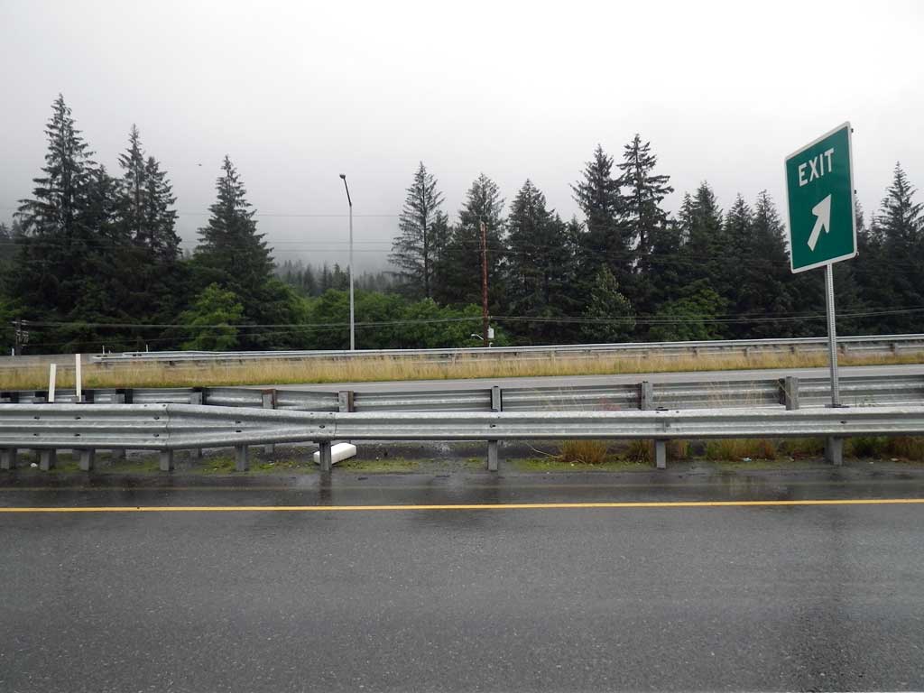
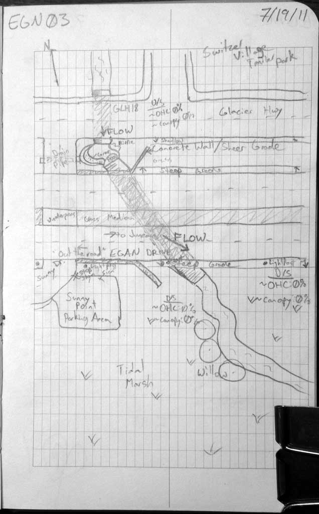
Road Name: Egan Drive
Datum: NAD83
Quad Name / ITM: Juneau B-2
AWC Stream #:
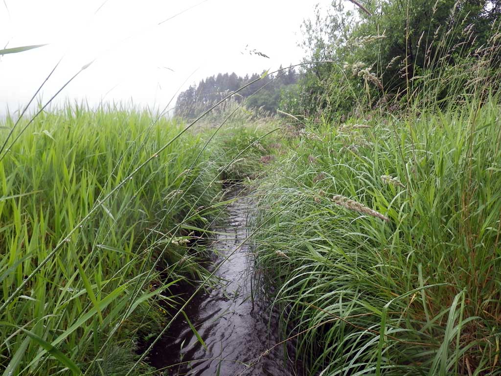
Stream Name: West Creek
Elevation:
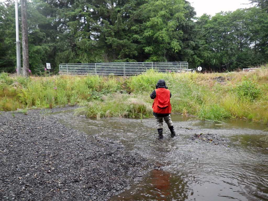
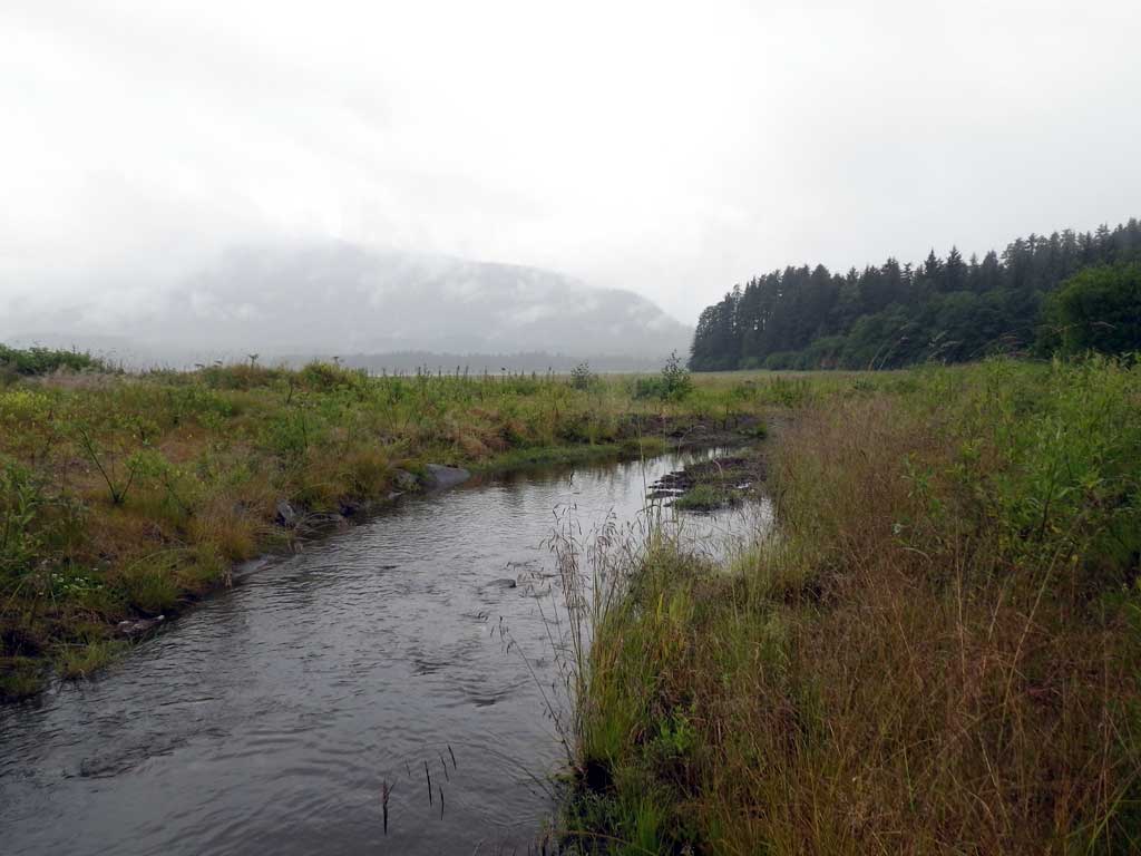
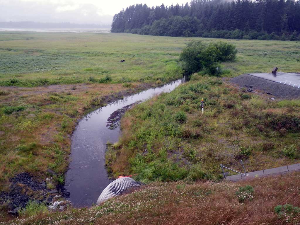
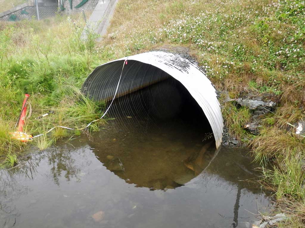
Site Comments: No traps were set as creek is already in the AWC. Juvenile salmonids observed upstream and downstream of pipe. 15 feet upstream of invert in stream channel becomes a ditch drain system through another culvert under Glacier Highway with a large degree of mechanical influence and downstream quickly becomes a tidal marsh making it impossible to get a stream gradient, however downstream stream widths were taken to aproximate a mean channel width in the marsh.
Survey SEA11-EGN03
Project Supervisor: Gillian O'Doherty, Alaska Department of Fish and Game
— Anchorage, AK
Observers: Jason Olds, Charmagne Gutierrez
Overall Fish Passage Rating:
Tidal: Yes
Backwatered: No
Step Pools: No
Construction Year:
Site Observations:
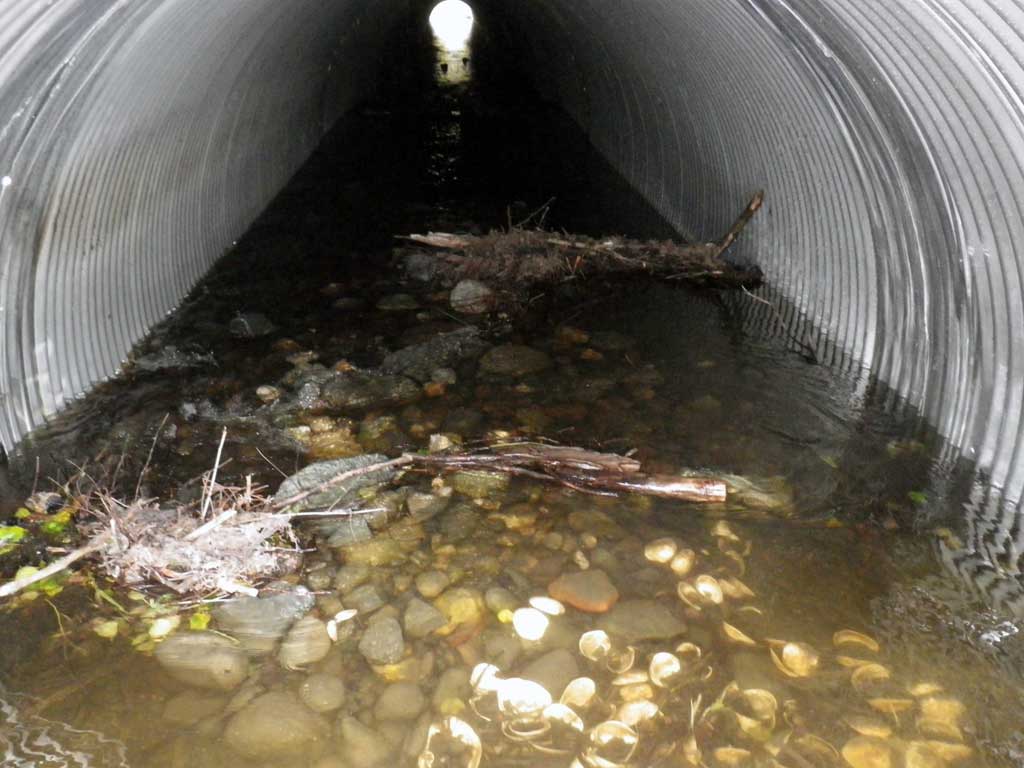
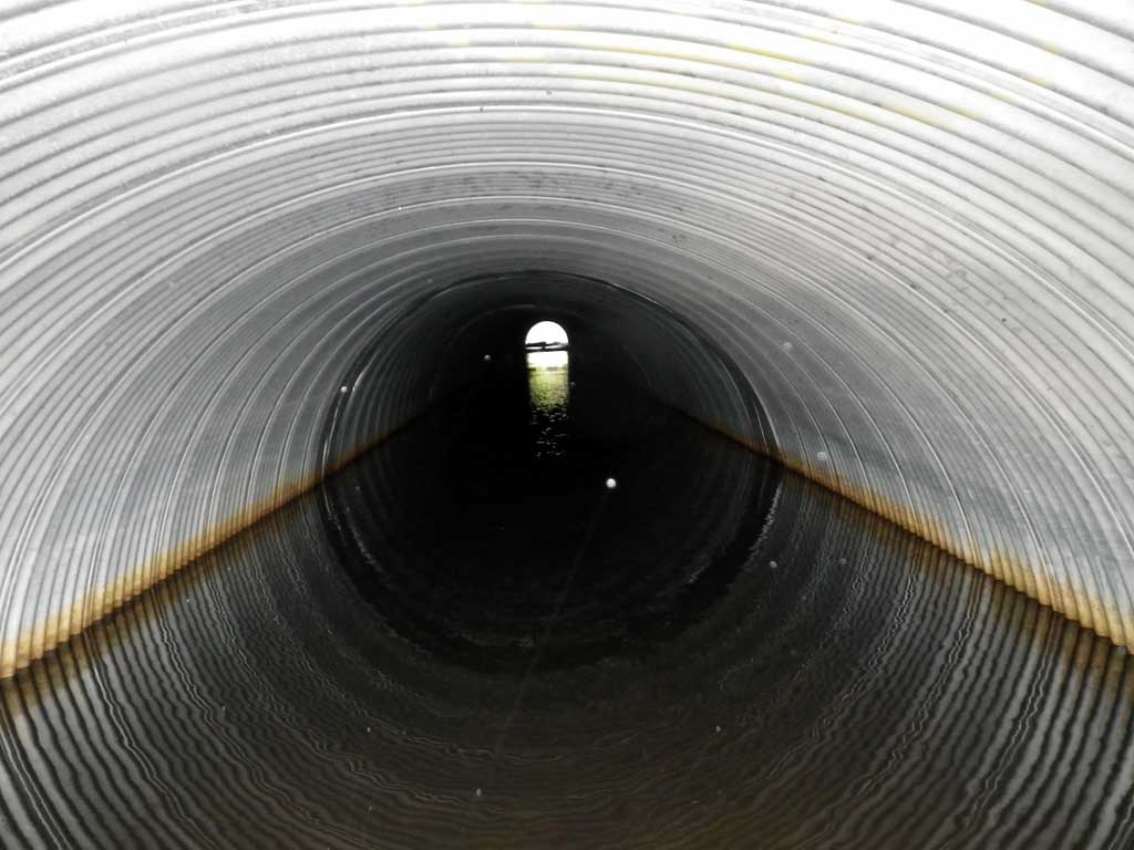
- Compound gradient in pipe
Comments: None
Culvert Measurements
| ID: 1 | Structure Type: Circular pipe (Corrugated aluminum) | Fish Passage Rating: | ||||||||||||||||||||||||||||||||||||||||||
|
|
|
||||||||||||||||||||||||||||||||||||||||||
Culvert Observations:
|
||||||||||||||||||||||||||||||||||||||||||||
Stream Measurements
|
|
| Stream Width Type | Distance From Crossing (ft) |
Stream Width (ft) |
|---|---|---|
| Downstream ordinary high water | 166.0 | 3.90 |
| Downstream ordinary high water | 191.0 | 6.10 |
| Downstream ordinary high water | 243.0 | 4.80 |
Elevations
| Locator ID | Culvert Number |
River Distance (ft)1 |
Distance From Crossing (ft)2 |
Relative Elevation (ft) |
|---|---|---|---|---|
| D/S Tailcrest or 1st Thalweg | 0.00 | 93.69 | ||
| D/S Water Surface Elev | 0.00 | 94.03 | ||
| Outlet Pool Water Elev | 9.00 | 94.05 | ||
| Max Pool Depth | 9.00 | 93.13 | ||
| Outlet Thalweg (Invert out, on substrate) | 15.00 | 93.33 | ||
| D/S Water Surface Elev (Invert out) | 15.00 | 94.05 | ||
| Outlet Culvert Top (Invert out, on metal) | 15.00 | 98.13 | ||
| U/S Grade Ctrl (Thalweg) (Inside pipe, max grade point, end of step riffle) | 224.00 | 94.13 | ||
| U/S Water Surface Elev (Inside pipe) | 224.00 | 94.48 | ||
| U/S Grade Ctrl (Thalweg) (Inside pipe, max grade point, top of riffle) | 233.00 | 94.90 | ||
| U/S Water Surface Elev (Inside pipe) | 233.00 | 95.33 | ||
| U/S Headwater (Invert in, 1st resting) | 239.00 | 95.34 | ||
| Inlet Thalweg (Invert in, on substrate) | 239.00 | 94.65 | ||
| Inlet Culvert Top (Invert in, on metal) | 239.00 | 99.38 |
Notes:
- River distance is measured continuously throughout the survey reach along the thalweg of the stream.
- Measured from each end of the crossing along the thalweg of the stream.
Fish Sampling Efforts
| Gear Type: Visual Observation, Ground (A) | Trap Duration(h): 30.0 | |
| Channel Type: Main Channel (>50% of water flow) | ||
| Comments: Visual observation | ||
| Gear Type: Visual Observation, Ground (B) | Trap Duration(h): 30.0 | |
| Channel Type: Main Channel (>50% of water flow) | ||
| Comments: Visual observation | ||
Fish Observations
| Species: juvenile salmonid-unspecified | Life History: Unknown | ||
| Total Fish Observed: 0 | Fish Measured: 0 | Fork Lengths (mm) Min: Max: Mean: | |
| Collected/Observed by Gear Type: Downstream Visual Observation, Ground (0) Upstream Visual Observation, Ground (0) | |||
Photos
Questions or comments about this report can be directed to dfg.dsf.webmaster@alaska.gov