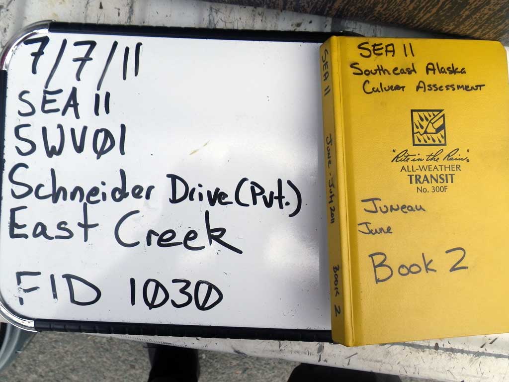
Fish Passage Site 10302161
Coordinates (dec. deg.): 58.36118°, -134.51860°
Legal Description: C040S066E33
Region: Southeast
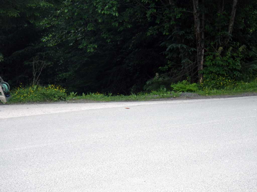
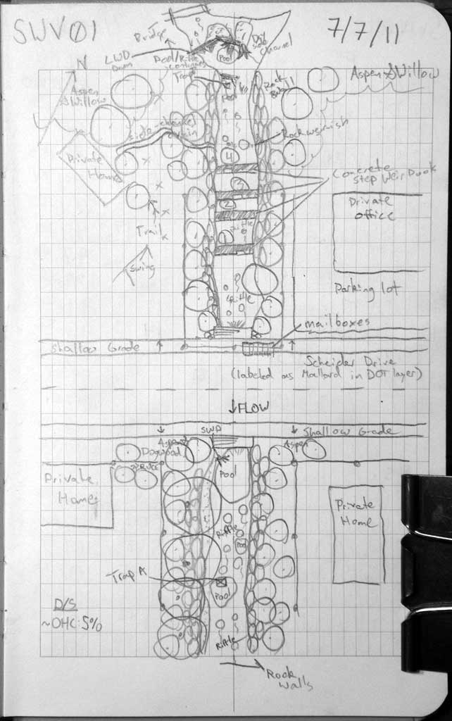
Road Name: Schinder Drive
Datum: NAD83
Quad Name / ITM: Juneau B-2
AWC Stream #:
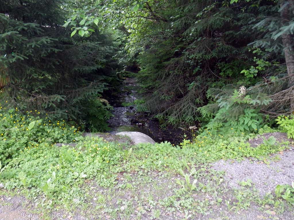
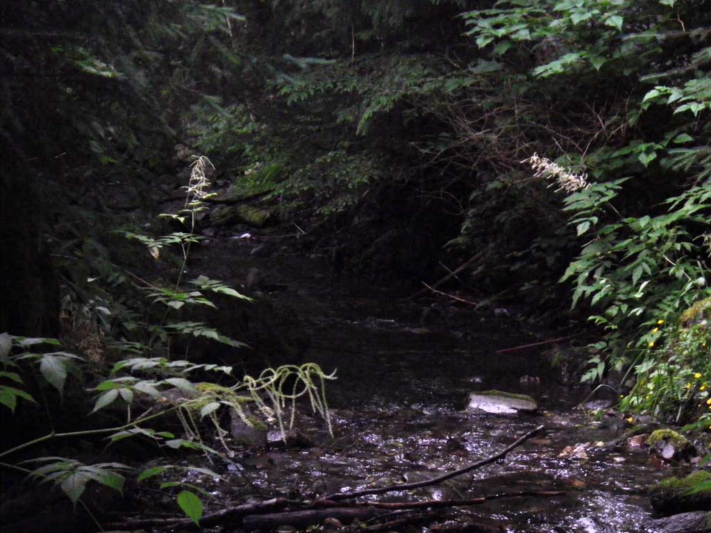
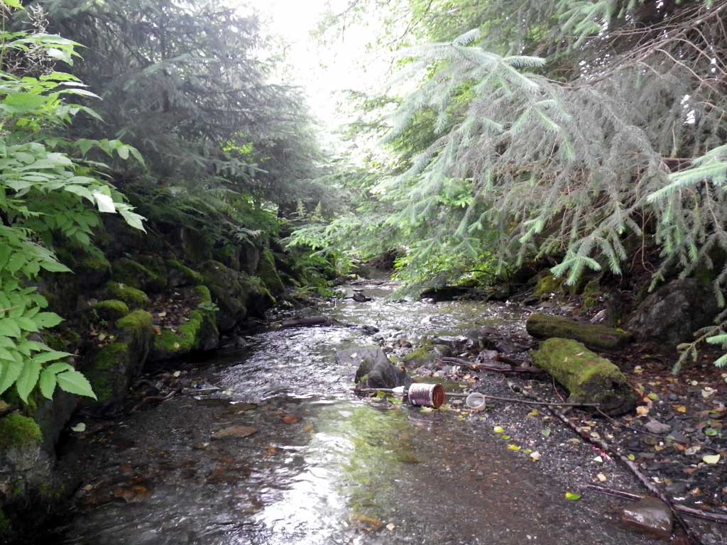
Stream Name: East Creek
Elevation:
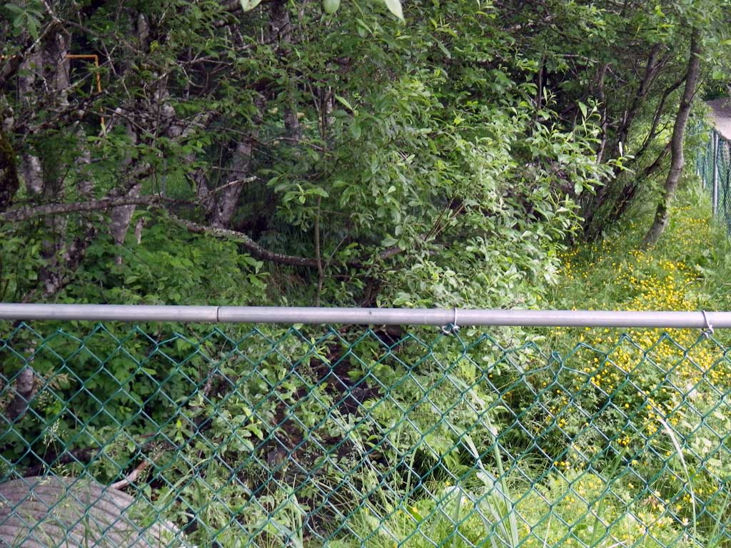
Site Comments: Located in Switzer Village. Road mapped as Mallard but is really Schneider.
Survey SEA11-SWV01
Project Supervisor: Gillian O'Doherty, Alaska Department of Fish and Game
— Anchorage, AK
Observers: Jason Olds, Charmagne Gutierrez, Gillian O'Doherty
Overall Fish Passage Rating:
Tidal: No
Backwatered: No
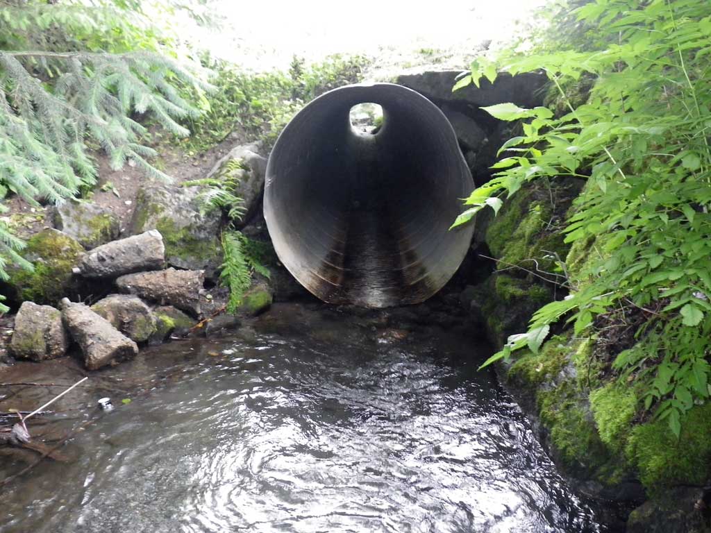
Step Pools: Yes
Construction Year:
Site Observations:
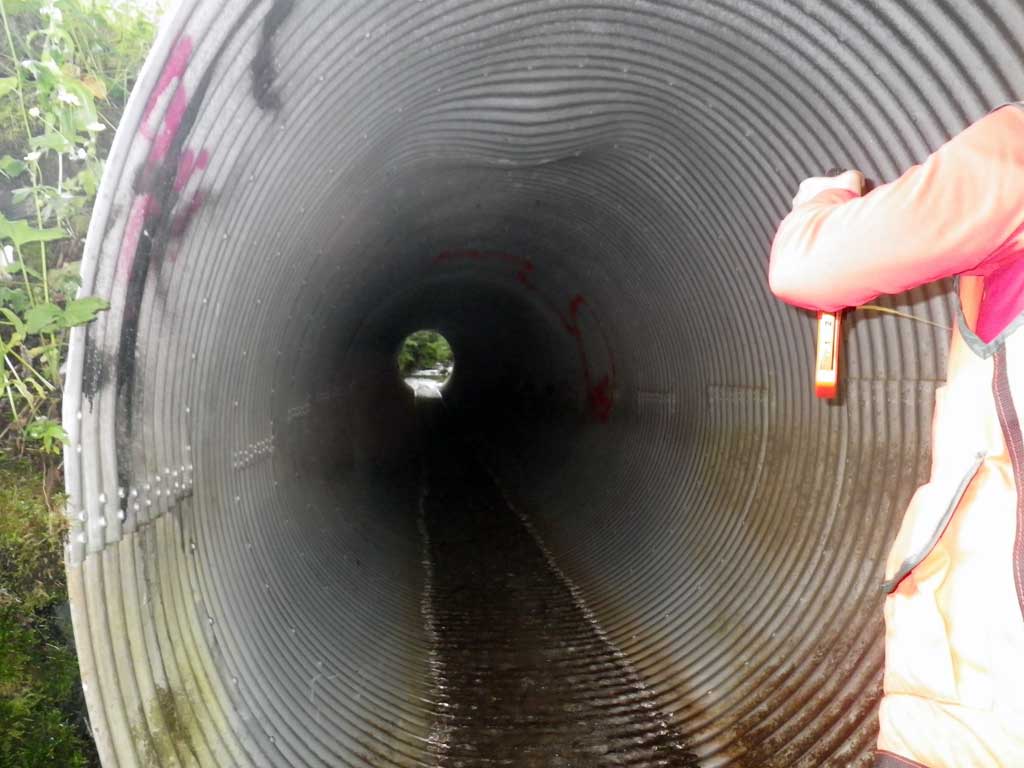
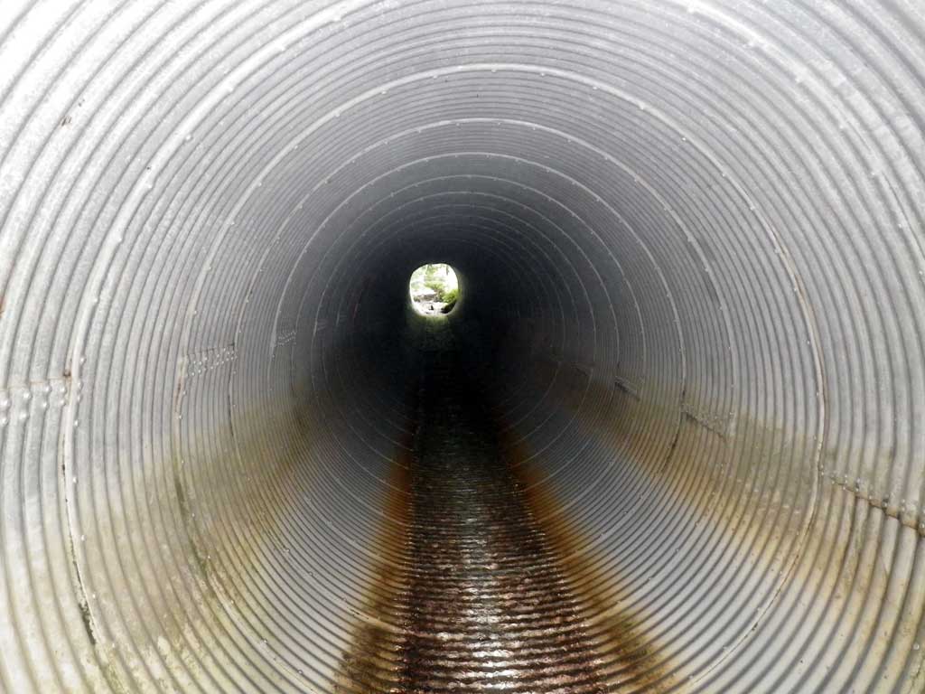
- Culvert gradient red
- Constriction ratio gray
- Inlet perch
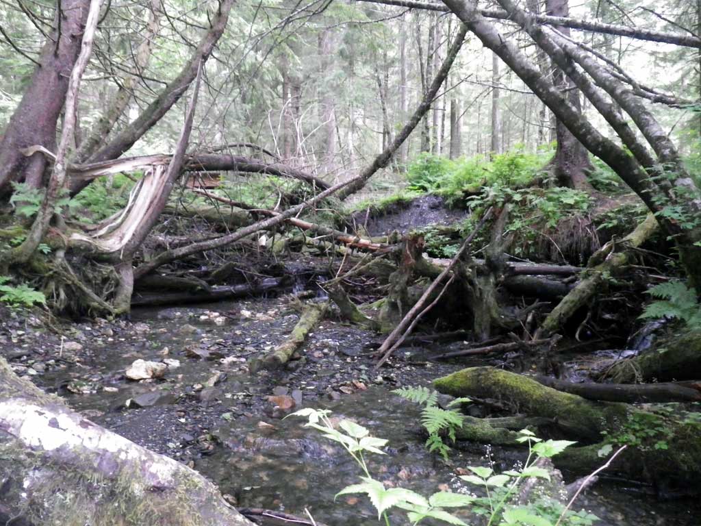
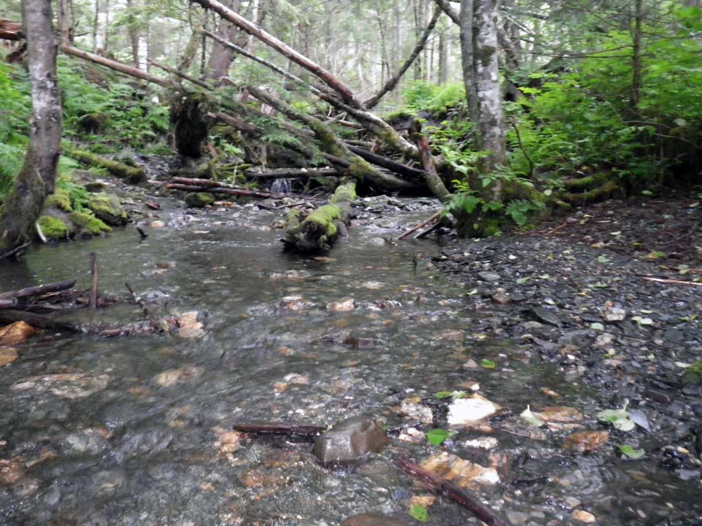
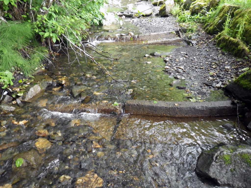
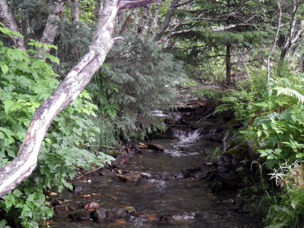
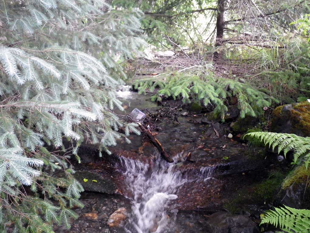
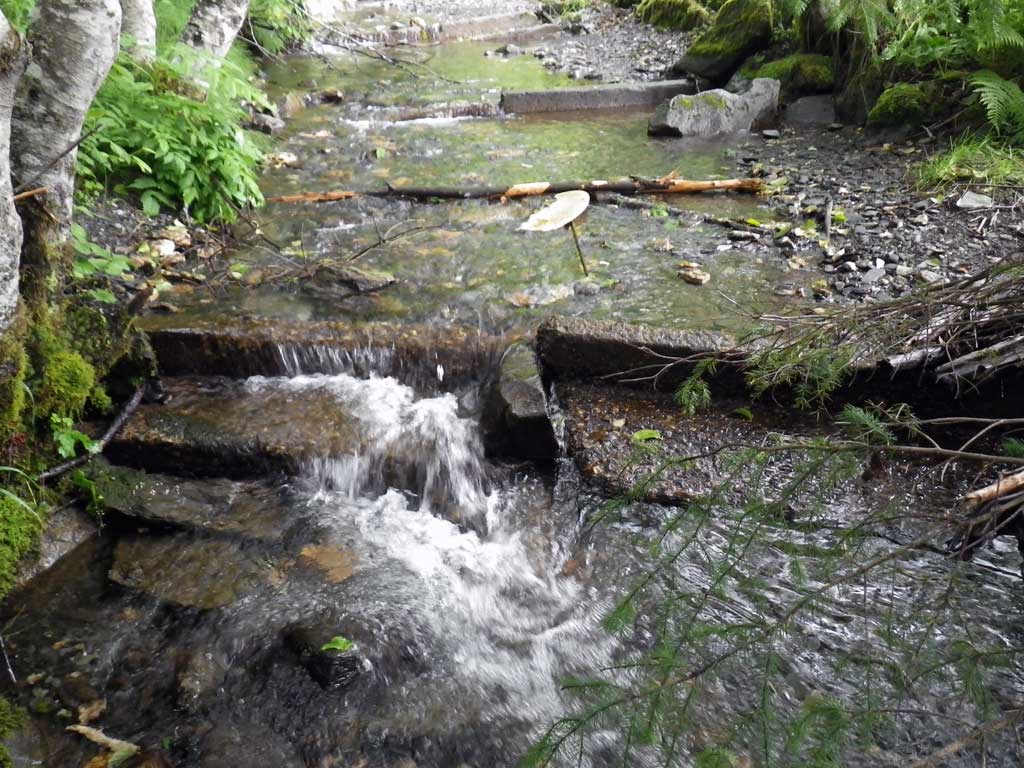
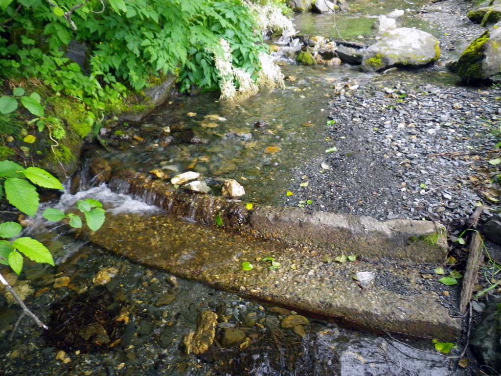
Comments: Concrete wiers old but functional. Structured stream with rock walls/Boulders. Fish pools upstream 100'. *Highly mechanically influenced; stream channeled and urbanized US/DS. Braids US @ 200'
Culvert Measurements
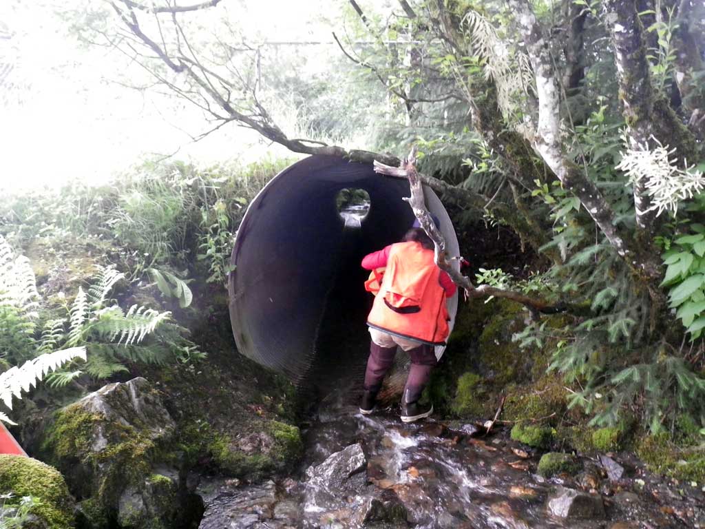
| ID: 1 | Structure Type: Oval (Structural aluminum plate) | Fish Passage Rating: | |||||||||||||||||||||||||||||||||||||||||
|
|
|
|||||||||||||||||||||||||||||||||||||||||
Culvert Observations:
|
|||||||||||||||||||||||||||||||||||||||||||
Stream Measurements
|
|
| Stream Width Type | Distance From Crossing (ft) |
Stream Width (ft) |
|---|---|---|
| Upstream ordinary high water | 60.0 | 10.80 |
| Upstream ordinary high water | 80.0 | 10.20 |
| Upstream ordinary high water | 100.0 | 11.20 |
Elevations
| Locator ID | Culvert Number |
River Distance (ft)1 |
Distance From Crossing (ft)2 |
Relative Elevation (ft) |
|---|---|---|---|---|
| D/S Water Surface Elev | 0.00 | 94.64 | ||
| D/S Grade Ctrl (Thalweg) | 0.00 | 94.50 | ||
| D/S Tailcrest or 1st Thalweg | 10.00 | 94.50 | ||
| D/S Water Surface Elev | 10.00 | 94.82 | ||
| Max Pool Depth | 22.50 | 93.53 | ||
| Outlet Invert (on metal) | 28.00 | 94.53 | ||
| D/S Water Surface Elev (tail water surface) | 28.00 | 94.84 | ||
| D/S Water Surface Elev (turbulant) | 28.00 | 94.91 | ||
| Inlet Culvert Invert (on metal) | 113.00 | 99.05 | ||
| U/S Water Surface Elev | 113.00 | 99.24 | ||
| Inlet Culvert Top | 113.00 | 105.56 | ||
| U/S Headwater | 114.50 | 99.62 | ||
| U/S Thalweg (just below weir 1) | 151.00 | 101.00 | ||
| U/S Water Surface Elev (turbulent) | 151.00 | 101.41 | ||
| U/S Grade Ctrl (Thalweg) (on concrete weir 1) | 152.00 | 101.78 | ||
| U/S Water Surface Elev | 152.00 | 102.06 | ||
| U/S Grade Ctrl (Thalweg) (on concrete weir 2) | 165.00 | 102.73 | ||
| U/S Water Surface Elev | 165.00 | 102.98 | ||
| U/S Grade Ctrl (Thalweg) (on concrete weir 3) | 175.50 | 103.11 | ||
| U/S Water Surface Elev | 175.50 | 103.34 | ||
| U/S Grade Ctrl (Thalweg) (on concrete weir 4) | 187.00 | 103.48 | ||
| U/S Water Surface Elev | 187.00 | 103.85 | ||
| U/S Grade Ctrl (Thalweg) (natural grade point) | 227.00 | 104.93 | ||
| U/S Water Surface Elev | 227.00 | 105.11 |
Notes:
- River distance is measured continuously throughout the survey reach along the thalweg of the stream.
- Measured from each end of the crossing along the thalweg of the stream.
Fish Sampling Efforts
| Gear Type: Minnow Trap (A) | Trap Duration(h): 2.8 | |
| Channel Type: Main Channel (>50% of water flow) | ||
| Gear Type: Minnow Trap (B) | Trap Duration(h): 2.8 | |
Fish Observations
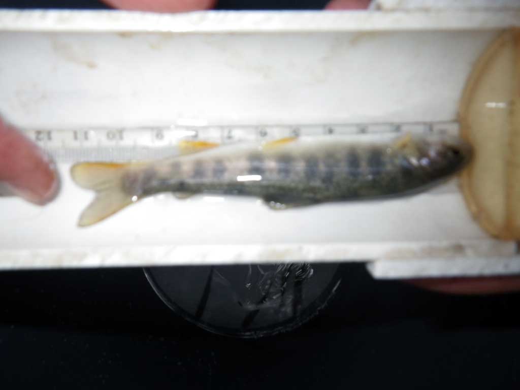
| Species: Dolly Varden | Life History: Unknown | ||
| Total Fish Observed: 13 | Fish Measured: 13 | Fork Lengths (mm) Min: 90 Max: 1050 Mean: 670 | |
| Collected/Observed by Gear Type: Upstream Minnow Trap (11) Downstream Minnow Trap (2) | |||
Photos
Questions or comments about this report can be directed to dfg.dsf.webmaster@alaska.gov