Fish Passage Site 30103677
Coordinates (dec. deg.): 51.89110°, -176.62581°
Legal Description: S096S195W01
Region: Southwest
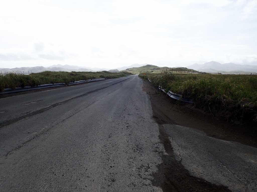
Road Name: Bayshore Highway
Datum: NAD83
Quad Name / ITM: Adak C-2
AWC Stream #: 306-70-10180
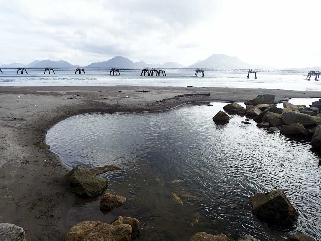
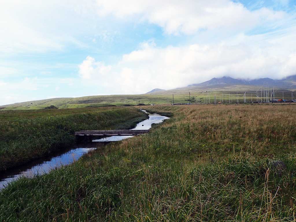
Stream Name: Airport Creek
Elevation:
Site Comments: None
Survey ADAK17-C78
Observers: Mark Eisenman, Jeanette Alas
Overall Fish Passage Rating:
Tidal: Yes
Backwatered: No
Step Pools: No
Construction Year:
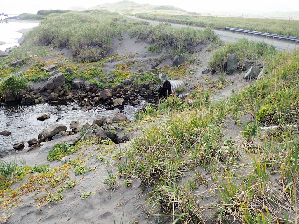
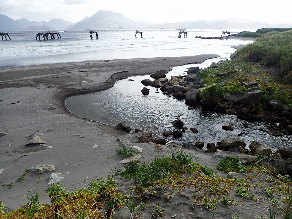
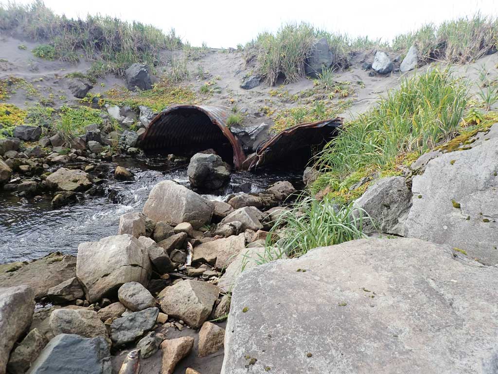
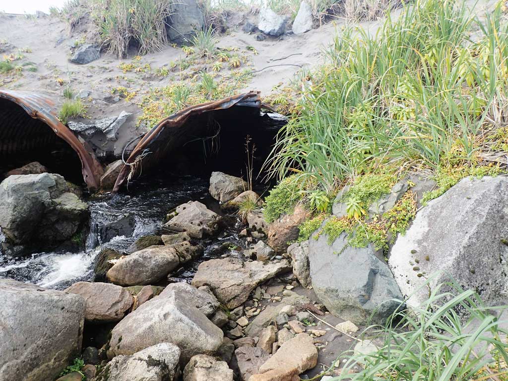
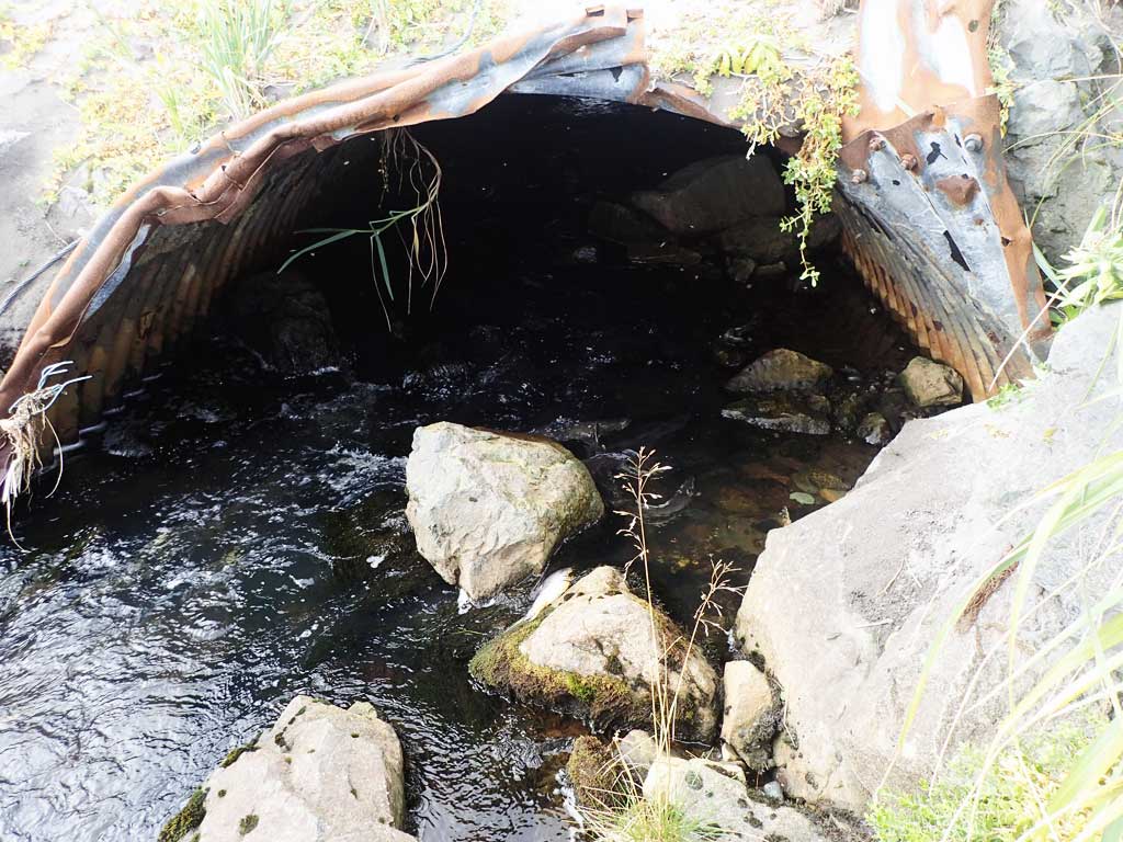
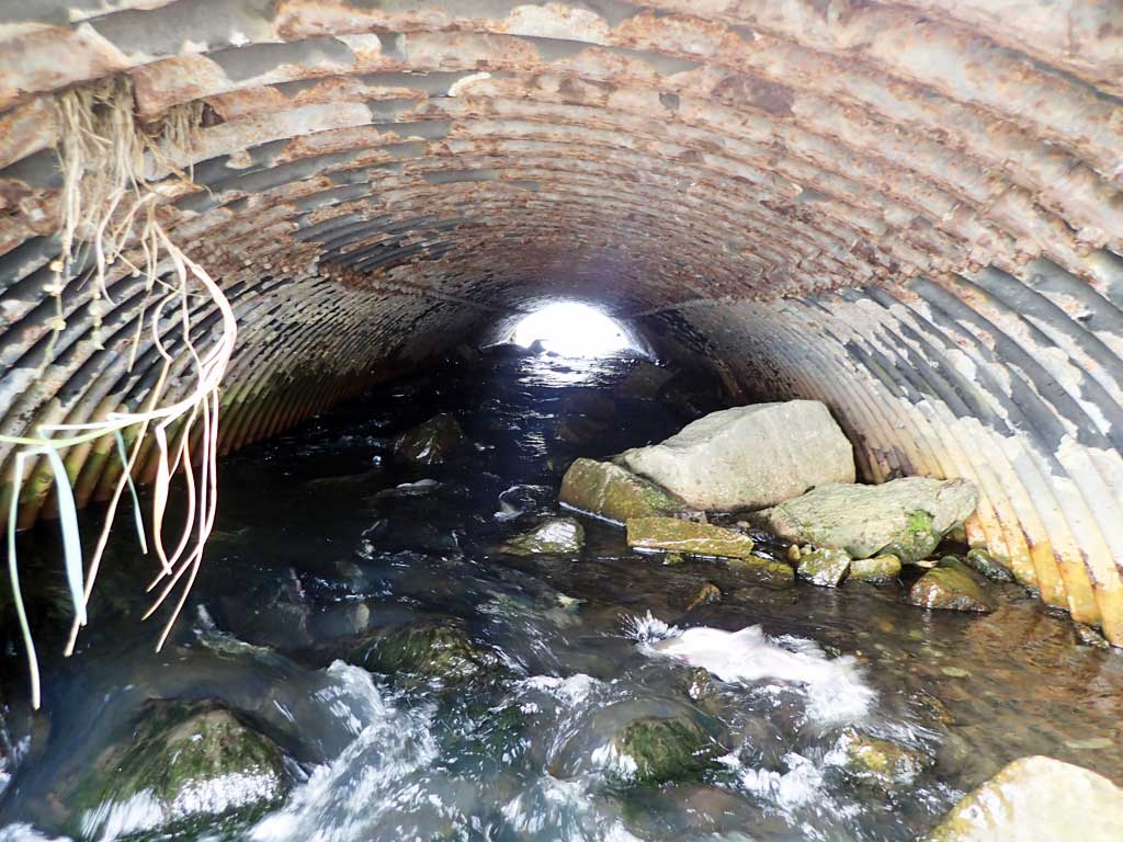
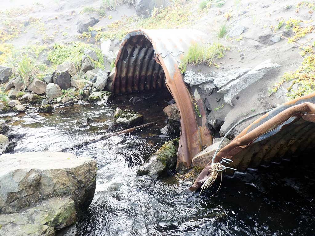
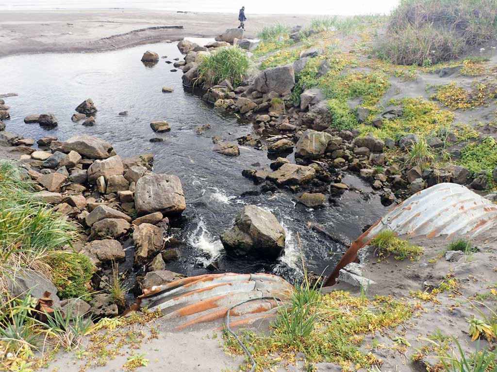
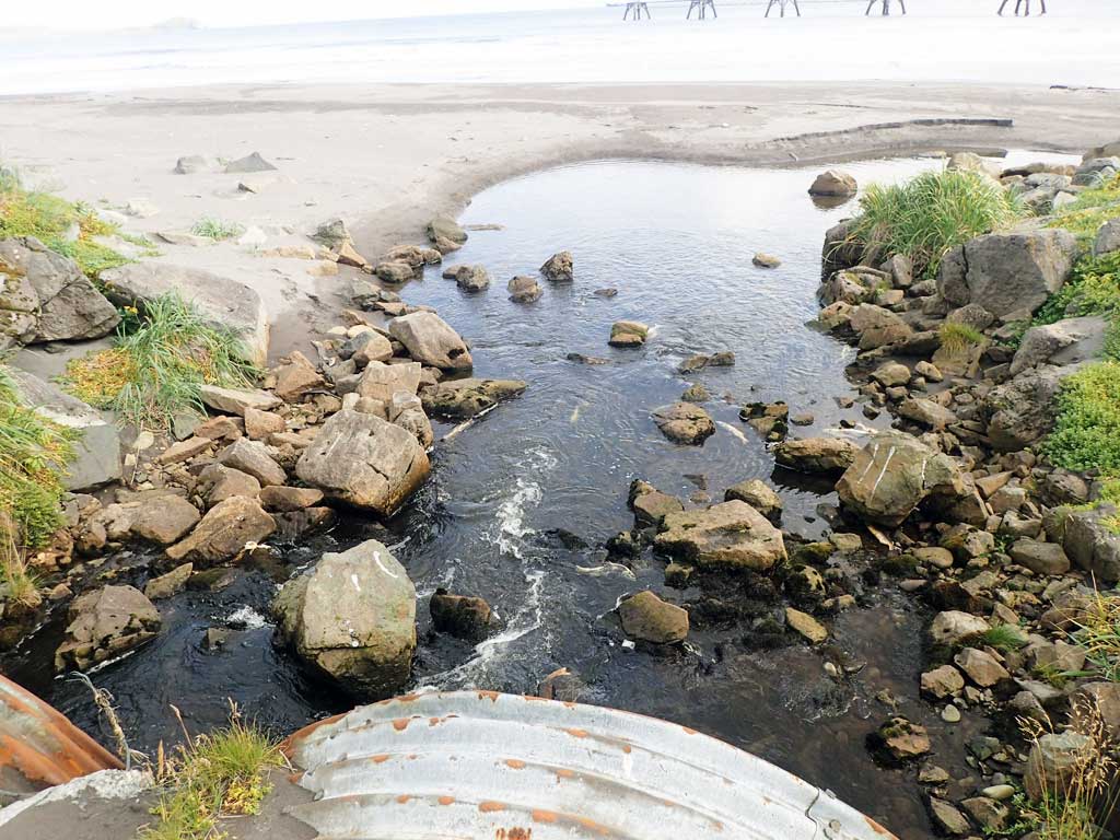
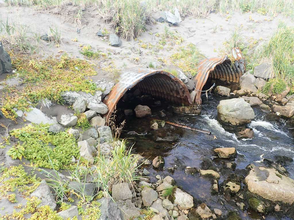
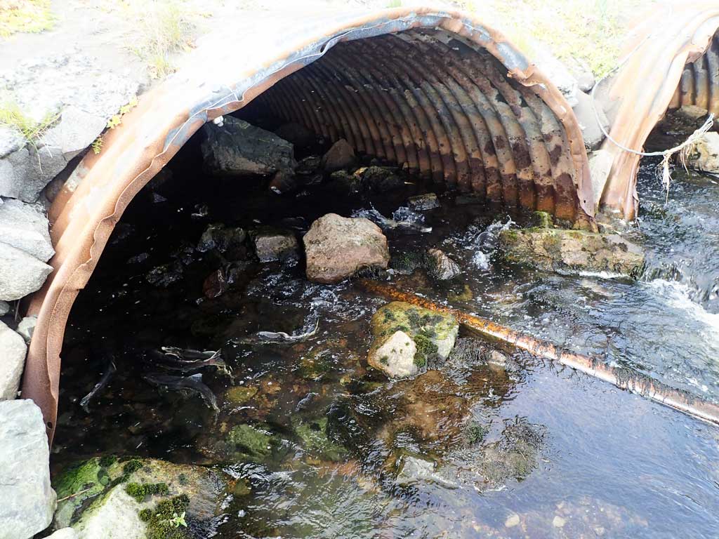
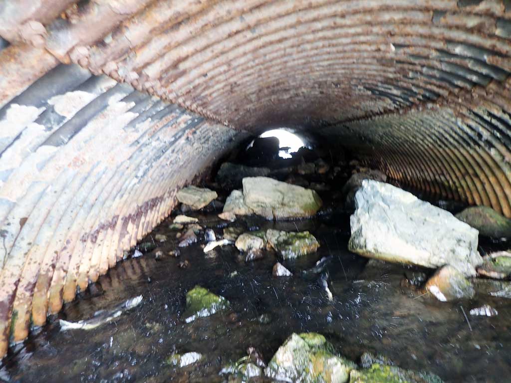
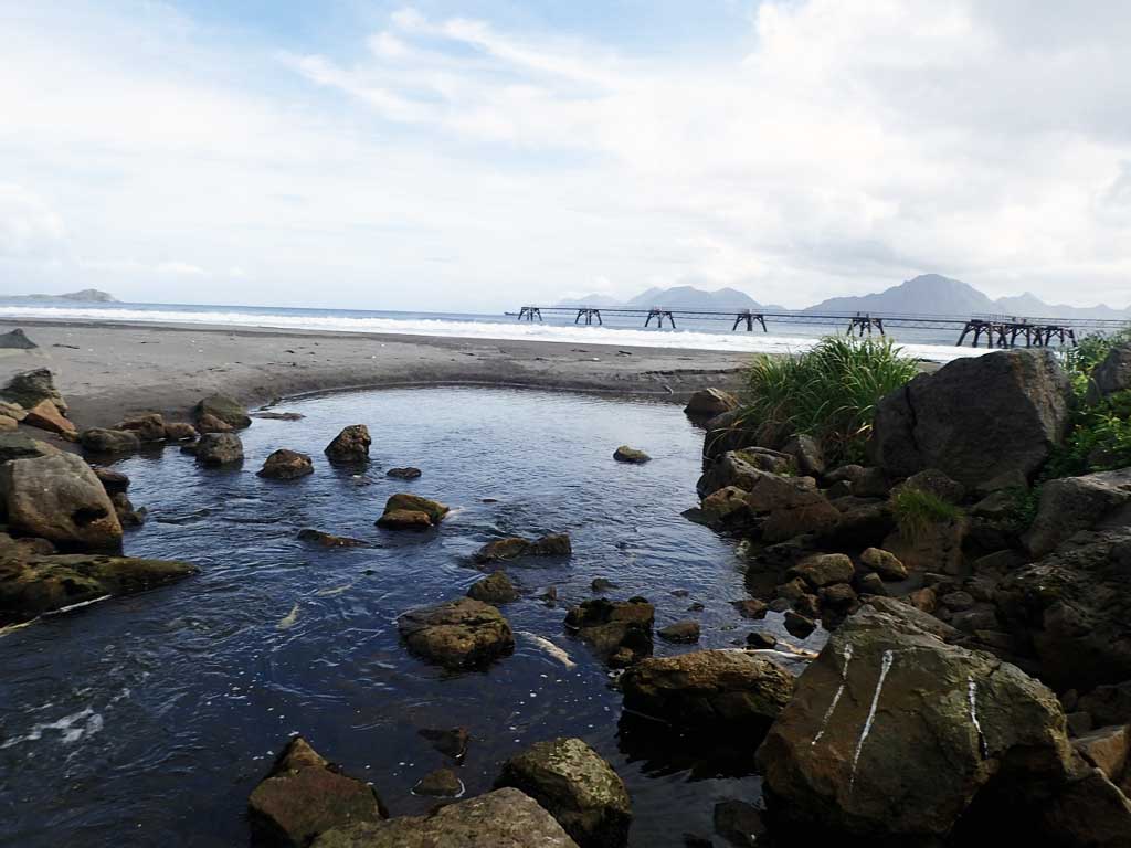
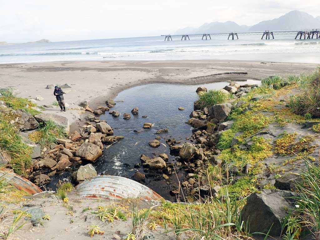
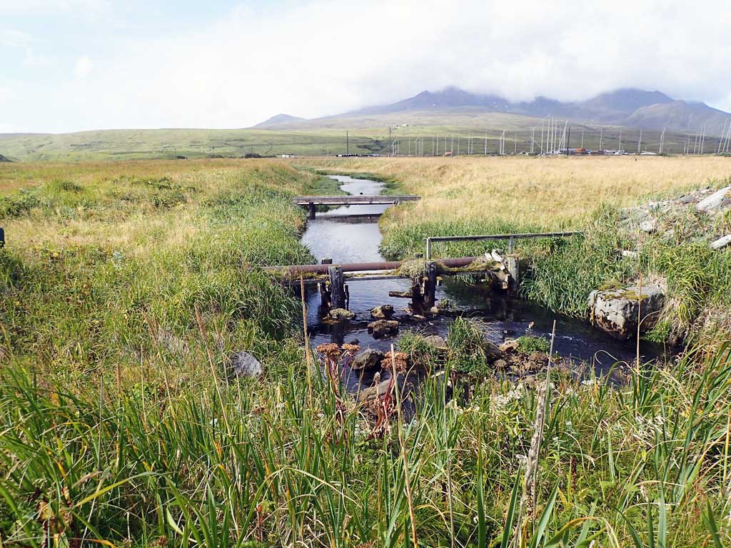
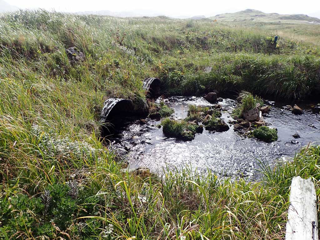
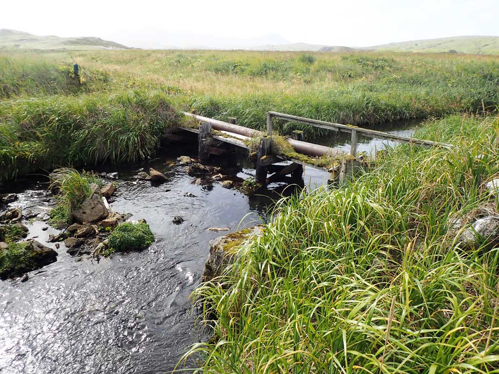
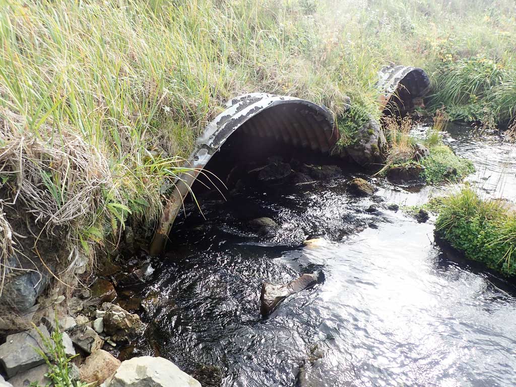
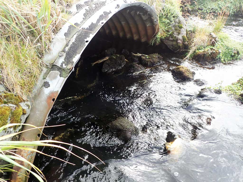
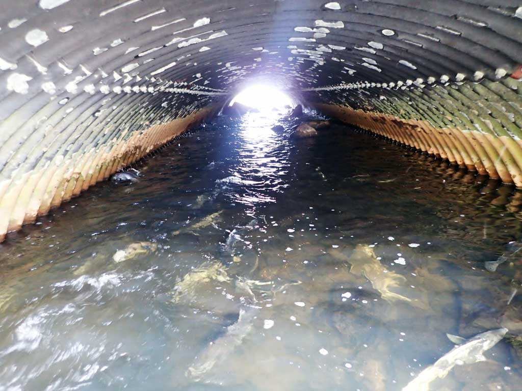
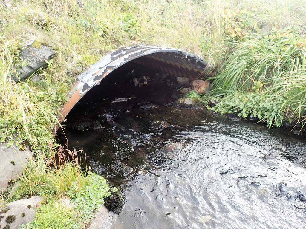
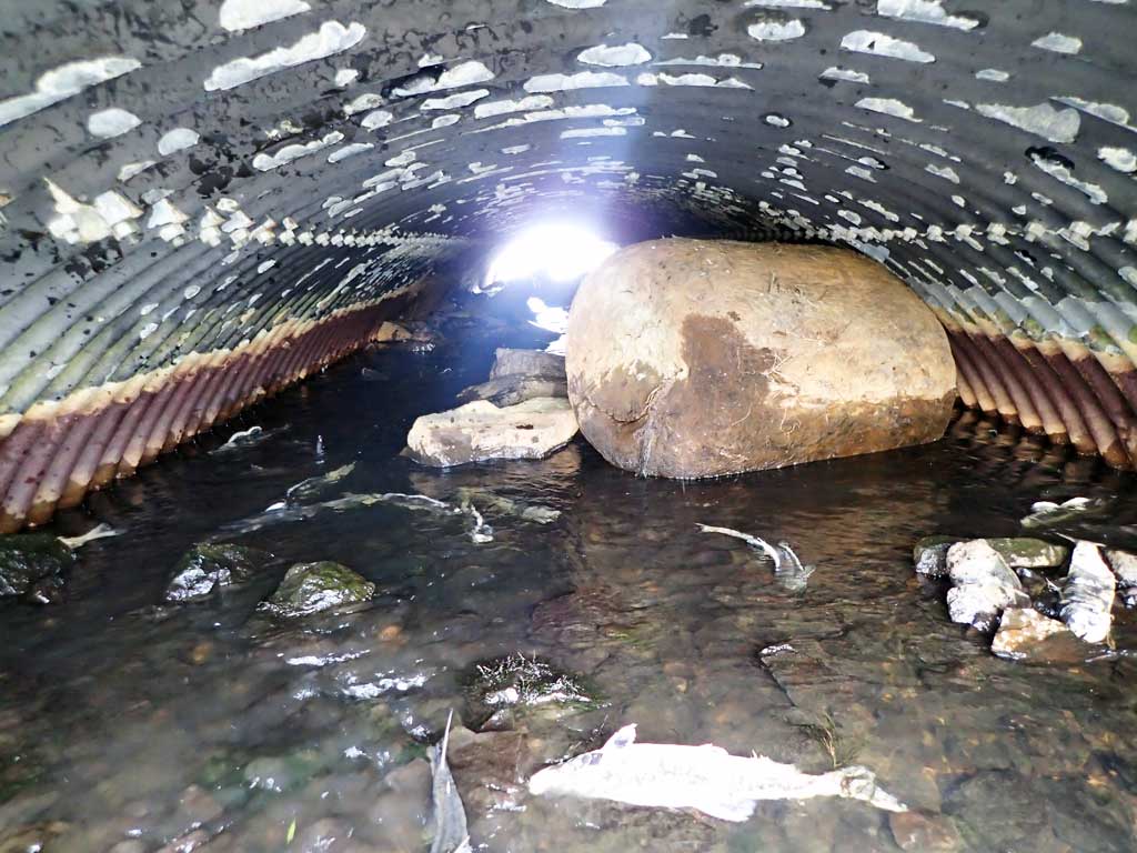
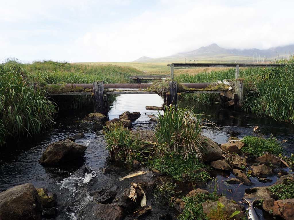
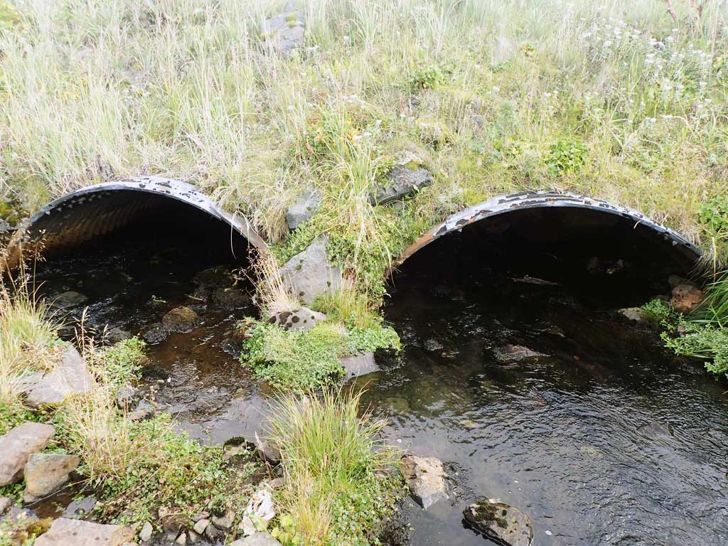
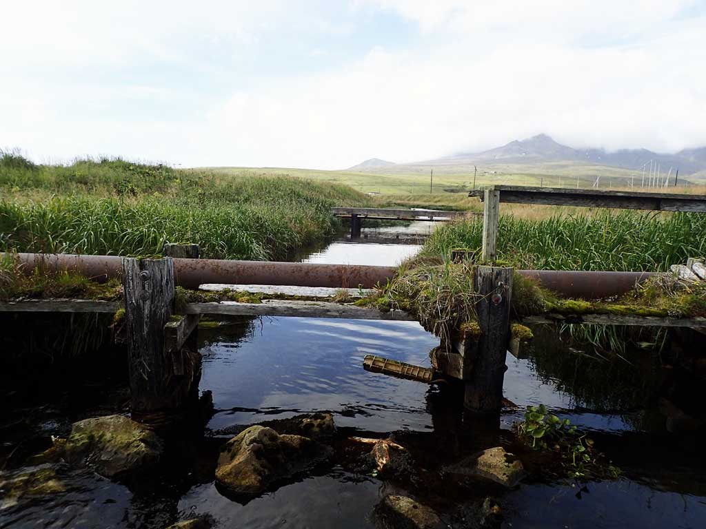
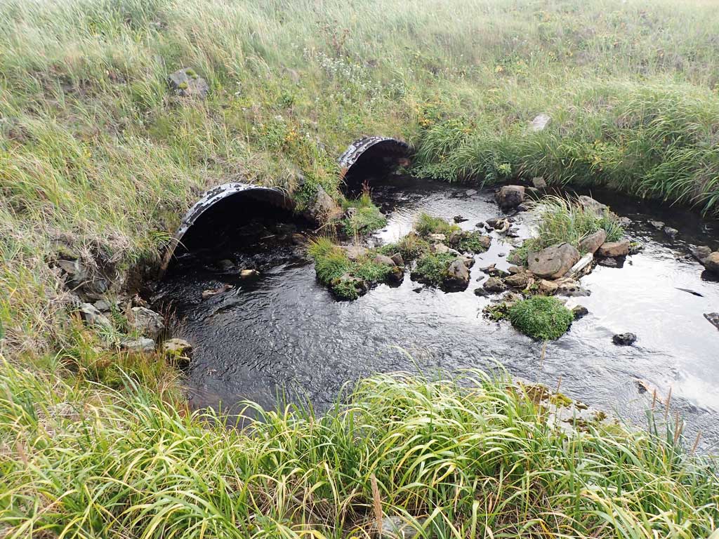
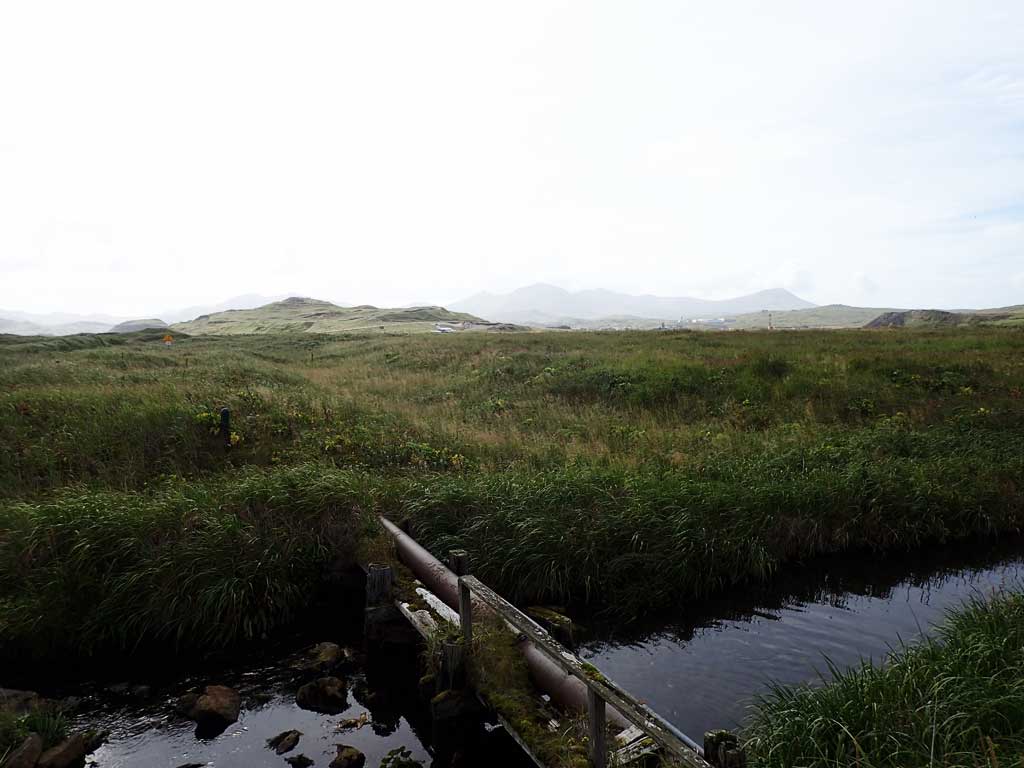
Comments: This information was gathered as part of the joint reconnaissance level project between the ADF&G Habitat Division and the Fish Passage Assessment Project on Adak Island. Due to time constraints full site assessments were not conducted, but base line information was collected. Large amount of substrate inside culvert, uanble to identify culvert type, likely circular, pipe arch, or open bottom arch. Airport creek empties out into Kuluk Bay directly downstream. Adult pink salmon observed upstream and downstream of culvert.
Culvert Measurements
| ID: 1 | Structure Type:N/A (Structural steel plate) | Fish Passage Rating: | |||||||||||||||||||||||||||||||||||||||||
|
|
|
|||||||||||||||||||||||||||||||||||||||||
Comments: Lots of large substrate inside barrel. Unable to really tell what type of culvert is here. Could be circular, PA or AO. Culvert is in tidal zone and shows significant signs of deterioration. Culvert length estimated using aerial imagery. Inlet and outlet damaged. |
|||||||||||||||||||||||||||||||||||||||||||
| ID: 2 | Structure Type:N/A (Structural steel plate) | Fish Passage Rating: | |||||||||||||||||||||||||||||||||||||||||
|
|
|
|||||||||||||||||||||||||||||||||||||||||
Comments: Lots of large substrate inside barrel. Unable to really tell what type of culvert is here. Could be circular, PA or AO. Culvert is in tidal zone and shows significant signs of deterioration. Cuvlert length estimated from aerial imagery. Inlets and outlets damaged. |
|||||||||||||||||||||||||||||||||||||||||||
Stream Measurements
|
|
No stream width data available.
Elevations
No elevation data available.
Fish Sampling Efforts
| Gear Type: Visual Observation, Ground (A) | ||
Fish Observations
| Species: adult spawning pink salmon | Life History: Anadromous | ||
| Total Fish Observed: 40 | Fish Measured: | Fork Lengths (mm) Min: Max: Mean: | |
| Collected/Observed by Gear Type: At Site Visual Observation, Ground (40) | |||
| Comments: About 10 pinks observed downstream and 30 or more upstream. | |||
Photos

Questions or comments about this report can be directed to dfg.dsf.webmaster@alaska.gov