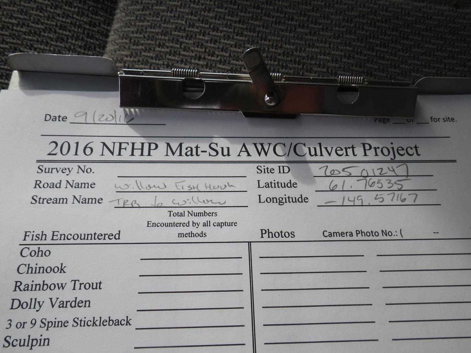
Fish Passage Site 20501247
Coordinates (dec. deg.): 61.76535°, -149.57161°
Legal Description: S019N002W02
Region: South Central
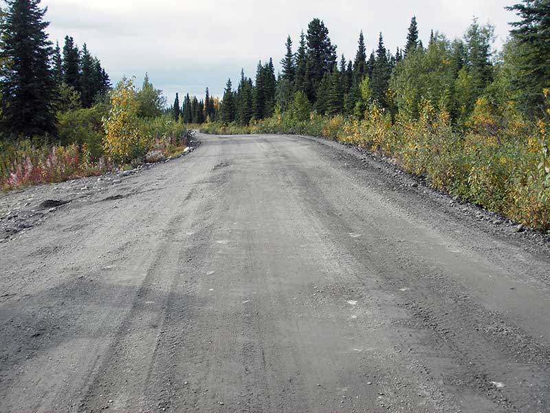
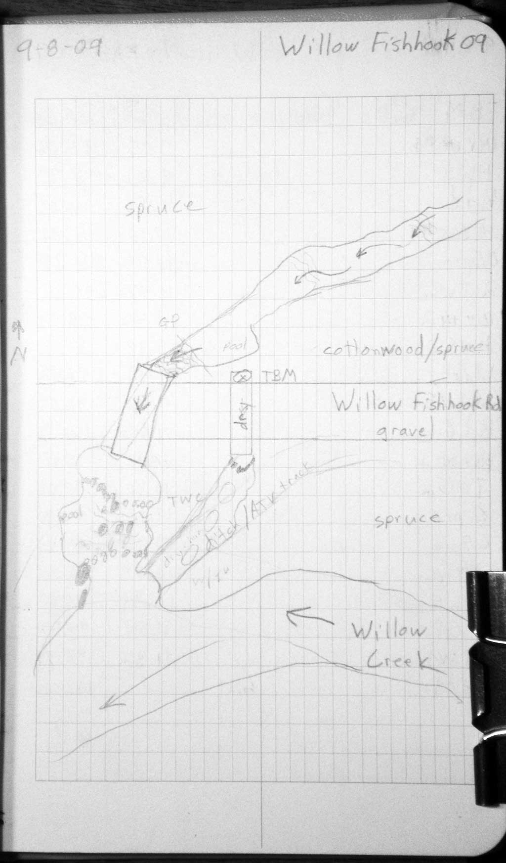
Road Name: Willow Fishhook Road
Datum: WGS84
Quad Name / ITM: Anchorage D-7
AWC Stream #:
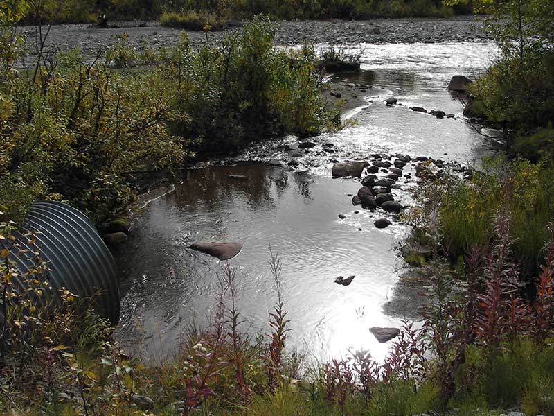
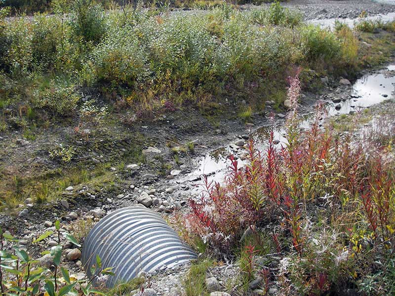
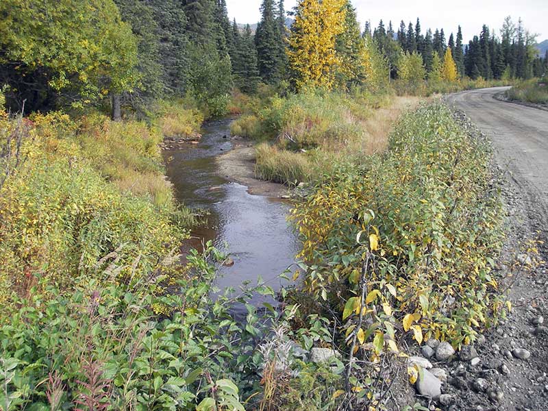
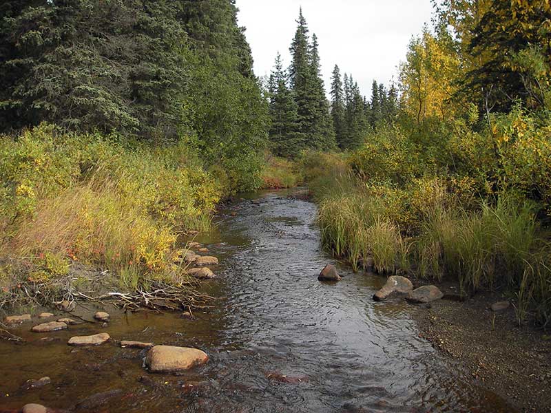
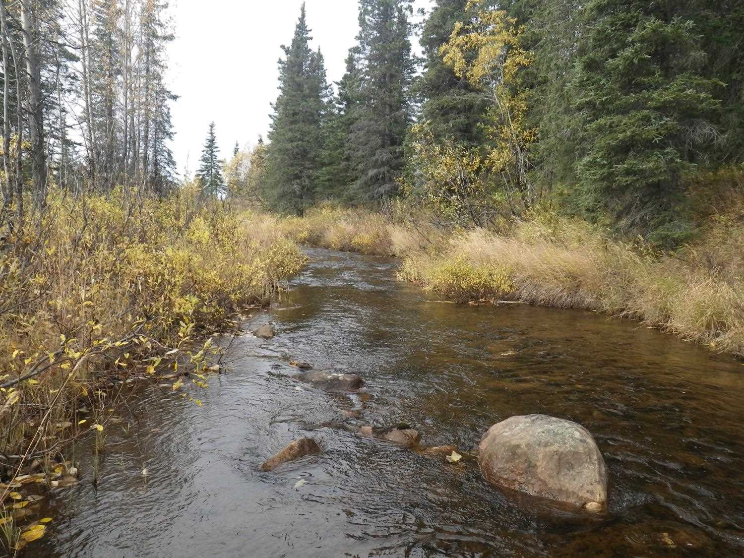
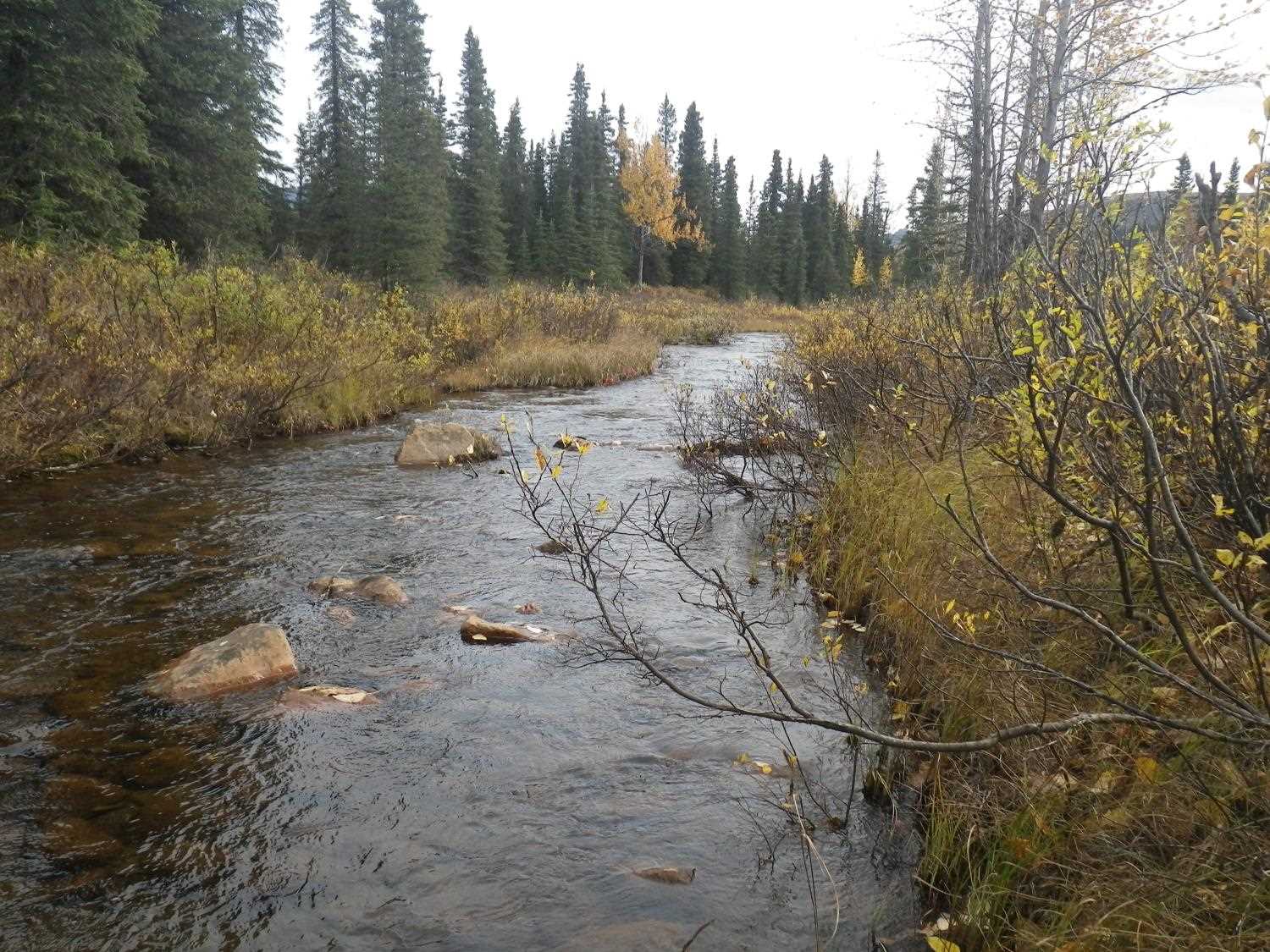
Stream Name: Willow Creek tributary
Elevation:
Site Comments: None
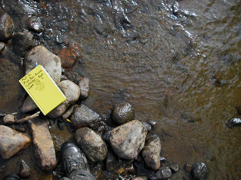
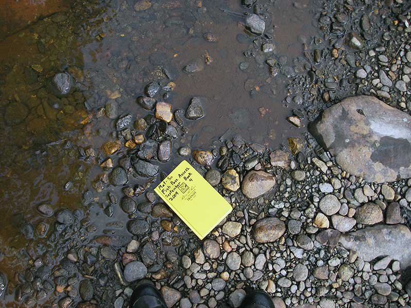
Survey MSB09-WFR09
Project Supervisor: Gillian O'Doherty, ADFG
Observers: Heidi Zimmer, Ben Histand
Overall Fish Passage Rating:
Tidal: No
Backwatered: No
Step Pools: No
Construction Year:
Site Observations:
- Constriction ratio red
- Culvert gradient red
- Culvert gradient gray
- Shallow fill; inadequate roadfill volume above culvert
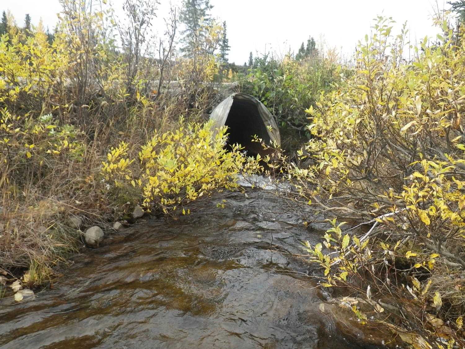
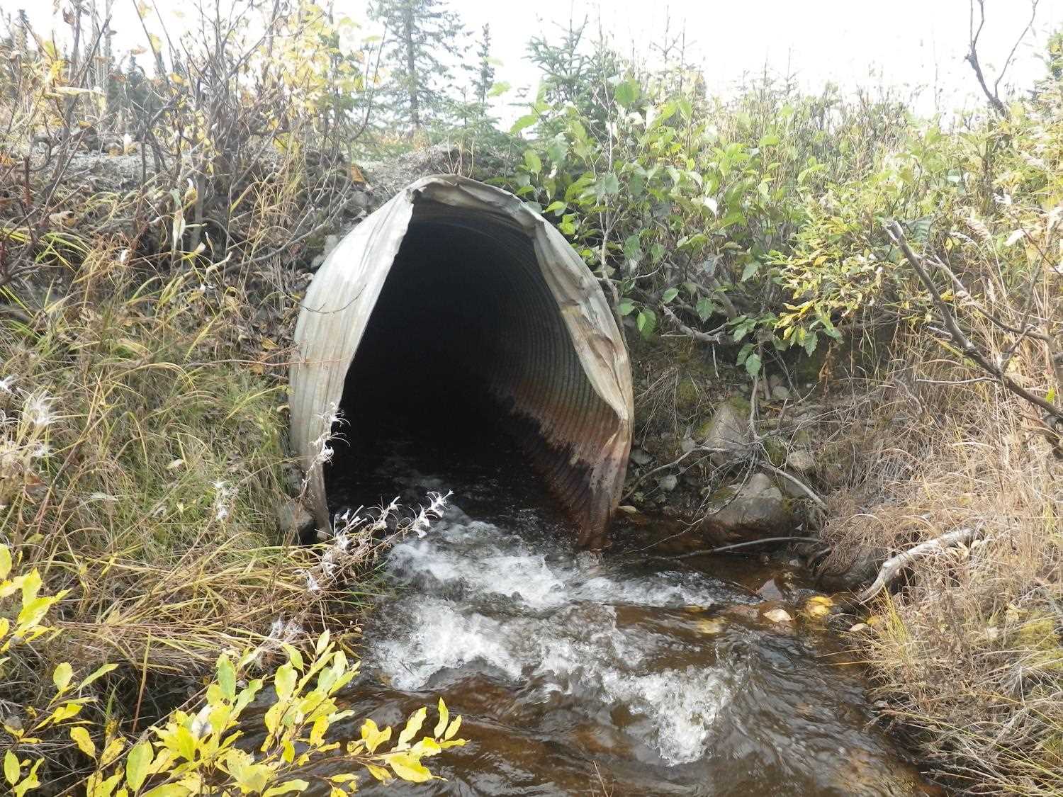
- Culvert is poorly aligned
- Mechanical damage or joints parting
Comments: ~12 cm salmonid (dolly?) obs u/s. **Updated site photos and fish capture information from 9/20/16 site visit from Sampling Unmapped Streams in the MSB project.
Culvert Measurements
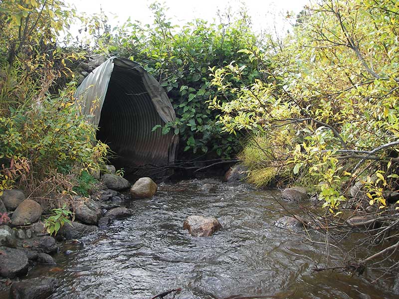
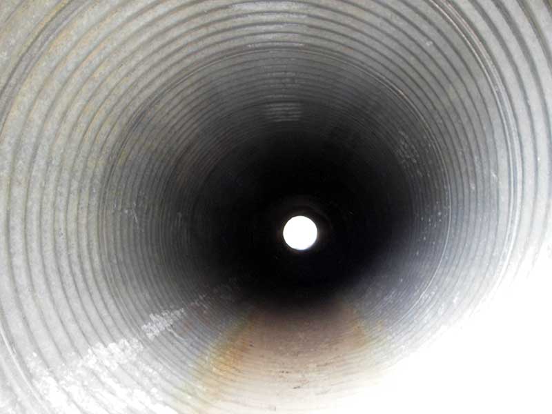
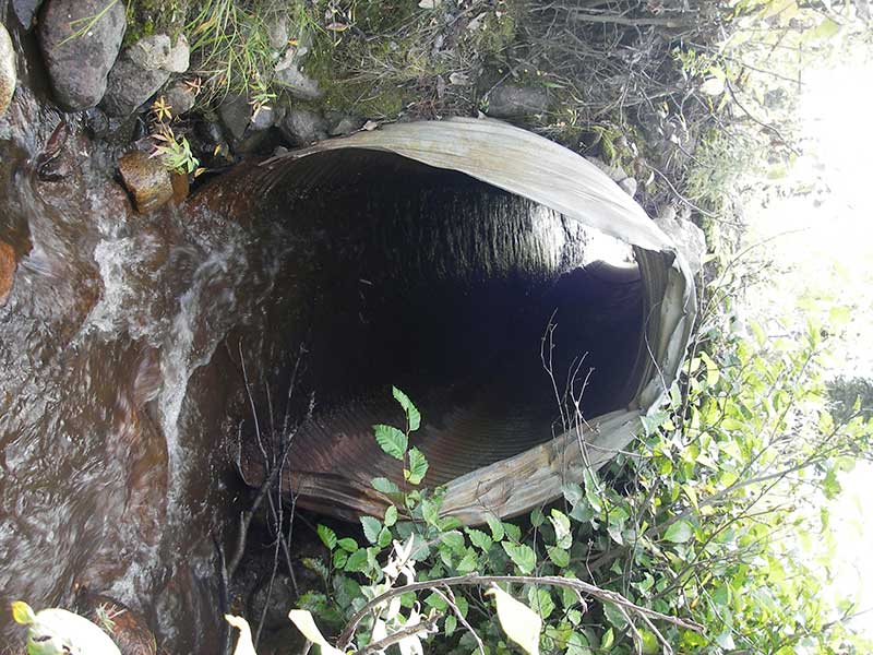
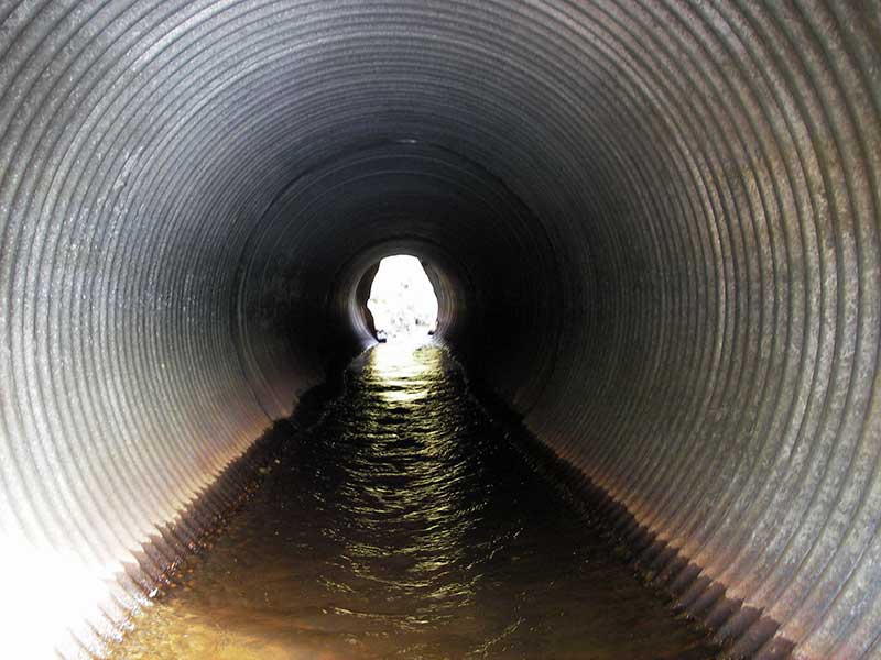
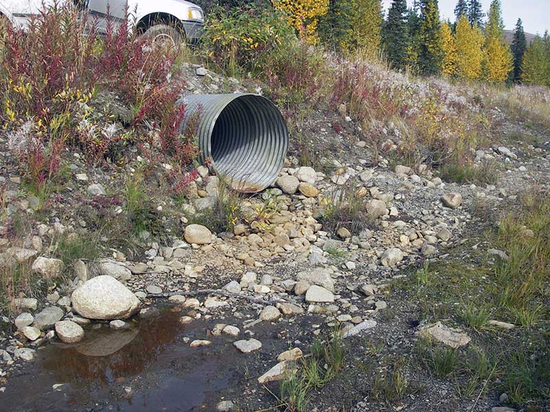
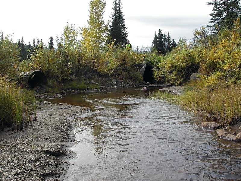
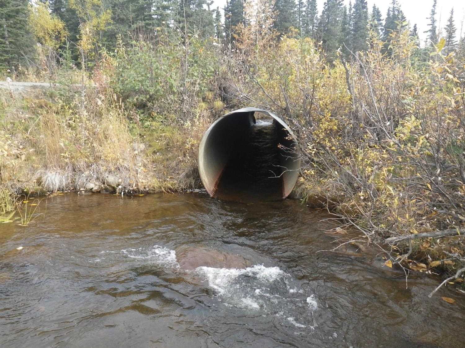
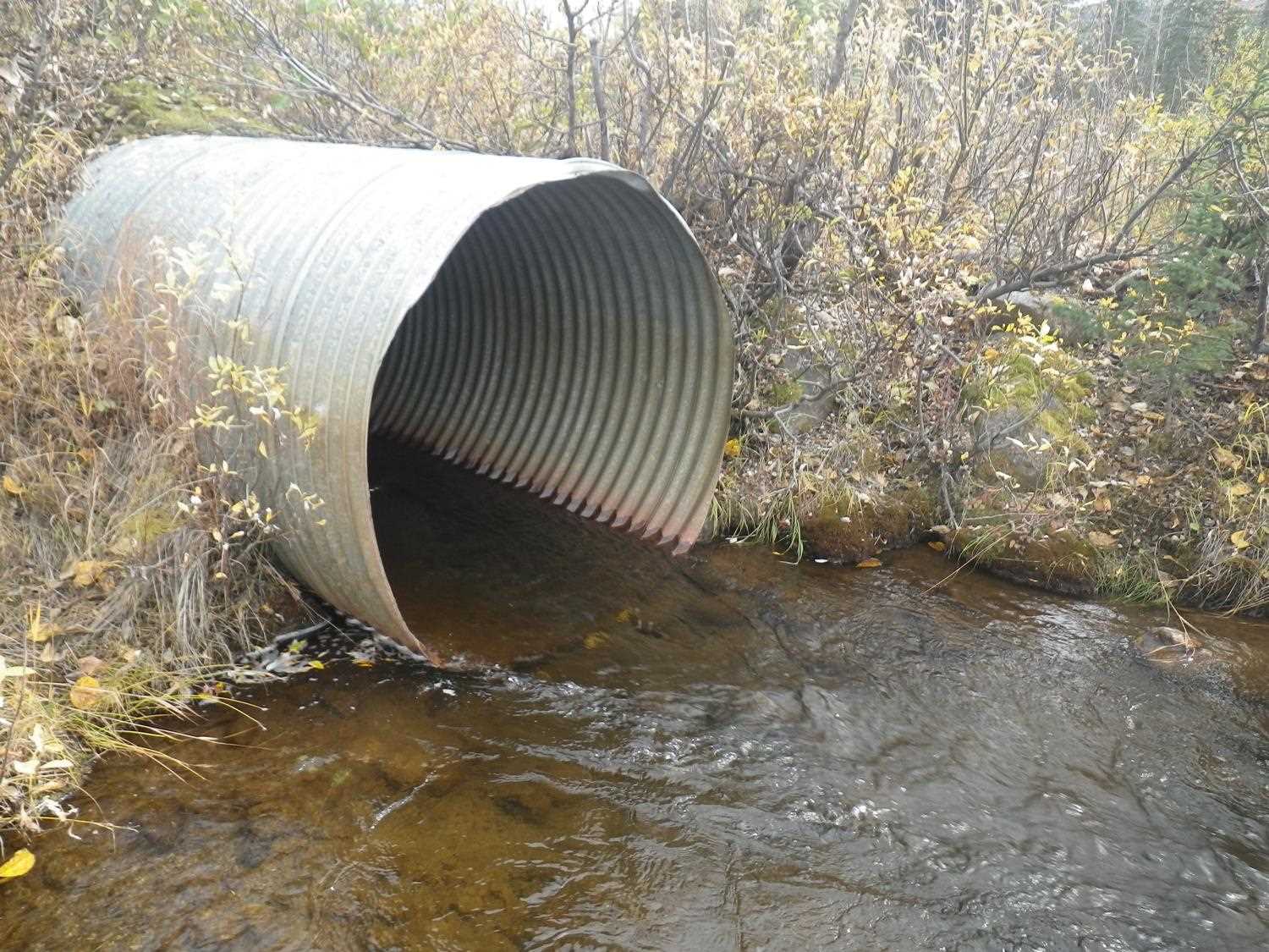
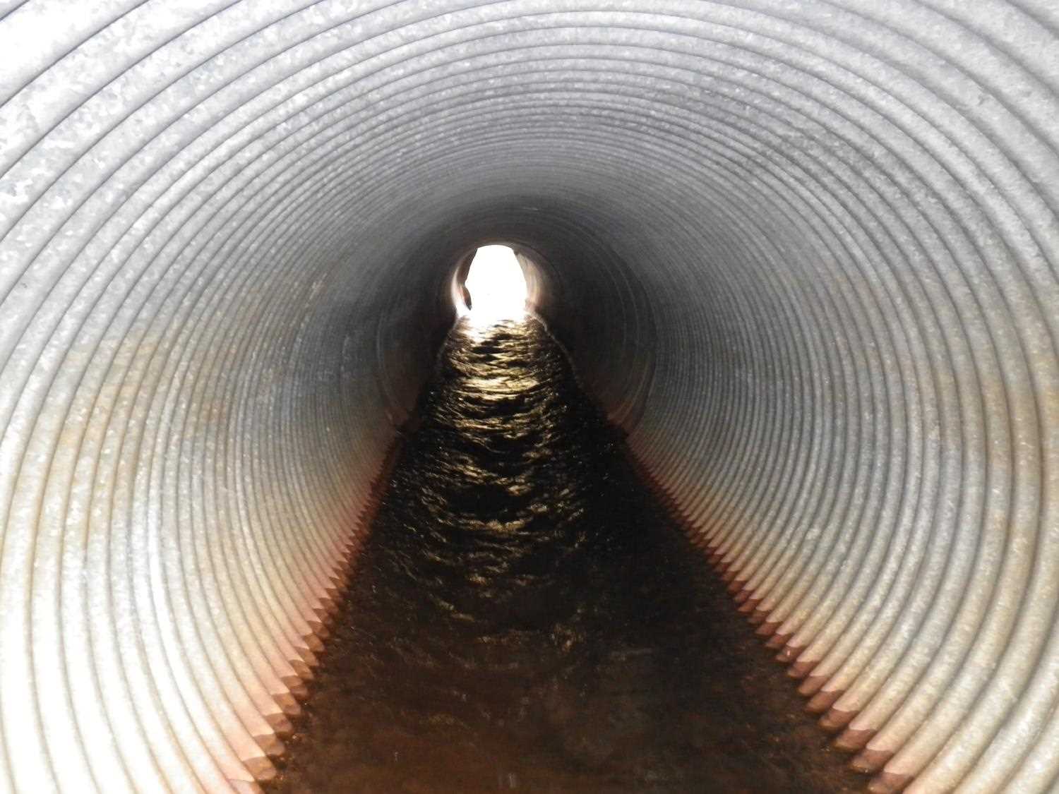
| ID: 1 | Structure Type: Circular pipe (Corrugated steel) | Fish Passage Rating: | |||||||||||||||||||||||||||||||||||||||||
|
|
|
|||||||||||||||||||||||||||||||||||||||||
Comments: Pipe is dry. |
|||||||||||||||||||||||||||||||||||||||||||
Culvert Observations:
|
|||||||||||||||||||||||||||||||||||||||||||
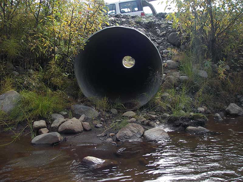
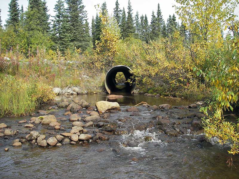
| ID: 2 | Structure Type: Circular pipe (Corrugated steel) | Fish Passage Rating: | |||||||||||||||||||||||||||||||||||||||||
|
|
|
|||||||||||||||||||||||||||||||||||||||||
Comments: Inlet of pipe badly mangled. |
|||||||||||||||||||||||||||||||||||||||||||
Culvert Observations:
|
|||||||||||||||||||||||||||||||||||||||||||
Stream Measurements
|
|
| Stream Width Type | Distance From Crossing (ft) |
Stream Width (ft) |
|---|---|---|
| Upstream ordinary high water | 115.0 | 10.50 |
| Upstream ordinary high water | 160.0 | 12.00 |
| Upstream ordinary high water | 200.0 | 12.00 |
Elevations
| Locator ID | Culvert Number |
River Distance (ft)1 |
Distance From Crossing (ft)2 |
Relative Elevation (ft) |
|---|---|---|---|---|
| Outlet Pool Water Elev | 2 | 95.81 | ||
| U/S Headwater | 2 | 96.13 | ||
| U/S Headwater (3' from inlet end of pipe) | 1 | 96.90 | ||
| D/S Grade Ctrl (Thalweg) | 2 | 0.00 | 49.0 | 94.57 |
| D/S Water Surface Elev (@GP) | 2 | 0.00 | 49.0 | 94.79 |
| D/S Tailcrest or 1st Thalweg | 2 | 27.00 | 22.0 | 95.36 |
| D/S Water Surface Elev (@TWC) | 2 | 27.00 | 22.0 | 95.80 |
| D/S Thalweg (bottom of out pool) | 2 | 42.50 | 6.5 | 93.44 |
| D/S Tailcrest or 1st Thalweg (if water present) | 1 | 47.00 | 2.0 | 95.64 |
| D/S Thalweg (bottom of dry outlet pool) | 1 | 48.50 | 0.5 | 95.25 |
| D/S Thalweg | 2 | 49.00 | 0.0 | 94.96 |
| Outlet Invert | 2 | 49.00 | 0.0 | 95.18 |
| Outlet Invert | 1 | 49.00 | 0.0 | 96.01 |
| Road Elev (over pipe 1) | 1 | 78.00 | 101.55 | |
| Road Elev (over pipe 2) | 2 | 78.00 | 102.06 | |
| Inlet Culvert Invert | 2 | 104.90 | 0.0 | 95.69 |
| U/S Thalweg (TC of 1st pool u/s) | 2 | 106.70 | 1.8 | 96.12 |
| U/S Water Surface Elev (@GP) | 2 | 106.70 | 1.8 | 96.55 |
| Inlet Culvert Invert (dry pipe) | 1 | 109.70 | 0.0 | 97.06 |
Notes:
- River distance is measured continuously throughout the survey reach along the thalweg of the stream.
- Measured from each end of the crossing along the thalweg of the stream.
Fish Sampling Efforts
| Gear Type: Minnow Trap (A) | Trap Duration(h): 1.0 | |
| Comments: no fish caught; 100ft u/s; salmonid observed, prob DV | ||
Fish Observations
| Species: | Life History: | ||
| Total Fish Observed: | Fish Measured: | Fork Lengths (mm) Min: Max: Mean: | |
| Collected/Observed by Gear Type: | |||
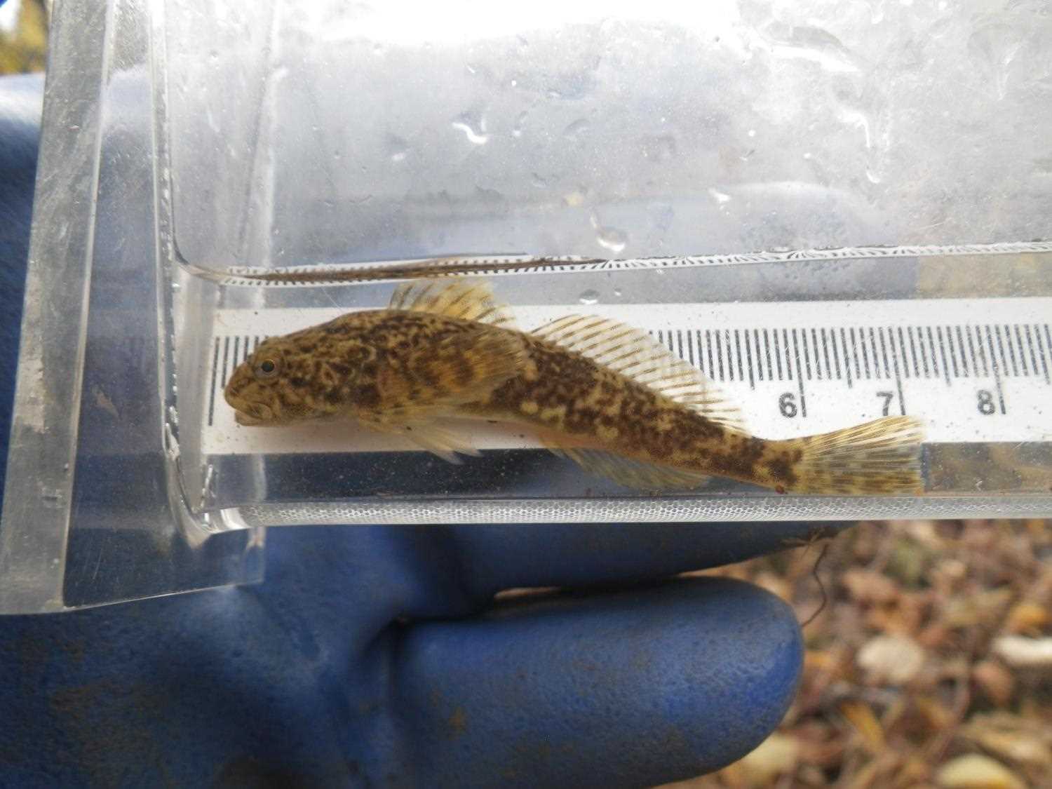
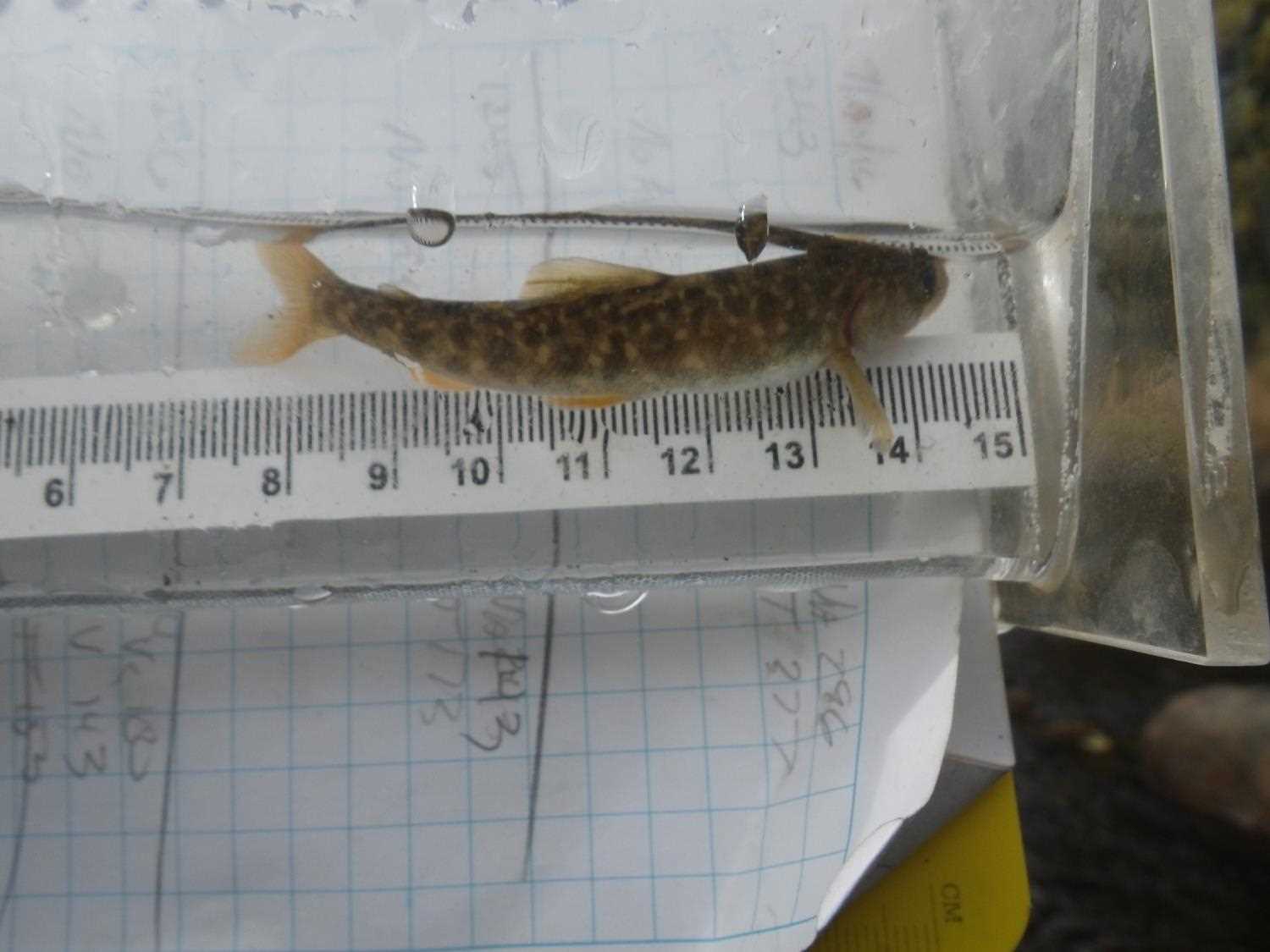
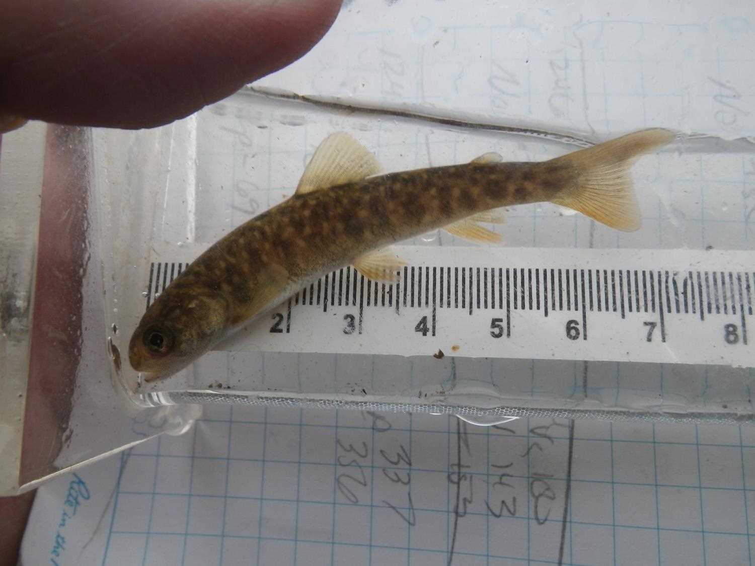
| Species: juvenile/adult sculpin-unspecified | Life History: Resident | ||
| Total Fish Observed: 3 | Fish Measured: 1 | Fork Lengths (mm) Min: 69 Max: 69 Mean: 69 | |
| Collected/Observed by Gear Type: | |||
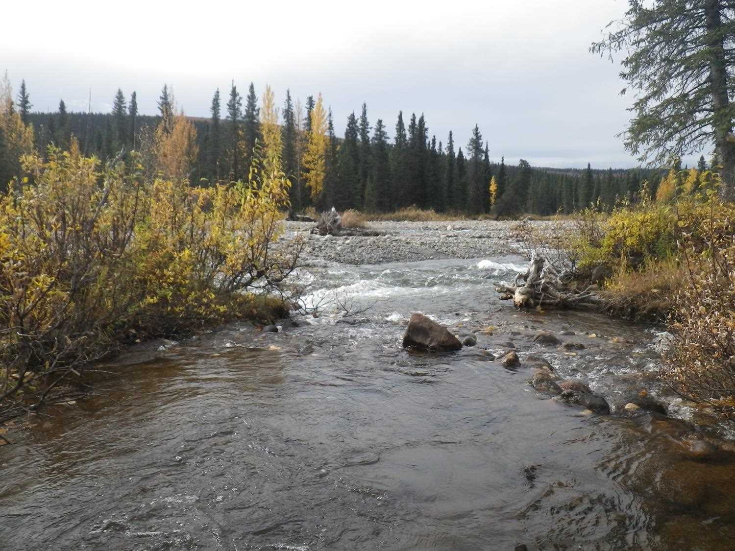
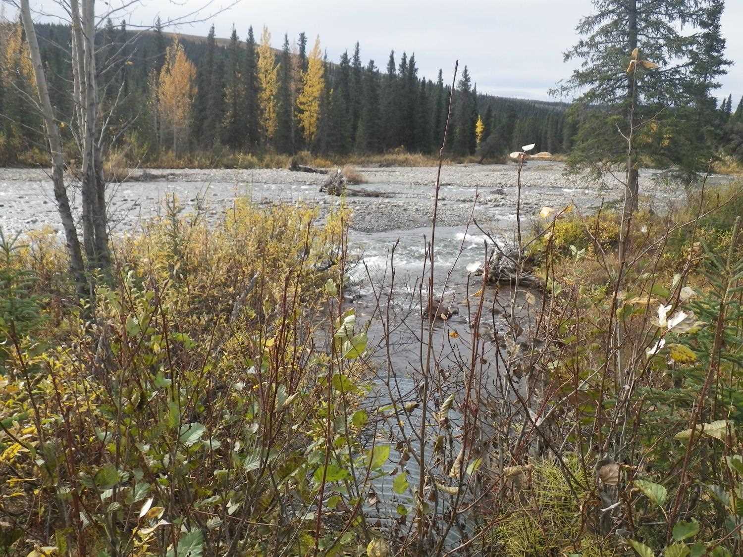
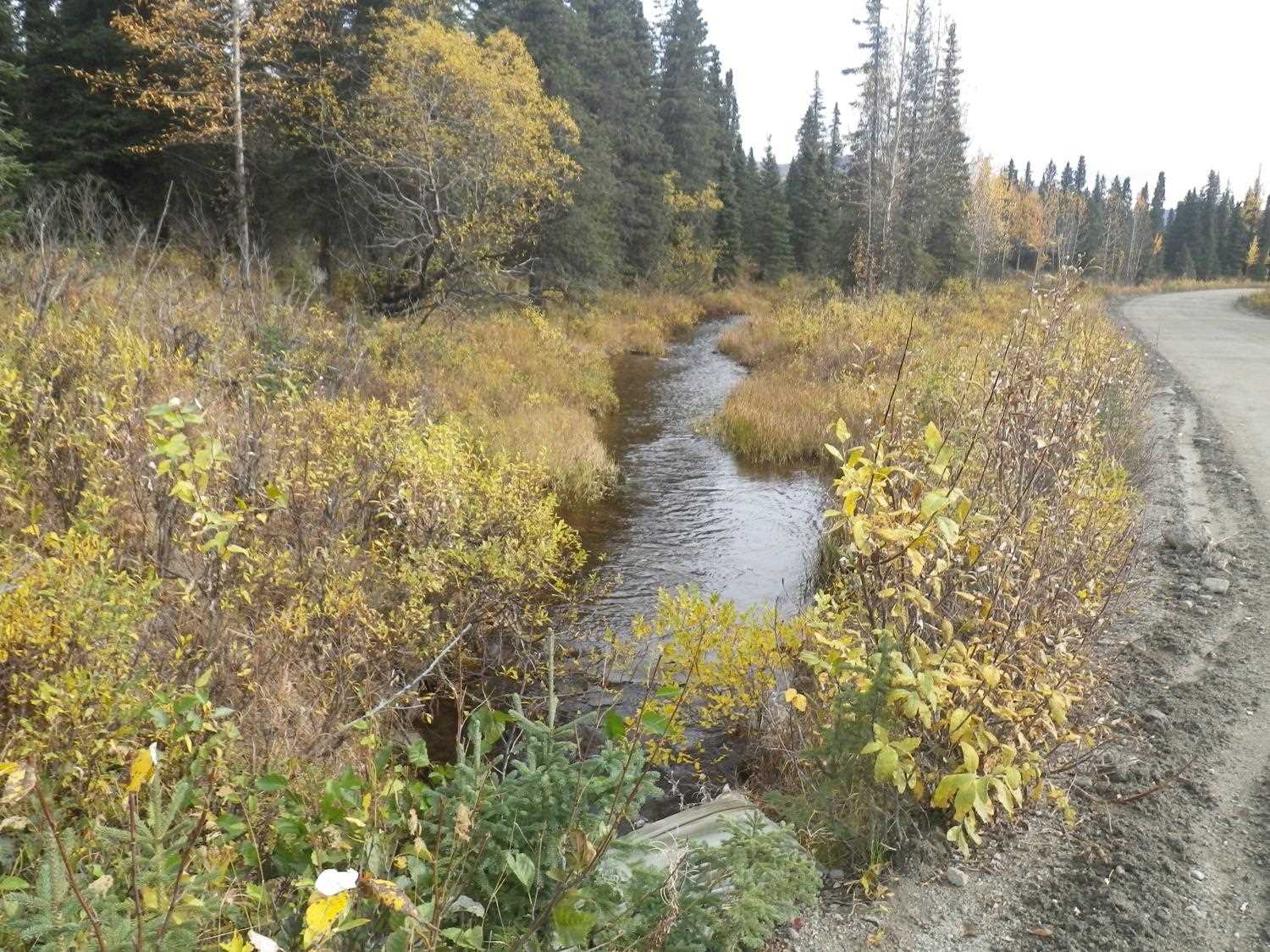
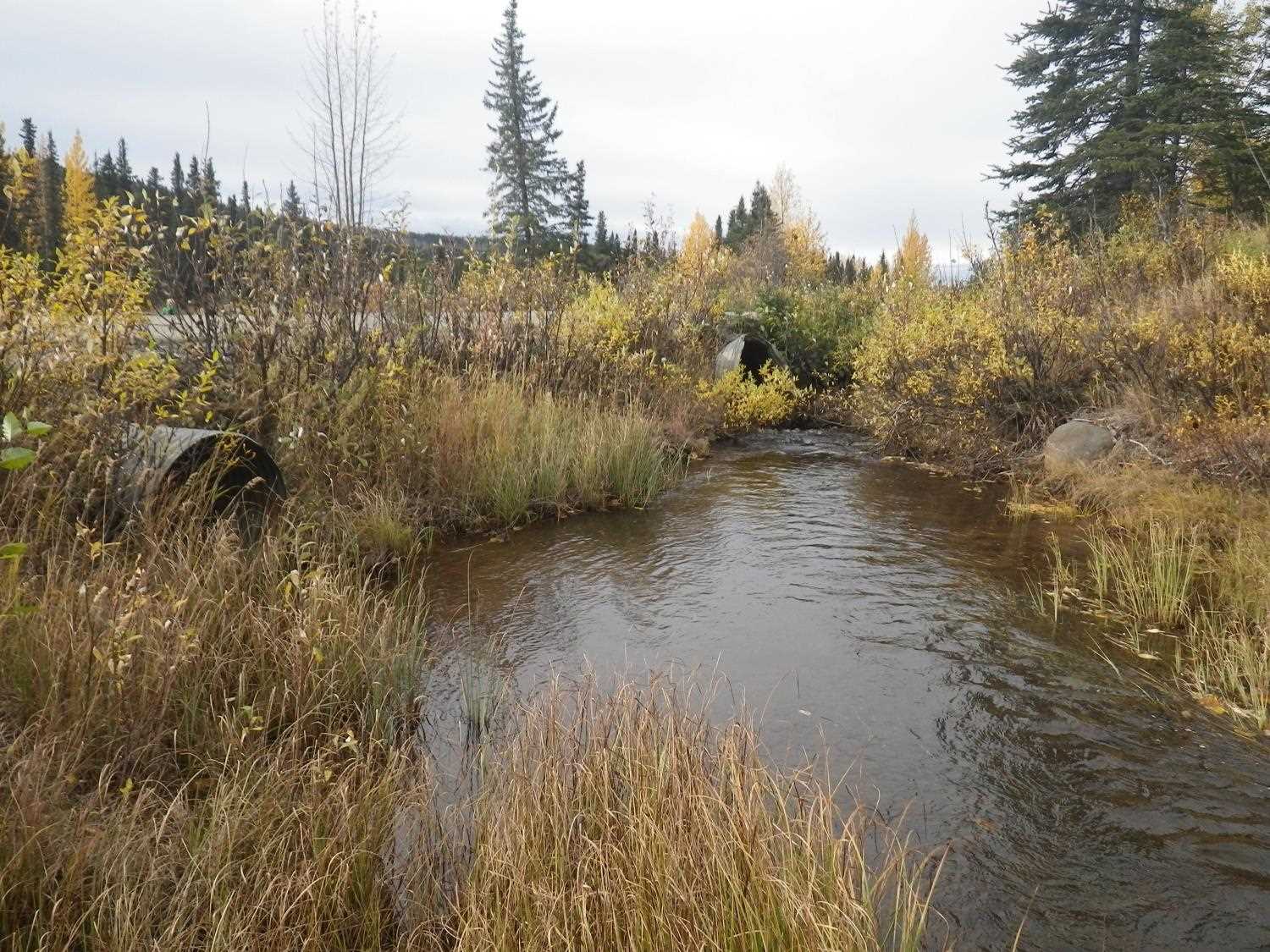
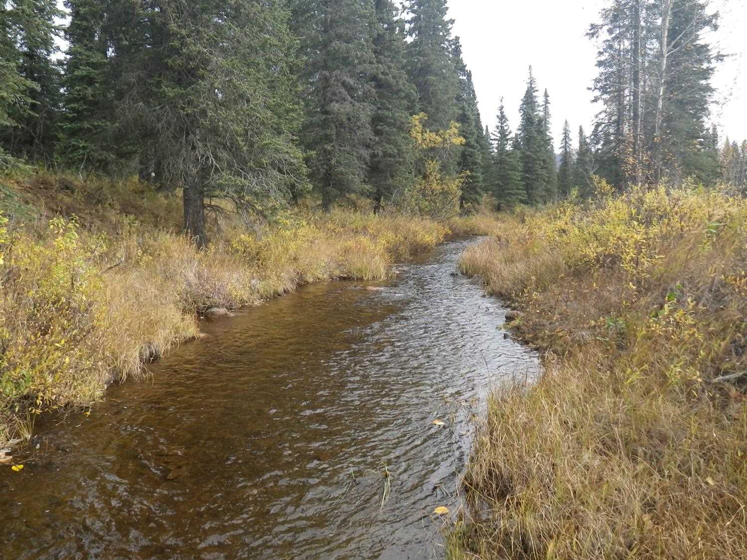
Photos

Questions or comments about this report can be directed to dfg.dsf.webmaster@alaska.gov