Fish Passage Site 20501233
Coordinates (dec. deg.): 61.58220°, -149.57127°
Legal Description: S017N002W11
Region: South Central
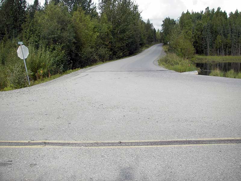
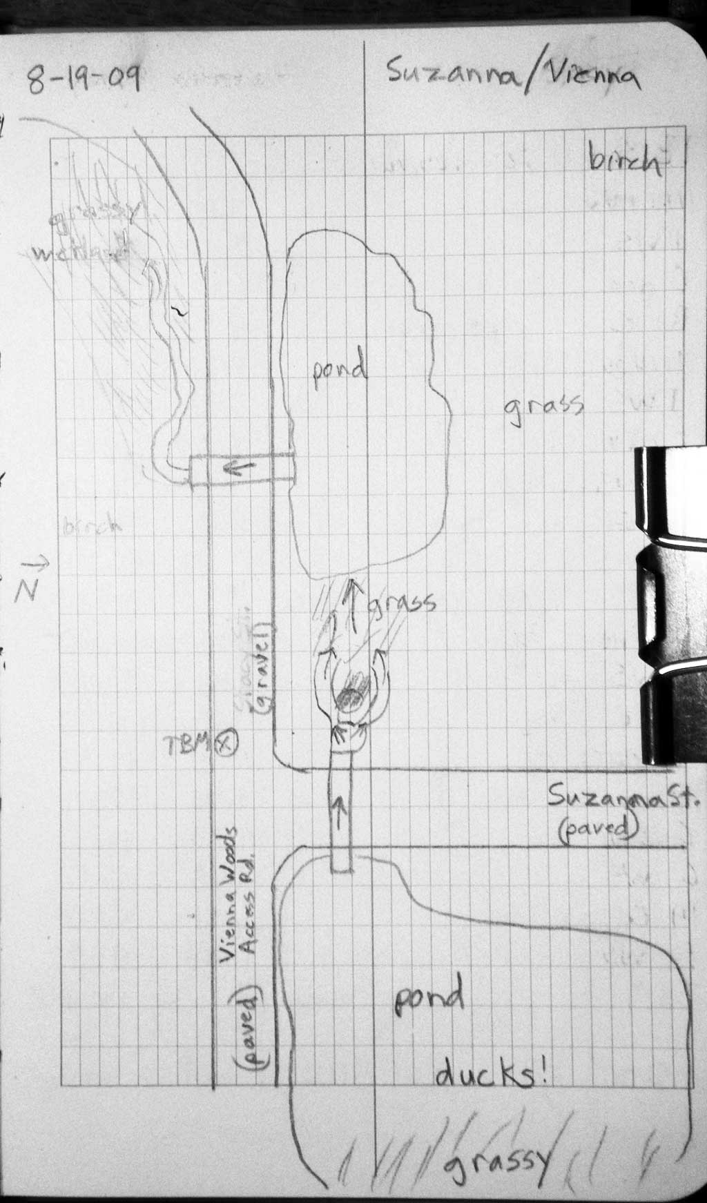
Road Name: Suzanna Street
Datum: WGS84
Quad Name / ITM: Anchorage C-7
AWC Stream #:
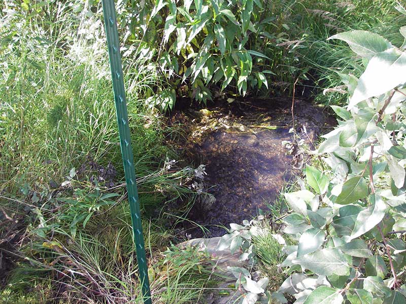
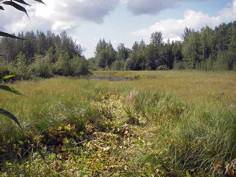
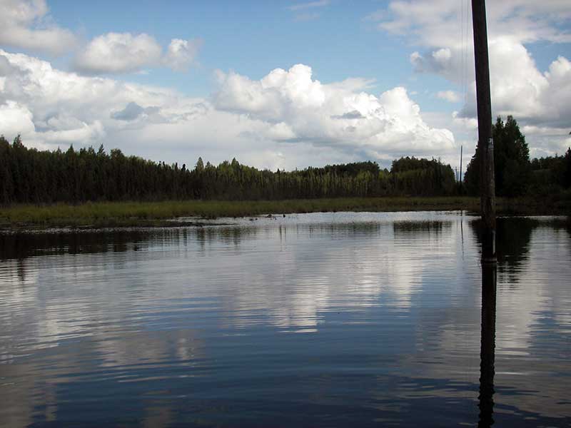
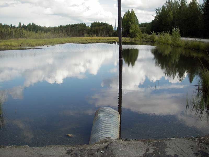
Stream Name: Unnamed pond outlet
Elevation:
Site Comments: None
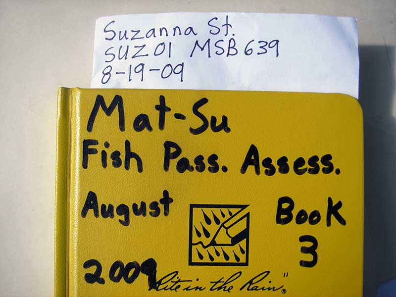
Survey MSB09-SUZ01
Project Supervisor: Gillian O'Doherty, ADFG
Observers: Heidi Zimmer, Ben Histand
Overall Fish Passage Rating:
Tidal: No
Backwatered: No
Step Pools: No
Construction Year:
Site Observations:
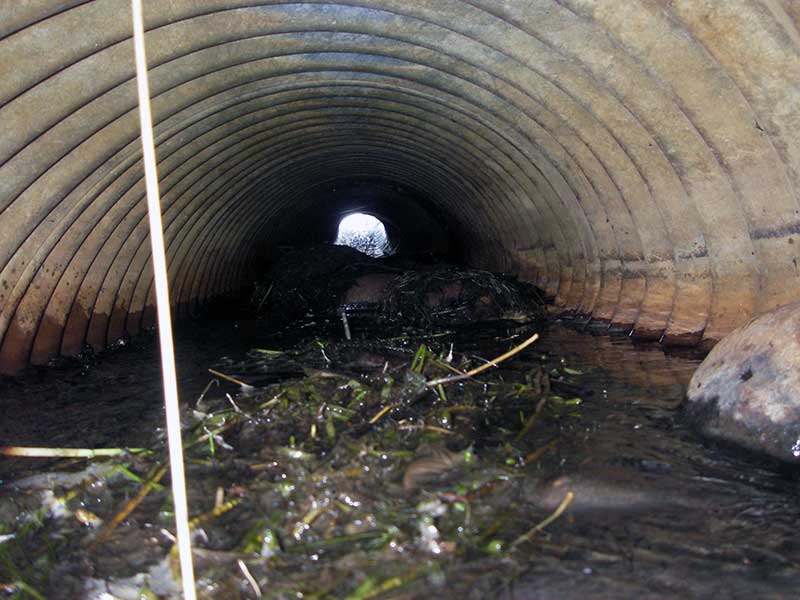
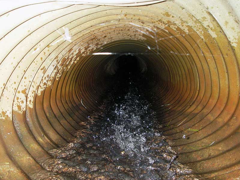
- Culvert gradient red
- Compound gradient in pipe
- Hydraulic flows exceeded capacity
- Mechanical damage or joints parting
- Shallow fill; inadequate roadfill volume above culvert
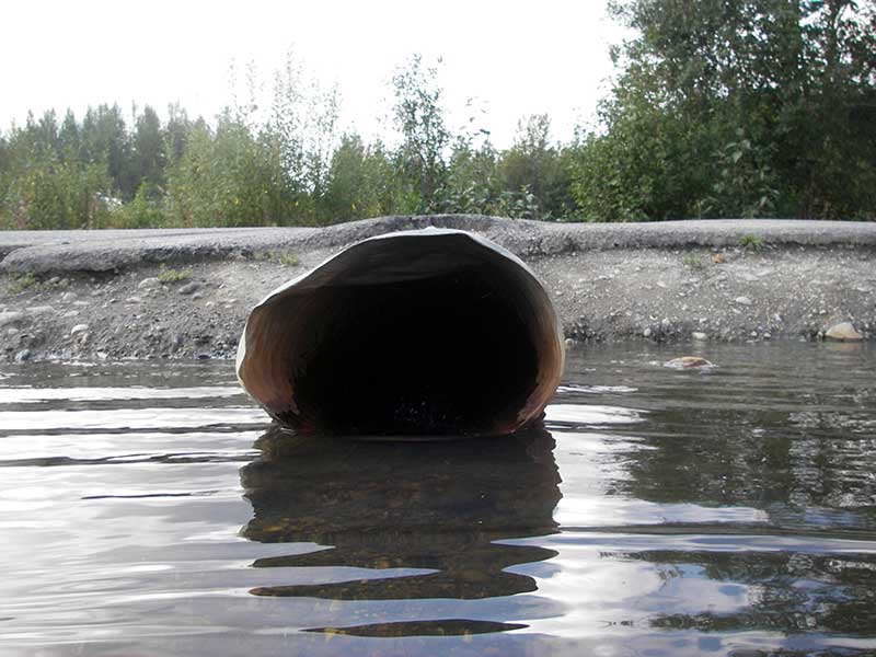
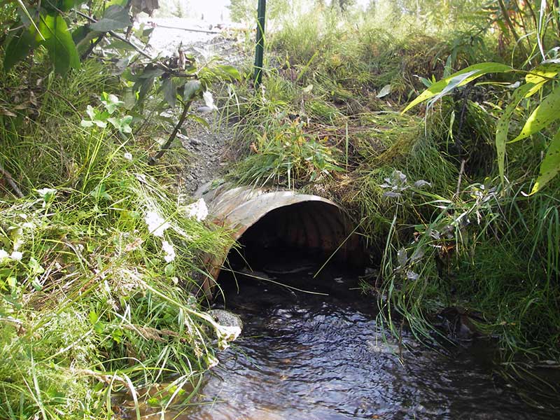
Comments: Pipe bent; max gradient greater than 6.63%; no fish caught. Pond upstream of culvert.
Culvert Measurements
| ID: 1 | Structure Type: Circular pipe (Corrugated steel) | Fish Passage Rating: | |||||||||||||||||||||||||||||||||||||||||
|
|
|
|||||||||||||||||||||||||||||||||||||||||
Culvert Observations:
|
|||||||||||||||||||||||||||||||||||||||||||
Stream Measurements
|
|
No stream width data available.
Elevations
| Locator ID | Culvert Number |
River Distance (ft)1 |
Distance From Crossing (ft)2 |
Relative Elevation (ft) |
|---|---|---|---|---|
| Outlet Pool Water Elev | 1 | 96.80 | ||
| U/S Headwater (u/s is pond) | 1 | 99.29 | ||
| D/S Grade Ctrl (Thalweg) | 1 | 0.00 | 8.5 | 96.07 |
| D/S Water Surface Elev (@GP) | 1 | 0.00 | 8.5 | 96.25 |
| D/S Tailcrest or 1st Thalweg | 1 | 7.50 | 1.0 | 96.56 |
| D/S Water Surface Elev (@TWC) | 1 | 7.50 | 1.0 | 96.78 |
| Outlet Invert (on substrate) | 1 | 8.50 | 0.0 | 96.48 |
| Road Elev | 1 | 28.50 | 100.39 | |
| U/S Thalweg | 1 | 48.50 | 0.0 | 98.66 |
| Inlet Culvert Invert | 1 | 48.50 | 0.0 | 99.13 |
Notes:
- River distance is measured continuously throughout the survey reach along the thalweg of the stream.
- Measured from each end of the crossing along the thalweg of the stream.
Fish Sampling Efforts
| Gear Type: Minnow Trap (A) | Trap Duration(h): 1.5 | |
| Comments: no fish caught; 10ft u/s | ||
| Gear Type: Minnow Trap (B) | Trap Duration(h): 1.5 | |
| Comments: no fish caught; 150ft d/s | ||
Fish Observations
No fish observations occurred during this survey.
Photos
Questions or comments about this report can be directed to dfg.dsf.webmaster@alaska.gov