Fish Passage Site 20501081
Coordinates (dec. deg.): 61.58802°, -149.72237°
Legal Description: S017N003W01
Region: South Central
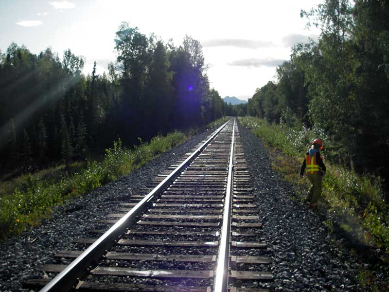
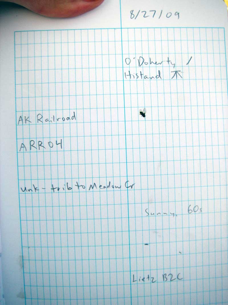
Road Name: Alaska Railroad
Datum: NAD83
Quad Name / ITM: Anchorage C-8
AWC Stream #:
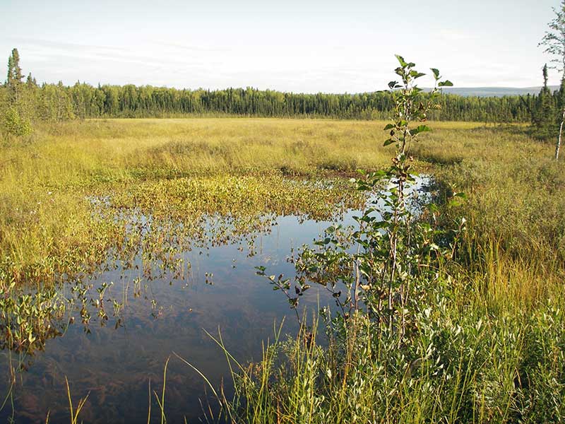
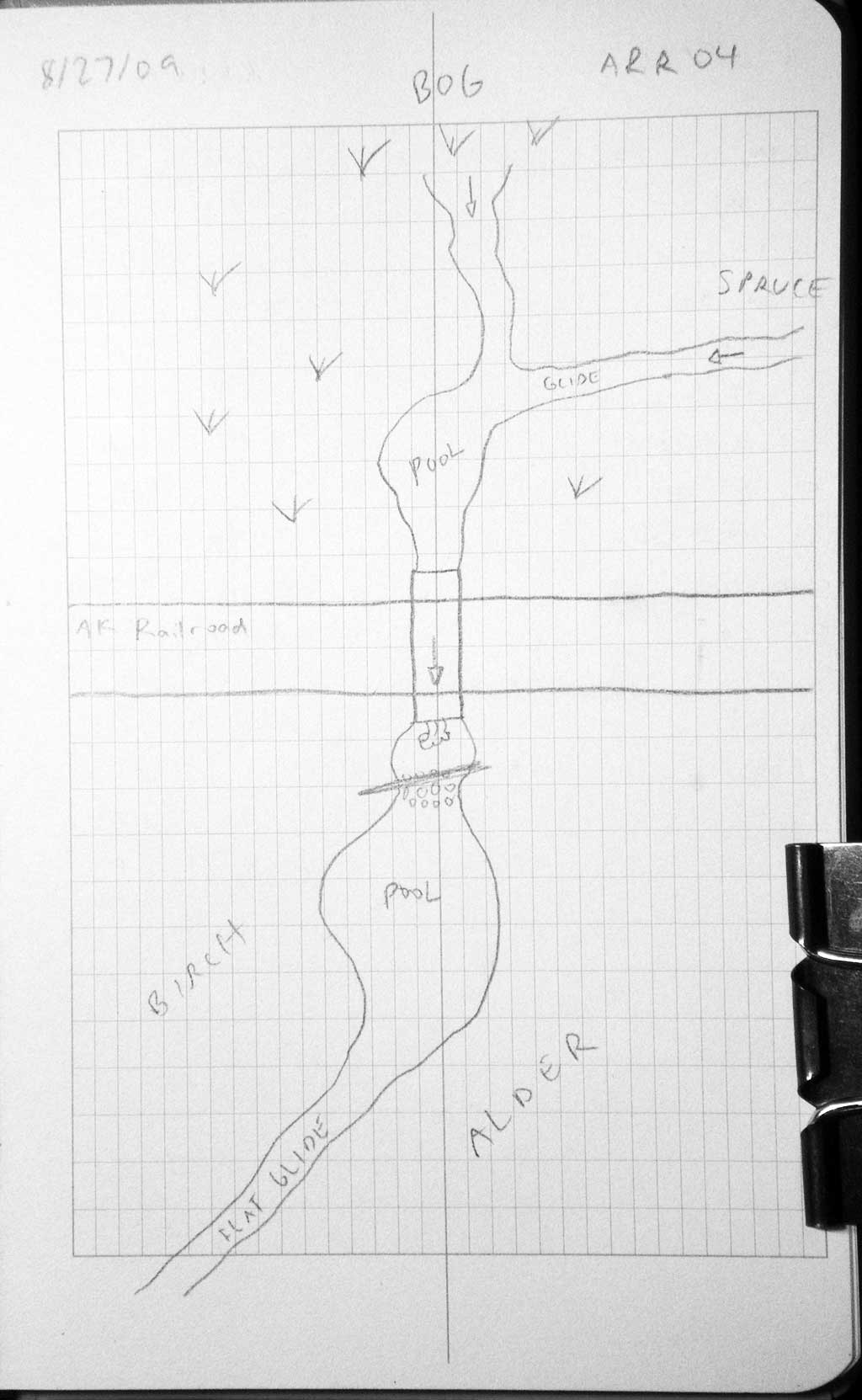
Stream Name: Meadow Creek tributary
Elevation:
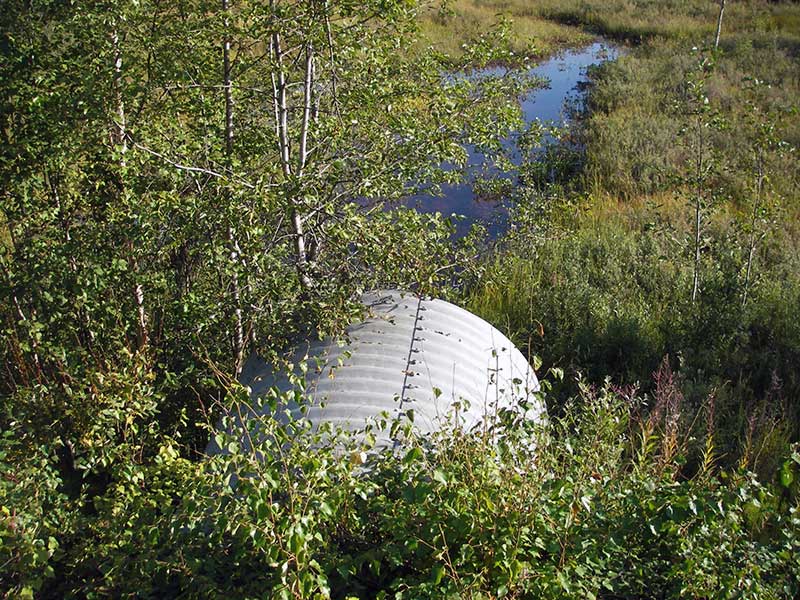
Site Comments: AKRR MP169.34
arrow to the right of the survey date below to choose a different report for this site.
Survey MSB09-ARR04
Project Supervisor: Gillian O'Doherty, ADFG
Observers: Gillian O'Doherty, Ben Histand
Overall Fish Passage Rating:
Tidal: No
Backwatered: No
Step Pools: No
Construction Year:
Site Observations:
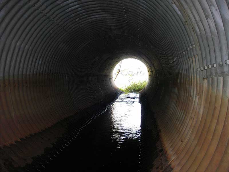
- Outfall height red
- Mechanical damage or joints parting
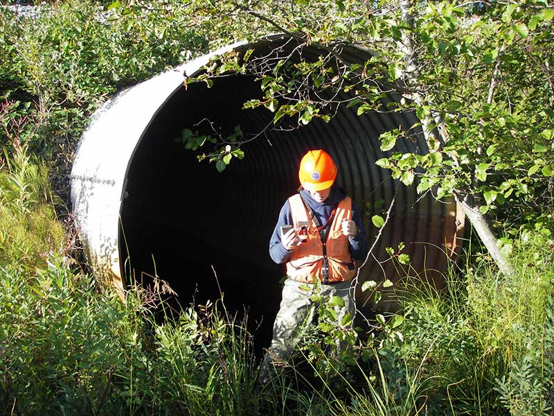
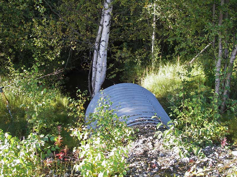
Comments: Visual observeration of Juvenile coho u/s. Culvert is adequately sized, but placed too high; rusted through at inlet and braced with railroad ties;
Culvert Measurements
| ID: 1 | Structure Type: Circular pipe (Corrugated steel) | Fish Passage Rating: | |||||||||||||||||||||||||||||||||||||||||
|
|
|
|||||||||||||||||||||||||||||||||||||||||
Comments: Adequately sized but placed too high; rusted thru @ inlet; braced w/RR ties; |
|||||||||||||||||||||||||||||||||||||||||||
Culvert Observations:
|
|||||||||||||||||||||||||||||||||||||||||||
Stream Measurements
|
|
| Stream Width Type | Distance From Crossing (ft) |
Stream Width (ft) |
|---|---|---|
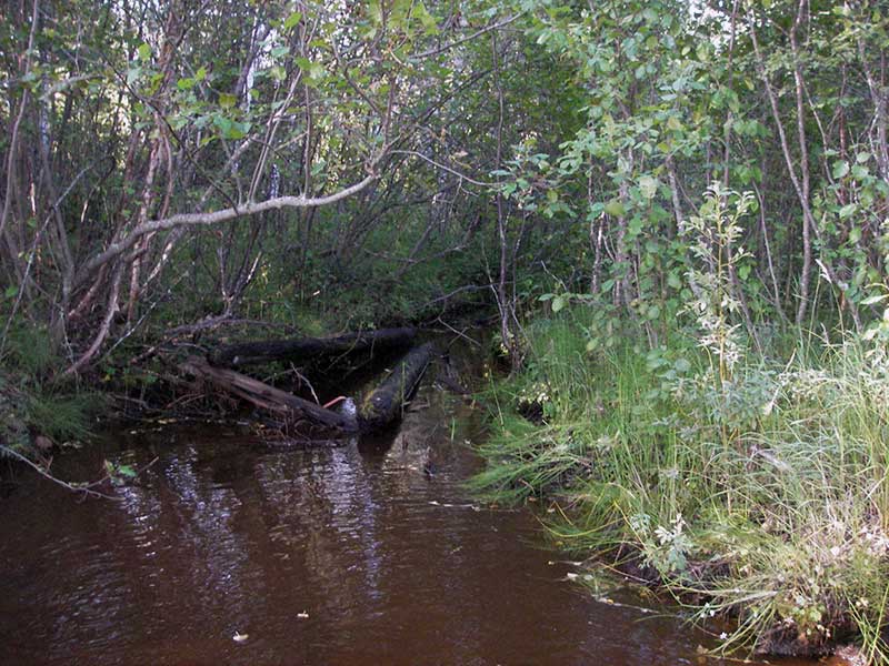
| Downstream ordinary high water | 58.0 | 7.20 |
| Downstream ordinary high water | 70.0 | 5.10 |
| Downstream ordinary high water | 83.0 | 5.70 |
Elevations
| Locator ID | Culvert Number |
River Distance (ft)1 |
Distance From Crossing (ft)2 |
Relative Elevation (ft) |
|---|---|---|---|---|
| Outlet Pool Water Elev | 1 | 90.80 | ||
| U/S Headwater (pool immed. u/s) | 1 | 92.40 | ||
| D/S Grade Ctrl (Thalweg) | 1 | 0.00 | 34.0 | 89.56 |
| D/S Water Surface Elev (@GP) | 1 | 0.00 | 34.0 | 90.22 |
| D/S Thalweg (bottom of large pool) | 1 | 10.50 | 23.5 | 88.56 |
| D/S Tailcrest or 1st Thalweg | 1 | 23.00 | 11.0 | 90.62 |
| D/S Water Surface Elev (@TWC) | 1 | 23.00 | 11.0 | 90.70 |
| D/S Thalweg (bottom of pool) | 1 | 32.00 | 2.0 | 89.59 |
| Outlet Invert | 1 | 34.00 | 0.0 | 91.66 |
| Road Elev | 1 | 64.50 | 105.48 | |
| Inlet Culvert Invert | 1 | 95.40 | 0.0 | 91.84 |
| U/S Thalweg | 1 | 102.40 | 7.0 | 90.59 |
Notes:
- River distance is measured continuously throughout the survey reach along the thalweg of the stream.
- Measured from each end of the crossing along the thalweg of the stream.
Fish Sampling Efforts
| Gear Type: Minnow Trap (A) | Trap Duration(h): 1.0 | |
| Comments: no fish caught; 60ft u/s | ||
| Gear Type: Minnow Trap (B) | Trap Duration(h): 1.0 | |
| Comments: 55ft d/s | ||
Fish Observations
| Species: adult ninespine stickleback | Life History: Not Recorded | ||
| Total Fish Observed: 3 | Fish Measured: | Fork Lengths (mm) Min: Max: Mean: | |
| Collected/Observed by Gear Type: Downstream Minnow Trap (3) | |||
| Species: juvenile Dolly Varden | Life History: Not Recorded | ||
| Total Fish Observed: 1 | Fish Measured: 1 | Fork Lengths (mm) Min: 63 Max: 63 Mean: 63 | |
| Collected/Observed by Gear Type: Upstream Minnow Trap (1) | |||
Photos
Questions or comments about this report can be directed to dfg.dsf.webmaster@alaska.gov