Fish Passage Site 20501046
Coordinates (dec. deg.): 61.65356°, -149.49871°
Legal Description: S018N001W17
Region: South Central
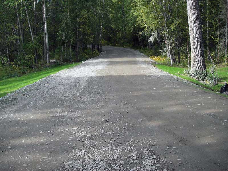
Road Name: N Sitze Road
Datum: NAD83
Quad Name / ITM: Anchorage C-7
AWC Stream #:
Stream Name: Moon Princess Creek
Elevation:
Site Comments: AKA Colter Creek.
arrow to the right of the survey date below to choose a different report for this site.
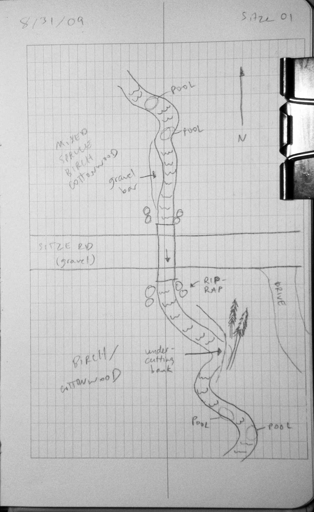
Survey MSB09-SIT01
Project Supervisor: Gillian O'Doherty, ADFG
Observers: Gillian O'Doherty, Ben Histand
Overall Fish Passage Rating:
Tidal: No
Backwatered: No
Step Pools: No
Construction Year: 2008
Site Observations:
- None of this type
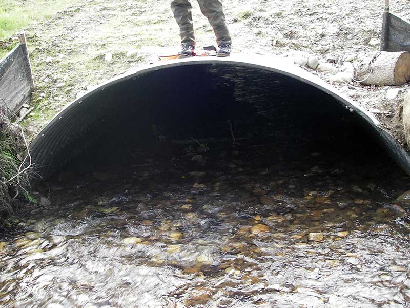
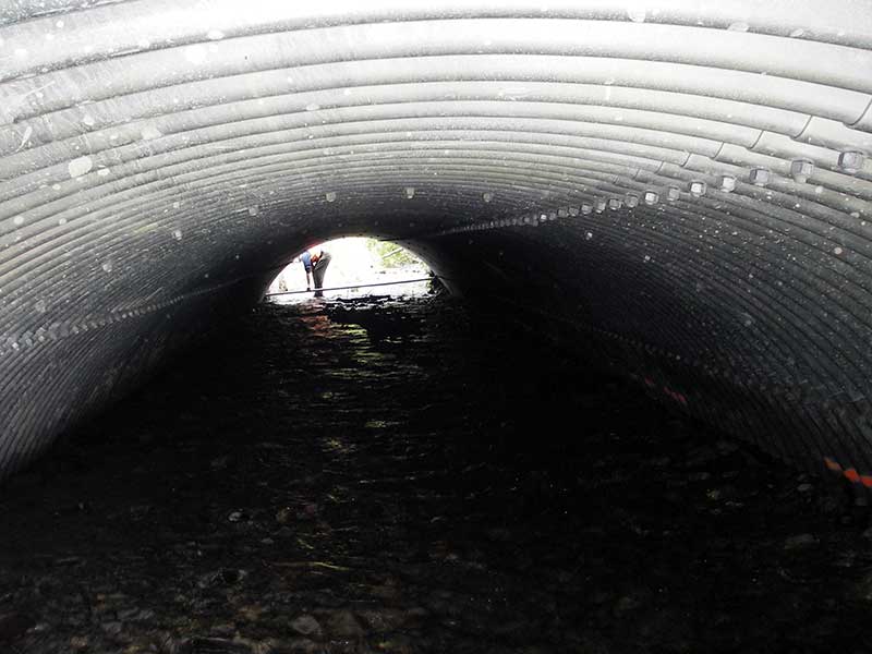
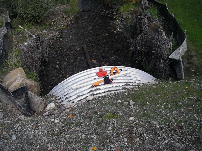
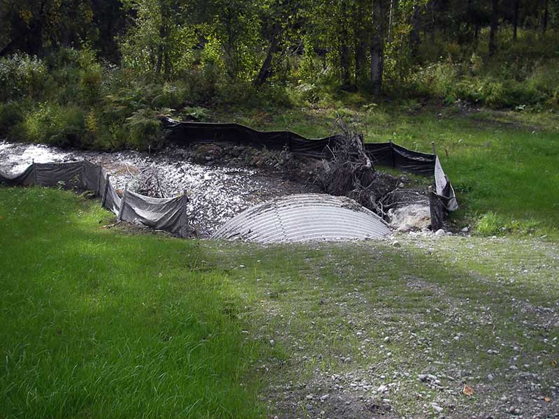
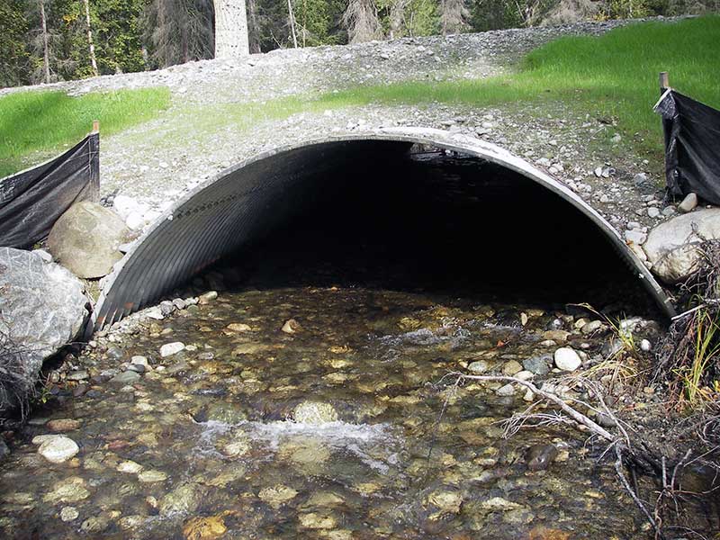
Comments: Post-replacement survey of MSB04ML020. Treated as bottomless arch but may be embedded pipe arch; slope calculated from top of pipe.
Culvert Measurements
| ID: 1 | Structure Type: Open-bottom arch (Structural steel plate) | Fish Passage Rating: | |||||||||||||||||||||||||||||||||||||||||
|
|
|
|||||||||||||||||||||||||||||||||||||||||
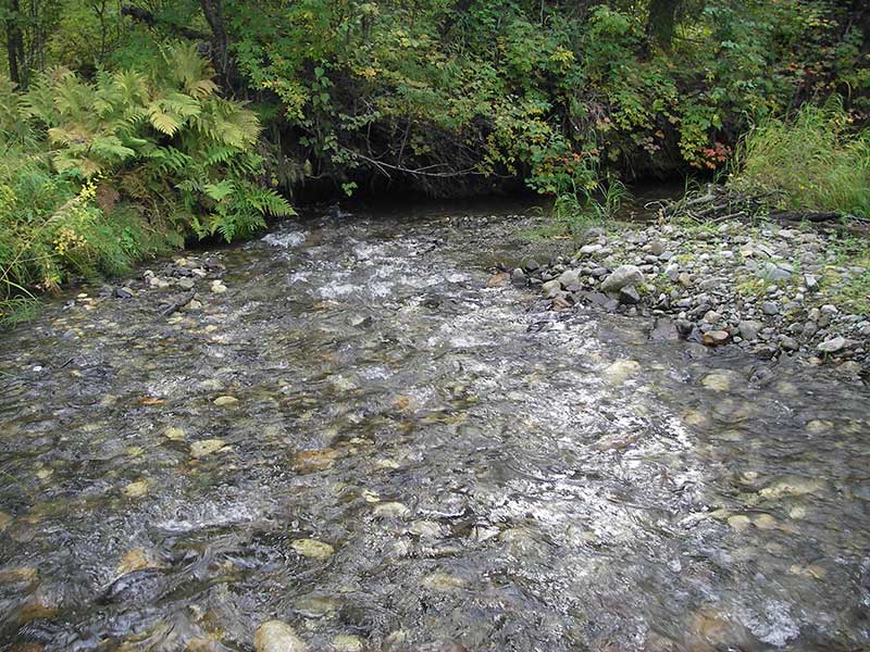
Comments: Gradient calculated using top of pipe. Upstream stream gradient is 1.85%. Uniform riffle inside culvert. |
|||||||||||||||||||||||||||||||||||||||||||
Culvert Observations:
|
|||||||||||||||||||||||||||||||||||||||||||
Stream Measurements
|
|
| Stream Width Type | Distance From Crossing (ft) |
Stream Width (ft) |
|---|---|---|
| Upstream ordinary high water | 130.0 | 11.00 |
| Upstream ordinary high water | 145.0 | 9.50 |
| Upstream ordinary high water | 175.0 | 11.00 |
Elevations
| Locator ID | Culvert Number |
River Distance (ft)1 |
Distance From Crossing (ft)2 |
Relative Elevation (ft) |
|---|---|---|---|---|
| Outlet Pool Water Elev | 1 | 93.77 | ||
| U/S Headwater | 1 | 95.86 | ||
| (***FROM DIFFERENT BENCHMARK*** invert out - top of pipe - use for slope) | 1 | 97.08 | ||
| (***FROM DIFFERENT BENCHMARK*** invert in - top of pipe (=original benchmark) - use for slope) | 1 | 98.70 | ||
| D/S Thalweg | 1 | 0.00 | 50.0 | 91.94 |
| D/S Water Surface Elev (@pro) | 1 | 0.00 | 50.0 | 92.33 |
| Outlet Invert | 1 | 50.00 | 0.0 | 93.06 |
| Road Elev | 1 | 85.40 | 103.57 | |
| Inlet Culvert Invert (thalweg on substrate) | 1 | 120.80 | 0.0 | 95.37 |
| U/S Grade Ctrl (Thalweg) | 1 | 133.80 | 13.0 | 95.73 |
| U/S Grade Ctrl (Thalweg) | 1 | 159.80 | 39.0 | 96.05 |
| U/S Water Surface Elev (@GP) | 1 | 159.80 | 39.0 | 96.54 |
| U/S Grade Ctrl (Thalweg) | 1 | 206.80 | 86.0 | 97.05 |
| U/S Water Surface Elev (@GP) | 1 | 206.80 | 86.0 | 97.72 |
| U/S Grade Ctrl (Thalweg) | 1 | 275.80 | 155.0 | 98.38 |
| U/S Water Surface Elev (@GP) | 1 | 275.80 | 155.0 | 98.69 |
Notes:
- River distance is measured continuously throughout the survey reach along the thalweg of the stream.
- Measured from each end of the crossing along the thalweg of the stream.
Fish Sampling Efforts
| Gear Type: Minnow Trap (A) | Trap Duration(h): 1.5 | |
| Comments: 75ft u/s; in pool with wood; rest of creek was shallow and fast-moving | ||
| Gear Type: Visual Observation, Ground (B) | ||
| Comments: Visual observation of adult unidentified salmon carcasses upstream from culvert. | ||
Fish Observations
| Species: juvenile coho salmon | Life History: Anadromous | ||
| Total Fish Observed: 14 | Fish Measured: 14 | Fork Lengths (mm) Min: 42 Max: 98 Mean: 56 | |
| Collected/Observed by Gear Type: Upstream Minnow Trap (14) | |||
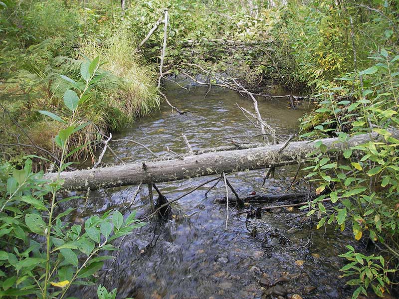
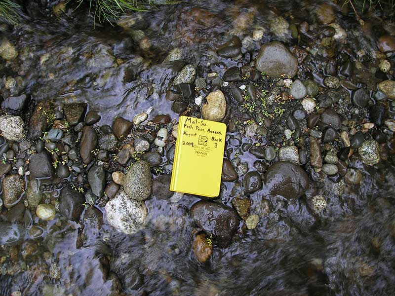
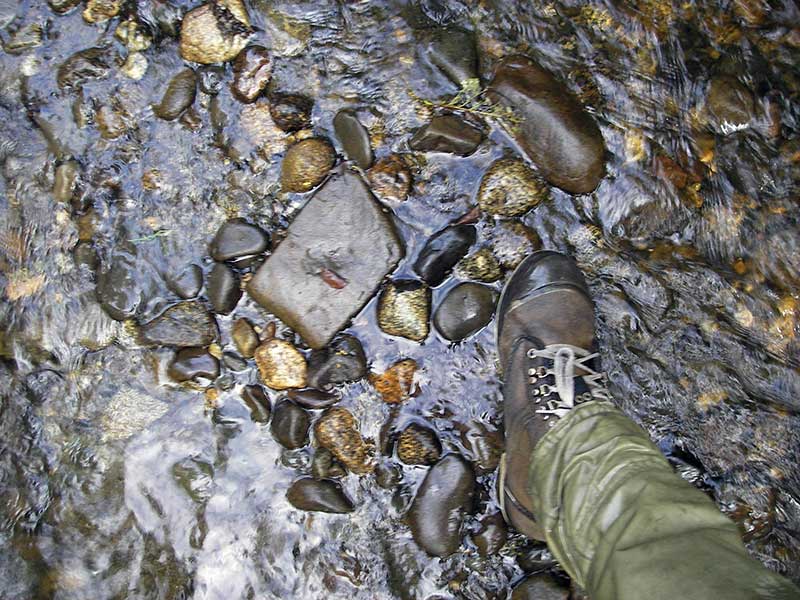
Photos
Questions or comments about this report can be directed to dfg.dsf.webmaster@alaska.gov