Fish Passage Site 20401349
Coordinates (dec. deg.): 61.66123°, -149.19296°
Legal Description: S018N001E12
Region: South Central
Road Name: Crabb Circle
Datum: NAD83
Quad Name / ITM: Anchorage C-6
AWC Stream #: 247-50-10260-2019-3087
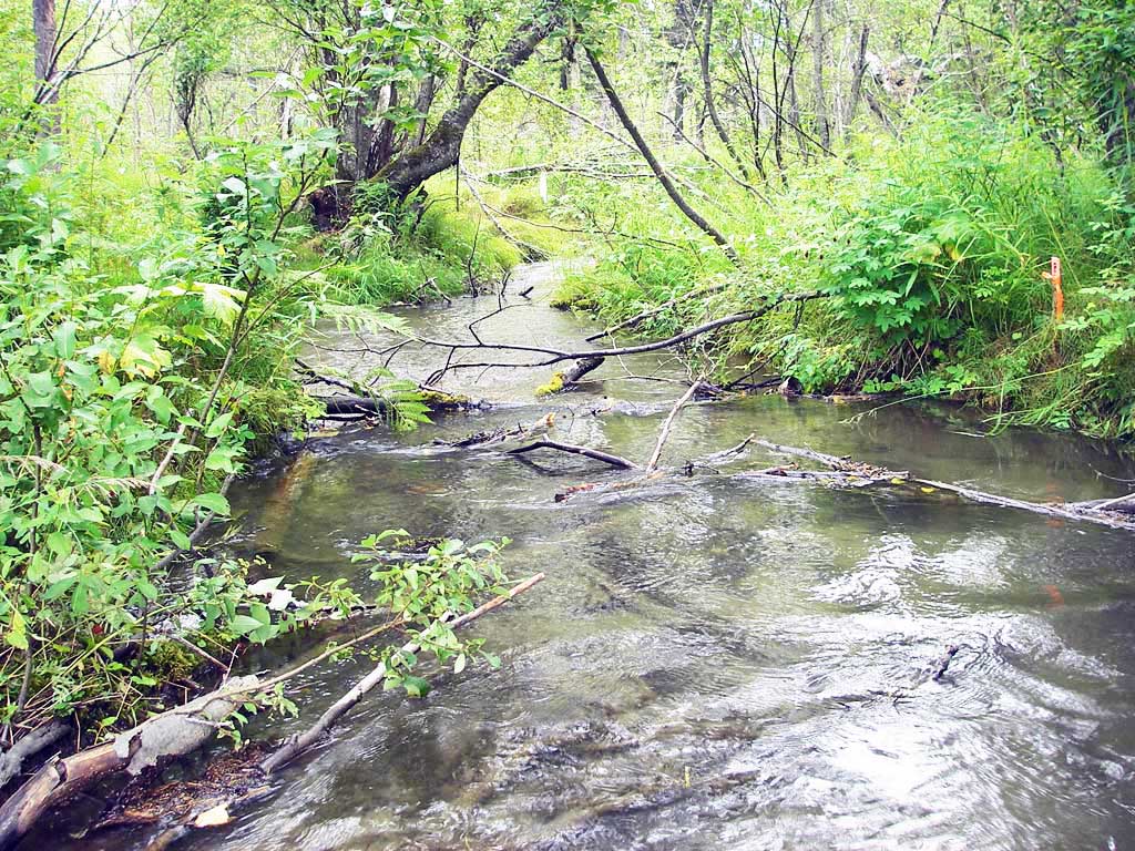
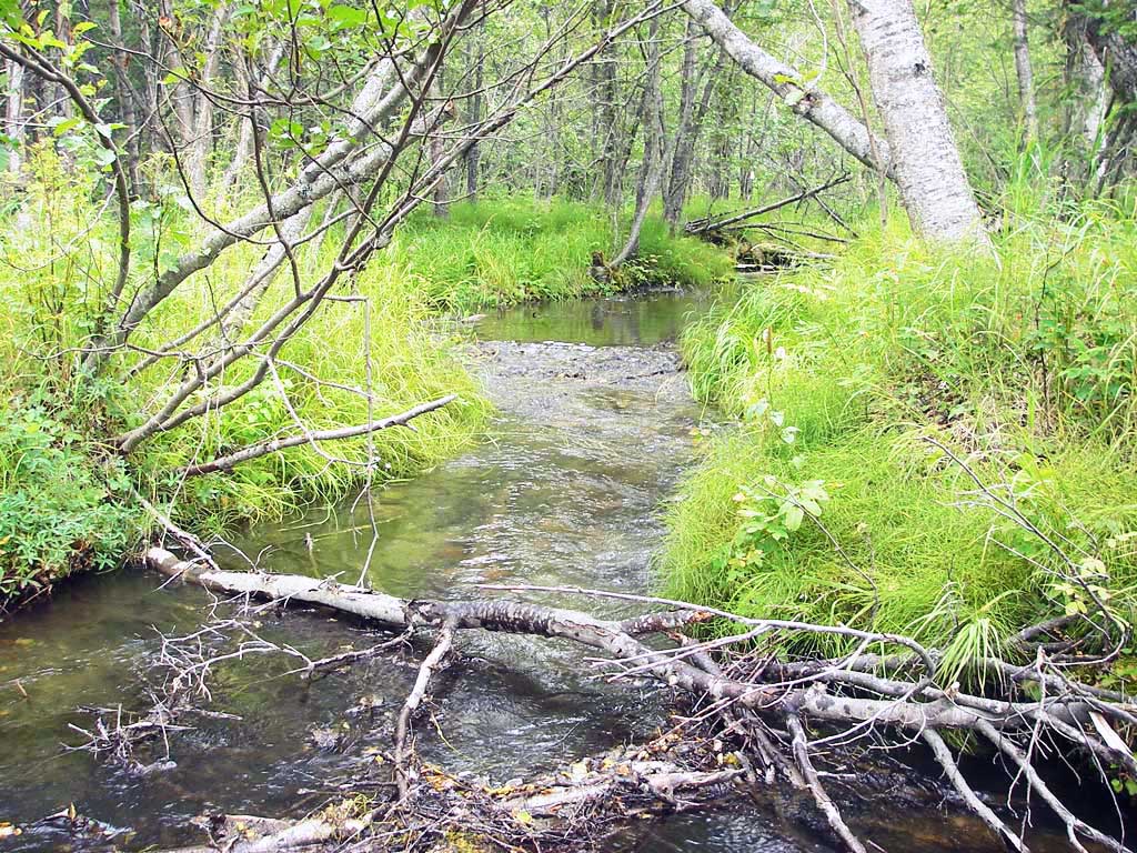
Stream Name: Spring Creek
Elevation:
Site Comments: None
arrow to the right of the survey date below to choose a different report for this site.
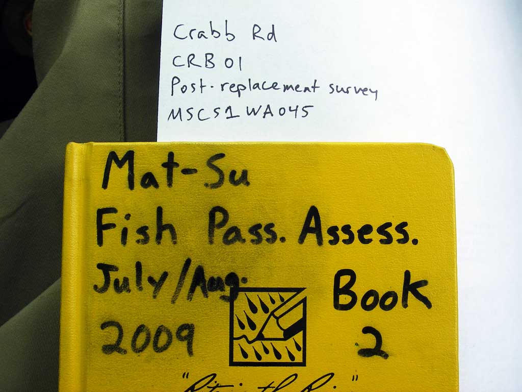
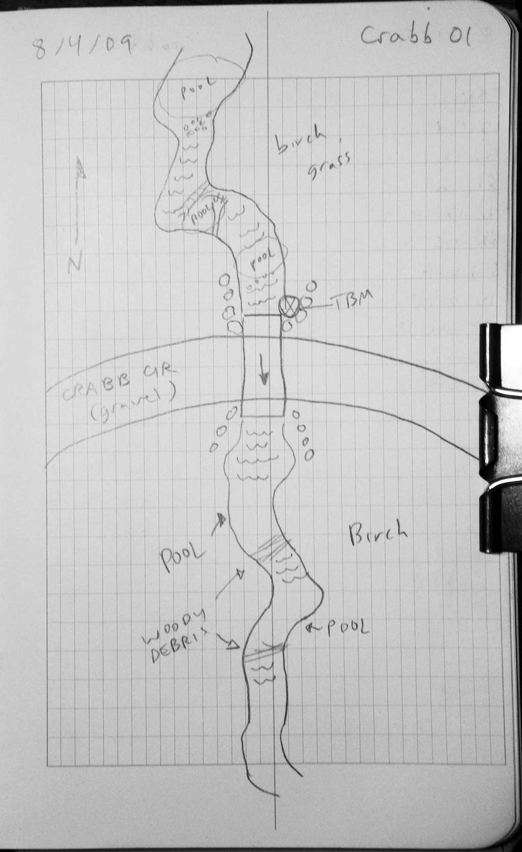
Survey MSB09-CRB01
Project Supervisor: Gillian O'Doherty, ADFG
Observers: Heidi Zimmer, Ben Histand
Overall Fish Passage Rating:
Tidal: No
Backwatered: No
Step Pools:
Construction Year: 2009
Site Observations:
- None of this type
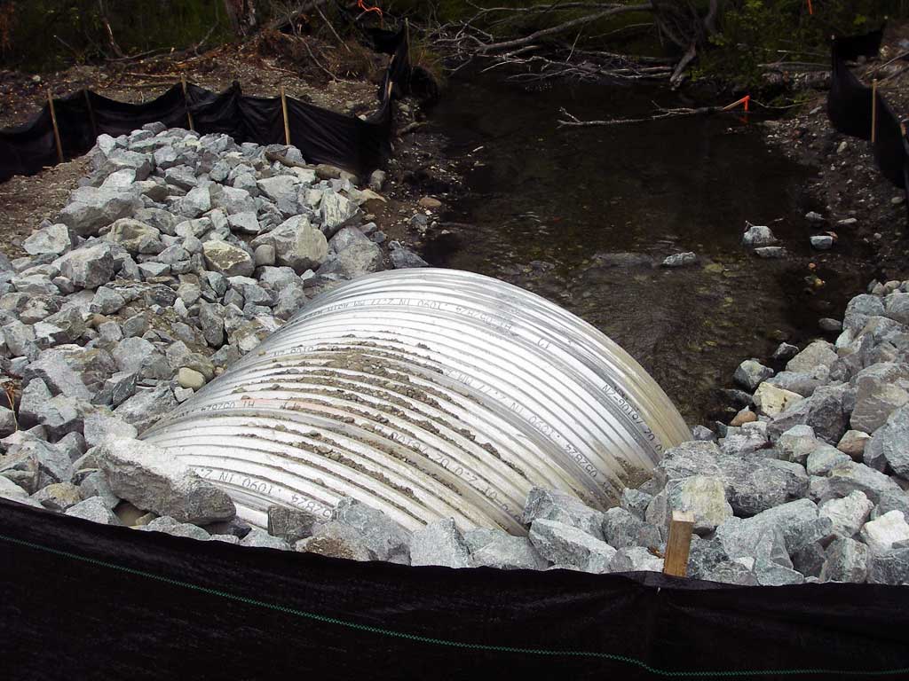
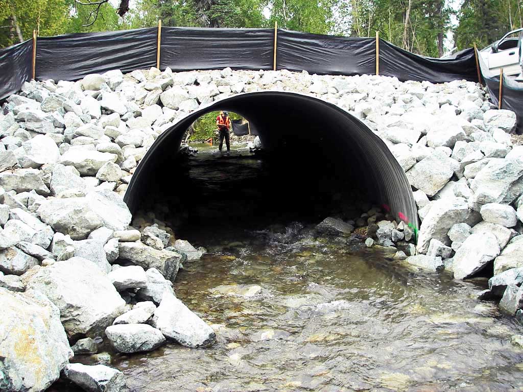
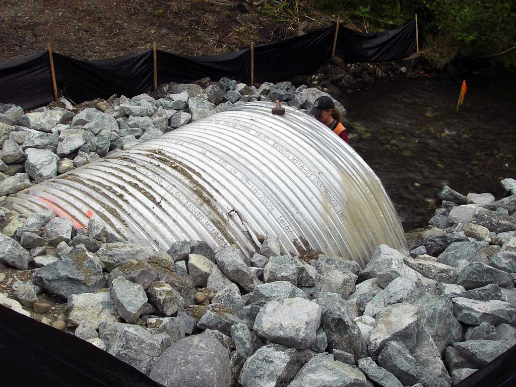
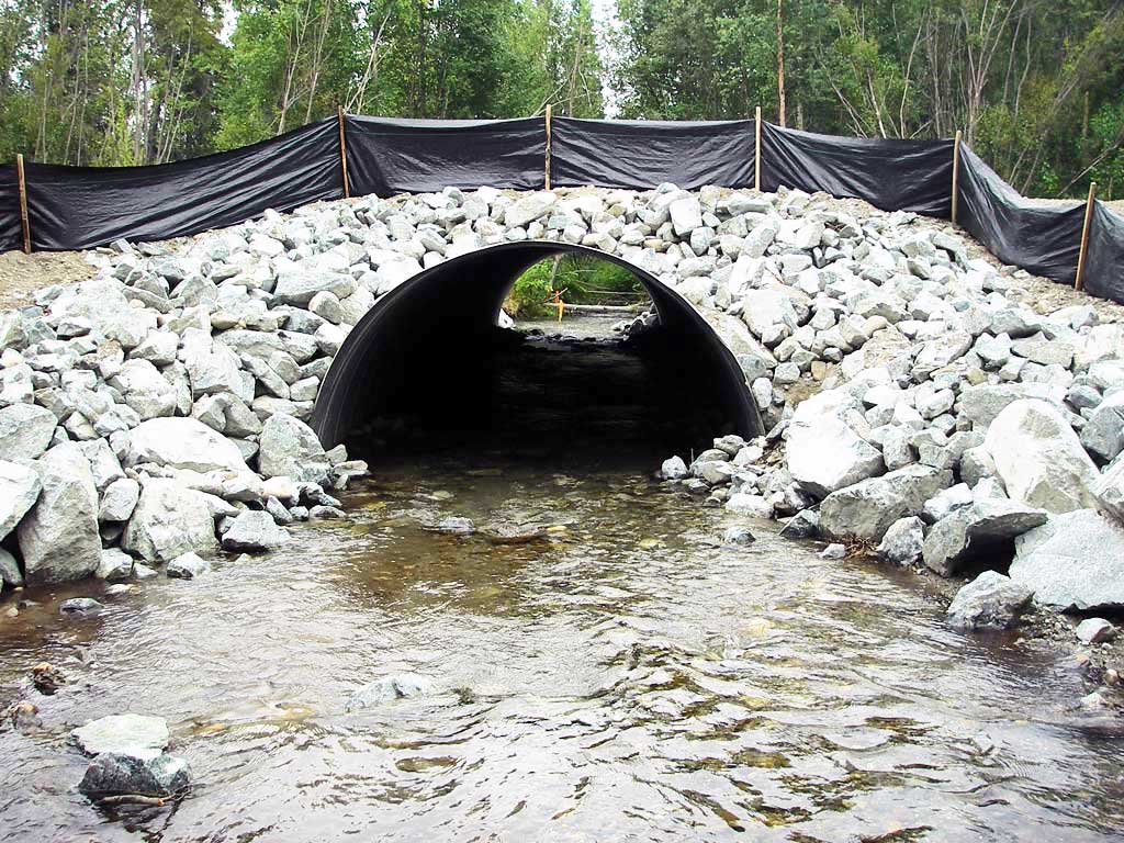
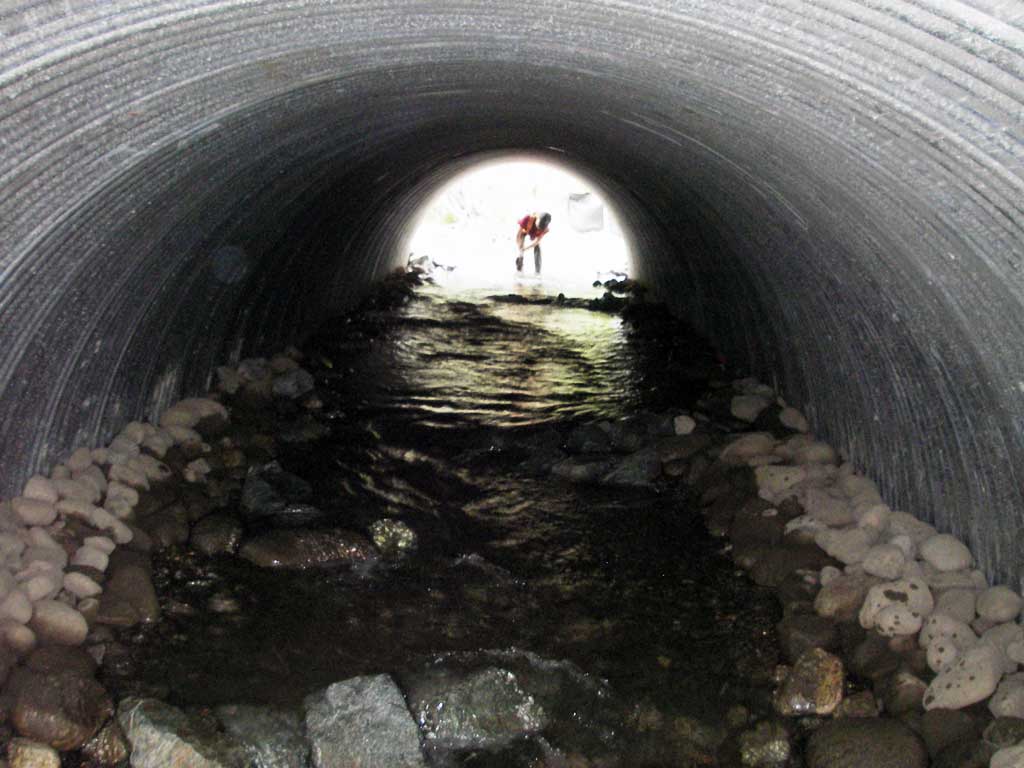
Comments: Post-replacement Survey of MSCS1WA045; may be open-bottom; prob 10' wide w/o subs; u/s gradient=1.01%;
Culvert Measurements
| ID: 1 | Structure Type: Circular pipe (Corrugated steel) | Fish Passage Rating: | ||||||||||||||||||||||||||||||||||||||||||
|
|
|
||||||||||||||||||||||||||||||||||||||||||
Comments: U/S stream gradient = 1.01%. Sinuous channel in pipe. Substrate depth is an estimation based off the belief that the pipe is circular. |
||||||||||||||||||||||||||||||||||||||||||||
Culvert Observations:
|
||||||||||||||||||||||||||||||||||||||||||||
Stream Measurements
|
|
| Stream Width Type | Distance From Crossing (ft) |
Stream Width (ft) |
|---|---|---|
| Upstream ordinary high water | 62.0 | 10.00 |
| Upstream ordinary high water | 100.0 | 7.00 |
| Upstream ordinary high water | 161.0 | 9.00 |
Elevations
| Locator ID | Culvert Number |
River Distance (ft)1 |
Distance From Crossing (ft)2 |
Relative Elevation (ft) |
|---|---|---|---|---|
| Road Elev | 1 | 104.73 | ||
| D/S Grade Ctrl (Thalweg) (ws @ gp) | 1 | 0.00 | 53.0 | 96.51 |
| D/S Water Surface Elev | 1 | 0.00 | 53.0 | 97.15 |
| D/S Water Surface Elev | 1 | 43.00 | 10.0 | 97.31 |
| D/S Grade Ctrl (Thalweg) (ws @ gp) | 1 | 43.00 | 10.0 | 96.98 |
| D/S Thalweg | 1 | 47.00 | 5.0 | 96.71 |
| Outlet Invert | 1 | 53.00 | 0.0 | 96.93 |
| Outlet Pool Water Elev | 1 | 53.00 | 97.41 | |
| Inlet Culvert Invert | 1 | 105.00 | 0.0 | 97.70 |
| U/S Headwater | 1 | 105.00 | 98.42 | |
| U/S Water Surface Elev (ws @ gp) | 1 | 123.00 | 18.0 | 98.52 |
| U/S Grade Ctrl (Thalweg) | 1 | 123.00 | 18.0 | 98.09 |
| U/S Grade Ctrl (Thalweg) | 1 | 185.00 | 80.0 | 99.14 |
| U/S Water Surface Elev (ws @ gp) | 1 | 185.00 | 80.0 | 99.31 |
| U/S Grade Ctrl (Thalweg) | 1 | 219.00 | 114.0 | 99.41 |
| U/S Water Surface Elev (ws @ gp) | 1 | 219.00 | 114.0 | 99.80 |
| U/S Water Surface Elev (ws @ pro) | 1 | 252.00 | 147.0 | 99.82 |
| U/S Thalweg | 1 | 252.00 | 147.0 | 99.33 |
Notes:
- River distance is measured continuously throughout the survey reach along the thalweg of the stream.
- Measured from each end of the crossing along the thalweg of the stream.
Fish Sampling Efforts
No fish sampling occurred during this survey.
Fish Observations
No fish observations occurred during this survey.
Photos
Questions or comments about this report can be directed to dfg.dsf.webmaster@alaska.gov