Fish Passage Site 20401347
Coordinates (dec. deg.): 61.72003°, -149.11873°
Legal Description: S019N002E20
Region: South Central
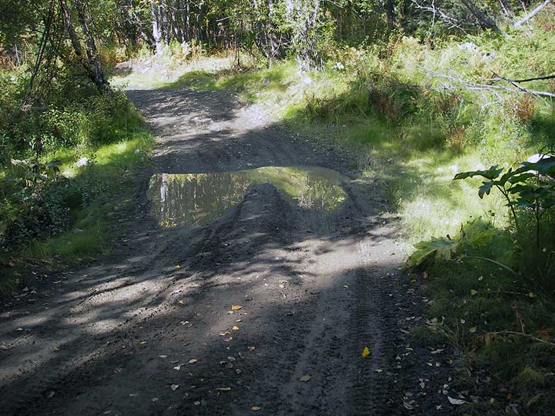
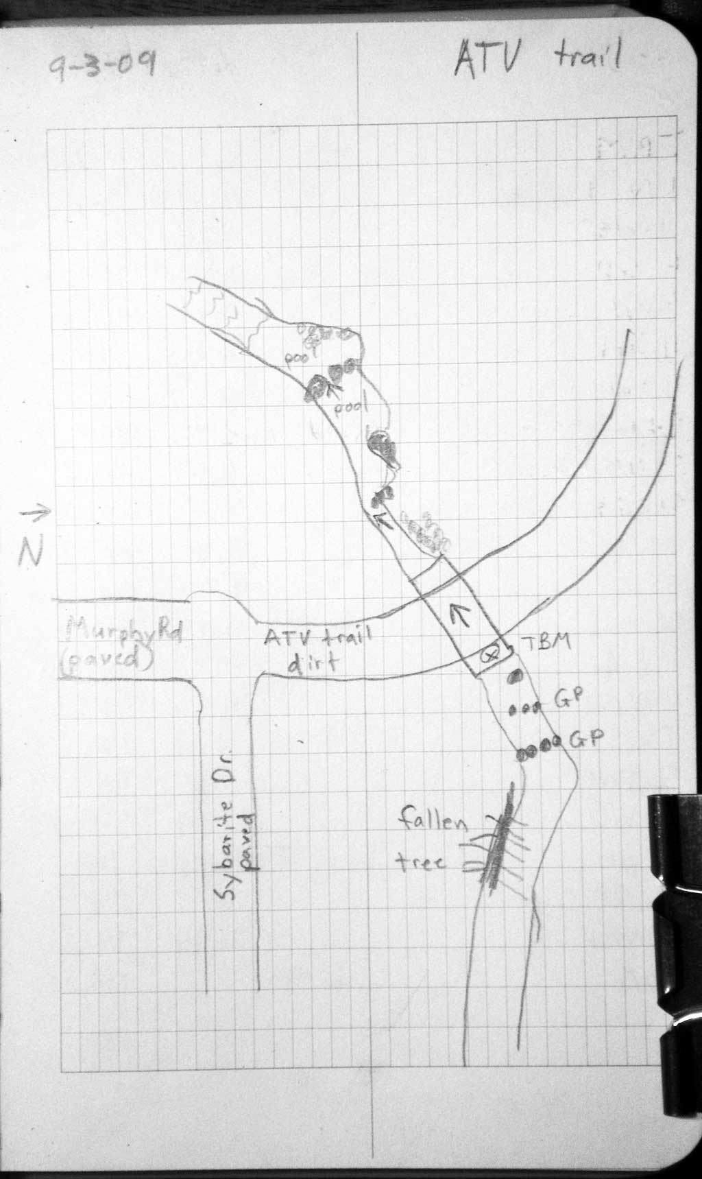
Road Name: ATV Trail
Datum: NAD83
Quad Name / ITM: Anchorage C-6
AWC Stream #:
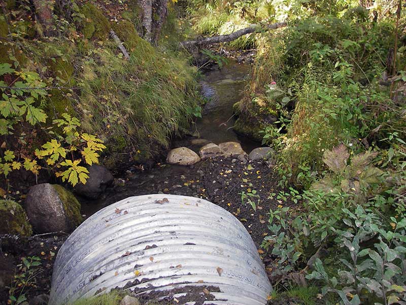
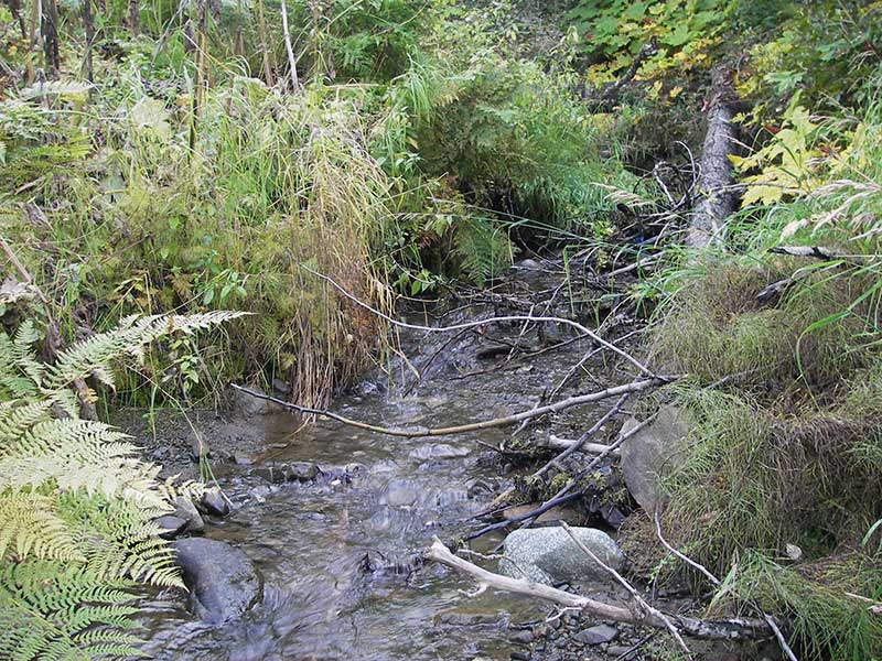
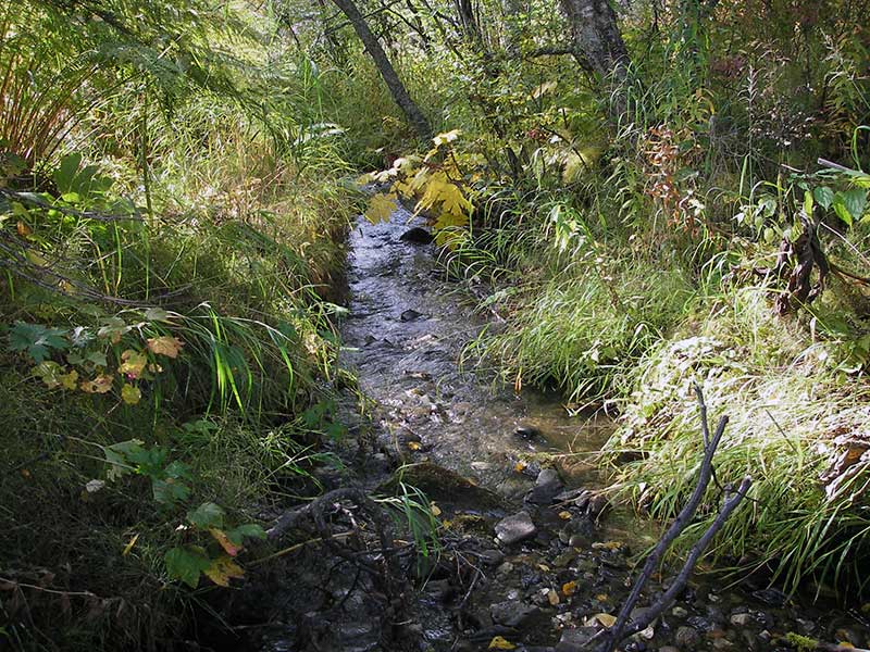
Stream Name: Wasilla Creek tributary
Elevation:
Site Comments: Trib to Wasilla Ck. ATV trail off of Murphy Road.
arrow to the right of the survey date below to choose a different report for this site.
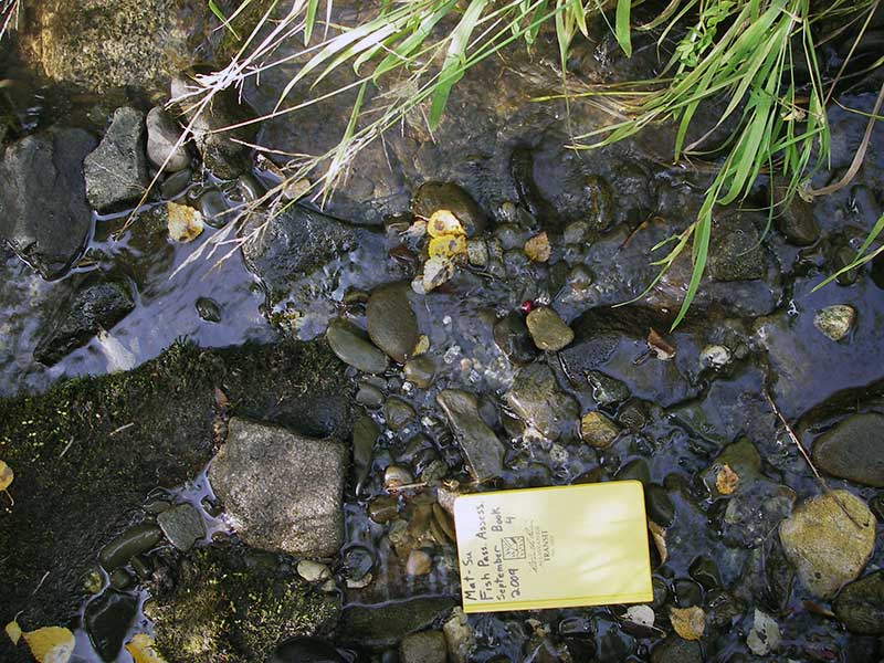
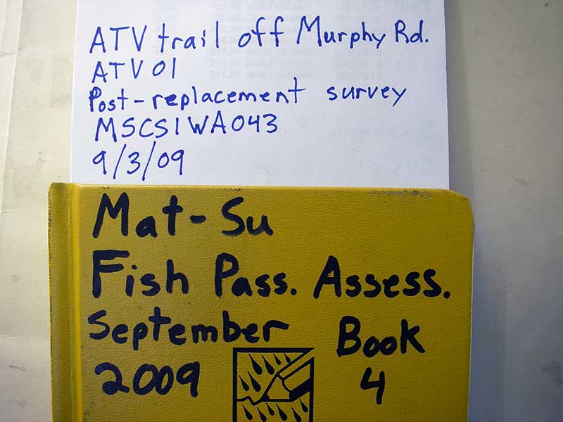
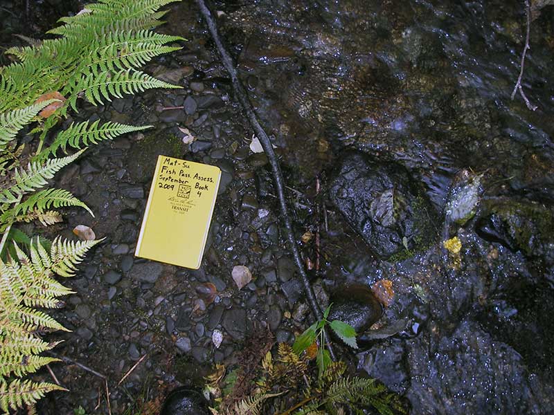
Survey MSB09-ATV01
Project Supervisor: Gillian O'Doherty, ADFG
Observers: Heidi Zimmer, Ben Histand
Overall Fish Passage Rating:
Tidal: No
Backwatered: No
Step Pools: Yes
Construction Year: 2008
Site Observations:
- None of this type
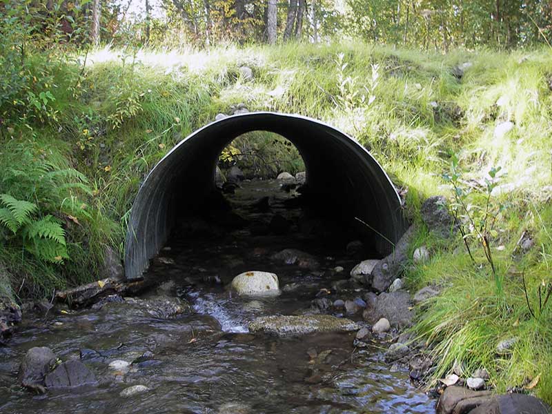
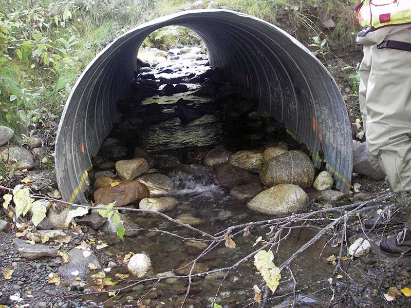
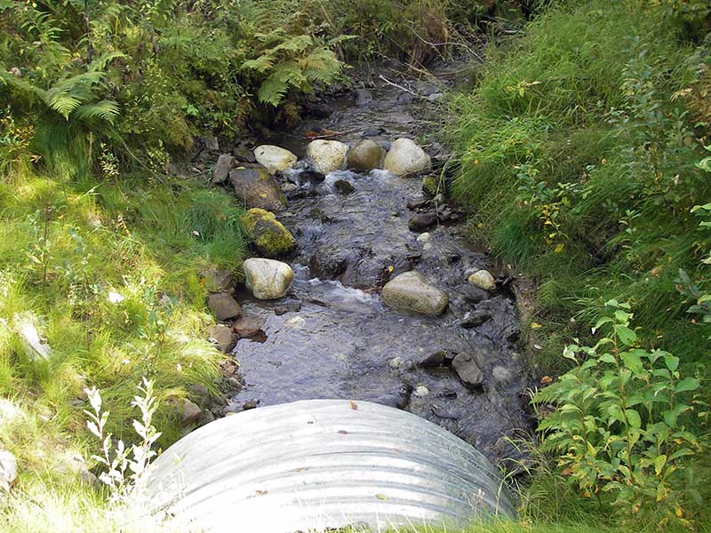
Comments: Post-Replacement survey of MSCS1WA043; Step-pools in pipe (fish passage project). Upstream grade = 5.11%;
Culvert Measurements
| ID: 1 | Structure Type: Circular pipe (Corrugated steel) | Fish Passage Rating: | ||||||||||||||||||||||||||||||||||||||||||
|
|
|
||||||||||||||||||||||||||||||||||||||||||
Comments: Step-pools in pipe (fish passage project).u/s grade = 5.11%; |
||||||||||||||||||||||||||||||||||||||||||||
Culvert Observations:
|
||||||||||||||||||||||||||||||||||||||||||||
Stream Measurements
|
|
| Stream Width Type | Distance From Crossing (ft) |
Stream Width (ft) |
|---|---|---|
| Upstream ordinary high water | 30.0 | 7.00 |
| Upstream ordinary high water | 60.0 | 6.50 |
| Upstream ordinary high water | 90.0 | 6.00 |
Elevations
| Locator ID | Culvert Number |
River Distance (ft)1 |
Distance From Crossing (ft)2 |
Relative Elevation (ft) |
|---|---|---|---|---|
| Outlet Pool Water Elev | 1 | 94.73 | ||
| U/S Headwater | 1 | 96.45 | ||
| D/S Grade Ctrl (Thalweg) | 1 | 0.00 | 20.0 | 94.10 |
| D/S Water Surface Elev (@GP) | 1 | 0.00 | 20.0 | 94.25 |
| D/S Tailcrest or 1st Thalweg | 1 | 15.00 | 5.0 | 94.54 |
| D/S Water Surface Elev (@TWC) | 1 | 15.00 | 5.0 | 94.70 |
| D/S Thalweg (bottom of out pool) | 1 | 19.00 | 1.0 | 94.31 |
| Outlet Invert | 1 | 20.00 | 0.0 | 94.37 |
| Road Elev | 1 | 35.00 | 101.26 | |
| Inlet Culvert Invert (on substrate) | 1 | 50.40 | 0.0 | 96.10 |
| U/S Grade Ctrl (Thalweg) (TC of 1st pool u/s) | 1 | 54.40 | 4.0 | 96.71 |
| D/S Water Surface Elev (@GP) | 1 | 54.40 | 4.0 | 96.86 |
| U/S Grade Ctrl (Thalweg) | 1 | 68.40 | 18.0 | 97.59 |
| D/S Water Surface Elev (@GP) | 1 | 68.40 | 18.0 | 97.92 |
| U/S Grade Ctrl (Thalweg) | 1 | 104.40 | 54.0 | 99.24 |
| D/S Water Surface Elev (@GP) | 1 | 104.40 | 54.0 | 99.52 |
| U/S Grade Ctrl (Thalweg) | 1 | 134.40 | 84.0 | 100.58 |
| D/S Water Surface Elev (@GP) | 1 | 134.40 | 84.0 | 100.94 |
| U/S Grade Ctrl (Thalweg) | 1 | 149.40 | 99.0 | 101.46 |
| D/S Water Surface Elev (@GP) | 1 | 149.40 | 99.0 | 101.71 |
Notes:
- River distance is measured continuously throughout the survey reach along the thalweg of the stream.
- Measured from each end of the crossing along the thalweg of the stream.
Fish Sampling Efforts
| Gear Type: Minnow Trap (A) | Trap Duration(h): 1.5 | |
| Channel Type: Main Channel (>50% of water flow) | ||
| Comments: 15ft d/s | ||
| Gear Type: Minnow Trap (B) | Trap Duration(h): 1.5 | |
| Channel Type: Main Channel (>50% of water flow) | ||
| Comments: 50ft u/s | ||
Fish Observations
| Species: juvenile coho salmon | Life History: Anadromous | ||
| Total Fish Observed: 18 | Fish Measured: 18 | Fork Lengths (mm) Min: 38 Max: 61 Mean: 49 | |
| Collected/Observed by Gear Type: Upstream Minnow Trap (8) Downstream Minnow Trap (10) | |||
| Species: juvenile Dolly Varden | Life History: Not Recorded | ||
| Total Fish Observed: 1 | Fish Measured: 1 | Fork Lengths (mm) Min: 80 Max: 80 Mean: 80 | |
| Collected/Observed by Gear Type: Upstream Minnow Trap (1) | |||
Photos
Questions or comments about this report can be directed to dfg.dsf.webmaster@alaska.gov